| Cruise Region : Caribbean |
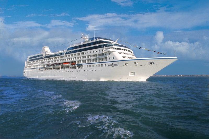
| Company : Oceania Cruises |
| Ship : Insignia |
| Journey Start : Thu 15 Jan 2026 |
| Journey End : Sun 15 Feb 2026 |
| Count Nights : 31 night |
| Day | Date | Port | Arrival | Departure |
|---|---|---|---|---|
| 1 | 15.01 Thu | Miami / USA | 07:00 | 17:00 |
| 2 | 16.01 Fri | Day at sea / Sea | ||
| 3 | 17.01 Sat | Day at sea / Sea | ||
| 4 | 18.01 Sun | Aruba (Oranjestad) / Aruba | 11:00 | 22:00 |
| 5 | 19.01 Mon | Curaçao / Curacao | 07:00 | 17:00 |
| 6 | 20.01 Tue | Day at sea / Sea | ||
| 7 | 21.01 Wed | Port of Spain / Trinidad and Tobago | 07:00 | 17:00 |
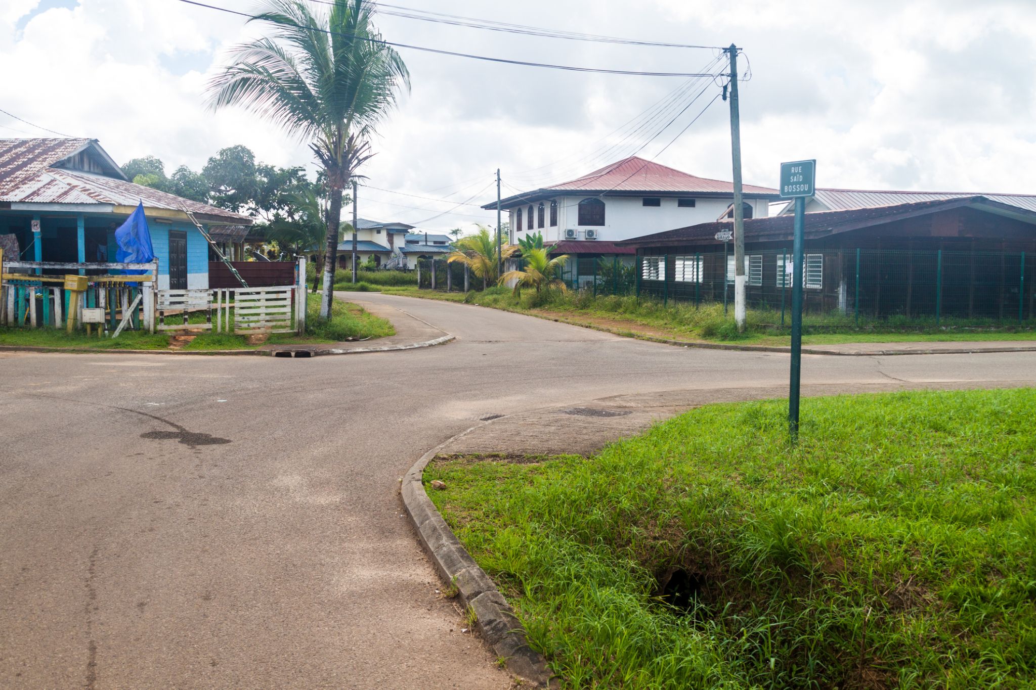
| 8 | 22.01 Thu | Saint-Georges / French Guiana | 07:00 | 17:00 |
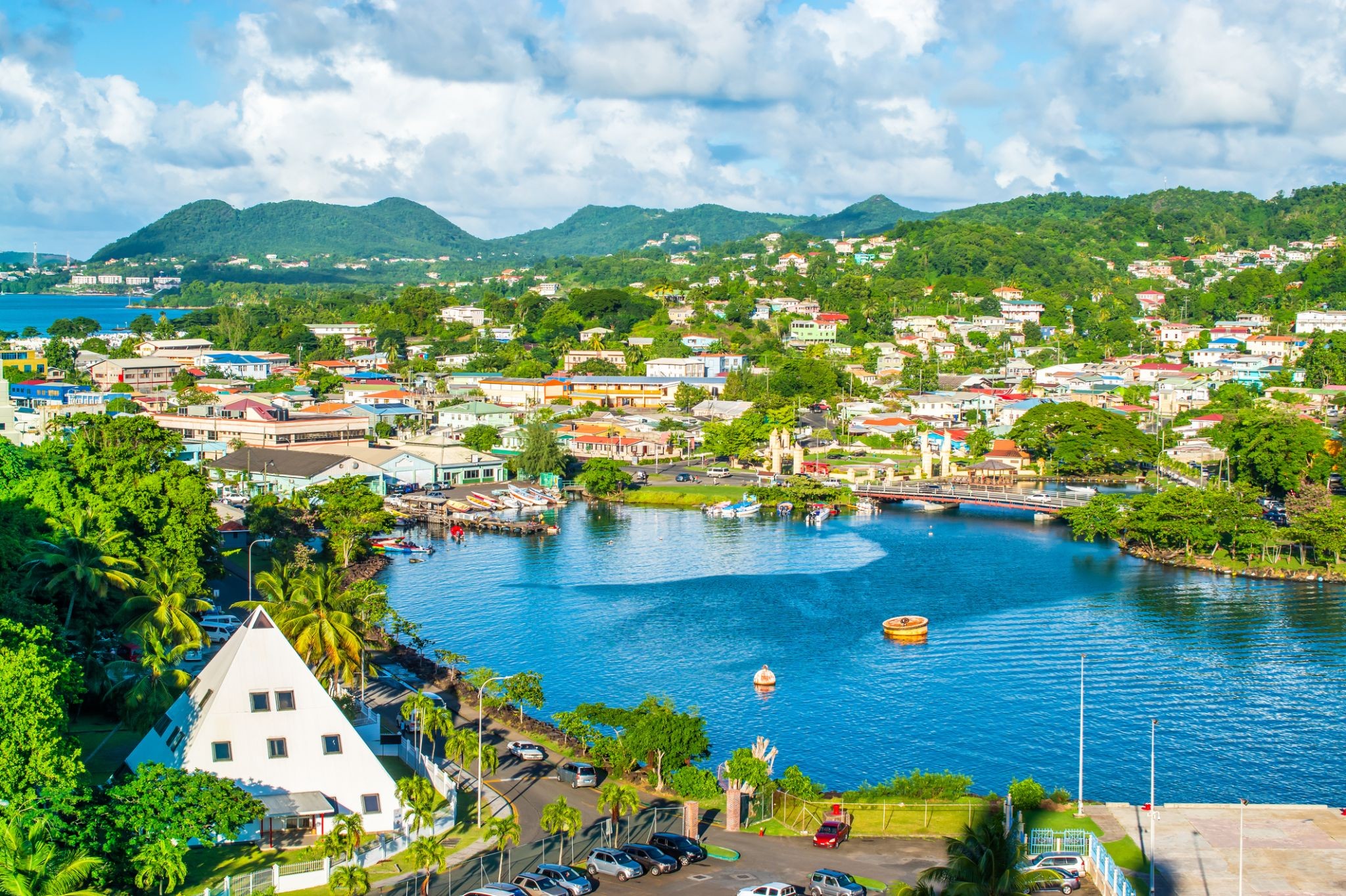
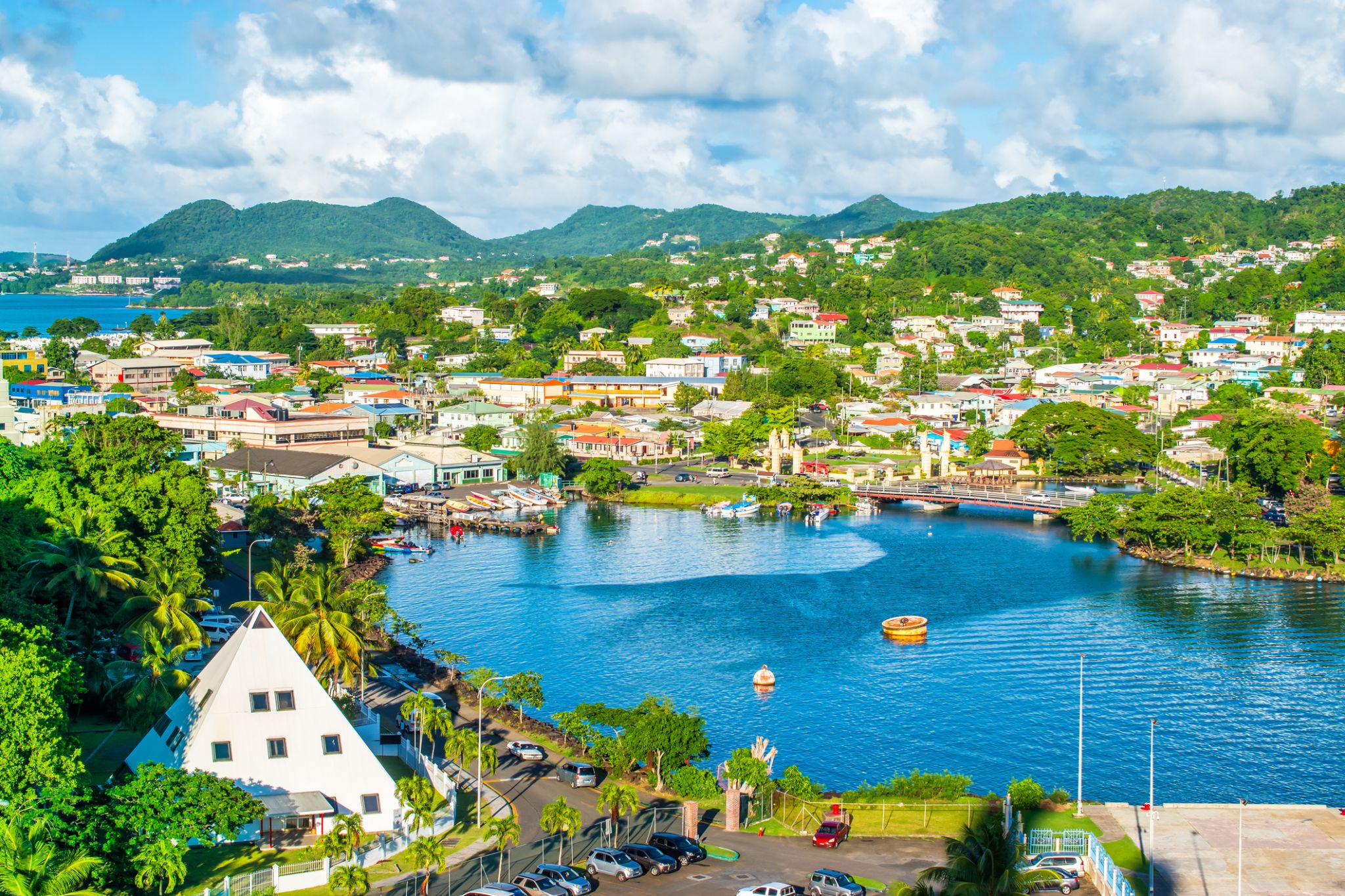
| 9 | 23.01 Fri | Castries / Saint Lucia | 07:00 | 17:00 |
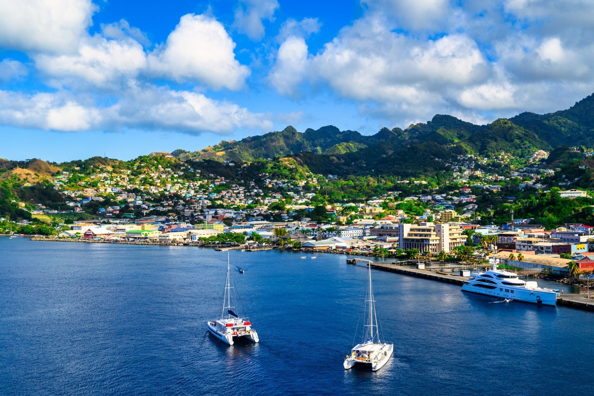
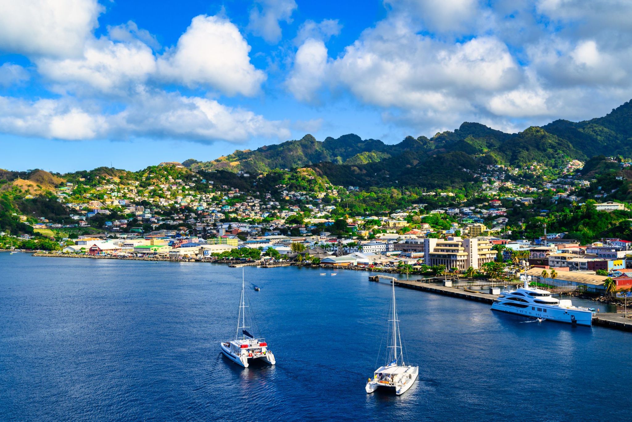
| 10 | 24.01 Sat | Kingstown / Saint Vincent and the Grenadines | 07:00 | 17:00 |
| 11 | 25.01 Sun | Roseau / Dominica | 07:00 | 17:00 |
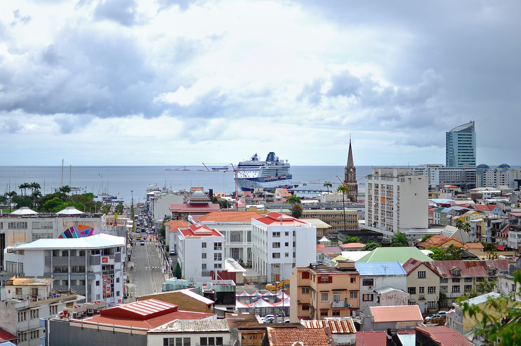
| 12 | 26.01 Mon | Fort-de-France, Martinique (island) / Martinique | 07:00 | 17:00 |
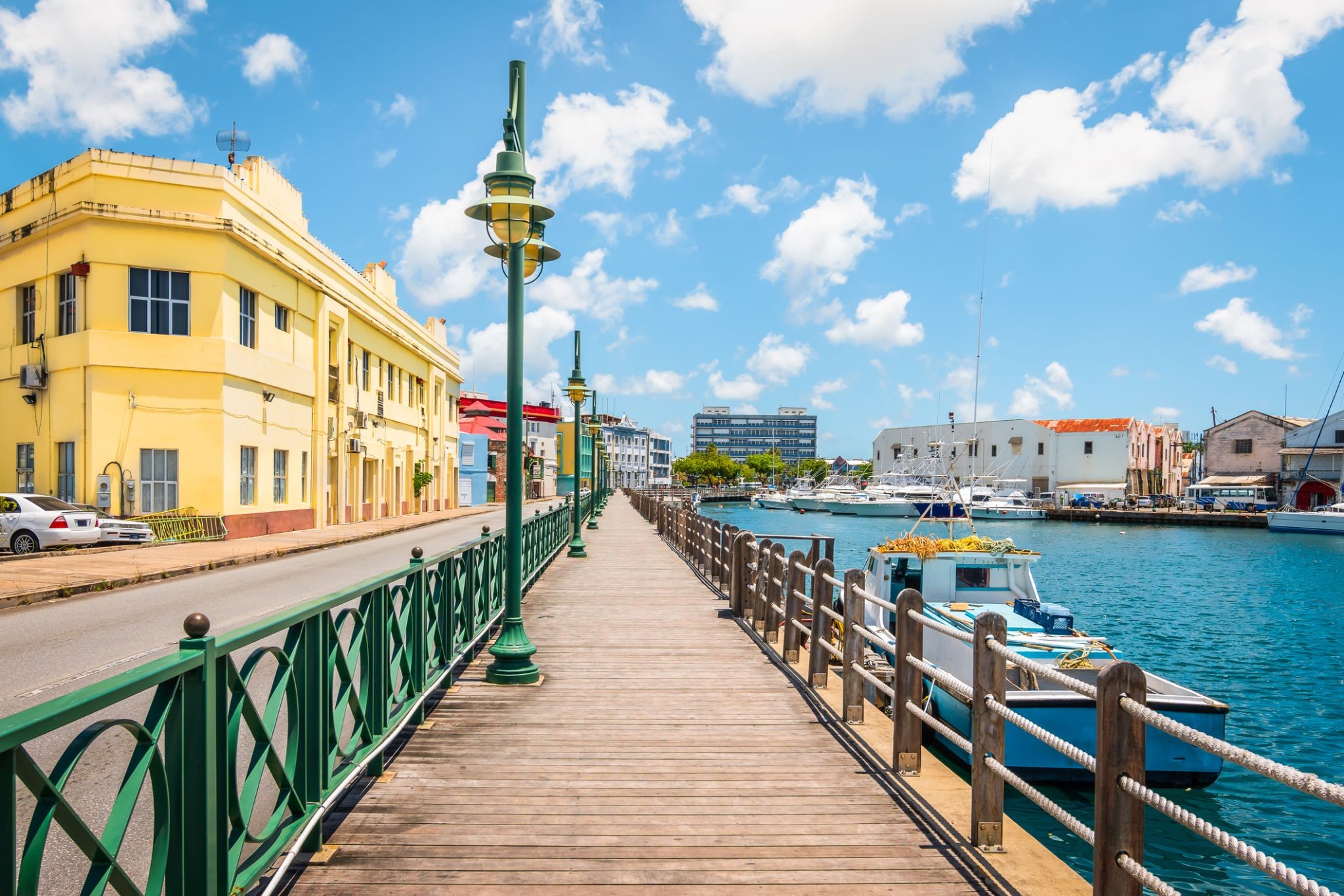
| 13 | 27.01 Tue | Bridgetown / Barbados | 07:00 | 17:00 |
| 14 | 28.01 Wed | Day at sea / Sea | ||
| 15 | 29.01 Thu | Day at sea / Sea | ||
| 16 | 30.01 Fri | Day at sea / Sea | ||
| 17 | 31.01 Sat | Santarem / Brazil | 12:00 | 20:00 |
| 18 | 1.02 Sun | Parintins / Brazil | 08:00 | 16:00 |
| 19 | 2.02 Mon | Manaus / Brazil | 09:00 | |
| 20 | 3.02 Tue | Manaus / Brazil | 16:00 | |
| 21 | 4.02 Wed | Valeria Village Mouth / Brazil | 11:00 | 18:00 |
| 22 | 5.02 Thu | Alter do Chao / Brazil | 07:00 | 16:00 |
| 23 | 6.02 Fri | Day at sea / Sea | ||
| 24 | 7.02 Sat | Day at sea / Sea | ||
| 25 | 8.02 Sun | Devil’s Point / Bahamas | 07:00 | 16:00 |
| 26 | 9.02 Mon | Day at sea / Sea | ||
| 27 | 10.02 Tue | Scarborough / Trinidad and Tobago | 07:00 | 17:00 |
| 28 | 11.02 Wed | Port of Spain / Trinidad and Tobago | 08:00 | 17:00 |
| 29 | 12.02 Thu | Saint-Georges / French Guiana | 07:00 | 17:00 |
| 30 | 13.02 Fri | Kingstown / Saint Vincent and the Grenadines | 07:00 | 17:00 |
| 31 | 14.02 Sat | Castries / Saint Lucia | 07:00 | 18:00 |
| 32 | 15.02 Sun | Bridgetown / Barbados | 07:00 | 18:00 |
Your World Included
With Your World Included, you’ll enjoy a wide array of included amenities for the ultimate comfort and value in ultra-premium cruising.
Unforgettable dining experiences at a variety of exquisite restaurants — all at no extra charge.
Complimentary specialty coffees, sodas, freshly pressed juices, and still and sparkling Vero Water® served throughout the ship.
Unlimited free Wi-Fi available in your suite, stateroom, and all public areas.
In-room dining with a superb variety of hot and cold selections.
Smoothies, milkshakes, gelato, and signature Humphry Slocombe ice cream — always included.
Group fitness classes at Aquamar® Spa + Vitality Center are complimentary.
Gratuities are included for your convenience.
Laundry is free for all guests.
With complimentary self-service launderettes on board, plus laundry and pressing services for Concierge and Suite categories, you’ll always look your finest.
Along with our hallmark personalized service, you’ll enjoy an enriching cruise experience with no hidden costs or nickel-and-diming.
Elevate Your Experience
Concierge Level Veranda Staterooms offer an unrivaled combination of luxury, privilege, and value. A wealth of amenities and exclusive benefits elevate your experience to the sublime — from in-room dining selections from The Grand Dining Room and complimentary laundry services to unlimited access to the Aquamar Spa Terrace.
On board Oceania Marina and Oceania Riviera, you’ll also enjoy the services of a dedicated Concierge and exclusive access to the private Concierge Lounge.
Located in the most desired areas of the ship, Concierge Level Veranda Staterooms are far more than just staterooms — they are an experience in themselves.
Concierge Level Veranda — Exclusive Privileges
Expanded in-room dining menu for lunch and dinner from The Grand Dining Room
Laundry service — up to 3 bags per stateroom
Exclusive key-card access to the private Concierge Lounge aboard Oceania Marina, Oceania Riviera, Oceania Vista, and Oceania Allura, featuring complimentary beverages, coffees, snacks, and the services of a dedicated Concierge
Welcome bottle of fine Italian Prosecco
Priority online reservations for specialty restaurants
Unlimited access to the Aquamar Spa Terrace
Oceania Cruises logo tote bag
Cashmere lap blankets — perfect for relaxing or snuggling
Pressing of garments upon embarkation
Complimentary shoeshine service
Deposit and Payments – Oceania Cruises
General Deposit:
For Owner’s, Vista, and Oceania Suites, a deposit of 20% of the cruise fare per person is required.
For all other suite/stateroom categories, the deposit is $500 per person.
For Grand Voyages, the deposit is $1,500 per person.
Deposit and Final Payment Deadlines:
Bookings more than 150 days from sailing:
Deposit 20% for Owner’s, Vista, and Oceania Suites and $500 for all other categories is required within 5 days of booking.
Bookings 90–120 days from sailing:
Full payment required within 3 days of booking.
Bookings 0–90 days from sailing:
Full payment due on the day of booking.
Important:
Bookings that are not deposited or paid in full according to this schedule will be automatically cancelled.
Unless otherwise noted, final payment must be received by Oceania Cruises 150 days prior to departure for cruises less than 15 days, and 150 days for cruises 15 days or longer.
Oceania Cruises reserves the right to cancel any booking not fully paid at the time of final payment.
Additional Information:
Passport details and special onboard service requests are due at final payment.
Payment may be made by personal check, American Express, Discover, MasterCard, or Visa.
For convenience, final payment may be automatically charged to the credit card used for the initial deposit.
Oceania Cruises is not responsible for foreign currency or transaction fees independently charged by issuing banks. These fees do not benefit Oceania Cruises.
Third-party credit card payments are accepted only with valid authorization from the cardholder.
Deposit and Payment – 180-Day Voyages
For 180-day voyages, a deposit of 20% of the cruise fare per person for all suites and staterooms is required within 7 days of booking.
Final payment must be received no later than 181 days prior to departure, along with passport details and any special onboard service requests.
Otherwise, the booking may be immediately cancelled, and applicable penalties will apply.
Oceania Cruises accepts payment for reservations by credit/debit card or bank transfer.
Unfortunately, personal checks are not accepted.
Credit/Debit Cards:
American Express, Visa, and Mastercard are accepted.
Please note: Oceania Cruises assumes no responsibility for foreign currency/transaction processing fees assessed by your issuing bank.

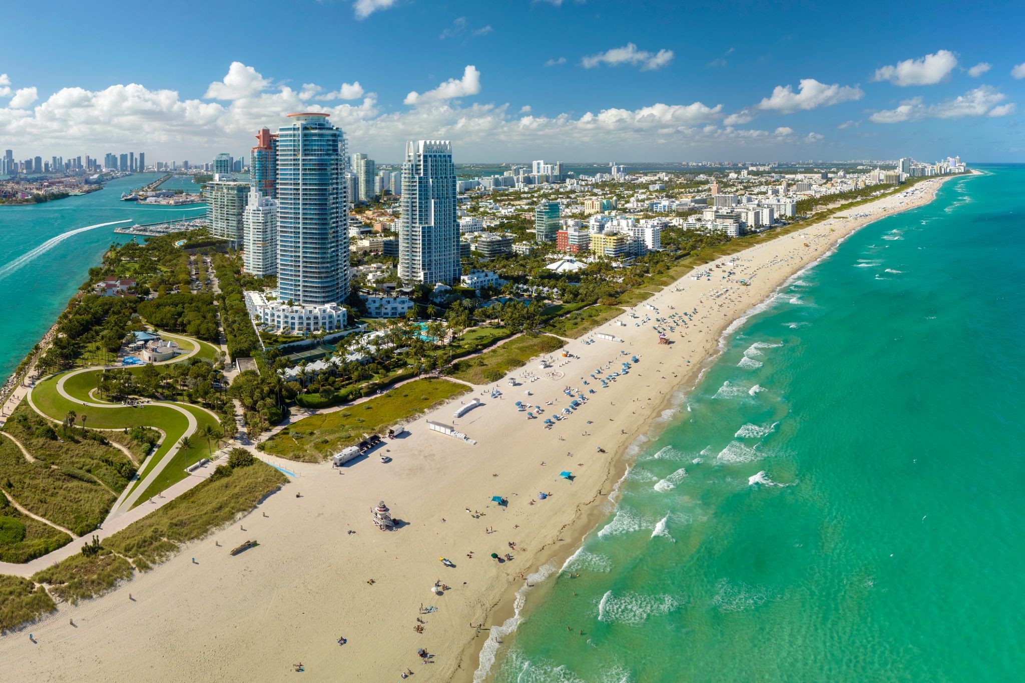
Miami, officially the City of Miami, is the cultural, economic and financial center of South Florida. Miami is the seat of Miami-Dade County, the most populous county in Florida. The city covers an area of about 56.6 square miles (147 km2), between the Everglades to the west and Biscayne Bay on the east; with a 2017 estimated population of 463,347, Miami is the sixth most densely populated major city in the United States. The Miami metropolitan area is home to 6.1 million people and the seventh-largest metropolitan area in the nation. Miami's metro area is the second-most populous metropolis in the southeastern United States and fourth-largest urban area in the U.S.
Miami is a major center, and a leader in finance, commerce, culture, media, entertainment, the arts, and international trade. The Miami Metropolitan Area is by far the largest urban economy in Florida and the 12th largest in the United States with a GDP of $344.9 billion as of 2017. In 2012, Miami was classified as an "Alpha−" level world city in the World Cities Study Group's inventory. In 2010, Miami ranked seventh in the United States and 33rd among global cities in terms of business activity, human capital, information exchange, cultural experience, and political engagement. In 2008, Forbes magazine ranked Miami "America's Cleanest City", for its year-round good air quality, vast green spaces, clean drinking water, clean streets, and citywide recycling programs. According to a 2009 UBS study of 73 world cities, Miami was ranked as the richest city in the United States, and the world's seventh-richest city in terms of purchasing power. Miami is nicknamed the "Capital of Latin America" and is the largest city with a Cuban-American plurality.
Greater Downtown Miami has one of the largest concentrations of international banks in the United States, and is home to many large national and international companies. The Civic Center is a major center for hospitals, research institutes, medical centers, and biotechnology industries. For more than two decades, the Port of Miami, known as the "Cruise Capital of the World", has been the number one cruise passenger port in the world. It accommodates some of the world's largest cruise ships and operations, and is the busiest port in both passenger traffic and cruise lines. Metropolitan Miami is also a major tourism hub in the southeastern U.S. for international visitors, ranking number two in the country after New York City.

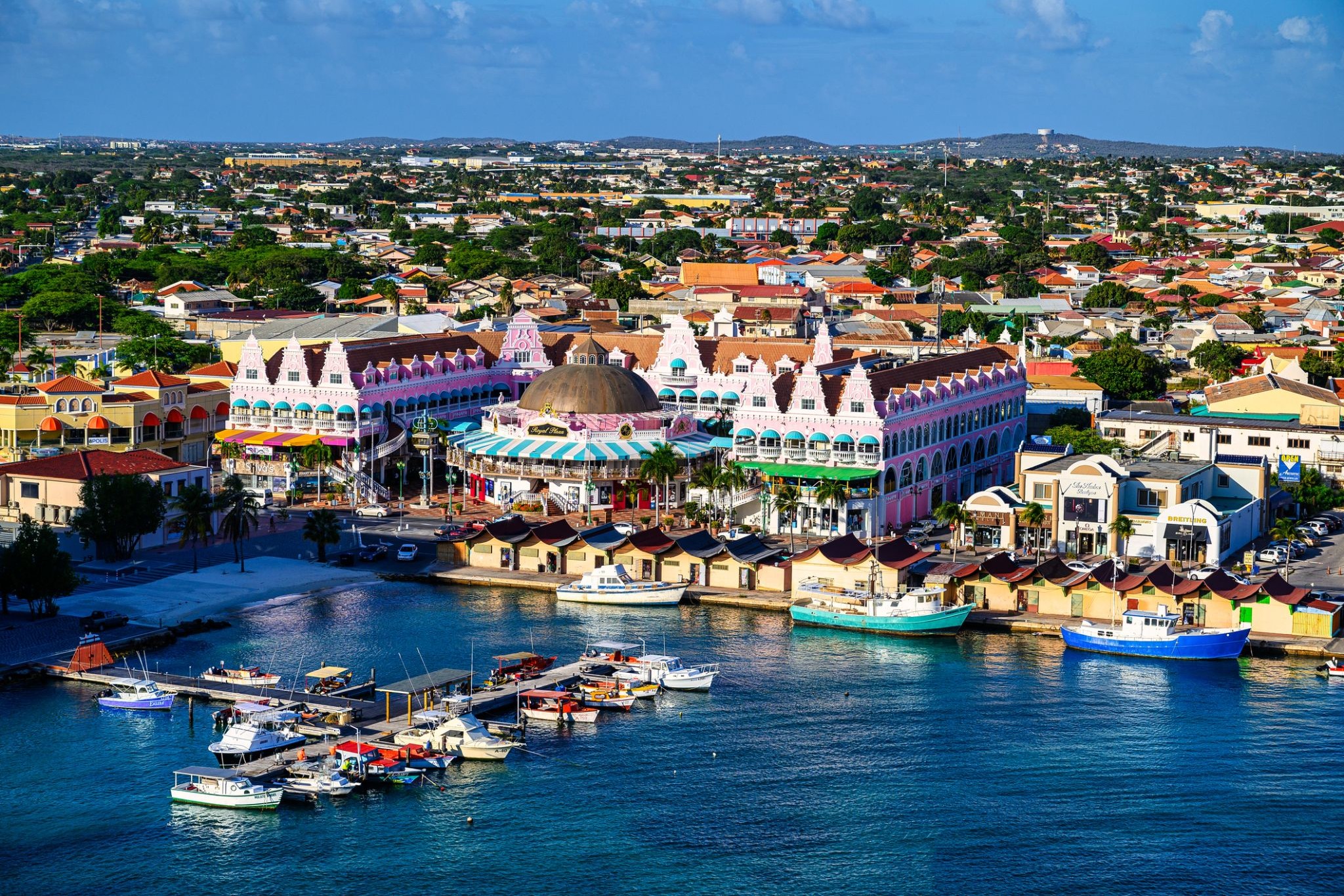
Aruba is an island and a constituent country of the Kingdom of the Netherlands in the southern Caribbean Sea, located about 1,600 kilometres (990 mi) west of the main part of the Lesser Antilles and 29 kilometres (18 mi) north of the coast of Venezuela. It measures 32 kilometres (20 mi) long from its northwestern to its southeastern end and 10 kilometres (6 mi) across at its widest point. Together with Bonaire and Curaçao, Aruba forms a group referred to as the ABC islands. Collectively, Aruba and the other Dutch islands in the Caribbean are often called the Dutch Caribbean.
Aruba is one of the four countries that form the Kingdom of the Netherlands, along with the Netherlands, Curaçao, and Sint Maarten; the citizens of these countries are all Dutch nationals. Aruba has no administrative subdivisions, but, for census purposes, is divided into eight regions. Its capital is Oranjestad.
Unlike much of the Caribbean region, Aruba has a dry climate and an arid, cactus-strewn landscape. This climate has helped tourism as visitors to the island can reliably expect warm, sunny weather. It has a land area of 179 km2(69.1 sq mi) and is densely populated, with a total of 102,484 inhabitants at the 2010 Census. It lies outside Hurricane Alley.
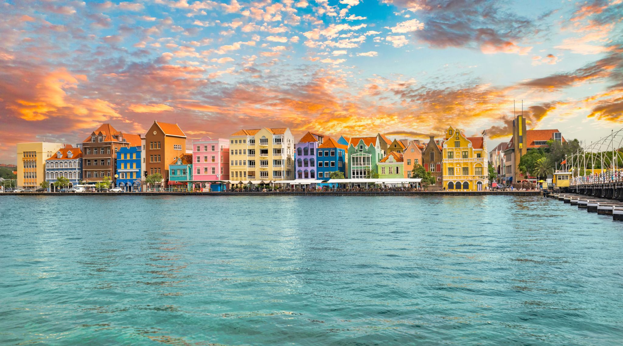
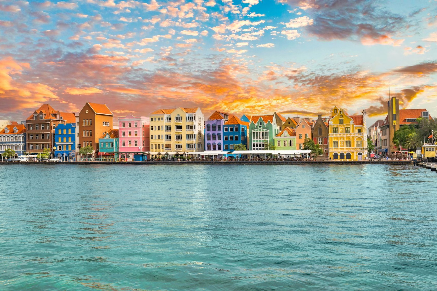
Curaçao is a Lesser Antilles island in the southern Caribbean Sea and the Dutch Caribbean region, about 65 km (40 mi) north of the Venezuelan coast. It is a constituent country (Dutch: land) of the Kingdom of the Netherlands.
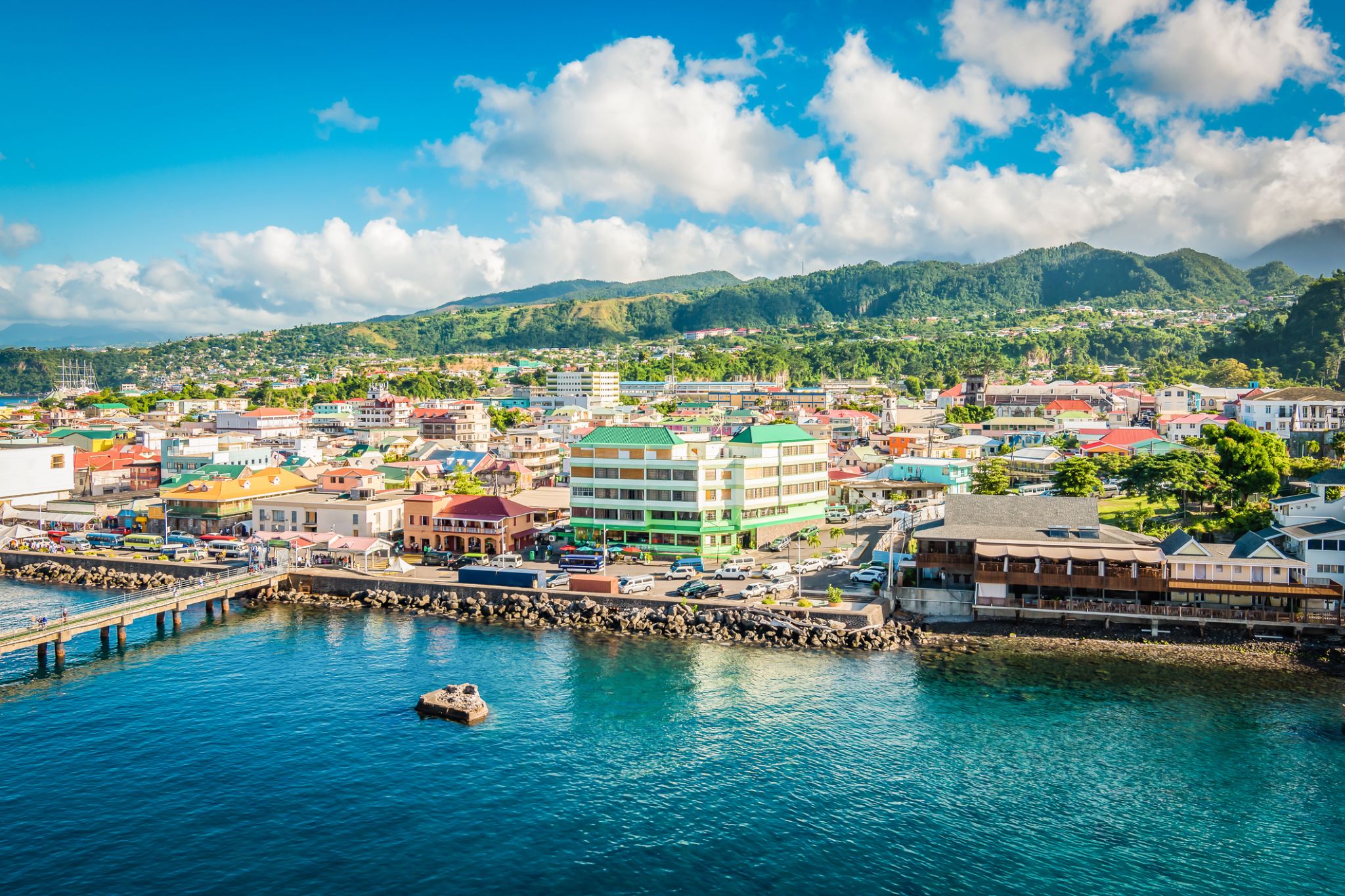
Dominica, officially the Commonwealth of Dominica, is an island country in the West Indies. The capital, Roseau, is located on the western side of the island. It is part of the Windward Islands in the Lesser Antilles archipelago in the Caribbean Sea. The island is located near Guadeloupe to the northwest and Martinique to the south-southeast. Its area is 750 km2 (290 sq mi), and the highest point is Morne Diablotins, at 1,447 m (4,747 ft) in elevation. The population was 71,293 at the 2011 census. The Commonwealth of Dominica is one of the Caribbean's few republics.
The island was originally inhabited by the Kalinago and later colonised by Europeans, predominantly by the French from the 1690s to 1763. Columbus is said to have passed the island on Sunday 3 November 1493, and the island's name is derived from the Latin for "Sunday". Great Britain took possession in 1763 after the Seven Years' War, and it gradually established English as its official language. The island republic gained independence in 1978.
Its name is pronounced with emphasis on the third syllable, related to its French name of Dominique. Dominica has been nicknamed the "Nature Isle of the Caribbean" for its natural environment. It is the youngest island in the Lesser Antilles, and in fact it is still being formed by geothermal-volcanic activity, as evidenced by the world's second-largest hot spring, called Boiling Lake. The island has lush mountainous rainforests, and it is the home of many rare plants, animals, and bird species. There are xeric areas in some of the western coastal regions, but heavy rainfall occurs inland. The Sisserou parrot, also known as the imperial amazon and found only on Dominica, is the island's national bird and featured on the national flag, which is one of only two national flags containing the color purple.
Fort-de-France – The Heart of Martinique
Fort-de-France is the capital of the island of Martinique, located in the southwest of the island. This picturesque port city blends French elegance with Caribbean exoticism. Strolling through its streets, visitors can enjoy the old architecture, the atmosphere of local markets, and stunning views of the bay. The main architectural landmark is the Fort-de-France Citadel, from which a panoramic view of the city and island can be admired.
For visitors, Fort-de-France offers a rich cultural experience: visiting museums, including the Martinique Museum, exploring local cuisine and traditions. The island's nature is captivating: white beaches, palm trees, tropical forests, and volcanic mountains — all of which make Fort-de-France an ideal destination for relaxation and discovering the unique Caribbean culture.

Bridgetown is the capital and largest city of Barbados. Formerly The Town of Saint Michael, the Greater Bridgetown area is located within the parish of Saint Michael. Bridgetown is sometimes locally referred to as "The City", but the most common reference is simply "Town". As of 2014, its metropolitan population stands at roughly 110,000.
The Bridgetown port, found along Carlisle Bay (at 13.106°N 59.632°W) lies on the southwestern coast of the island. Parts of the Greater Bridgetown area (as roughly defined by the Ring Road Bypass or more commonly known as the ABC Highway), sit close to the borders of the neighbouring parishes Christ Church and St. James. The Grantley Adams International Airport for Barbados, is located 16 kilometres (10 mi) southeast of Bridgetown city centre, and has daily flights to major cities in the United Kingdom, United States, Canada and the Caribbean. There is no longer a local municipal government, but it is a constituency of the national Parliament. During the short-lived 1950s-1960s Federation of the British West Indian Territories, Bridgetown was one of three capital cities within the region being considered to be the Federal capital of region.
The present-day location of the city was established by English settlers in 1628; a previous settlement under the authority of Sir William Courten was at St. James Town. Bridgetown is a major West Indies tourist destination, and the city acts as an important financial, informatics, convention centre, and cruise ship port of call in the Caribbean region. On 25 June 2011, "Historic Bridgetown and its Garrison" was added as a World Heritage Site of UNESCO.

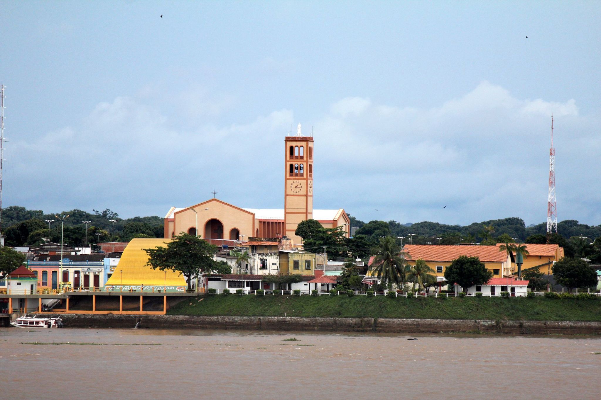
Surrounded by vibrant traditions and picturesque nature, the region on the island of Parintins offers a unique blend of cultural celebration and tropical wilderness. Every year, the famous Bumba-Meu-Boi festival takes place here, attracting thousands of tourists from around the world eager to immerse themselves in local legends, music, and dance. Additionally, the surroundings are rich with rivers and forests where visitors can enjoy walks and explore the abundant Amazon wildlife.
A trip to Parintins is an opportunity to discover not only the beauty of Amazonian landscapes but also the living culture of the Brazilian people. Small villages with friendly locals, traditional crafts, and cuisine create an atmosphere of coziness and authenticity. This is a place where every guest will find something special — from breathtaking natural adventures to unforgettable cultural experiences.
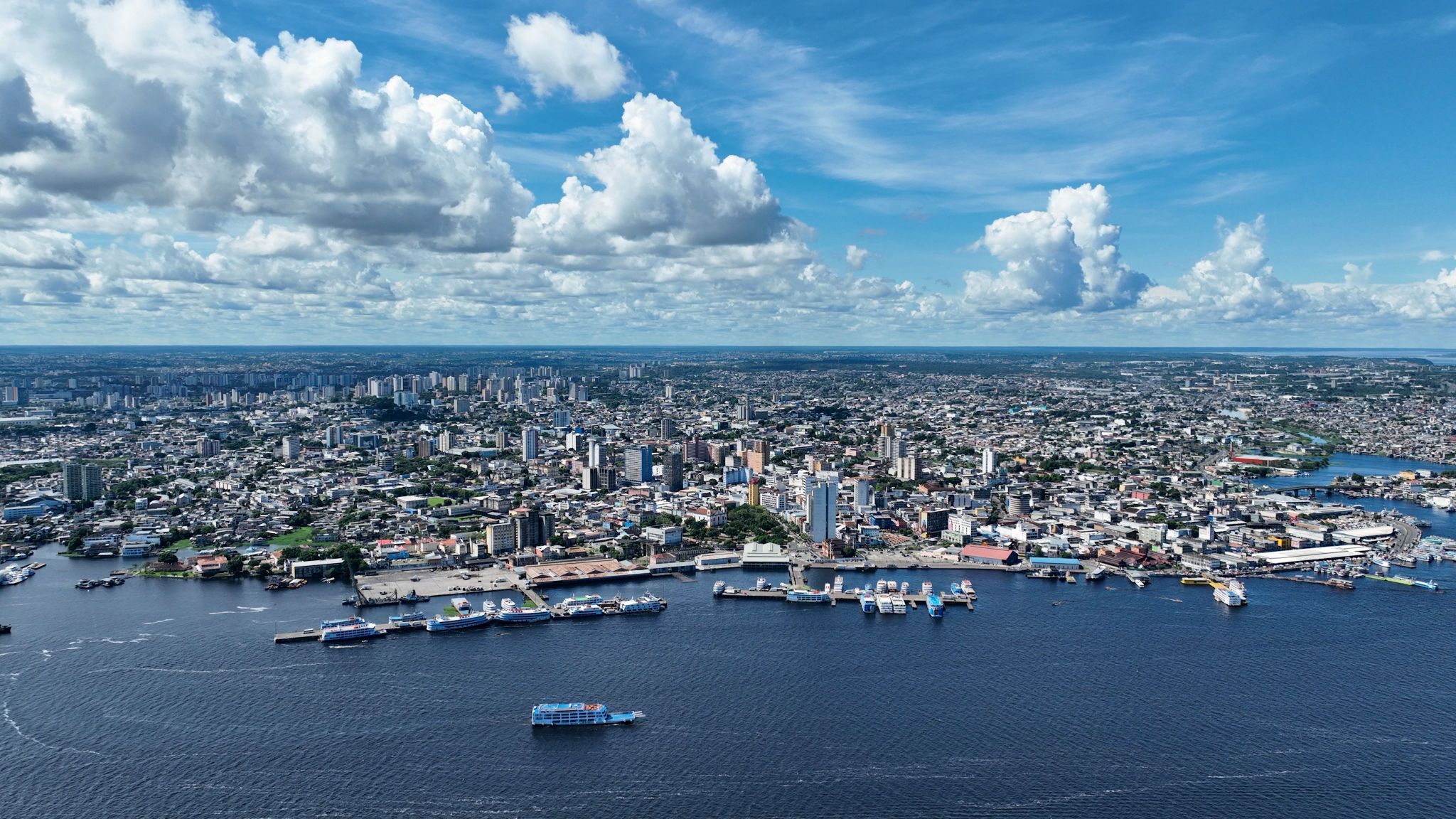
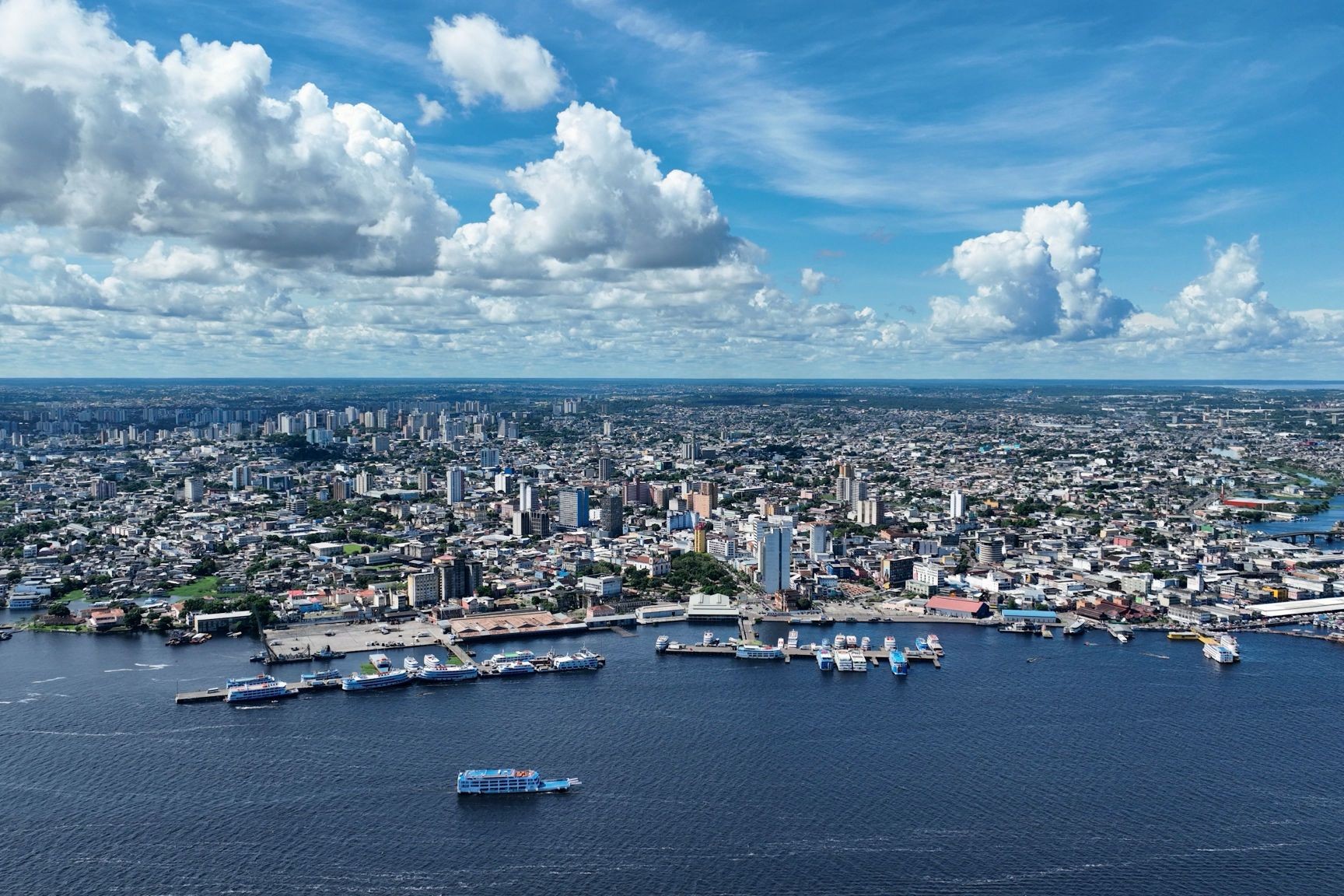
In the heart of the Amazon, where nature and history blend uniquely, lies the city of Manaus — the capital of the Amazonas state and the largest city in the region with over a million inhabitants. It gained fame during the rubber boom of the last century, when the luxurious Opera House was built in 1896 using materials imported from Europe despite the high costs. Surrounded by jungle on three sides, Manaus stands apart from European cities with its shaded streets, small parks, and traditional boot cleaners. Just a ten-minute walk from the city center, you can find palm-thatched stilt houses inhabited by indigenous families, offering a genuine Amazonian experience.
One of the city’s natural wonders is the "Meeting of the Waters." Here, the dark mineral-rich waters of the Rio Negro merge with the yellowish waters of the Solimões River to form the mighty Amazon. For about two kilometers, these waters flow side by side without mixing due to their temperature difference, creating a stunning natural spectacle. Manaus is considered one of the cleanest ecological cities in the world and is located just five hours by plane from Rio de Janeiro — a perfect starting point for exploring the amazing Amazon rainforest.
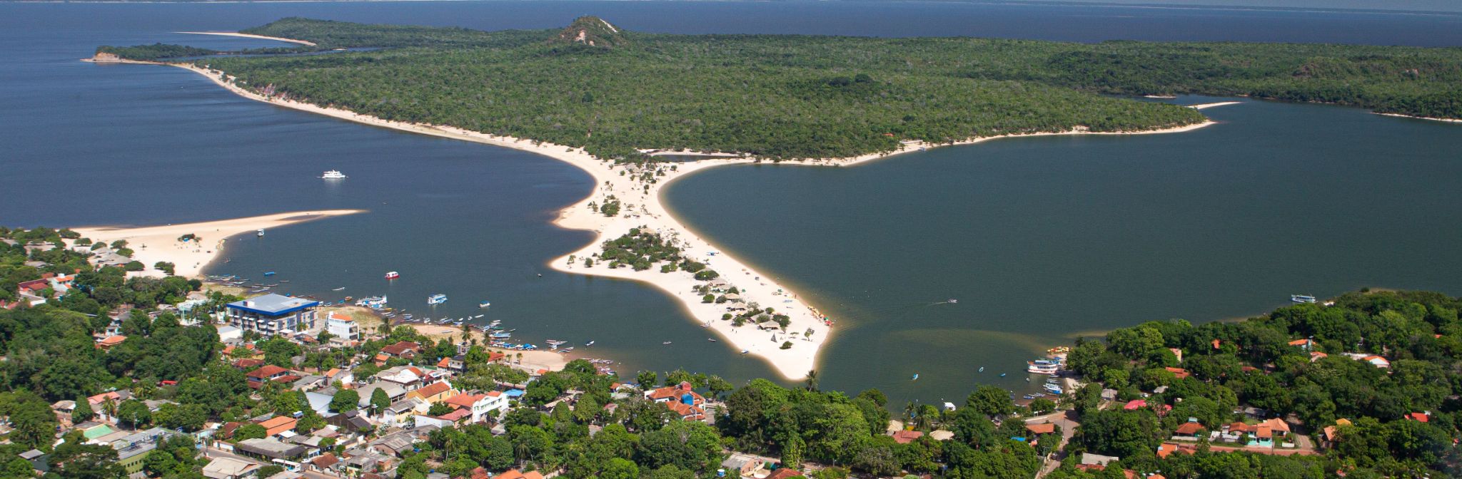
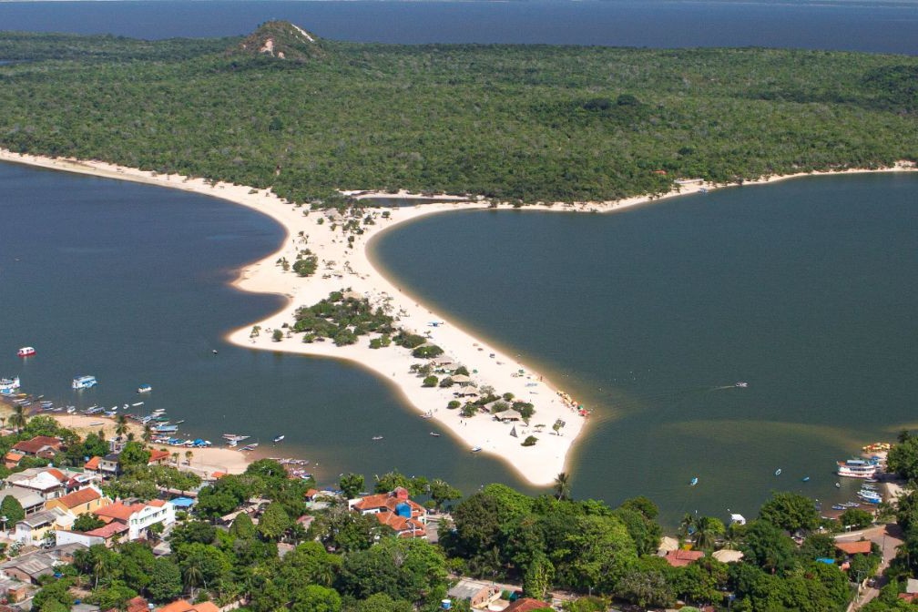
White-sand beaches that appear and disappear with the changing water levels of the Amazon River make Alter do Chão a true natural wonder of Brazil. Located in the state of Pará, it is often called the “Brazilian Caribbean” for its crystal-clear waters, palm-fringed scenery, and soft sands. Visitors come not only for the beach experience but also for the charm of a fishing village where fresh fish dishes and jungle serenity await.
Alter do Chão is especially popular in September during the annual Sairé Festival — a vibrant celebration with traditional dances, costumes, and river parades. Adventure seekers can enjoy kayaking through flooded forests, spotting pink river dolphins, and exploring ancient archaeological sites. It’s a place where culture, nature, and the magic of the Amazon come together in one unforgettable location.
Breathtaking landscapes and pristine silence welcome travelers to Devil’s Point, the southernmost tip of Cat Island. Despite its ominous name, this place offers a rare chance for solitude amid the vast Atlantic Ocean. Here, the sun sets into the water, and a gentle breeze carries away all worries.
For adventurers and romantics alike, Devil’s Point is an ideal spot for hiking, photography, and quiet reflection in nature. Legend has it that the cape earned its name due to unusual rocks and strong currents that misled sailors for centuries. Today, it is a peaceful corner where only the whisper of waves and seabirds’ calls can be heard.
Scarborough (Tobago) is a charming town located on the eastern coast of the island of Tobago in the Caribbean Sea. As the capital of the island, it serves as the cultural and historical heart of Tobago. The town is known for its picturesque streets, vibrant markets, and old buildings that blend harmoniously with modern architecture. One of the main landmarks is the historic St. Anne’s Church, built in 1770, which remains an important part of the town’s heritage. Visitors are also drawn to the local market, where fresh fruits, spices, and handmade crafts showcase the island’s rich traditions.
Beyond its cultural and historical appeal, Scarborough offers travelers stunning natural surroundings. Nearby beaches with white sand and crystal-clear waters are perfect for swimming and diving. Pleasant Bay, popular among tourists, offers scenic views and a colorful underwater world. Scarborough is also an ideal base for exploring Tobago’s nature reserves and enjoying active outdoor adventures.
Bridgetown is the capital and largest city of Barbados. Formerly The Town of Saint Michael, the Greater Bridgetown area is located within the parish of Saint Michael. Bridgetown is sometimes locally referred to as "The City", but the most common reference is simply "Town". As of 2014, its metropolitan population stands at roughly 110,000.
The Bridgetown port, found along Carlisle Bay (at 13.106°N 59.632°W) lies on the southwestern coast of the island. Parts of the Greater Bridgetown area (as roughly defined by the Ring Road Bypass or more commonly known as the ABC Highway), sit close to the borders of the neighbouring parishes Christ Church and St. James. The Grantley Adams International Airport for Barbados, is located 16 kilometres (10 mi) southeast of Bridgetown city centre, and has daily flights to major cities in the United Kingdom, United States, Canada and the Caribbean. There is no longer a local municipal government, but it is a constituency of the national Parliament. During the short-lived 1950s-1960s Federation of the British West Indian Territories, Bridgetown was one of three capital cities within the region being considered to be the Federal capital of region.
The present-day location of the city was established by English settlers in 1628; a previous settlement under the authority of Sir William Courten was at St. James Town. Bridgetown is a major West Indies tourist destination, and the city acts as an important financial, informatics, convention centre, and cruise ship port of call in the Caribbean region. On 25 June 2011, "Historic Bridgetown and its Garrison" was added as a World Heritage Site of UNESCO.