| Region rejsu : Morze Śródziemne |
| Firma : Oceania Cruises |
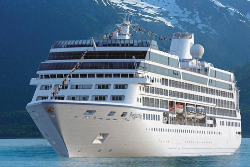
| Statek : Regatta |
| Data rozpoczęcia : pon. 17 sie 2026 |
| Data zakończenia : czw. 27 sie 2026 |
| Liczba nocy : 10 nocy |
| Dzień | Data | Port | Wypłynięcie | Odpłynięcie |
|---|---|---|---|---|
| 1 | 17.08 pon. | Dubrownik / Chorwacja | 07:00 | 17:00 |
| 2 | 18.08 wt. | Kotor / Czarna Góra | 07:00 | 17:00 |
| 3 | 19.08 śr. | Opatka / Grecja | 10:00 | 18:00 |
| 4 | 20.08 czw. | Katakolo / Grecja | 07:00 | 16:00 |
| 5 | 21.08 pt. | Santorini, Cyklady / Grecja | 10:00 | 19:00 |
| 6 | 22.08 sob. | Pireus (Ateny) / Grecja | 05:00 | 21:00 |
| 7 | 23.08 niedz. | Mykonos / Grecja | 07:00 | 19:00 |
| 8 | 24.08 pon. | Selcuk / Turcja | 07:00 | 19:00 |
| 9 | 25.08 wt. | Ks. BOZJAADDA / Turcja | 08:00 | 18:00 |
| 10 | 26.08 śr. | Stambuł / Turcja | 09:00 | |
| 11 | 27.08 czw. | Stambuł / Turcja | 16:00 |
Twój Świat w cenie
Dzięki Twojemu Światu w cenie, będziesz cieszyć się szeroką gamą udogodnień, zapewniających najwyższy komfort i wartość rejsów ultra-premium.
Niezapomniane doznania kulinarne w licznych, wykwintnych restauracjach — wszystko bez dodatkowych opłat.
Bezpłatne kawy specjalistyczne, napoje gazowane, świeżo wyciskane soki oraz woda gazowana i niegazowana Vero Water® serwowane na całym statku.
Nielimitowany, bezpłatny dostęp do Wi-Fi w apartamentach, kabinach i wszystkich pomieszczeniach ogólnodostępnych.
Posiłki serwowane w pokoju z doskonałym wyborem dań na ciepło i zimno.
Koktajle, koktajle mleczne, gelato i firmowe lody Humphry Slocombe — zawsze w cenie.
Grupowe zajęcia fitness w Aquamar® Spa + Vitality Center są bezpłatne.
Napiwki są wliczone w cenę dla Twojej wygody.
Pranie jest bezpłatne dla wszystkich gości.
Dzięki bezpłatnym pralniom samoobsługowym na pokładzie, a także usługom prania i prasowania dla kategorii Concierge i Suite, zawsze będziesz wyglądać olśniewająco. Oprócz naszej charakterystycznej, spersonalizowanej obsługi, zapewnimy Ci wzbogacający rejs bez ukrytych kosztów i prowizji.
Podnieś poziom swoich wrażeń
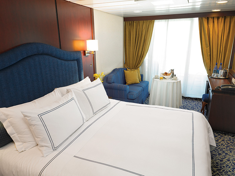
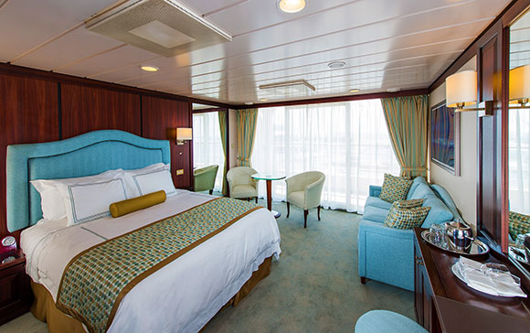
Kajuty Concierge Level Veranda oferują niezrównane połączenie luksusu, przywilejów i wartości. Bogactwo udogodnień i ekskluzywnych korzyści sprawi, że Twoje wrażenia będą jeszcze bardziej wzniosłe — od dań do wyboru z The Grand Dining Room, przez bezpłatne usługi pralnicze, po nieograniczony dostęp do tarasu Aquamar Spa.
Na pokładzie Oceania Marina i Oceania Riviera możesz również skorzystać z usług dedykowanego Concierge i ekskluzywnego dostępu do prywatnego salonu Concierge Lounge.
Kajuty Concierge Level Veranda, zlokalizowane w najbardziej pożądanych miejscach statku, to coś więcej niż tylko kabiny — to niezapomniane przeżycie.
Concierge Level Veranda — Ekskluzywne przywileje
Rozszerzone menu posiłków do pokoju na lunch i kolację z The Grand Dining Room
Usługi pralnicze — do 3 sztuk bagażu na kabinę
Ekskluzywny dostęp do prywatnego salonu Concierge Lounge na statkach Oceania Marina, Oceania Riviera, Oceania Vista i Oceania Allura za pomocą karty-klucza, oferujący bezpłatne napoje, kawę, przekąski i usługi dedykowanego Concierge'a
Powitalna butelka wyśmienitego włoskiego Prosecco
Priorytetowe rezerwacje online w restauracjach specjalistycznych
Nieograniczony dostęp do tarasu Aquamar Spa
Torba z logo Oceania Cruises
Kaszmirowe koce na kolana — idealne do relaksu i przytulania
Prasowanie odzieży po wejściu na pokład
Bezpłatna usługa czyszczenia butów
Depozyt i płatności – Oceania Cruises
Depozyt ogólny:
W przypadku apartamentów typu Owner’s, Vista i Oceania Suites wymagany jest depozyt w wysokości 20% ceny rejsu od osoby.
W przypadku wszystkich pozostałych kategorii apartamentów/kabin, depozyt wynosi 500 USD od osoby.
W przypadku Grand Voyages depozyt wynosi 1500 USD od osoby.
Terminy depozytu i płatności końcowej:
Rezerwacje dokonane na ponad 150 dni przed rejsem:
Depozyt w wysokości 20% w przypadku apartamentów typu Owner’s, Vista i Oceania Suites oraz 500 USD w przypadku wszystkich pozostałych kategorii wymagany jest w ciągu 5 dni od rezerwacji.
Rezerwacje dokonane na 90–120 dni przed rejsem:
Pełna płatność wymagana w ciągu 3 dni od rezerwacji.
Rezerwacje dokonane na 0–90 dni przed rejsem:
Pełna płatność wymagana w dniu rezerwacji.
Ważne:
Rezerwacje, które nie zostaną wpłacone lub opłacone w całości zgodnie z niniejszym harmonogramem, zostaną automatycznie anulowane. O ile nie zaznaczono inaczej, płatność końcowa musi wpłynąć do Oceania Cruises na 150 dni przed wypłynięciem w przypadku rejsów krótszych niż 15 dni oraz na 150 dni w przypadku rejsów trwających 15 dni lub dłużej.
Oceania Cruises zastrzega sobie prawo do anulowania rezerwacji, które nie zostały w pełni opłacone w momencie płatności końcowej.
Informacje dodatkowe:
Dane paszportowe i specjalne prośby dotyczące usług pokładowych należy przesłać w momencie płatności końcowej.
Płatności można dokonać czekiem osobistym, kartą American Express, Discover, MasterCard lub Visa.
Dla wygody płatność końcowa może zostać automatycznie pobrana z karty kredytowej użytej do wpłaty początkowej.
Oceania Cruises nie ponosi odpowiedzialności za opłaty walutowe ani opłaty transakcyjne pobierane niezależnie przez banki wystawiające karty. Opłaty te nie przysługują Oceania Cruises.
Płatności kartami kredytowymi osób trzecich są akceptowane wyłącznie po uzyskaniu ważnej autoryzacji od posiadacza karty.
Depozyt i płatność – rejsy 180-dniowe
W przypadku rejsów 180-dniowych wymagany jest depozyt w wysokości 20% ceny rejsu od osoby za wszystkie apartamenty i kabiny w ciągu 7 dni od rezerwacji.
Ostateczna płatność musi zostać otrzymana najpóźniej 181 dni przed wypłynięciem, wraz z danymi paszportowymi i wszelkimi specjalnymi prośbami o usługi na pokładzie.
W przeciwnym razie rezerwacja może zostać natychmiast anulowana, a naliczone zostaną stosowne kary.
Forma płatności (FORMA PŁATNOŚCI)
Oceania Cruises akceptuje płatności za rezerwacje kartą kredytową/debetową lub przelewem bankowym.
Niestety, czeki osobiste nie są akceptowane.
Karty kredytowe/debetowe:
Akceptowane są karty American Express, Visa i Mastercard.
Uwaga: Oceania Cruises nie ponosi odpowiedzialności za opłaty za wymianę waluty/transakcje naliczane przez bank wystawiający kartę.
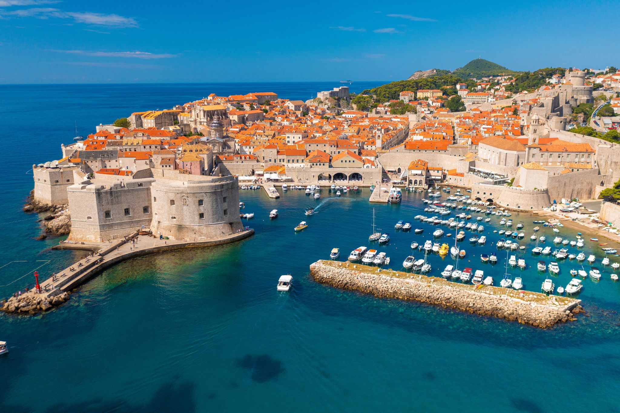
Dubrovnik is a Croatian city on the Adriatic Sea. It is one of the most prominent tourist destinations in the Mediterranean Sea, a seaport and the centre of Dubrovnik-Neretva County. Its total population is 42,615 (census 2011). In 1979, the city of Dubrovnik joined the UNESCO list of World Heritage sites.
The prosperity of the city was historically based on maritime trade; as the capital of the maritime Republic of Ragusa, it achieved a high level of development, particularly during the 15th and 16th centuries, as it became notable for its wealth and skilled diplomacy.
In 1991, after the break-up of Yugoslavia, Dubrovnik was besieged by Serbian and Montenegrin soldiers of the Yugoslav People's Army (JNA) for seven months and suffered significant damage from shelling. After repair and restoration works in the 1990s and early 2000s, Dubrovnik re-emerged as one of the top tourist destinations in the Mediterranean.
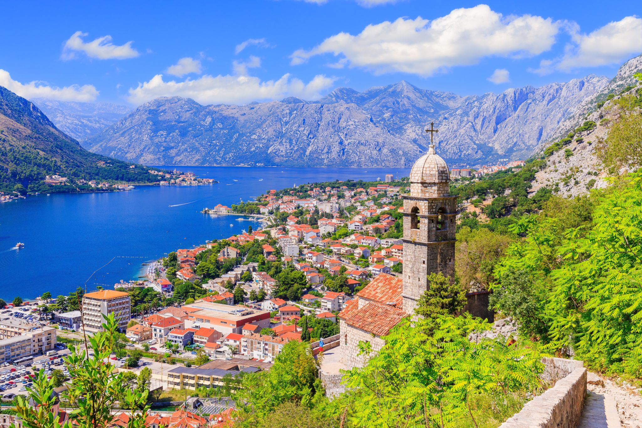
Kotor is a coastal town in Montenegro. It is located in a secluded part of the Gulf of Kotor. The city has a population of 13,510 and is the administrative center of Kotor Municipality.
The old Mediterranean port of Kotor is surrounded by fortifications built during the Venetian period. It is located on the Bay of Kotor (Boka Kotorska), one of the most indented parts of the Adriatic Sea. Some have called it the southern-most fjord in Europe, but it is a ria, a submerged river canyon. Together with the nearly overhanging limestone cliffs of Orjen and Lovćen, Kotor and its surrounding area form an impressive landscape.
Since the early 2000s Kotor has seen an increase in tourists , many of them coming by cruise ship. Visitors are attracted by the natural environment of the Gulf of Kotor and by the old town of Kotor. Kotor is part of the World Heritage Site dubbed the Natural and Culturo-Historical Region of Kotor.
The fortified city of Kotor was also included in UNESCO's World Heritage Site list as part of Venetian Works of Defence between 15th and 17th centuries: Stato da Terra – western Stato da Mar in 201
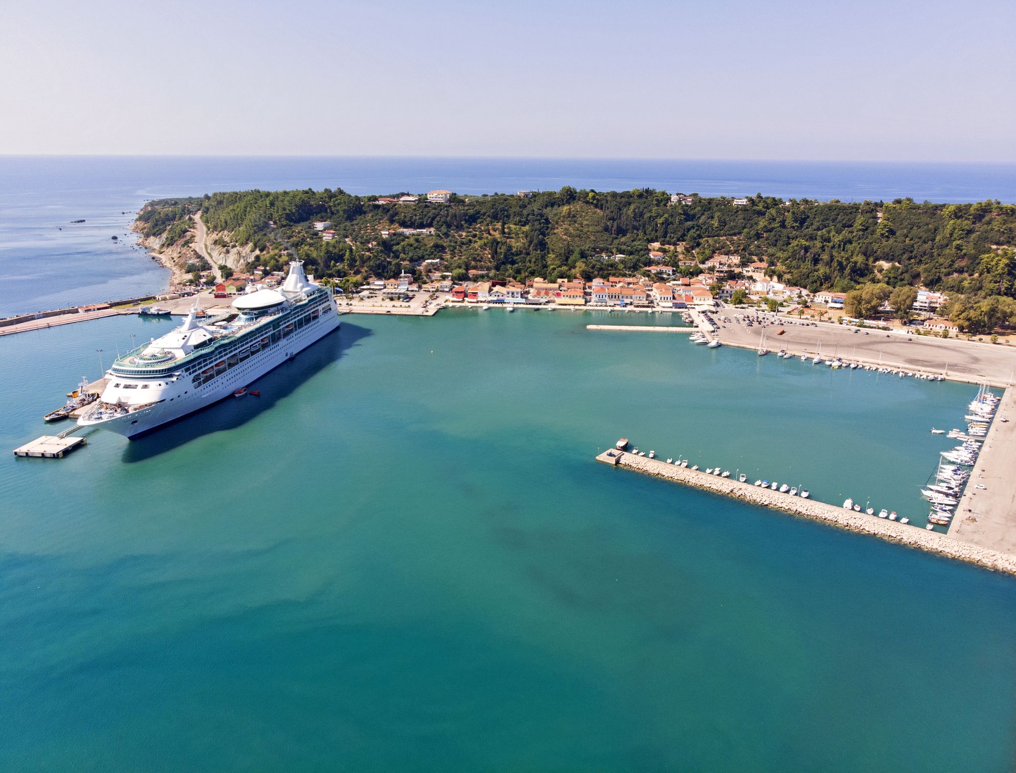
Katakolon to małe miasteczko nadmorskie położone na zachodzie Peloponezu w Grecji, pełniące funkcję morskiej bramy do legendarnej starożytnej Olimpii — kolebki igrzysk olimpijskich. Dzięki dogodnemu położeniu Katakolon stał się popularnym portem dla statków wycieczkowych. Port otaczają malownicze wzgórza, a wzdłuż wybrzeża znajdują się przytulne kawiarnie, sklepy z lokalnymi przysmakami i pamiątkami. Turyści często rozpoczynają swoją podróż po regionie właśnie tutaj, udając się następnie do stanowisk archeologicznych w Olimpii, oddalonych o około 30 km.
Katakolon oferuje spokojną atmosferę i tradycyjny grecki urok: wąskie uliczki, domy z dachówką i lazurowe wody Morza Jońskiego. W okolicach znajdują się winnice produkujące lokalne wino oraz niewielkie plaże idealne do kąpieli i relaksu. W miasteczku działa również Muzeum Starożytnej Techniki Greckiej, prezentujące unikalne modele starożytnych wynalazków — od automatycznych drzwi po wczesne formy komputerów. Katakolon to harmonijne połączenie historii, natury i autentycznej greckiej gościnności.

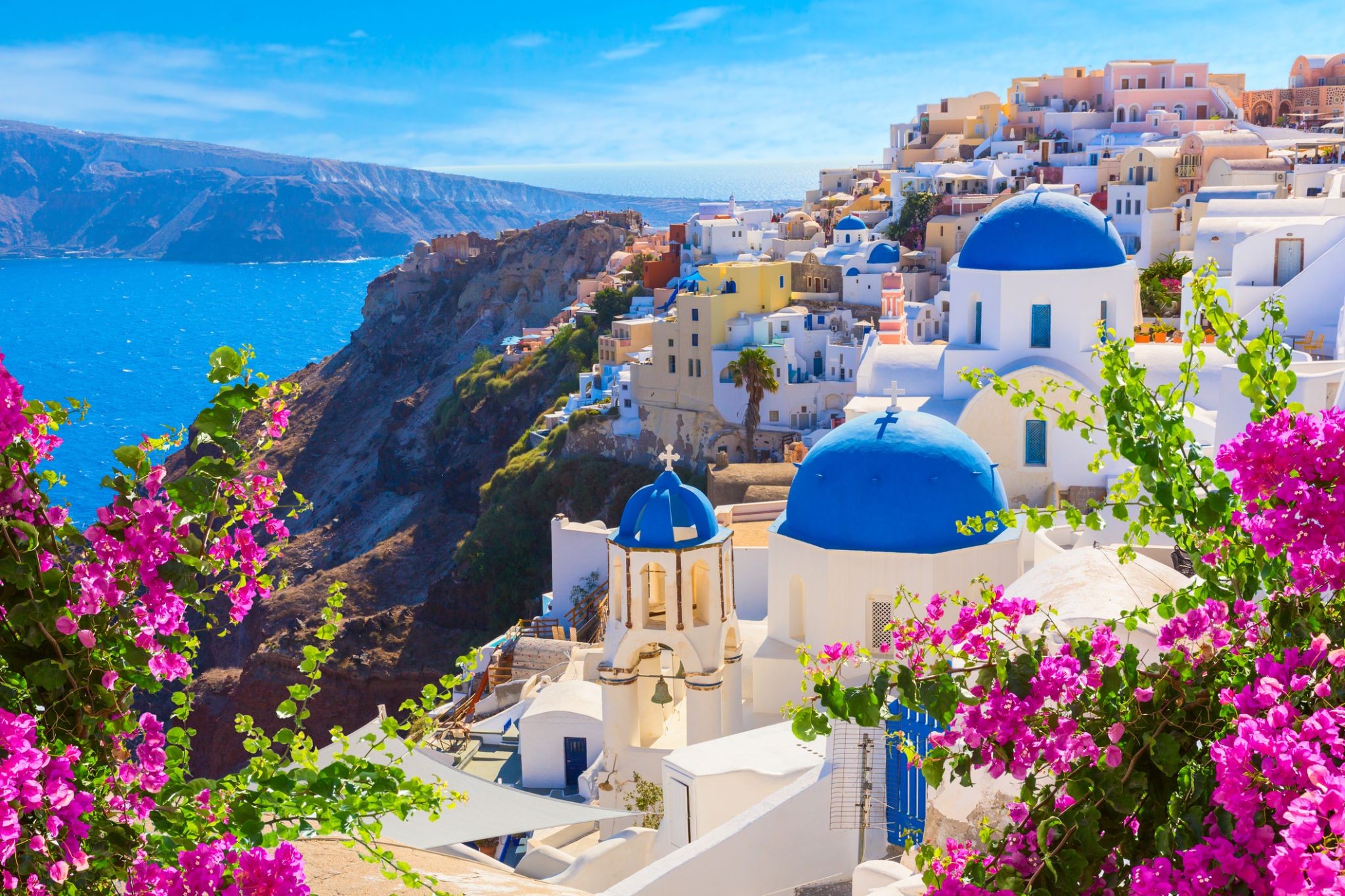
Grecja dzieli się z Tobą pięknem jednego z najczarowniejszych wulkanicznych archipelagów Morza Egejskiego – Santorini. Wulkan wciąż jest aktywny, ale dla turystów stworzono bezpieczne warunki, dzięki czemu można tu śmiało przyjeżdżać. To właśnie jemu zawdzięczamy czarne plaże, krajobrazy ze stwardniałej czerwono-brunatnej lawy, turkusowe widoki morza i kontrastujące z nimi bielone domki. Jeśli odwiedzisz Santorini, nie zapomnij o stanowisku archeologicznym w Akrotiri, gdzie zachowały się pozostałości minojskiej cywilizacji.

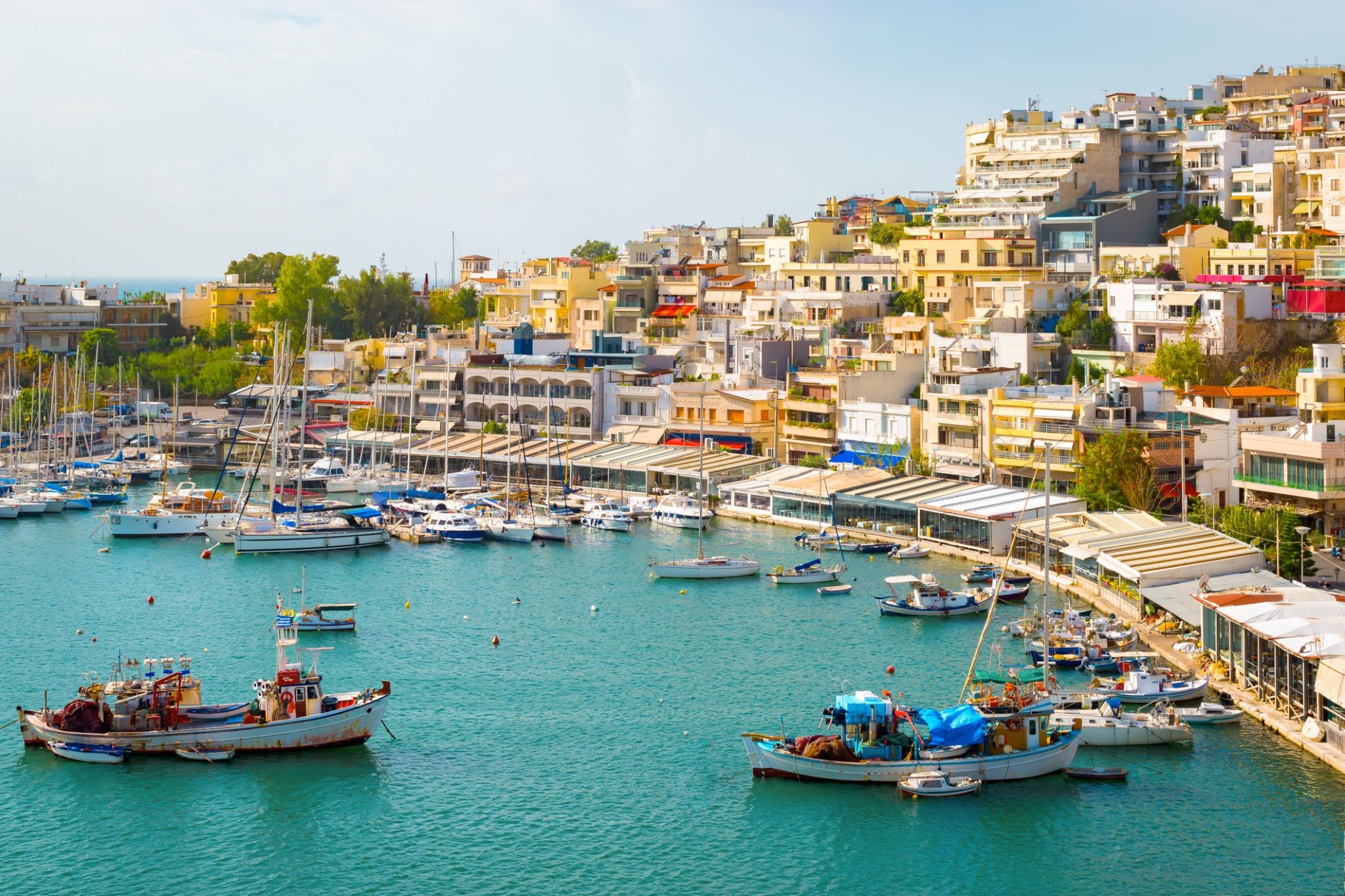
Pireus to stare miasto portowe, będące portem Aten i jednocześnie największym portem Grecji w dniu dzisiejszym. Pireus stanowi część wielkich Aten, które mogą poszczycić się bogactwem atrakcji, w tym unikalnymi zabytkami narodowej sztuki plastycznej.
Ponad dwieście muzeów i galerii, w tym Muzeum Historii Uniwersytetu, Muzeum Archeologiczne Keramejkos i wiele innych, gościnnie powita Państwa w swoich murach i zapozna z kulturą tej okolicy.
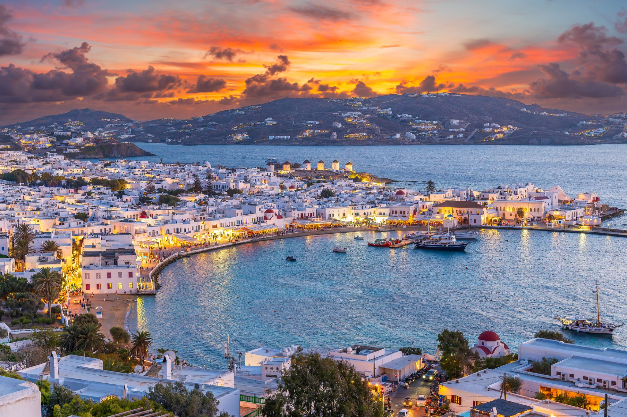
Słynna, nowoczesna wyspa Mykonos przyciąga turystów swoim urokiem. Trudno oprzeć się widokowi lazurowego morza i skąpanego w słońcu białego miasta. Mykonos to wyspa kontrastów – biel domów, błękit głębin i kolorowe okna. Wśród atrakcji warto wspomnieć liczne kościoły i muzea, m.in. Muzeum Archeologiczne z amforą przedstawiającą scenę z Trojańskim koniem.
Mykonos to modny kurort i ulubione miejsce bohemy. To tutaj można zanurzyć się w wir luksusowych usług, rozrywek i nocnego życia. Ale wyspa ma także spokojniejsze oblicze – czekają na Ciebie urokliwe, ciche zakątki, idealne do relaksu i odpoczynku.

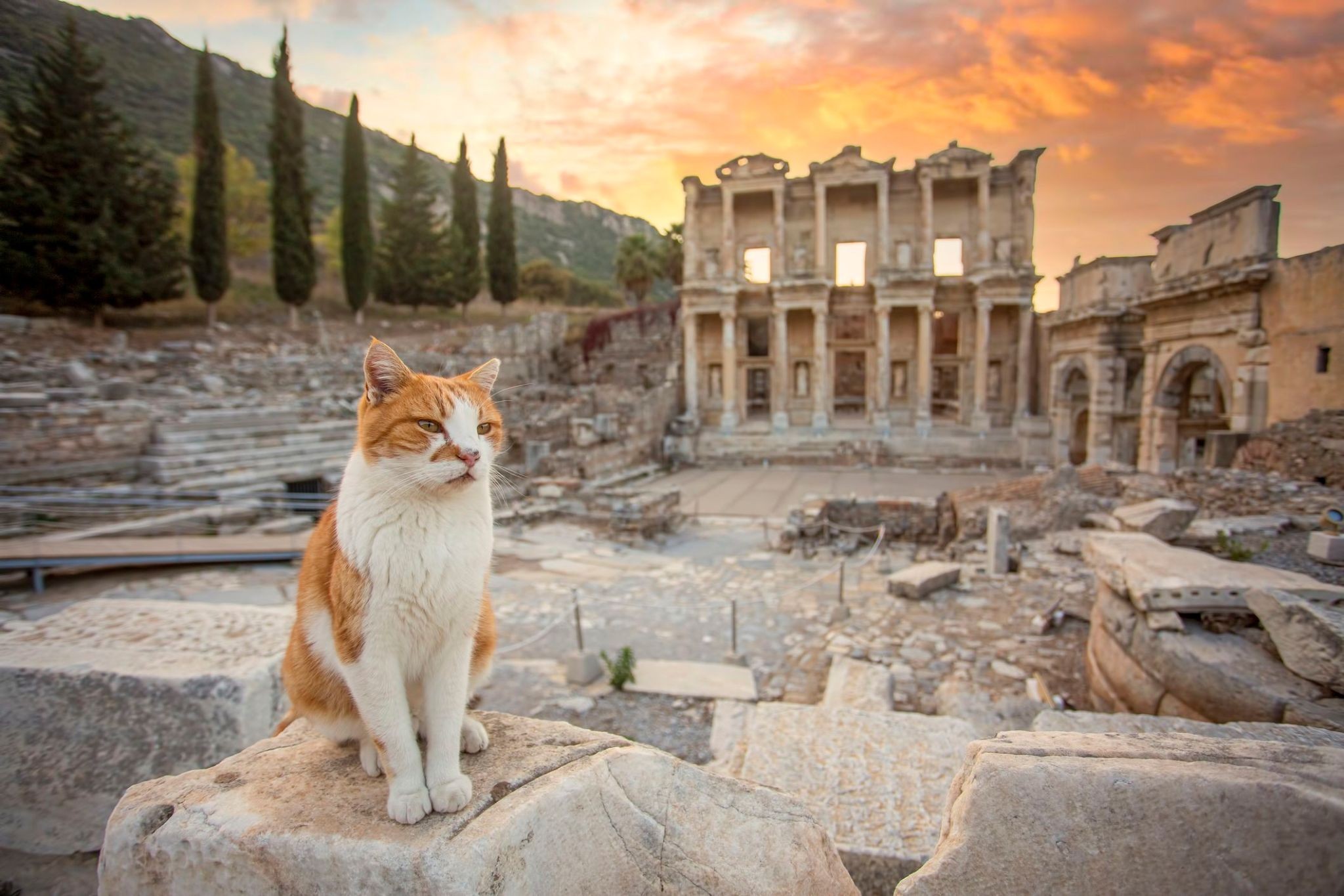
Śródziemnomorskie słońce, zapach lawendy i wieki historii towarzyszą podróżnym przybywającym do Selçuk, małego tureckiego miasteczka położonego zaledwie kilka kilometrów od legendarnego Efezu. Miejsce to łączy urok anatolijskiego życia z antycznymi ruinami, gdzie każdy kamień opowiada historie z czasów Cesarstwa Rzymskiego i Bizancjum. To doskonała baza wypadowa do zwiedzania jednego z najsłynniejszych stanowisk archeologicznych w Turcji, ale samo miasteczko również zasługuje na uwagę: można tu znaleźć stare meczety, bizantyjską twierdzę i pozostałości akweduktów.
W Selçuk czas płynie powoli, pozwalając na spokojne odkrywanie muzeów i ulicznych targów z przyprawami oraz ręcznie robioną ceramiką. Wiosną odbywa się tu festiwal tulipanów, a w pobliżu znajduje się Dom Matki Bożej – miejsce pielgrzymek chrześcijan. To rzadkie połączenie starożytności, religijnej symboliki i nowoczesnego tureckiego życia sprawia, że Selçuk zostawia po sobie nie tylko zdjęcia, ale i głębokie wrażenia.

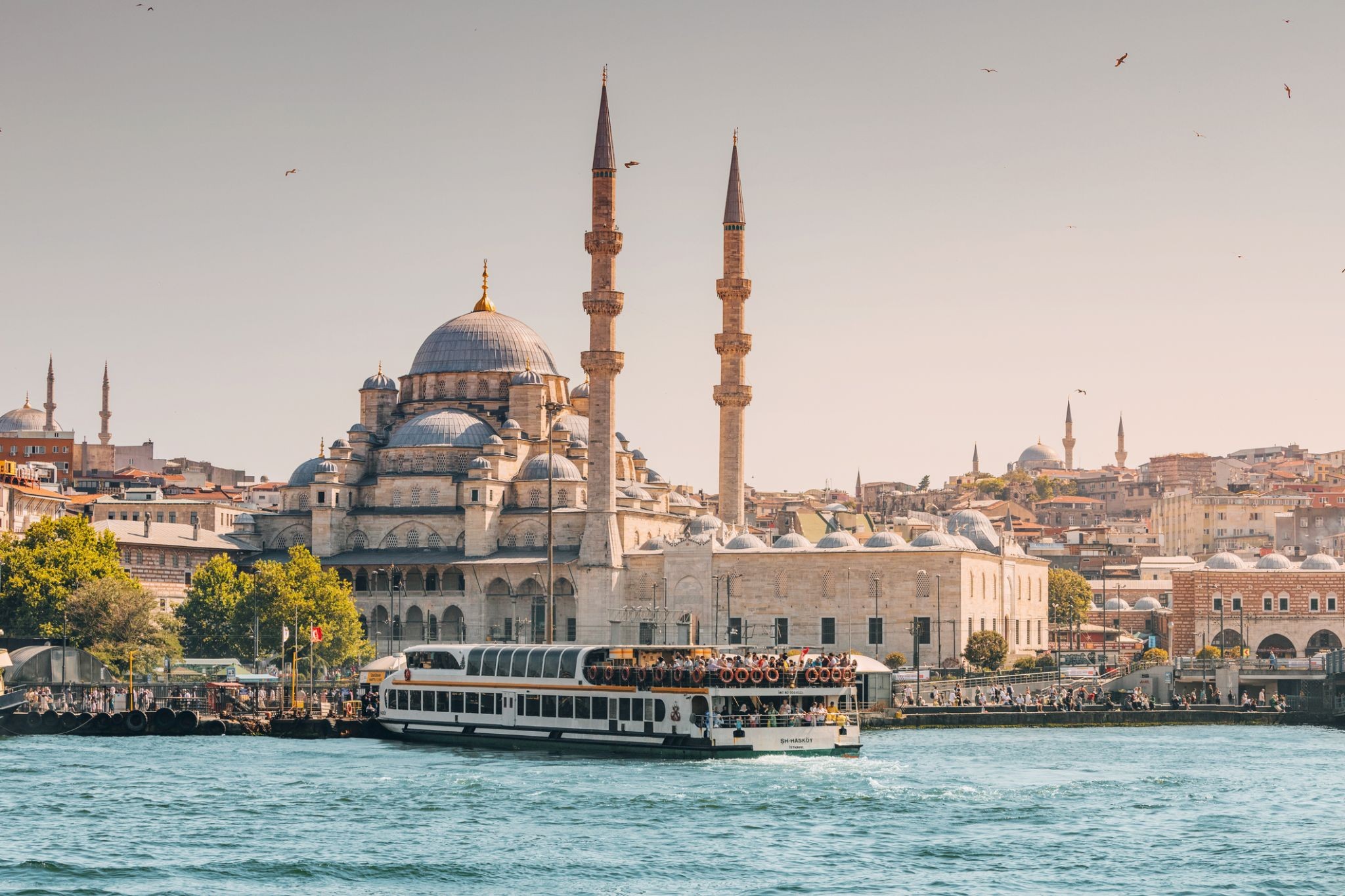
Stambuł – największe miasto Turcji, położone nad Bosforem. Do 1930 roku znane jako Konstantynopol, było stolicą Imperium Rzymskiego, Bizantyjskiego, Łacińskiego i Osmańskiego. W mieście i jego okolicach zachowały się zabytki dawnych cywilizacji, świątynie, pałace i fortyfikacje. Dziś Stambuł to ważne centrum kultury, handlu i przemysłu. Turyści przyjeżdżają tu nie tylko, by zobaczyć historyczne pomniki, ale też zrobić zakupy na słynnych tureckich bazarach, gdzie można kupić przyprawy, biżuterię, antyki czy kolorowe fajki wodne i oczywiście potargować się jak miejscowi.
Stambuł – największe miasto Turcji, położone nad Bosforem. Do 1930 roku znane jako Konstantynopol, było stolicą Imperium Rzymskiego, Bizantyjskiego, Łacińskiego i Osmańskiego. W mieście i jego okolicach zachowały się zabytki dawnych cywilizacji, świątynie, pałace i fortyfikacje. Dziś Stambuł to ważne centrum kultury, handlu i przemysłu. Turyści przyjeżdżają tu nie tylko, by zobaczyć historyczne pomniki, ale też zrobić zakupy na słynnych tureckich bazarach, gdzie można kupić przyprawy, biżuterię, antyki czy kolorowe fajki wodne i oczywiście potargować się jak miejscowi.