| Region rejsu : USA /Kanada / Meksyk, Rejsy po Pacyfiku |
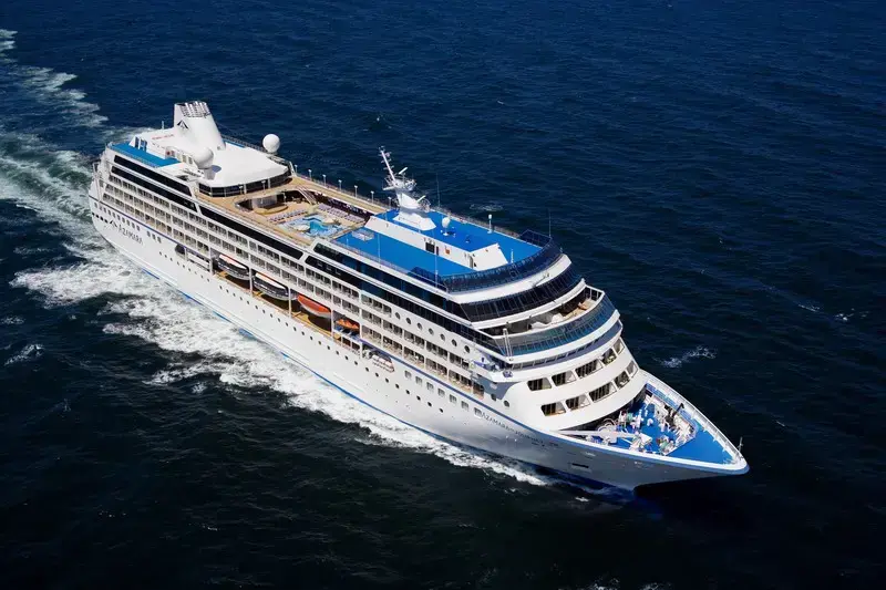
| Firma : Azamara Cruises |
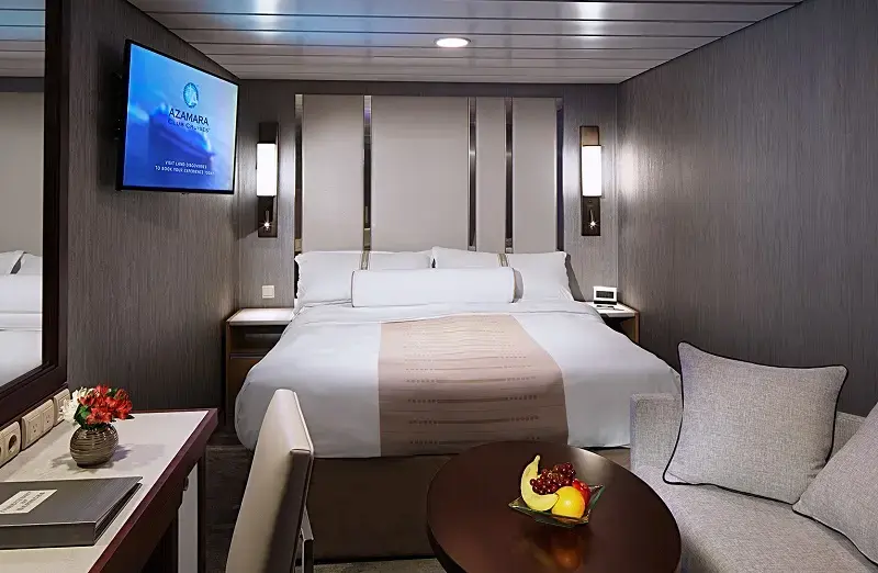
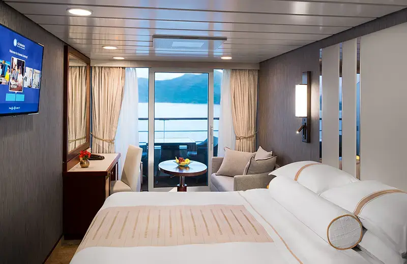
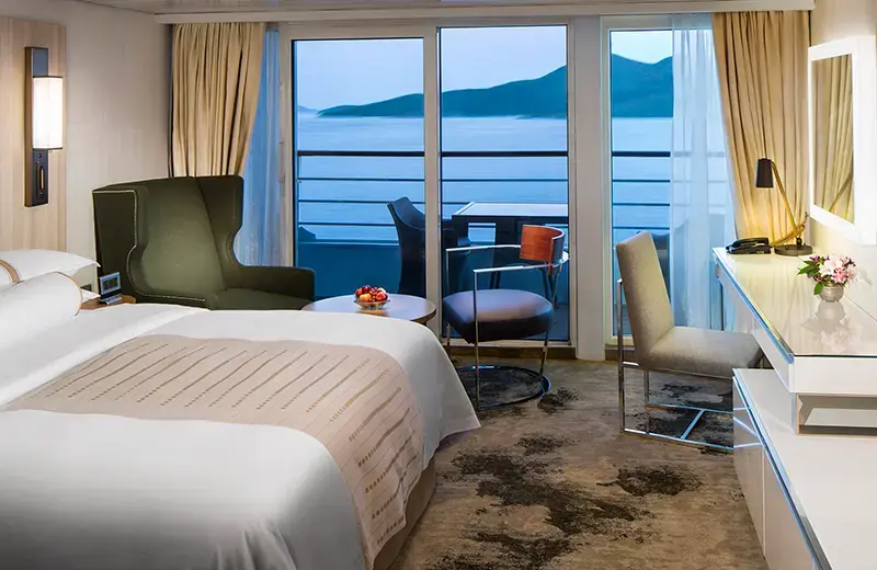
| Statek : Azamara Quest |
| Data rozpoczęcia : wt. 05 sty 2027 |
| Data zakończenia : pt. 02 kwi 2027 |
| Liczba nocy : 87 nocy |
| Dzień | Data | Port | Wypłynięcie | Odpłynięcie |
|---|---|---|---|---|
| 1 | 5.01 wt. | San Francisco / USA | 17:00 | |
| 2 | 6.01 śr. | Dzień na morzu / Morze | 15:00 | |
| 3 | 7.01 czw. | Dzień na morzu / Morze | 15:00 | |
| 4 | 8.01 pt. | Dzień na morzu / Morze | 15:00 | |
| 5 | 9.01 sob. | Dzień na morzu / Morze | 15:00 | |
| 6 | 10.01 niedz. | Dzień na morzu / Morze | 15:00 | |
| 7 | 11.01 pon. | Honolulu, Oahu, Hawaje / Hawaje | 08:00 | |
| 8 | 12.01 wt. | Honolulu, Oahu, Hawaje / Hawaje | 22:00 | |
| 9 | 13.01 śr. | Navilili, ks. Kauai na Hawajach / Hawaje | 08:00 | 17:00 |
| 10 | 14.01 czw. | Kailua-Kona / Hawaje | 09:00 | 20:00 |
| 11 | 15.01 pt. | Dzień na morzu / Morze | 15:00 | |
| 12 | 16.01 sob. | Dzień na morzu / Morze | 15:00 | |
| 13 | 17.01 niedz. | Dzień na morzu / Morze | 15:00 | |
| 14 | 18.01 pon. | Dzień na morzu / Morze | 15:00 | |
| 15 | 19.01 wt. | Dzień na morzu / Morze | 15:00 | |
| 16 | 20.01 śr. | Dzień na morzu / Morze | 15:00 | |
| 17 | 21.01 czw. | Moorea, Wyspy Towarzystwa / French Polynesia | 08:00 | 21:00 |
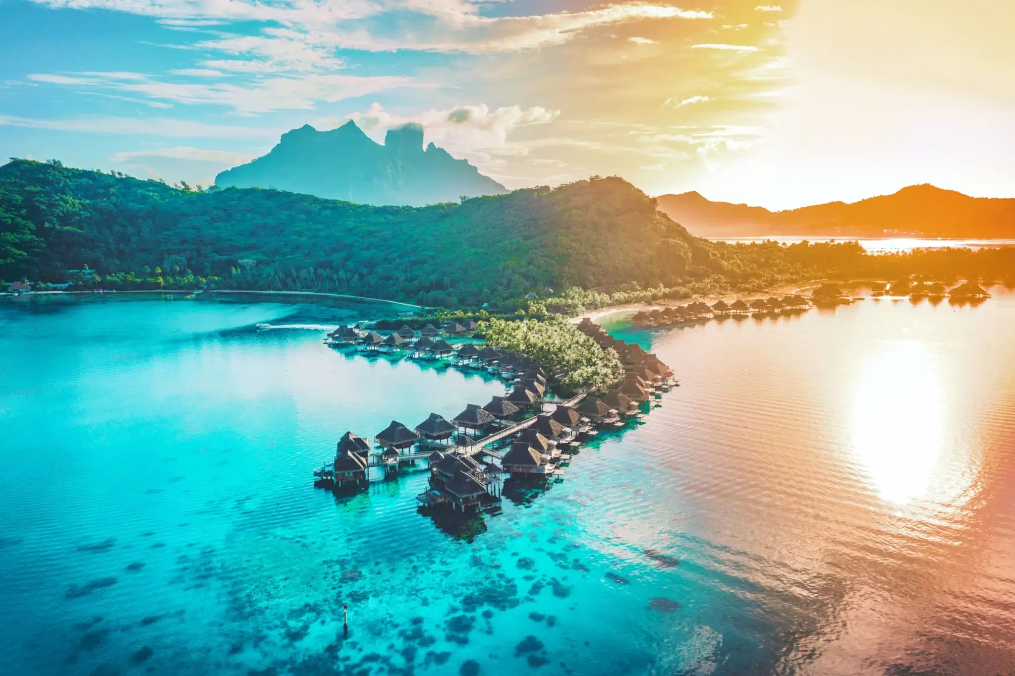
| 18 | 22.01 pt. | Bora Bora, Society Islands / French Polynesia | 08:00 | 20:00 |
| 19 | 23.01 sob. | Papeete Papeete / French Polynesia | 07:00 | 20:00 |
| 20 | 24.01 niedz. | Bora Bora, Society Islands / French Polynesia | 08:00 | 17:00 |
| 21 | 25.01 pon. | Dzień na morzu / Morze | 15:00 | |
| 22 | 26.01 wt. | Dzień na morzu / Morze | 15:00 | |
| 23 | 27.01 śr. | Pago-Pago / Samoa | 08:00 | 18:00 |
| 24 | 28.01 czw. | Dzień na morzu / Morze | 15:00 | |
| 25 | 29.01 pt. | Przekrocz międzynarodową linię zmiany daty | 03:00 | 06:00 |
| 26 | 30.01 sob. | Apia / Samoa | 08:00 | 17:00 |
| 27 | 31.01 niedz. | Dzień na morzu / Morze | 15:00 | |
| 28 | 1.02 pon. | Savusavu / Fiji | 13:30 | 20:00 |
| 29 | 2.02 wt. | Lautoka / Fiji | 08:00 | 22:00 |
| 30 | 3.02 śr. | Dzień na morzu / Morze | ||
| 31 | 4.02 czw. | Dzień na morzu / Morze | ||
| 32 | 5.02 pt. | WYSPA NORFOLK | 08:00 | 17:00 |
| 33 | 6.02 sob. | Dzień na morzu / Morze | 15:00 | |
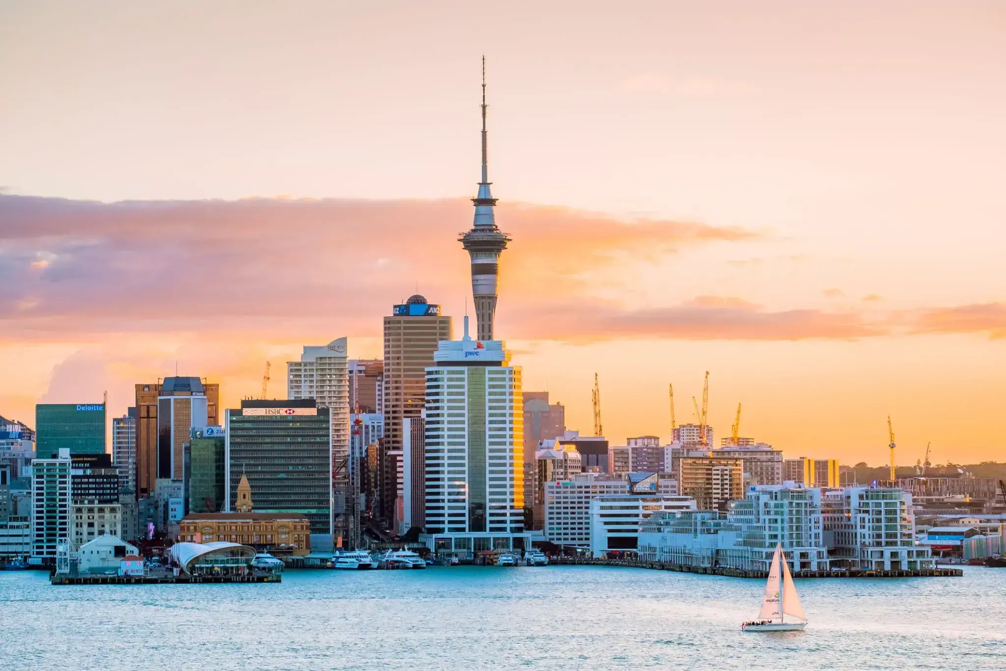
| 34 | 7.02 niedz. | Okland / Nowa Zelandia | 13:00 | |
| 35 | 8.02 pon. | Okland / Nowa Zelandia | 08:00 | 18:00 |
| 36 | 9.02 wt. | Toranga / Nowa Zelandia | 08:00 | 17:00 |
| 37 | 10.02 śr. | Нейпир / Nowa Zelandia | 11:30 | 18:00 |
| 38 | 11.02 czw. | Goal Goal / Australia | 11:30 | 18:00 |
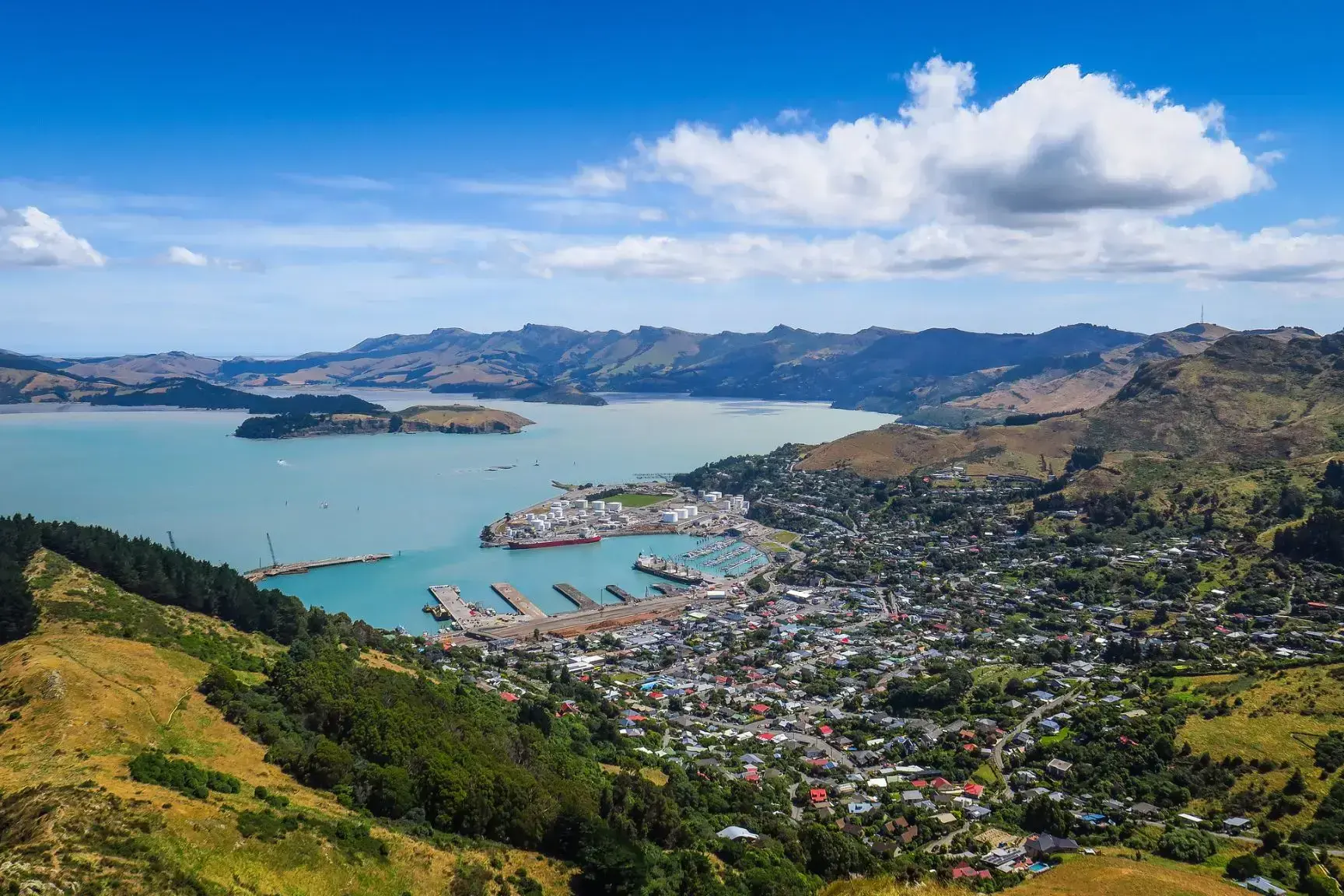
| 39 | 12.02 pt. | Christchurch / Nowa Zelandia | 09:00 | 17:00 |
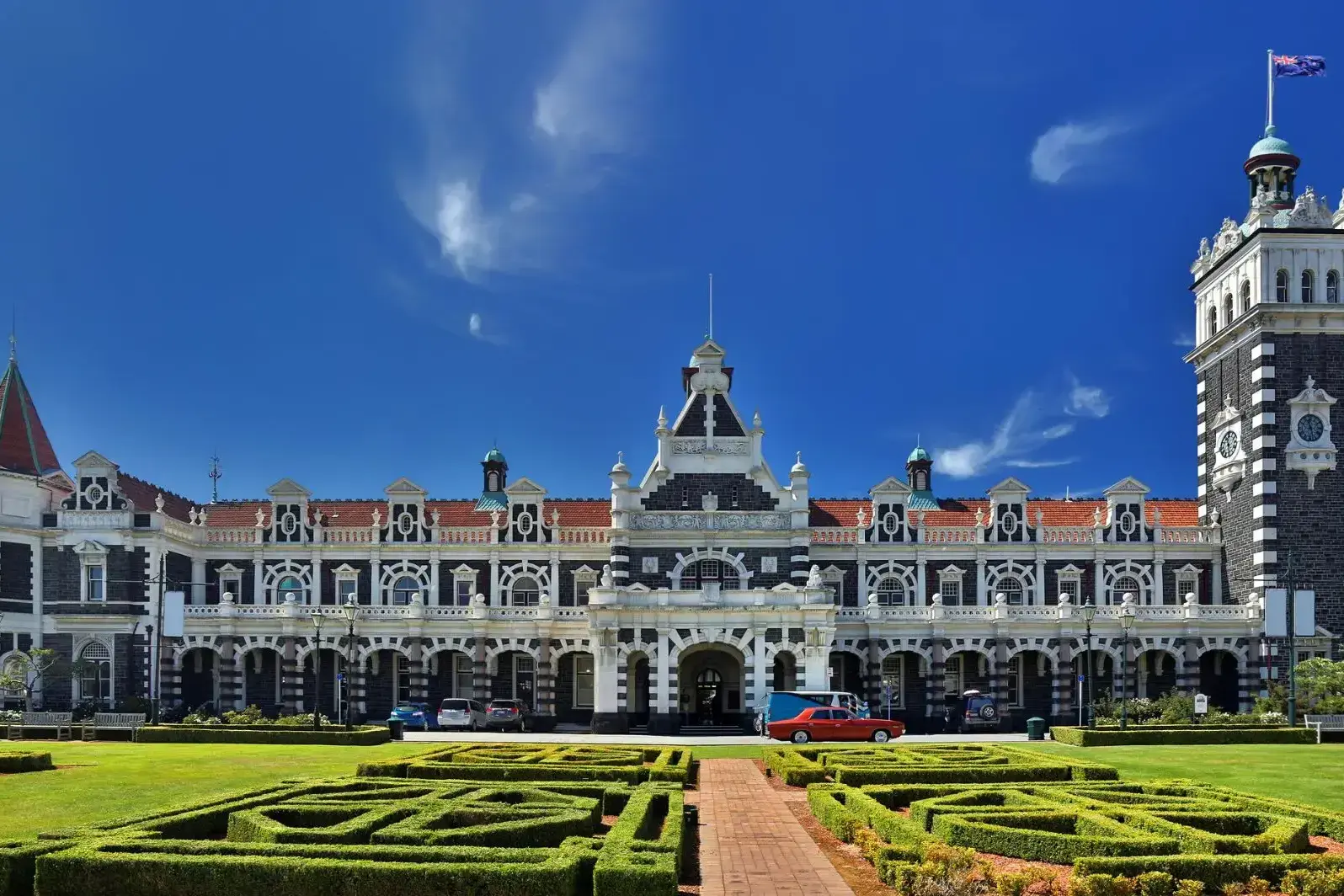
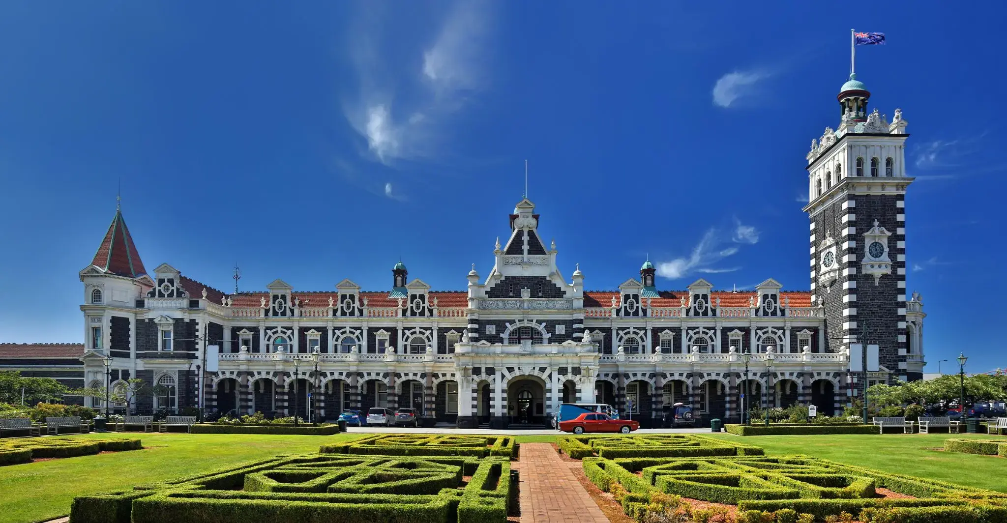
| 40 | 13.02 sob. | Danidin / Nowa Zelandia | 08:00 | 18:00 |
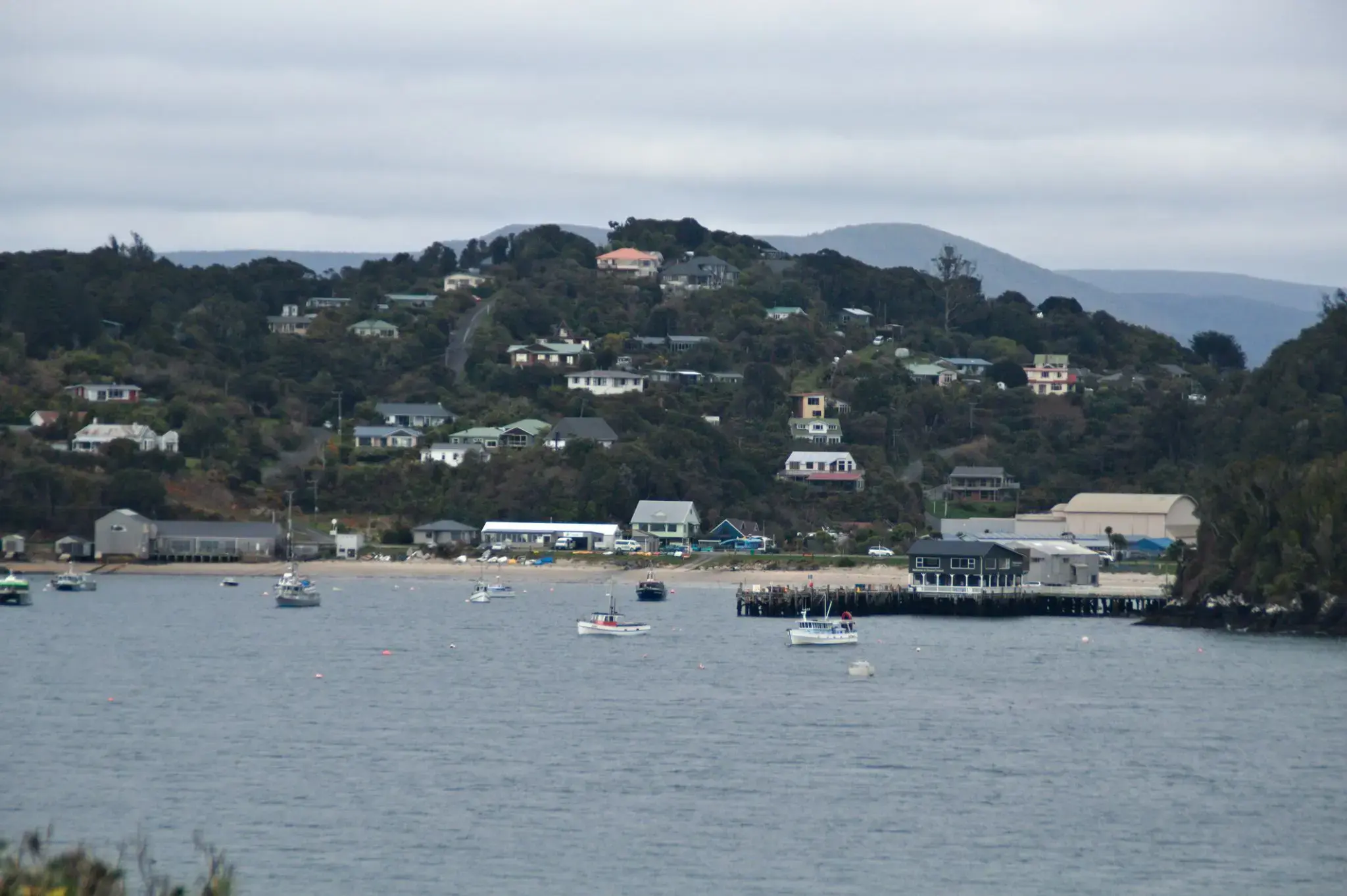
| 41 | 14.02 niedz. | Oban, Stewart / Nowa Zelandia | 08:00 | 14:00 |
| 42 | 15.02 pon. | Milford-Sound / Nowa Zelandia | 07:00 | 10:00 |
| 43 | 16.02 wt. | Dzień na morzu / Morze | 15:00 | |
| 44 | 17.02 śr. | Dzień na morzu / Morze | 15:00 | |
| 45 | 18.02 czw. | Gobarta na Tasmanii / Australia | 08:00 | 22:00 |
| 46 | 19.02 pt. | Dzień na morzu / Morze | 15:00 | |
| 47 | 20.02 sob. | Melbourne / Australia | 08:00 | 22:00 |
| 48 | 21.02 niedz. | Dzień na morzu / Morze | 15:00 | |
| 49 | 22.02 pon. | Eden Valley / Australia | 07:30 | 14:00 |
| 50 | 23.02 wt. | Sydnej / Australia | 07:00 | |
| 51 | 24.02 śr. | Sydnej / Australia | 18:00 | |
| 52 | 25.02 czw. | Dzień na morzu / Morze | 15:00 | |
| 53 | 26.02 pt. | Dzień na morzu / Morze | 15:00 | |
| 54 | 27.02 sob. | KANGUR ISL | 08:00 | 20:00 |
| 55 | 28.02 niedz. | Adelaida / Australia | 08:00 | 22:00 |
| 56 | 1.03 pon. | Port Lincoln / Australia | 10:00 | 17:00 |
| 57 | 2.03 wt. | Dzień na morzu / Morze | 15:00 | |
| 58 | 3.03 śr. | Dzień na morzu / Morze | 15:00 | |
| 59 | 4.03 czw. | Albany / Australia | 08:00 | 17:00 |
| 60 | 5.03 pt. | RZEKA MARGARET | 13:00 | 21:00 |
| 61 | 6.03 sob. | Pert | 08:00 | |
| 62 | 7.03 niedz. | Pert | 14:00 | |
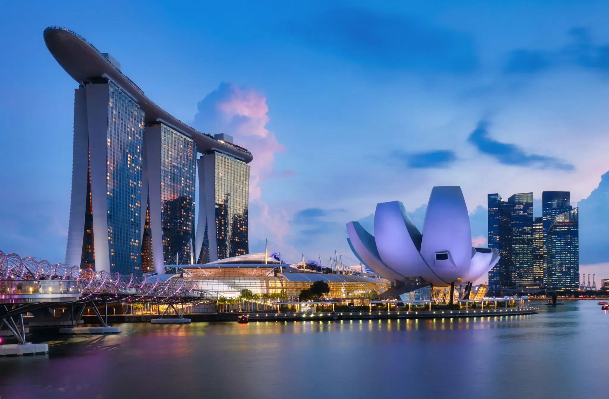
| 63 | 8.03 pon. | Dzień na morzu / Morze | 15:00 | |
| 64 | 9.03 wt. | Dzień na morzu / Morze | 15:00 | |
| 65 | 10.03 śr. | Dzień na morzu / Morze | 15:00 | |
| 66 | 11.03 czw. | Tanjung Benoit / Indonezja | 09:00 | 22:00 |
| 67 | 12.03 pt. | Chelukan-Bawang | 08:00 | 17:00 |
| 68 | 13.03 sob. | Dzień na morzu / Morze | 15:00 | |
| 69 | 14.03 niedz. | Dzień na morzu / Morze | 15:00 | |
| 70 | 15.03 pon. | Singapur / Singapur | 08:00 | 22:00 |
| 71 | 16.03 wt. | Dzień na morzu / Morze | 15:00 | |
| 72 | 17.03 śr. | Dzień na morzu / Morze | 15:00 | |
| 73 | 18.03 czw. | Wyspa Samui / Koh Samui / Thailand | 07:30 | 14:00 |
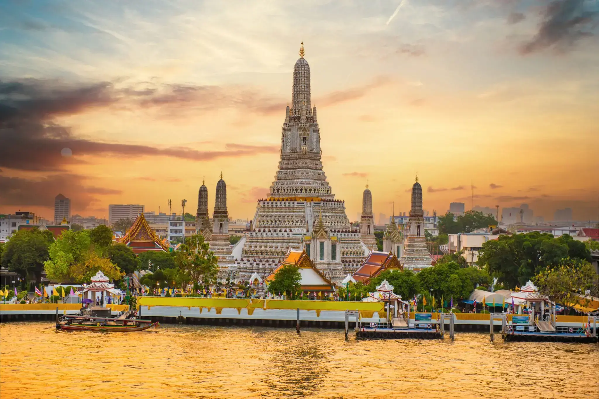
| 74 | 19.03 pt. | Bangkok / Thailand | 09:00 | |
| 75 | 20.03 sob. | Bangkok / Thailand | 22:00 | |
| 76 | 21.03 niedz. | Dzień na morzu / Morze | ||
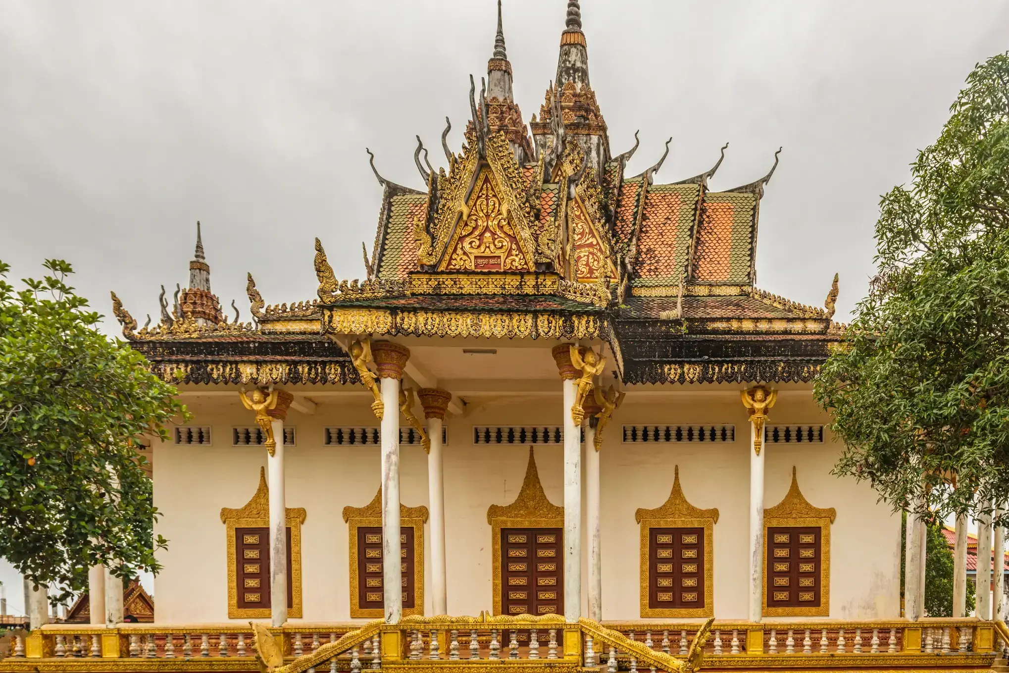
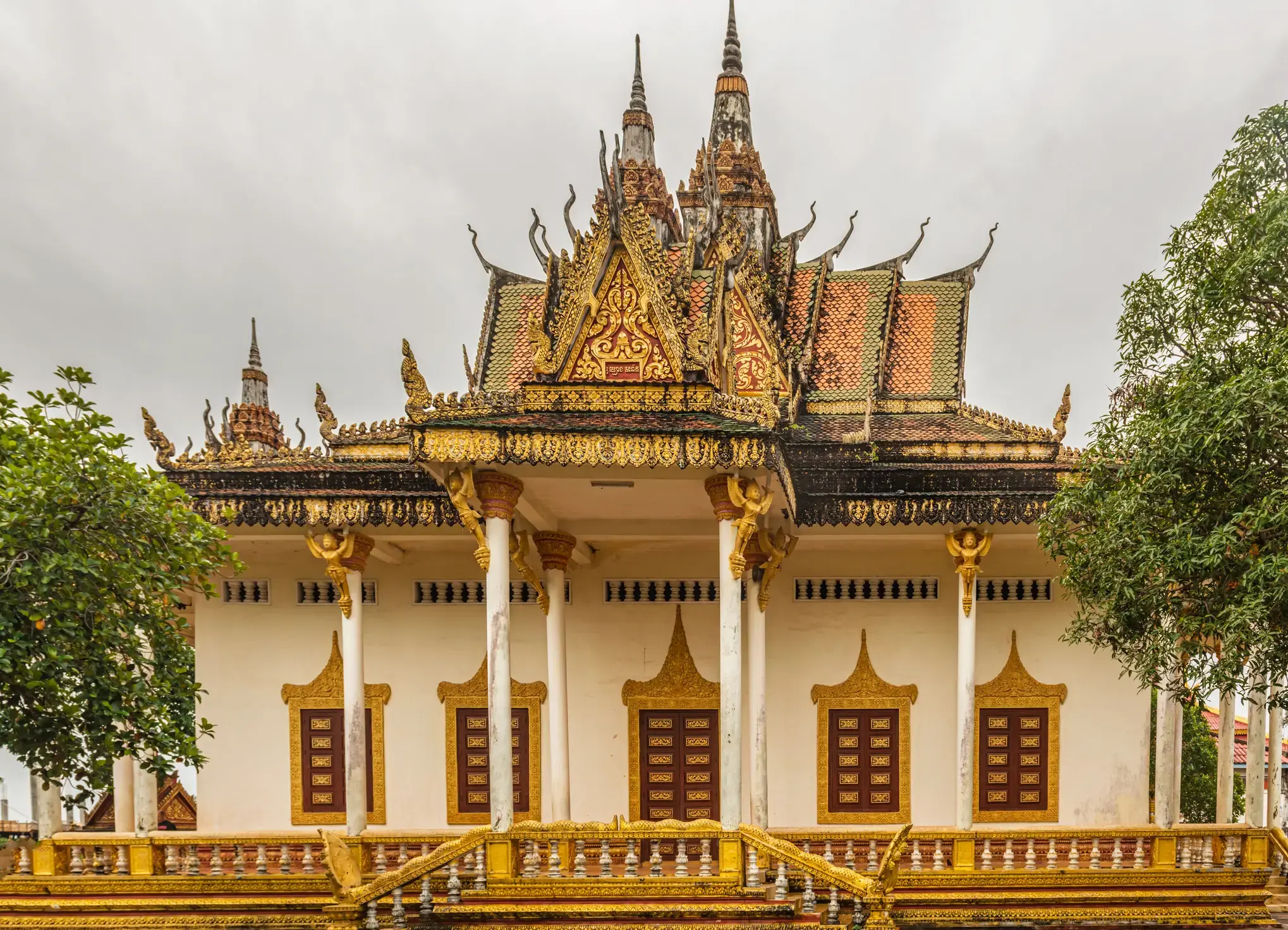
| 77 | 22.03 pon. | Kampongsaom (Sihanoukville) / Cambodia | 08:00 | 17:00 |
| 78 | 23.03 wt. | Dzień na morzu / Morze | 15:00 | |
| 79 | 24.03 śr. | Ho Chi Minh / Vietnam | 09:00 | |
| 80 | 25.03 czw. | Ho Chi Minh / Vietnam | ||
| 81 | 26.03 pt. | Ho Chi Minh / Vietnam | 07:00 | |
| 82 | 27.03 sob. | Dzień na morzu / Morze | 15:00 | |
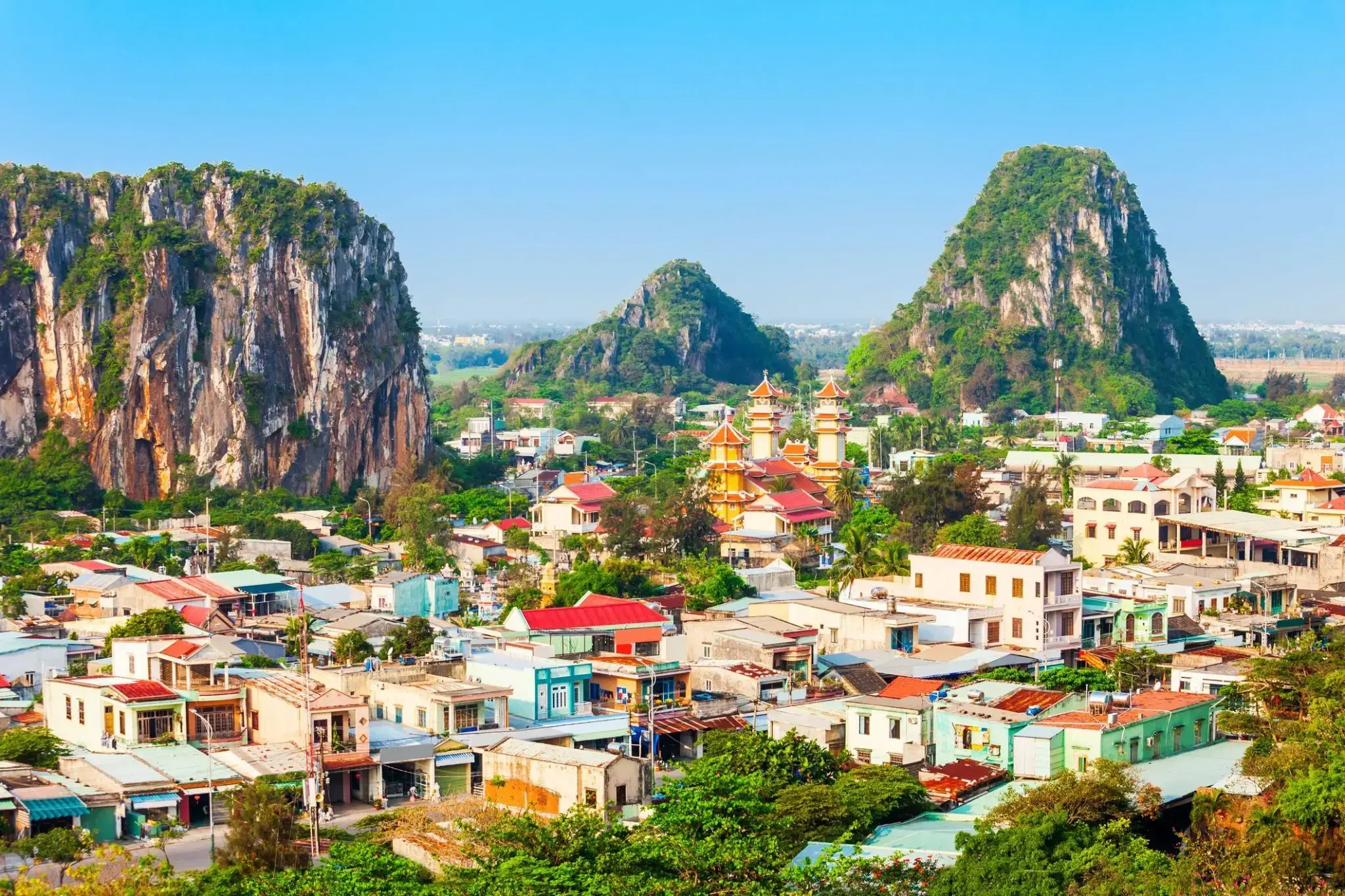
| 83 | 28.03 niedz. | Da Nang / Vietnam | 06:00 | 22:00 |
| 84 | 29.03 pon. | Dzień na morzu / Morze | 15:00 | |
| 85 | 30.03 wt. | Ha Long / Vietnam | 08:00 | |
| 86 | 31.03 śr. | Ha Long / Vietnam | 20:00 | |
| 87 | 1.04 czw. | Dzień na morzu / Morze | 15:00 | |
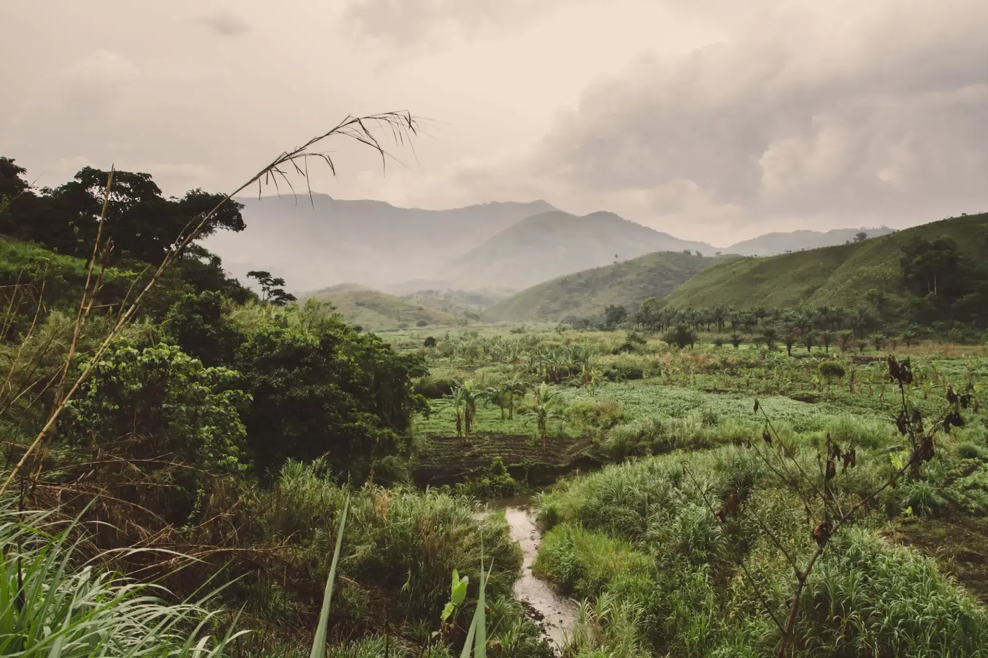
| 88 | 2.04 pt. | Limbe / Cameroon | 08:00 | |
| 89 | 3.04 sob. | Limbe / Cameroon | 09:00 |
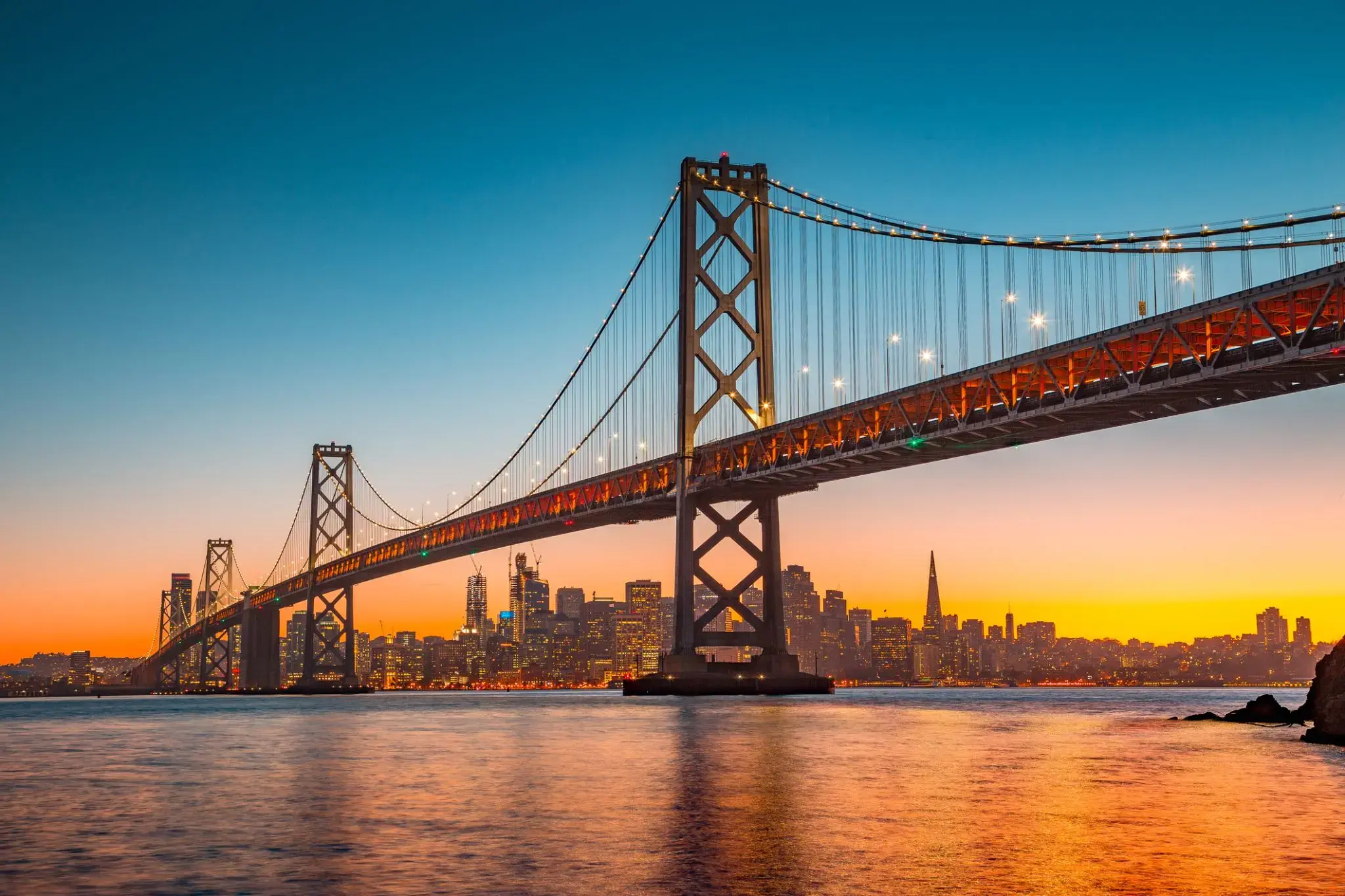
San Francisco , officially the City and County of San Francisco, is the cultural, commercial, and financial center of Northern California. San Francisco is the 13th-most populous city in the United States, and the fourth-most populous in California, with 884,363 residents as of 2017. It covers an area of about 46.89 square miles (121.4 km2), mostly at the north end of the San Francisco Peninsula in the San Francisco Bay Area, making it the second-most densely populated large US city, and the fifth-most densely populated U.S. county, behind only four of the five New York City boroughs. San Francisco is also part of the fifth-most populous primary statistical area in the United States, the San Jose–San Francisco–Oakland, CA Combined Statistical Area (9.7 million residents).
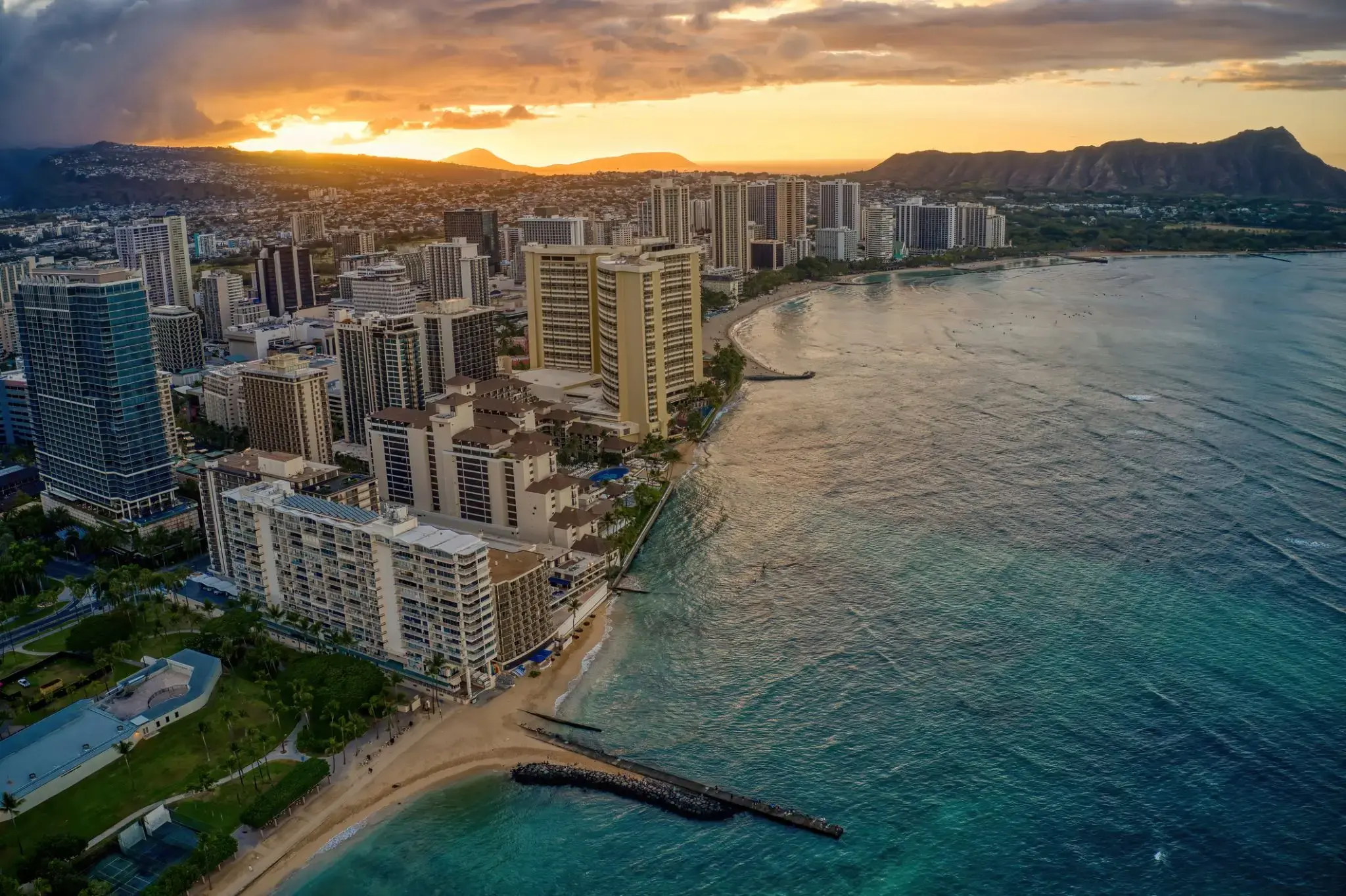
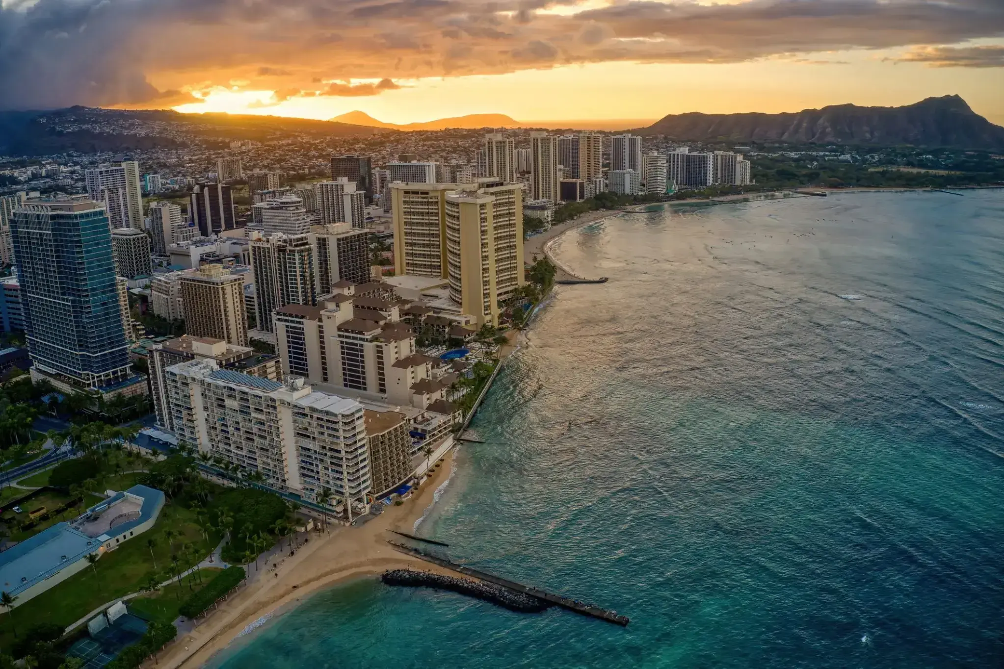
Honolulu is the capital and largest city of the U.S. state of Hawaiʻi. It is an unincorporated part of and the county seat of the City and County of Honolulu along the southeast coast of the island of Oʻahu. The city is the main gateway to Hawaiʻi and a major portal into the United States. The city is also a major hub for international business, military defense, as well as famously being host to a diverse variety of east-west and Pacific culture, cuisine, and traditions.
Honolulu is the most remote city of its size in the world and is the westernmost major U.S. city. For statistical purposes, the United States Census Bureau recognizes the approximate area commonly referred to as "City of Honolulu" (not to be confused with the "City and County") as a census county division (CCD). Honolulu is a major financial center of the islands and of the Pacific Ocean. The population of the Honolulu census designated place(CDP) was 359,870 as of the 2017 population estimate, while the Honolulu CCD was 390,738 and the population of the consolidated city and county was 953,207.
Honolulu means "sheltered harbor" or "calm port". The old name is Kou, a district roughly encompassing the area from Nuʻuanu Avenue to Alakea Street and from Hotel Street to Queen Street which is the heart of the present downtown district. The city has been the capital of the Hawaiian Islands since 1845 and gained historical recognition following the attack on Pearl Harbor by Japan near the city on December 7, 1941.
As of 2015, Honolulu was ranked high on world livability rankings, and was also ranked as the 2nd safest city in the U.S. It is also the most populated Oceanian city outside Australasia and ranks second to Auckland as the most-populous city in Polynesia.
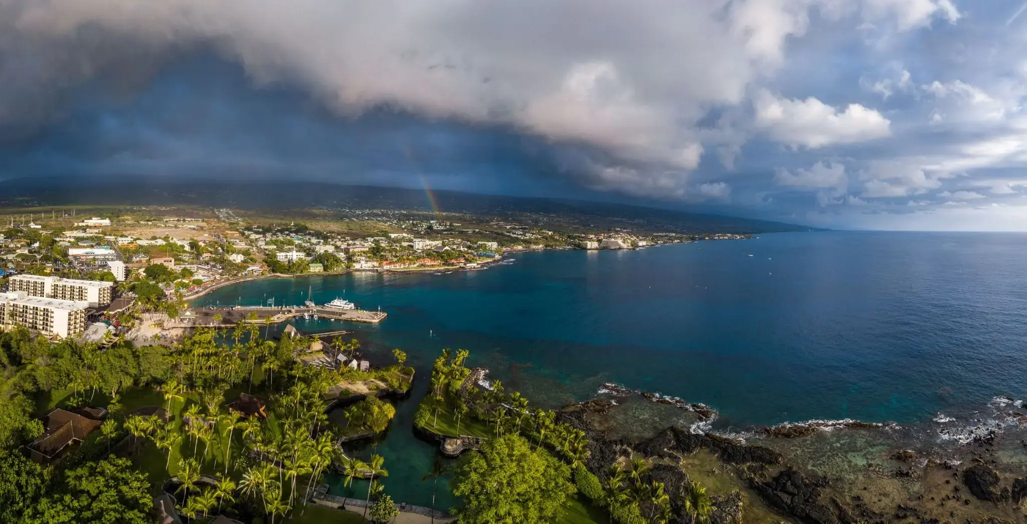
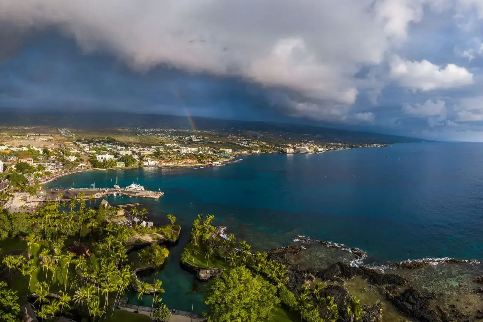
Kailua-Kona to malownicze nadmorskie miasteczko położone na zachodnim wybrzeżu wyspy Hawaje (znanej także jako Wielka Wyspa). Słynie z słonecznej pogody, spokojnych wód oraz bogatej historii — kiedyś była rezydencją króla Kamehamehy I, pierwszego zjednoczyciela wysp hawajskich. Promenada Alii Drive biegnąca wzdłuż oceanu oferuje spacery wśród historycznych budynków, sklepów, kawiarni i plaż z czarnym wulkanicznym piaskiem. Jedną z głównych atrakcji jest kościół Mokuaikaua — najstarszy chrześcijański kościół na Hawajach, zbudowany w 1820 roku.
Kailua-Kona jest popularnym miejscem wśród miłośników nurkowania i snorkelingu: w okolicznych wodach można zobaczyć manty, żółwie morskie i kolorowe tropikalne ryby. Niedaleko znajduje się Puʻuhonua o Hōnaunau National Historical Park — starożytne sanktuarium, które dawało schronienie łamiącym prawo kapu. Miasto jest również miejscem startu słynnych zawodów Ironman World Championship. To idealne miejsce dla tych, którzy szukają równowagi między naturą, kulturą i aktywnym wypoczynkiem.

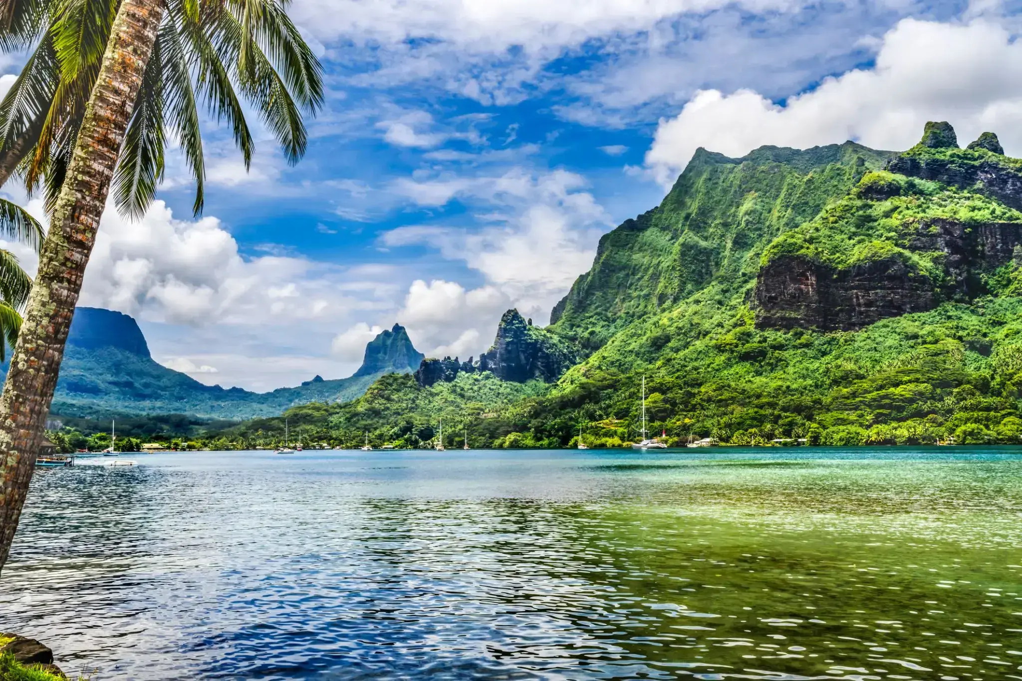
The island was formed as a volcano 1.5 to 2.5 million years ago, the result of a Society hotspot in the mantle under the oceanic plate that formed the whole of the Society Archipelago. It is theorized that the current bays were formerly river basins that filled during the Holocene searise.
Mo'orea is about 10 miles in width from the west to the east. There are two small, nearly symmetrical bays on the north shore. The one to the west is called 'Ōpūnohu Bay, which is not very populated but many travelers have come into the bay. The main surrounding communes of the bay are Piha'ena in the east and Papetō'ai to the west. The one to the east is Cook's Bay, also called Pao Pao Bay since the largest commune of Mo'orea is at the bottom of the bay. The other communes are Piha'ena to the west and busy Maharepa to the east. The highest point is Mount Tohi'e'a, near the center of Mo'orea. It dominates the vista from the two bays and can be seen from Tahiti. There are also hiking trails in the mountains. The Vai'are Bay is another small inlet, smaller than the two main bays, on the east shore. This bay has been settled a lot and has a lot of business. The main village is located just south of the bay.

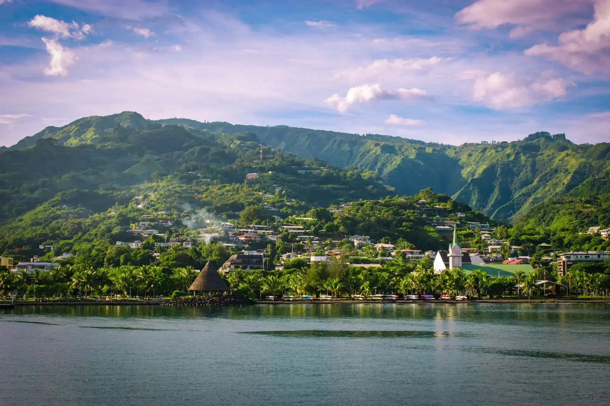
Papeete is the capital city of French Polynesia, an overseas collectivity of France in the Pacific Ocean. The commune of Papeete is located on the island of Tahiti, in the administrative subdivision of the Windward Islands, of which Papeete is the administrative capital. The French High Commissioner also resides in Papeete. It is the primary center of Tahitian and French Polynesian public and private governmental, commercial, industrial and financial services, the hub of French Polynesian tourism and a commonly used port of call. The Windward Islands are themselves part of the Society Islands. The name Papeete means "water from a basket".
The urban area of Papeete had a total population of 136,771 inhabitants at the August 2017 census, 26,926 of whom lived in the commune of Papeete proper.

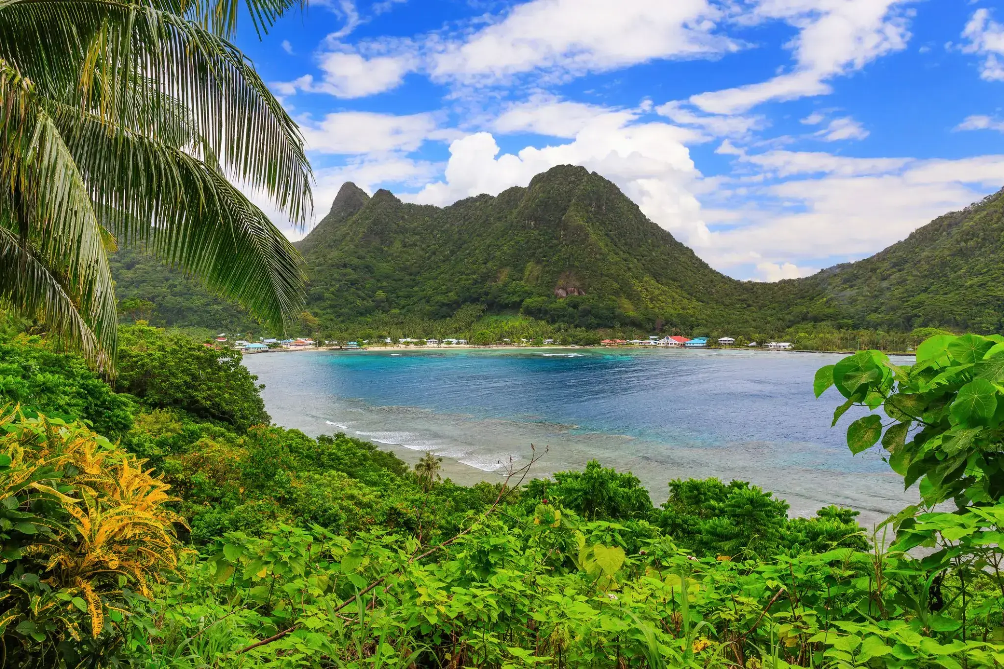
Pago Pago is the territorial capital of American Samoa. It is in Maoputasi County on the main island of American Samoa, Tutuila. It is home to one of the best and deepest natural deepwater harbors in the South Pacific Ocean, sheltered from wind and rough seas, and strategically located. The harbor is also one of the best protected in the South Pacific, which gives American Samoa a natural advantage with respect to landing fish for processing. Tourism, entertainment, food, and tunacanning are its main industries. Pago Pago was the world's 4th largest tuna processor as of 1993. It was home to two of the largest tuna companies in the world: Chicken of the Sea and StarKist, which exported an estimated $445 million in canned tuna to the U.S. mainland.
Pago Pago is the only modern urban center in American Samoa. The Greater Pago Pago Metropolitan Area encompasses several villages strung together along Pago Pago Harbor. One of the villages is itself named Pago Pago, and in 2010 had a population of 3,656. The constituent villages are, in order, Utulei, Fagatogo, Malaloa, Pago Pago, Satala and Atu'u. Fagatogo is the downtown area referred to as Town and is home to the legislature, while the executive is located in Utulei. In Fagatogo is the Fono, Police Department, Port of Pago Pago, many shops and hotels. The Greater Pago Pago Area was home to 8,000 residents in 2000.
Rainmaker Mountain (Mount Pioa) is located in Pago Pago, and gives the city the highest annual rainfall of any harbor in the world.
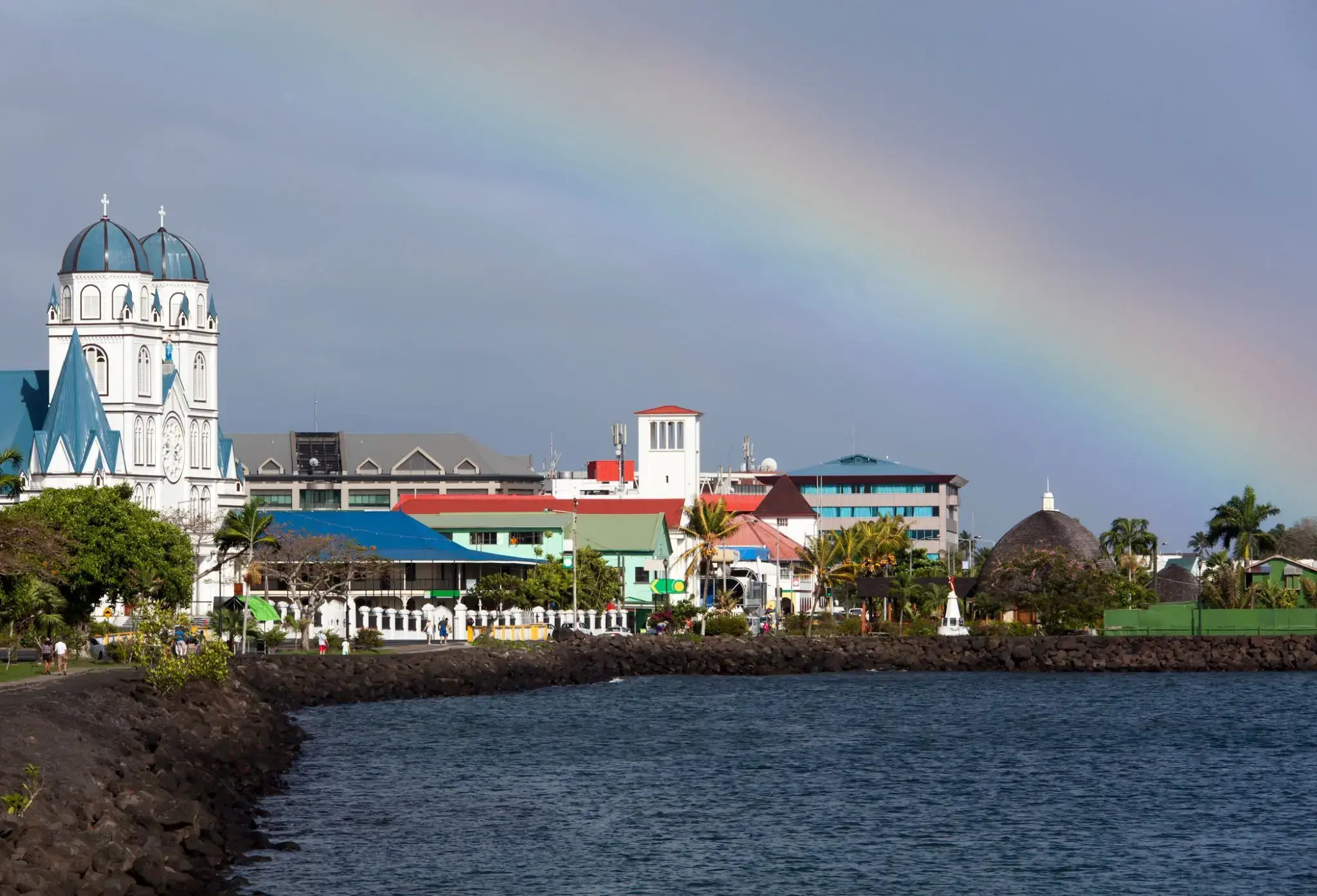
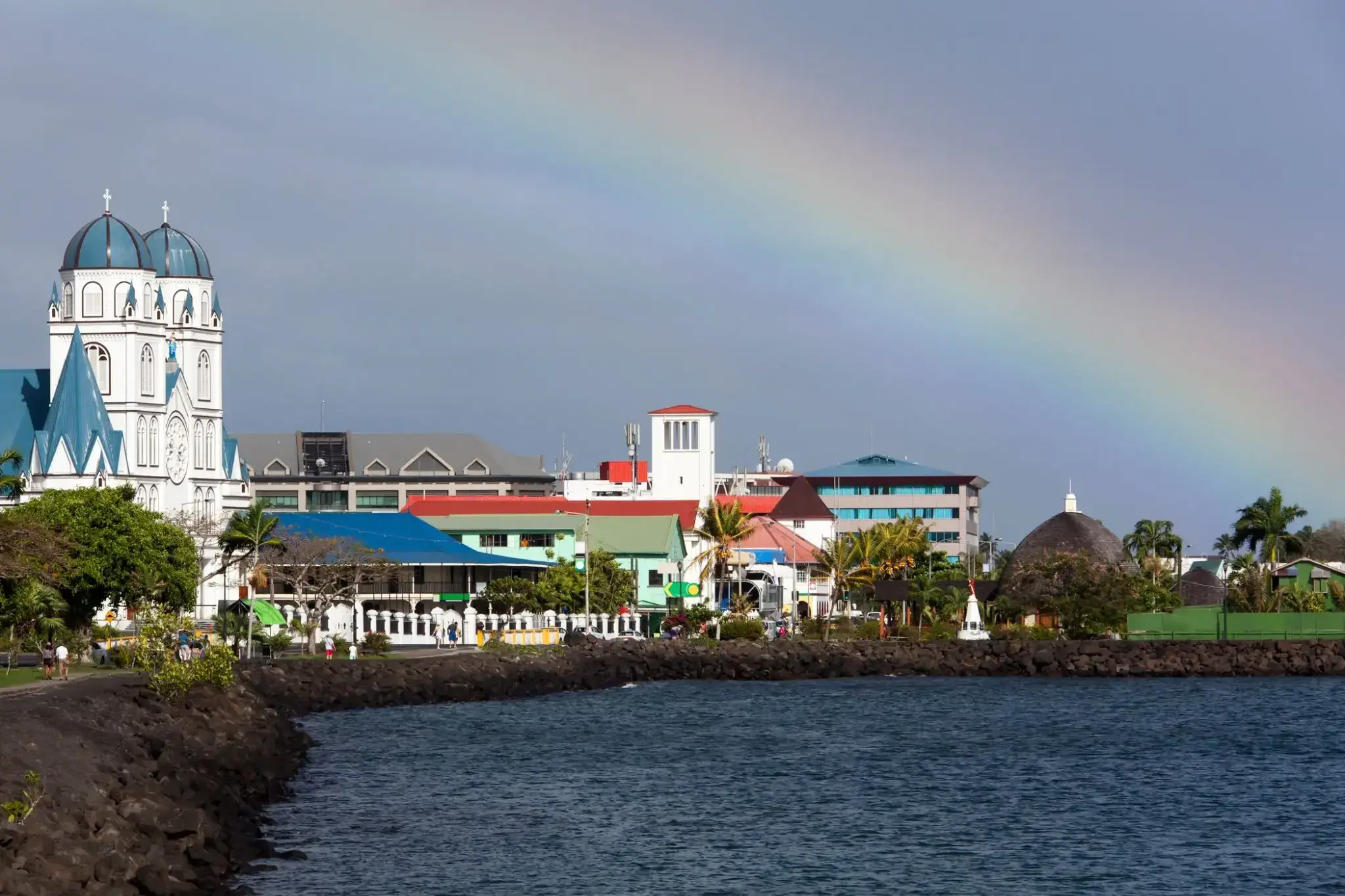
Apia is the capital and the largest city of Samoa. From 1900 to 1919, it was the capital of German Samoa. The city is located on the central north coast of Upolu, Samoa's second largest island. Apia is the only city in Samoa and falls within the political district (itūmālō) of Tuamasaga.
The Apia Urban Area has a population of 36,735 (2011 census) and is generally referred to as the City of Apia. The geographic boundaries of Apia Urban Area is mainly from Letogo village to the new industrialized region of Apia known as Vaitele.
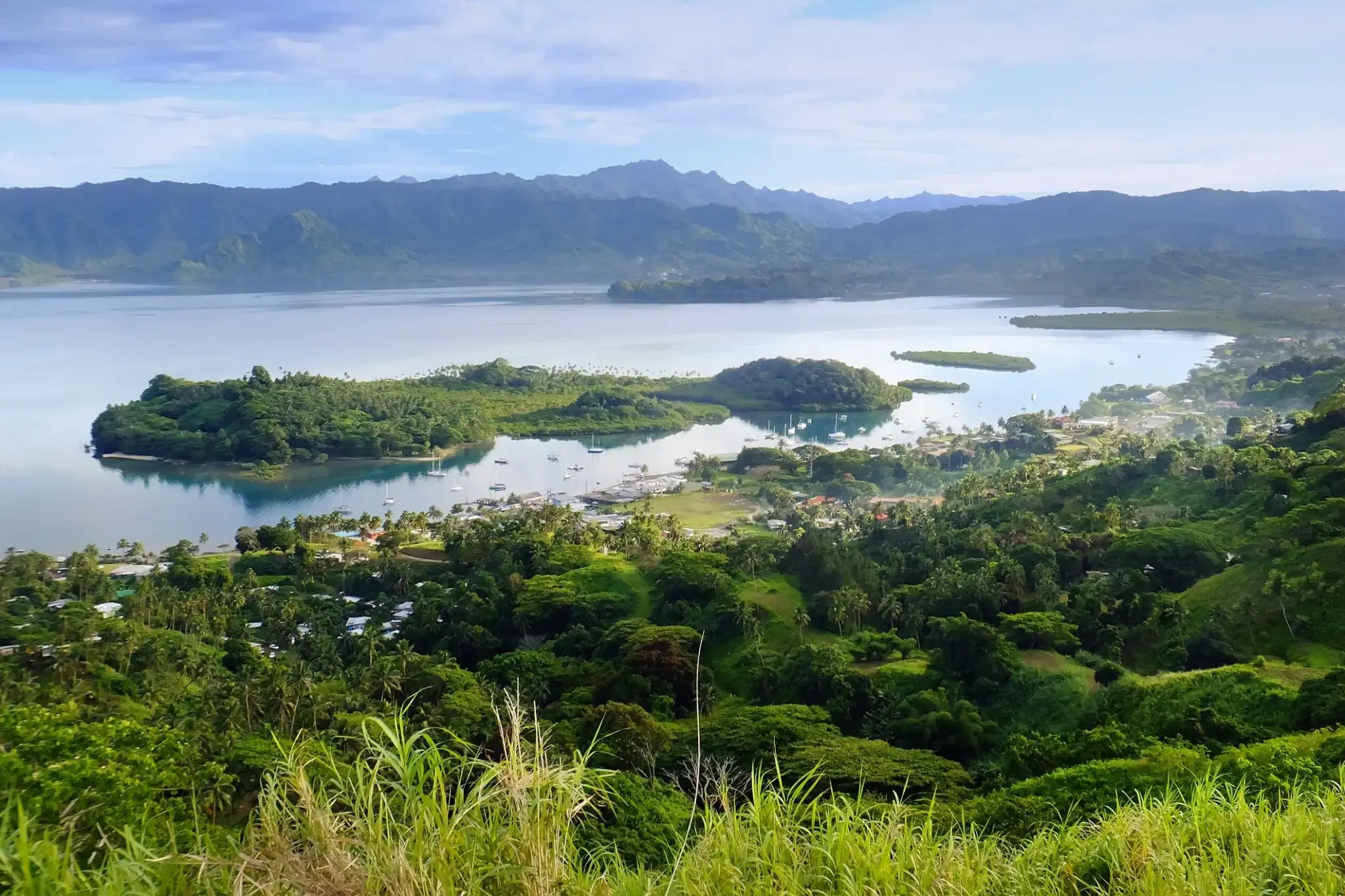
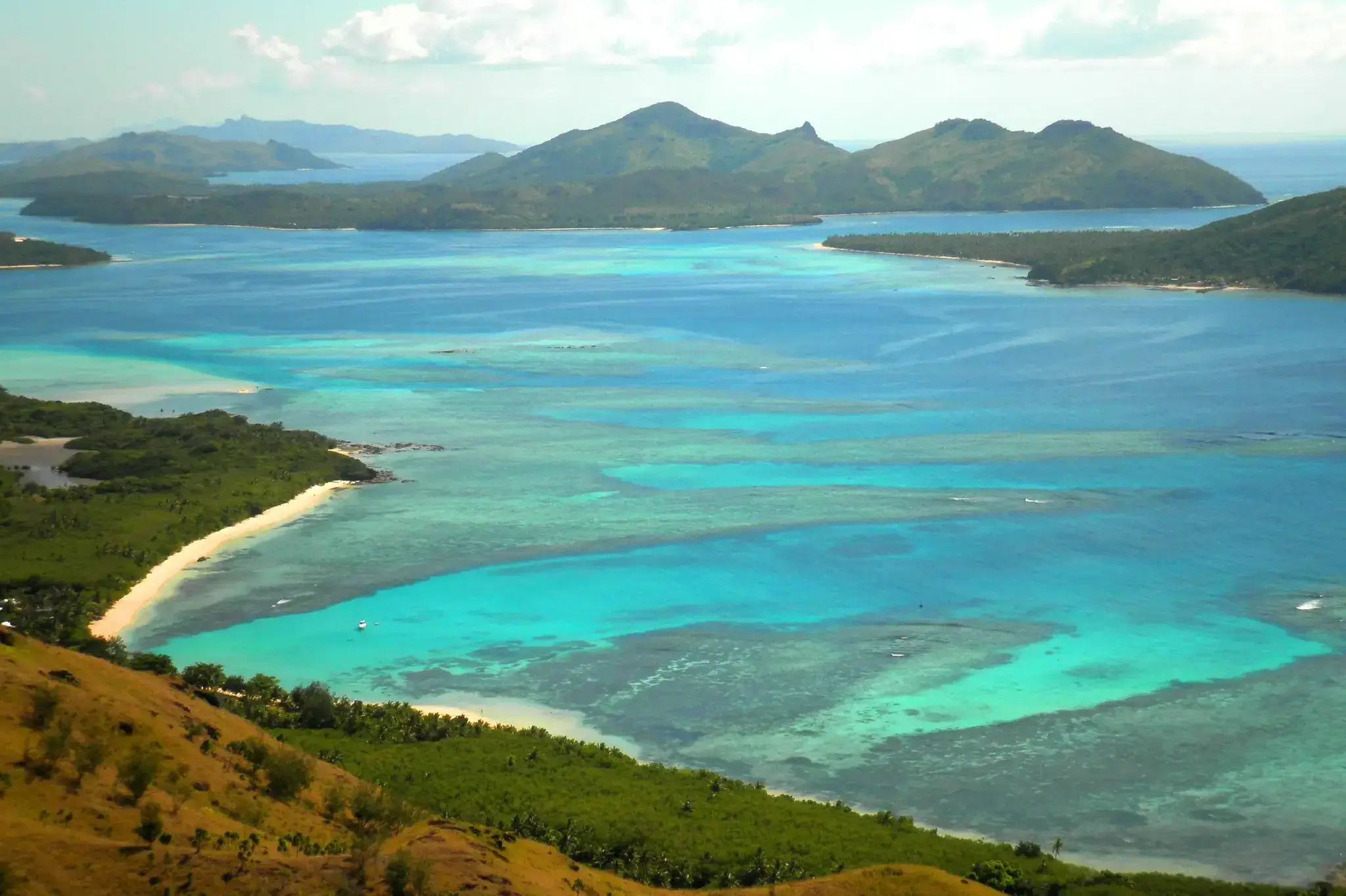
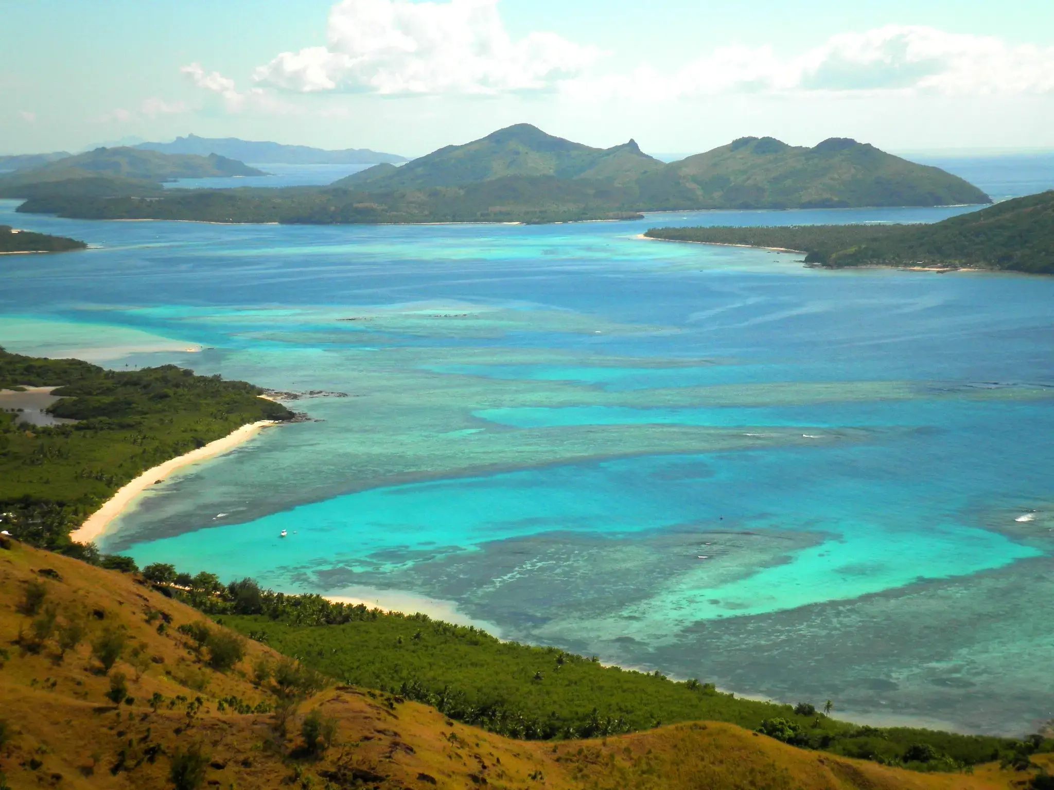
Savusavu is a town in the Fijian Province of Cakaudrove. The town is located on the south coast of Vanua Levu Island and had a population of 3,372 in the 2007 census.
Savusavu is known as "the hidden paradise of Fiji."

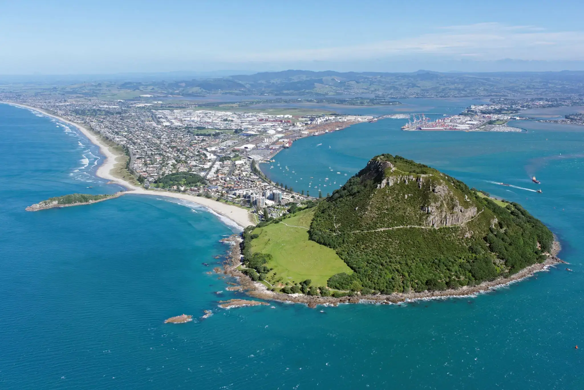
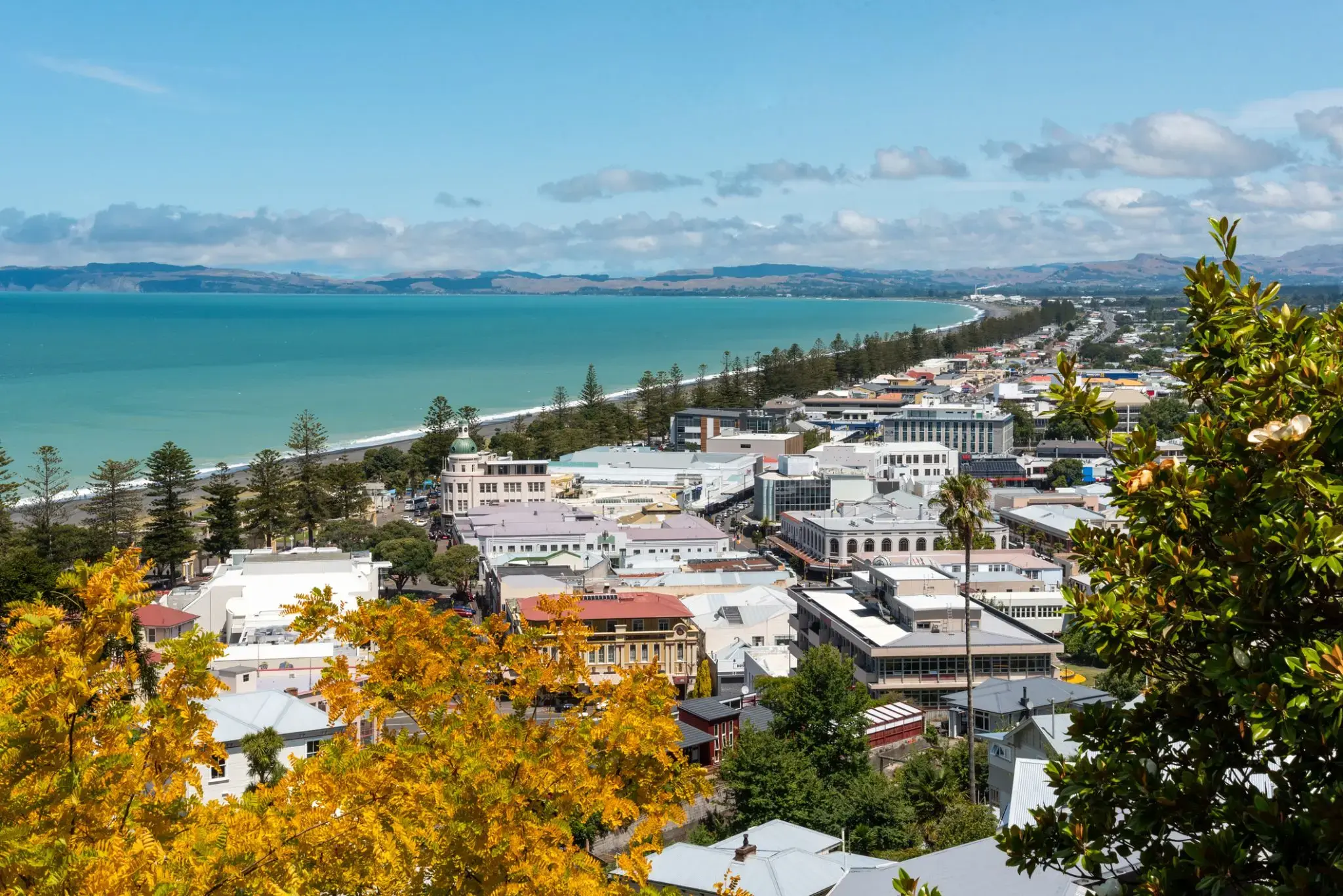
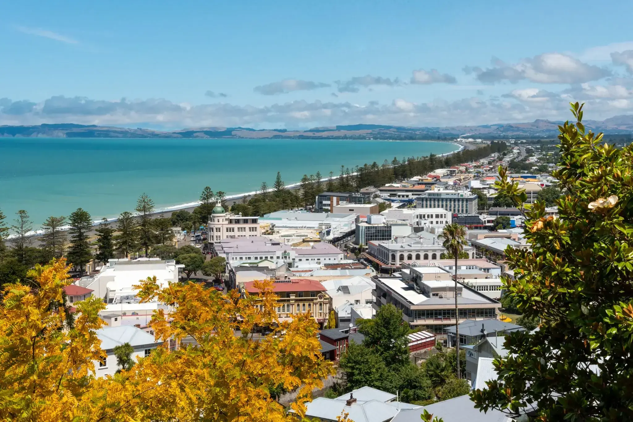
Napier is a New Zealand city with a seaport, located in Hawke's Bay on the eastern coast of the North Island. The population of Napier is about 63,900 as of the June 2018. About 18 kilometres (11 mi) south of Napier is the inland city of Hastings. These two neighbouring cities are often called "The Bay Cities" or "The Twin Cities" of New Zealand. The total population of the Napier-Hastings Urban Area is 134,500 people, which makes it the sixth-largest urban area in New Zealand, closely followed by Dunedin (122,000), and trailing Tauranga(141,600).
Napier is about 320 kilometres (200 mi) northeast of the capital city of Wellington. Napier (63,900) has a smaller population than its neighbouring city of Hastings (70,600) but is seen as the main centre due to it being closer in distance to both the seaport and the main airport that service Hawke's Bay, and Hastings' population figure includes 13,000 people living in Havelock North, which is often considered a town in its own right. The City of Napier has a land area of 106 square kilometres (41 sq mi) and a population density of 540.0 per square kilometre.
Napier is the nexus of the largest wool centre in the Southern Hemisphere, and it has the primary export seaport for northeastern New Zealand – which is the largest producer of apples, pears, and stone fruit in New Zealand. Napier has also become an important grape and wine production area, with the grapes grown around Hastings and Napier being sent through the Port of Napier for export. Large amounts of sheep's wool, frozen meat, wood pulp, and timber also pass through Napier annually for export. Smaller amounts of these materials are shipped via road and railway to the large metropolitan areas of New Zealand itself, such as Auckland, Wellington and Hamilton.
Napier is a popular tourist city, with a unique concentration of 1930s Art Deco architecture, built after much of the city was razed in the 1931 Hawke's Bay earthquake. It also has one of the most photographed tourist attractions in the country, a statue on Marine Parade called Pania of the Reef. Thousands of people flock to Napier every February for the Tremains Art Deco Weekend event, a celebration of its Art Deco heritage and history. Other notable tourist events attracting many outsiders to the region annually include F.A.W.C! Food and Wine Classic events, and the Mission Estate Concert at Mission Estate and Winery in the suburb of Taradale.
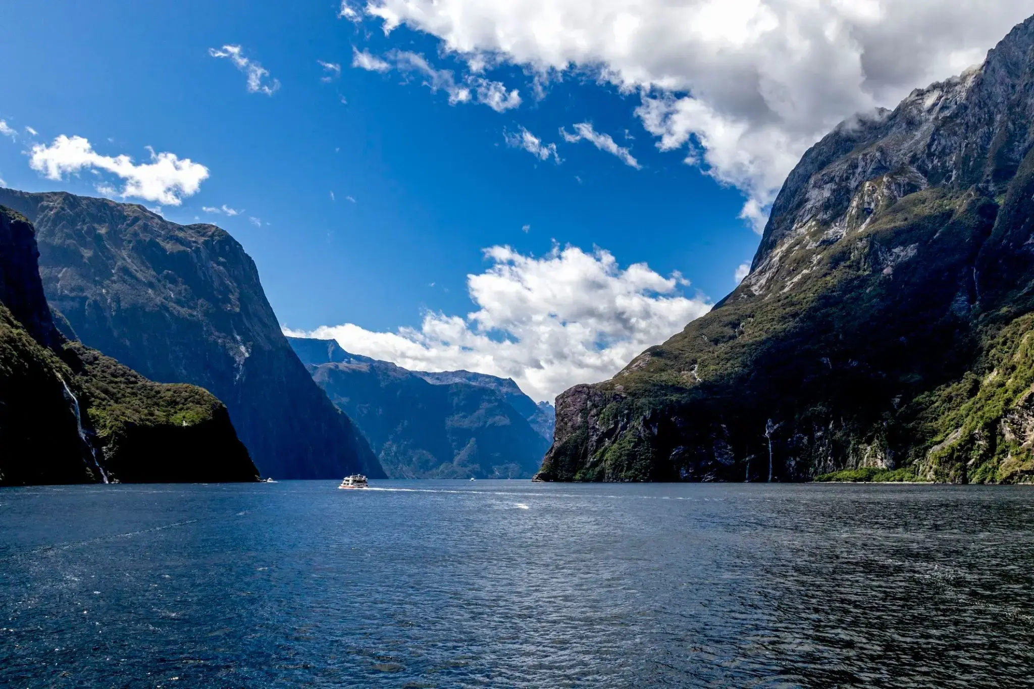
Trudno uwierzyć, że wśród tropikalnych lasów deszczowych i stromych klifów kryje się świat mglistych szczytów i lśniących wodospadów, które w Milford Sound w Nowej Zelandii spadają z wysokości ponad 150 metrów prosto do błękitnych wód fiordu. Ten zakątek Wyspy Południowej zaskakuje swoją mistyczną atmosferą: deszcze padają tu często, ale to one tworzą dziesiątki tymczasowych wodospadów, zamieniając Milford Sound w żywy obraz natury. W wodach fiordu można spotkać delfiny, foki i pingwiny, a przy dobrej pogodzie widać odbicie majestatycznego szczytu Mitre na spokojnej tafli wody.
Najlepszym sposobem, aby poczuć potęgę tego miejsca, jest rejs lub spływ kajakiem obok słynnego wodospadu Stirling i klifów wznoszących się setki metrów nad wodą. Dla bardziej kameralnych wrażeń turyści mogą wybrać się szlakiem Milford Track, jednym z najbardziej malowniczych szlaków pieszych na świecie, prowadzącym przez lasy deszczowe i wiszące mosty do zapierających dech w piersiach widoków na Milford Sound. Tutaj każdy deszcz staje się częścią magii, która pozostaje z wami długo po opuszczeniu tych brzegów.
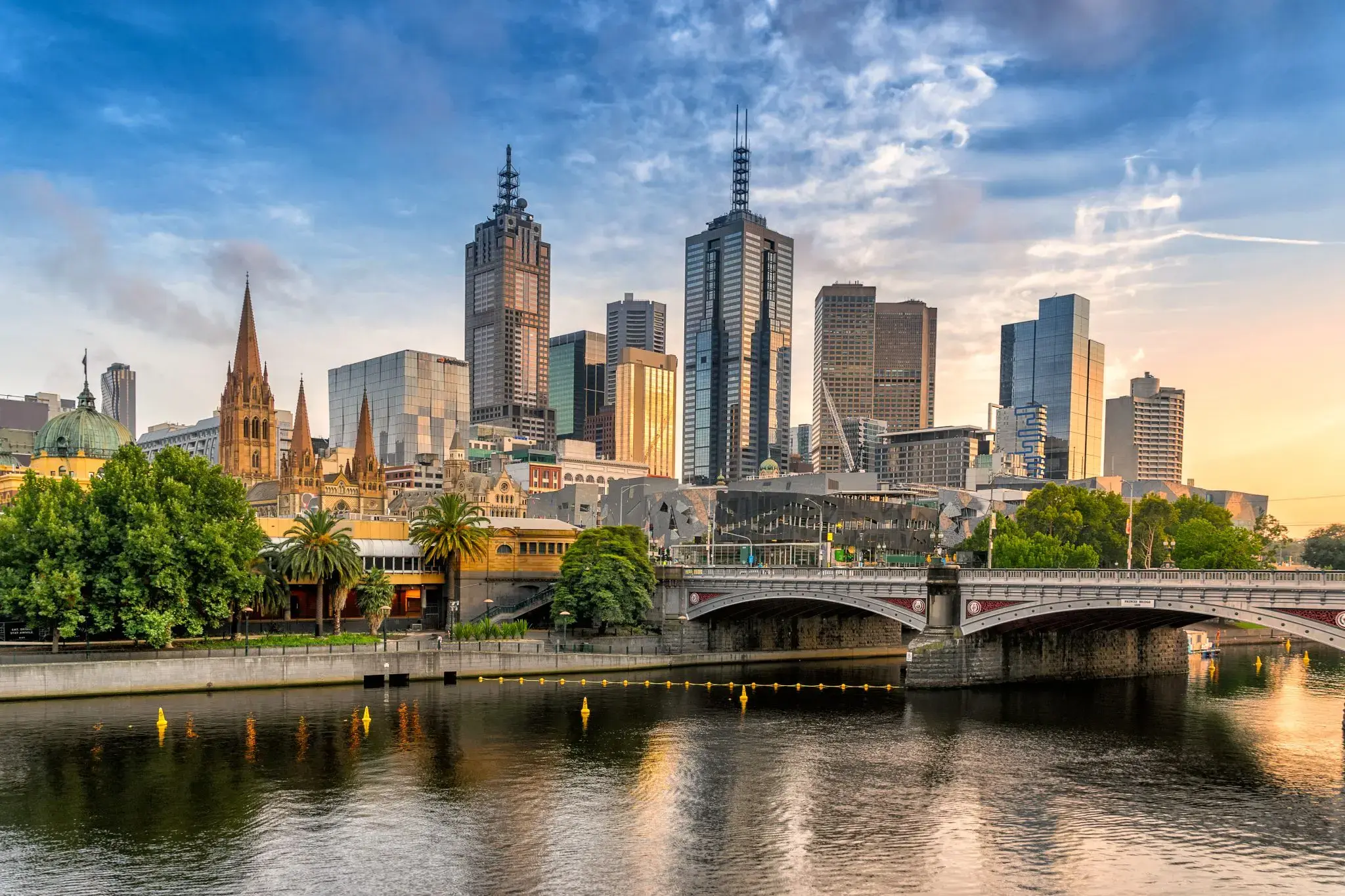
Melbourne is the capital and most populous city of the Australian state of Victoria, and the second most populous city in Australia and Oceania. Its name refers to an urban agglomeration of 9,992.5 km2 (3,858.1 sq mi), comprising a metropolitan area with 31 municipalities, and is also the common name for its city centre. The city occupies much of the coastline of Port Phillip bay and spreads into the hinterlands towards the Dandenong and Macedon ranges, Mornington Peninsula and Yarra Valley. It has a population of approximately 4.9 million (19% of the population of Australia), and its inhabitants are referred to as "Melburnians".
The city was founded on 30 August 1835, in what was the British colony of New South Wales, by free settlers from the colony of Van Diemen’s Land. It was incorporated as a Crown settlement in 1837 and named in honour of the British Prime Minister, William Lamb, 2nd Viscount Melbourne. It was declared a city by Queen Victoria in 1847, after which it became the capital of the new colony of Victoria in 1851. In the wake of the 1850s Victorian gold rush, the city entered the "Marvellous Melbourne" boom period, transforming into one of the most important cities in the British Empire and one of the largest and wealthiest in the world. After the federation of Australia in 1901, it served as interim seat of government of the new nation until Canberra became the permanent capital in 1927. Today, it is a leading financial centre in the Asia-Pacific region and ranks 20th in the Global Financial Centres Index.
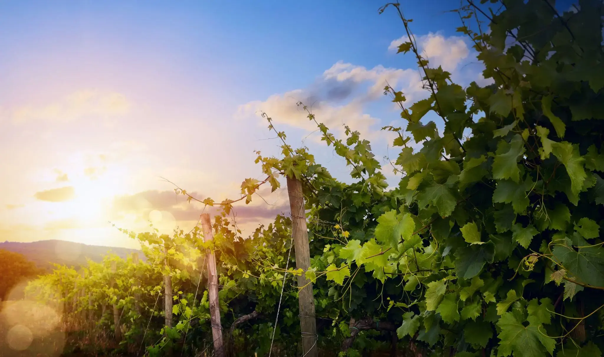
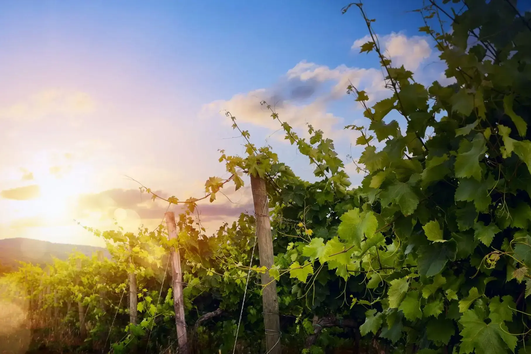
Eden Valley to malownicza dolina położona w sercu Australii, w stanie Południowa Australia. Miejsce to jest znane ze swojej unikalnej naturalnej urody, obfitości dzikiej fauny oraz żyznych ziem rolniczych. W dolinie znajdują się urodzajne gleby, na których uprawia się winorośle, a także produkowane są słynne lokalne wina. Krajobrazy Eden Valley zachwycają zarówno latem, jak i zimą, gdy pagórki pokrywają się zielenią, a na horyzoncie błyszczą ośnieżone szczyty. To także jeden z najlepszych regionów do wycieczek i degustacji win, gdzie turyści mogą nie tylko spróbować miejscowych win, ale również poznać proces ich produkcji.
Dla podróżnych Eden Valley oferuje nie tylko piękno natury, ale również szereg aktywnych zajęć na świeżym powietrzu. Region idealnie nadaje się do pieszych wędrówek, biwakowania i obserwacji dzikiej fauny. Można tu zobaczyć rzadkie gatunki zwierząt, takie jak koale i kangury, a także podziwiać wspaniałe widoki na dolinę z wysokości. Lato w Eden Valley to czas festiwali i wydarzeń kulturalnych, które przyciągają zarówno mieszkańców, jak i turystów. To miejsce dla tych, którzy szukają połączenia natury, przygód i kulinarnych przyjemności, nie oddalając się zbytnio od cywilizacji.
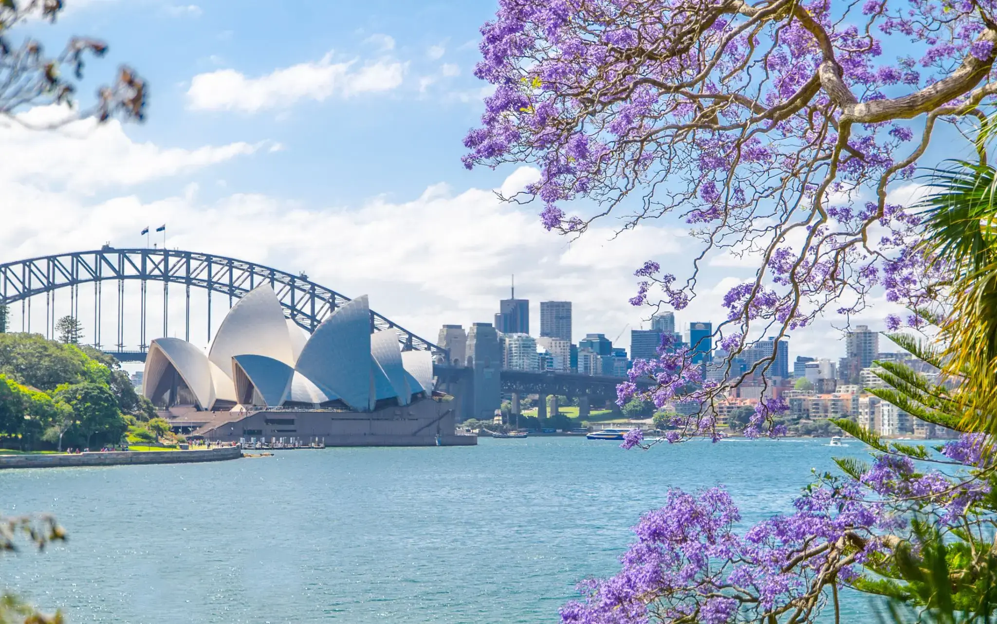
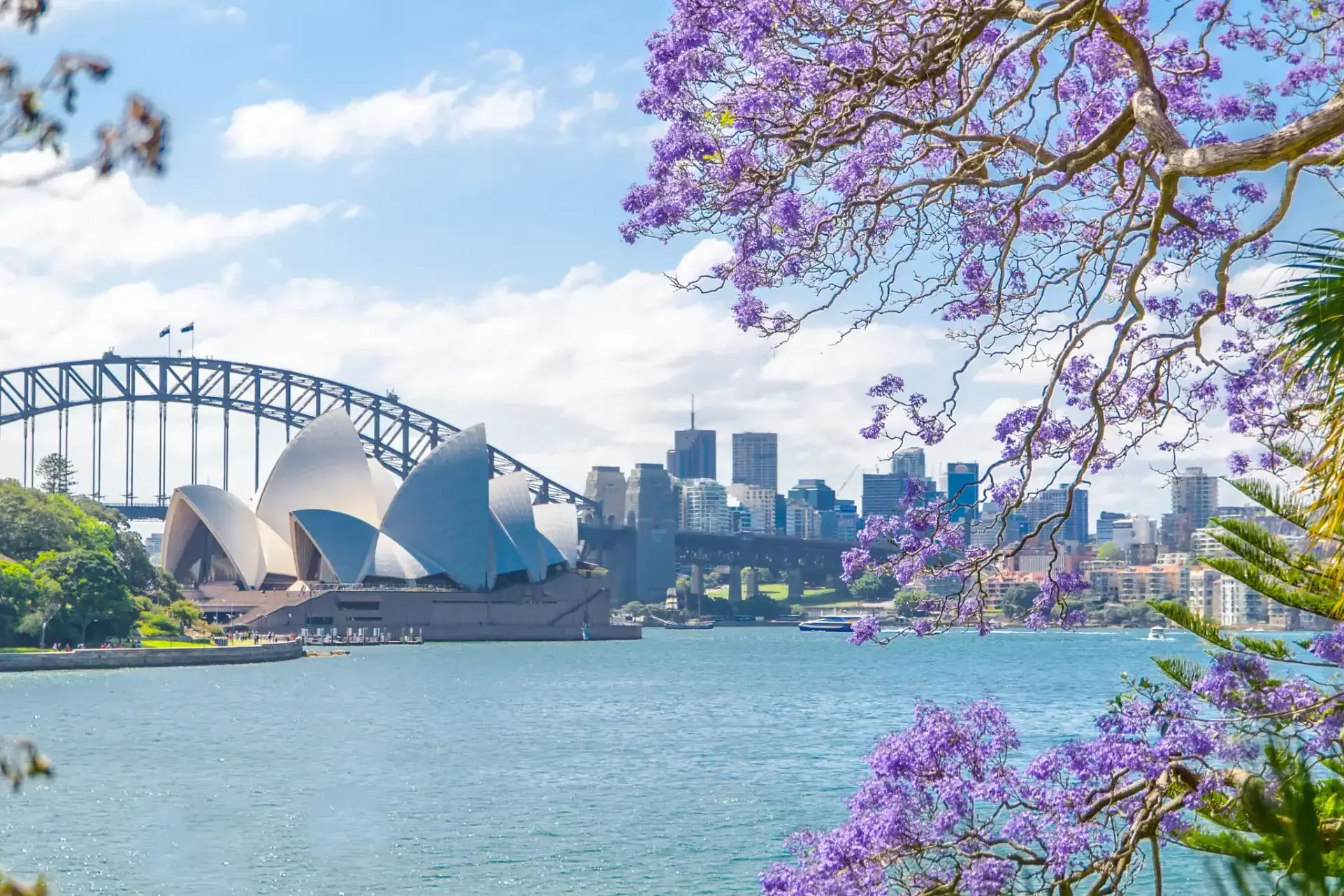
Sydney is the state capital of New South Wales and the most populous city in Australiaand Oceania. Located on Australia's east coast, the metropolis surrounds Port Jackson and extends about 70 km (43.5 mi) on its periphery towards the Blue Mountains to the west, Hawkesbury to the north, and Macarthur to the south. Sydney is made up of 658 suburbs, 40 local government areas and 15 contiguous regions. Residents of the city are known as "Sydneysiders". As of June 2017, Sydney's estimated metropolitan population was 5,131,326, and is home to approximately 65% of the state's population.
Sydney is the state capital of New South Wales and the most populous city in Australiaand Oceania. Located on Australia's east coast, the metropolis surrounds Port Jackson and extends about 70 km (43.5 mi) on its periphery towards the Blue Mountains to the west, Hawkesbury to the north, and Macarthur to the south. Sydney is made up of 658 suburbs, 40 local government areas and 15 contiguous regions. Residents of the city are known as "Sydneysiders". As of June 2017, Sydney's estimated metropolitan population was 5,131,326, and is home to approximately 65% of the state's population.
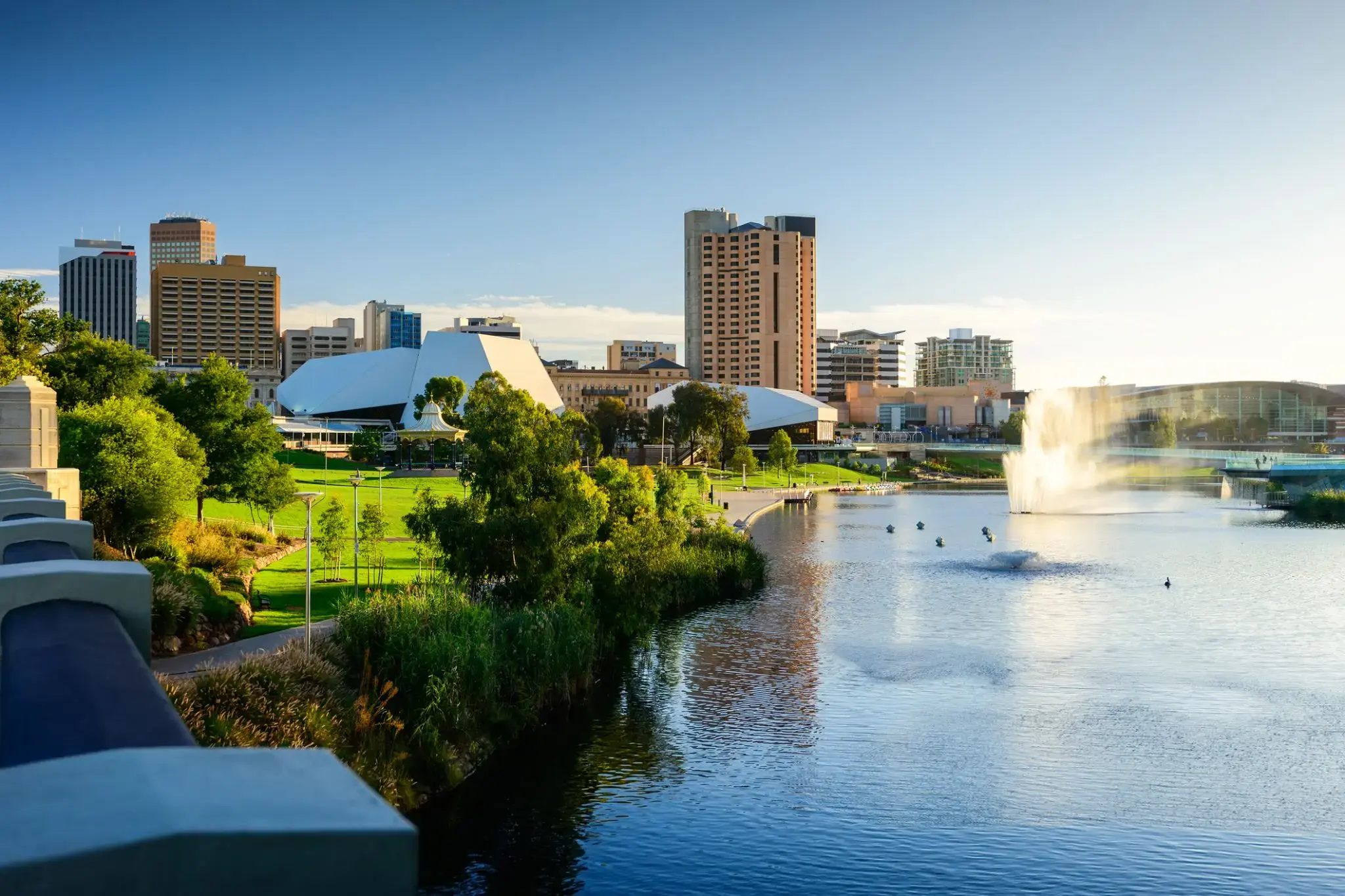
Adelaide is the capital city of the state of South Australia, and the fifth-most populous city of Australia. In June 2017, Adelaide had an estimated resident population of 1,333,927. Adelaide is home to more than 75 percent of the South Australian population, making it the most centralised population of any state in Australia.
Położone na malowniczym półwyspie Eyre w Australii Południowej, Port Lincoln słynie z zapierających dech w piersiach widoków i unikalnych morskich przygód. Tutaj podróżnicy mogą spróbować jednej z najbardziej ekscytujących atrakcji — nurkowania w klatce z rekinami i obserwowania tych majestatycznych drapieżników z bliska. Miłośnicy przyrody docenią dziewicze plaże i parki narodowe, gdzie można spotkać kangury, koale i pelikany.
Port Lincoln to nie tylko stolica australijskich owoców morza, gdzie serwuje się najświeższe ostrygi i owoce morza, ale także idealne miejsce na wędkowanie i rejsy wzdłuż wybrzeża. Miasto słynie także z wina i wydarzeń kulturalnych, które co roku przyciągają gości z całego kraju. To miejsce doskonale nadaje się zarówno na aktywne wakacje, jak i na relaks nad oceanem.

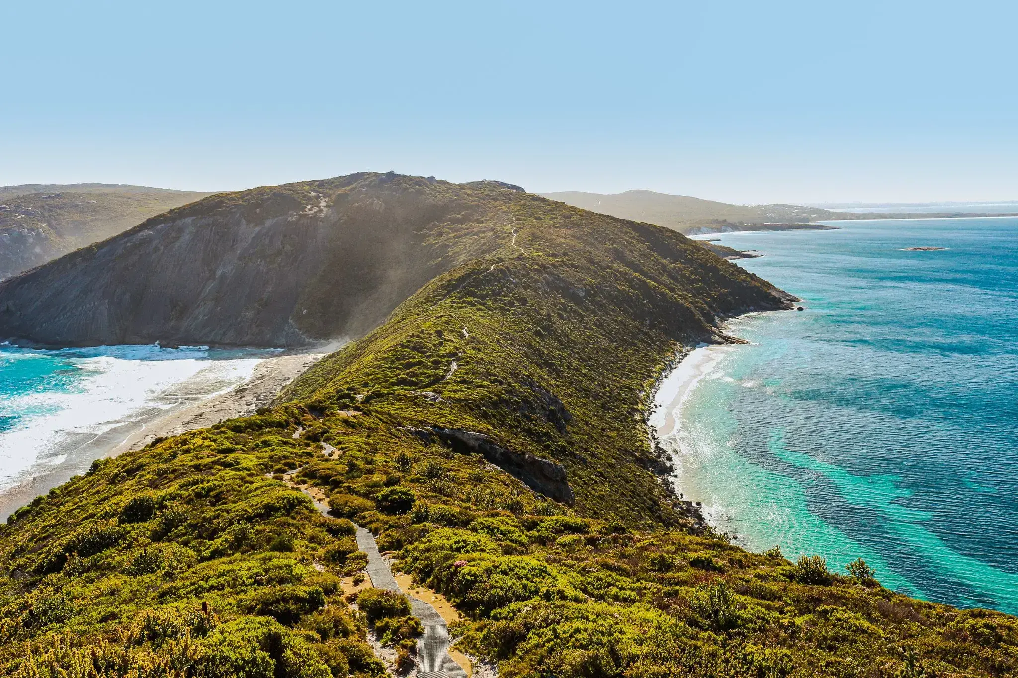
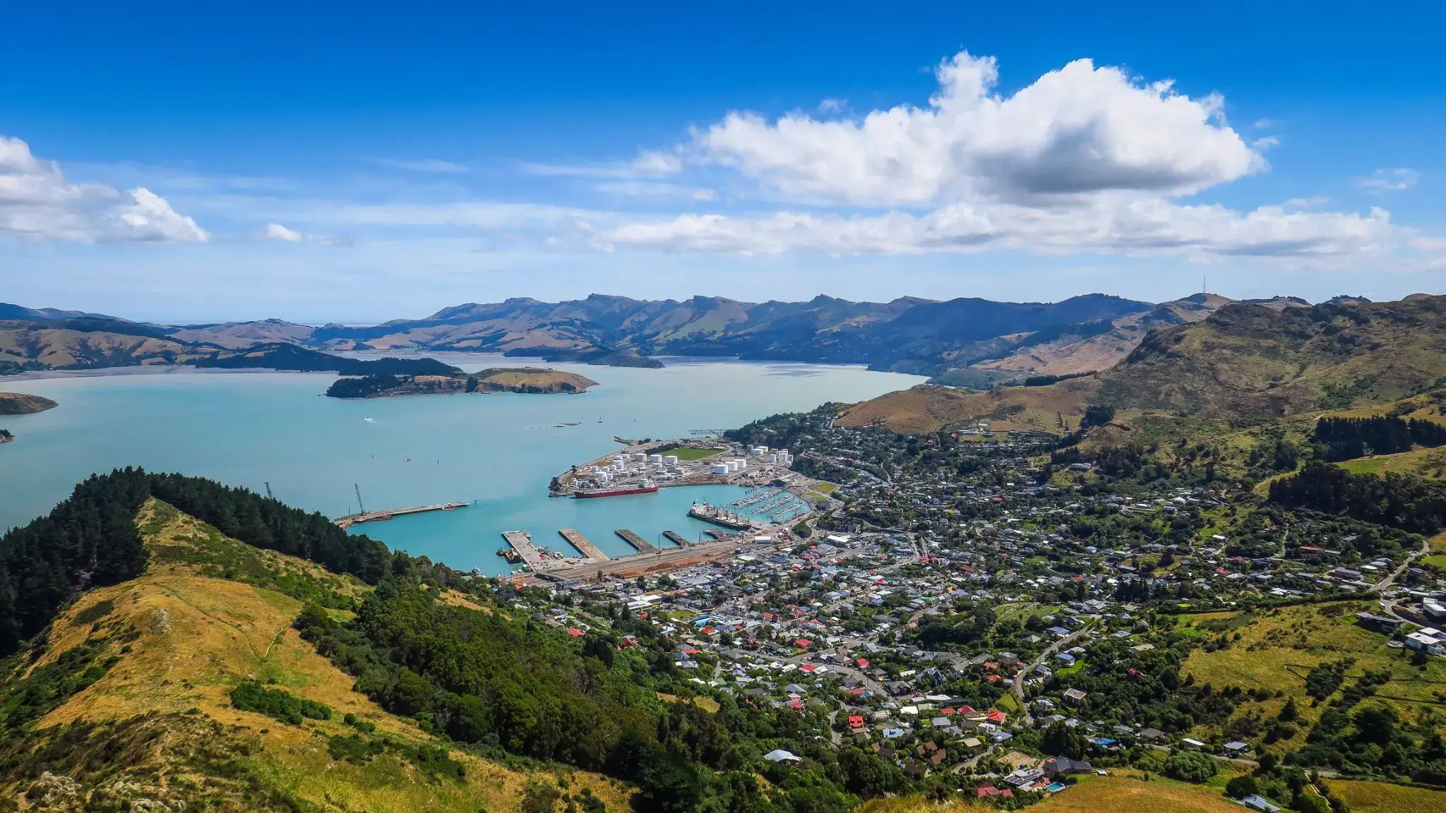
Albany is a port city in the Great Southern region of Western Australia, 418 km SE of Perth, the state capital. Albany is the oldest colonial settlement in Western Australia, predating Perth and Fremantle by over two years.
The city centre is at the northern edge of Princess Royal Harbour, which is a part of King George Sound. The central business district is bounded by Mount Clarence to the east and Mount Melville to the west. The city is in the local government area of the City of Albany.

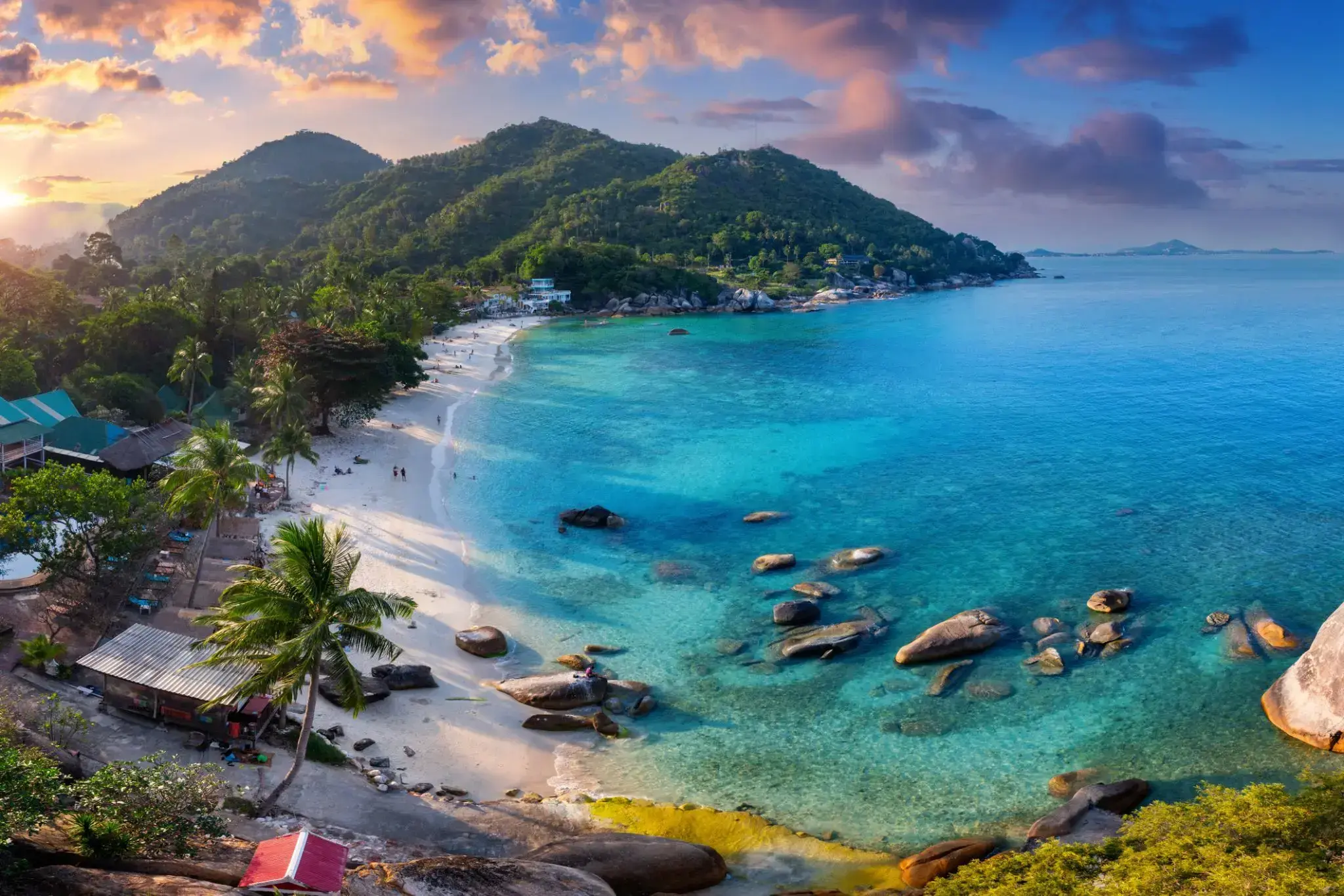
Wśród tropikalnych wysp Tajlandii Koh Samui wyróżnia się swoją unikalną naturą i atmosferą. Ta wyspa przyciąga podróżnych z całego świata swoimi białymi, piaszczystymi plażami, malowniczymi wodospadami i gęstymi dżunglami. To idealne miejsce na relaks, niezależnie od tego, czy chodzi o sport wodny, odkrywanie natury, czy po prostu cieszenie się ciszą i pięknem.
Dodatkowo, Koh Samui jest znana ze swojego dziedzictwa kulturowego, w tym wielu buddyjskich świątyń i sanktuariów. Jedną z najbardziej znanych jest Świątynia Wielkiego Buddy, która jest nie tylko centrum religijnym, ale także jedną z głównych atrakcji wyspy. Lokalne jedzenie, w tym świeże owoce morza i egzotyczne owoce, sprawi, że podróż będzie jeszcze bardziej ekscytująca i smaczna.

Bangkok is the capital and most populous city of Thailand. It is known in Thai as Krung Thep Maha Nakhon or simply Krung Thep. The city occupies 1,568.7 square kilometres (605.7 sq mi) in the Chao Phraya River delta in central Thailand, and has a population of over eight million, or 12.6 percent of the country's population. Over fourteen million people (22.2 percent) lived within the surrounding Bangkok Metropolitan Region at the 2010 census, making Bangkok the nation's primate city, significantly dwarfing Thailand's other urban centres in terms of importance.
Bangkok is the capital and most populous city of Thailand. It is known in Thai as Krung Thep Maha Nakhon or simply Krung Thep. The city occupies 1,568.7 square kilometres (605.7 sq mi) in the Chao Phraya River delta in central Thailand, and has a population of over eight million, or 12.6 percent of the country's population. Over fourteen million people (22.2 percent) lived within the surrounding Bangkok Metropolitan Region at the 2010 census, making Bangkok the nation's primate city, significantly dwarfing Thailand's other urban centres in terms of importance.
Kompong Som (Sihanoukville)
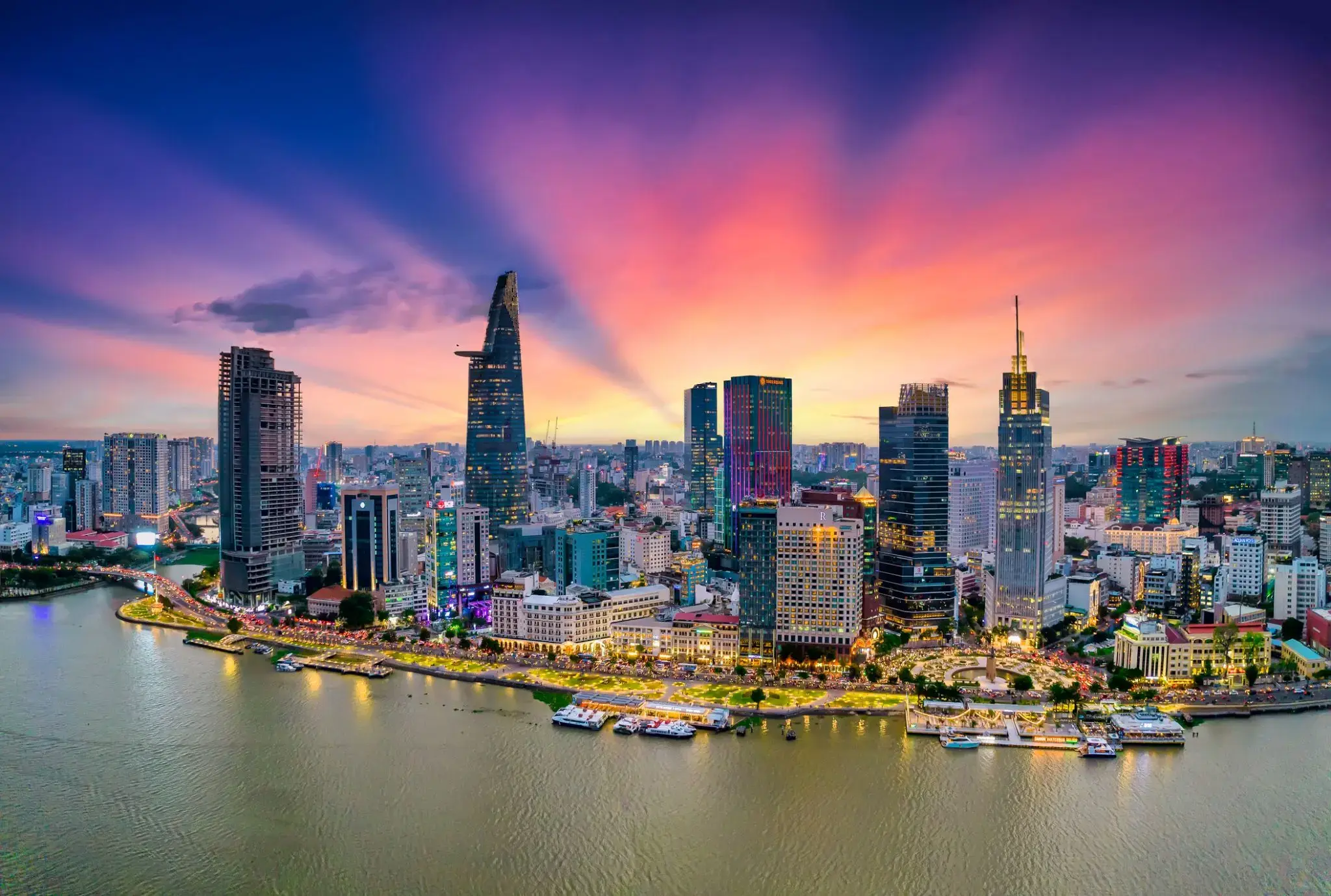
Ho Chi Minh, znane również pod swoją dawną nazwą Sajgon, jest najludniejszym miastem Wietnamu z populacją 8,4 miliona (13 milionów w obszarze metropolitalnym) według stanu na 2017 rok. Położona w południowo-wschodnim Wietnamie metropolia otacza rzekę Sajgon i zajmuje powierzchnię około 2061 kilometrów kwadratowych (796 mil kwadratowych).
Pod nazwą Sajgon było stolicą Indochin Francuskich od 1887 do 1902 roku i ponownie od 1945 do 1954 roku. Sajgon stał się później stolicą Wietnamu Południowego od 1955 roku aż do jego upadku w 1975 roku. 2 lipca 1976 roku Sajgon połączył się z otaczającą prowincją Gia Định i został oficjalnie przemianowany na Ho Chi Minh City na cześć przywódcy rewolucyjnego Hồ Chí Minha (chociaż nazwa Sài Gòn jest nadal powszechnie używana).
Ho Chi Minh City jest centrum finansowym Wietnamu i jest klasyfikowane jako miasto światowe Beta+ przez Globalization and World Cities Research Network. Jest siedzibą Giełdy Papierów Wartościowych w Ho Chi Minh City, największej giełdy papierów wartościowych pod względem całkowitej kapitalizacji rynkowej w Wietnamie oraz siedzibą wielu krajowych i międzynarodowych banków i firm.
Ho Chi Minh City jest najczęściej odwiedzanym miastem w Wietnamie, z 6,3 miliona odwiedzających w 2017 roku. Wiele znanych międzynarodowym turystom zabytków miasta to między innymi targ Bến Thành, ratusz w Ho Chi Minh City, bazylika katedralna Notre-Dame w Sajgonie, Pałac Niepodległości i Teatr Miejski. Głównym lotniskiem pasażerskim obsługującym obszar metropolitalny jest międzynarodowe lotnisko Tân Sơn Nhất, najbardziej ruchliwe lotnisko w Wietnamie, które w 2017 roku obsłużyło 36 milionów pasażerów.
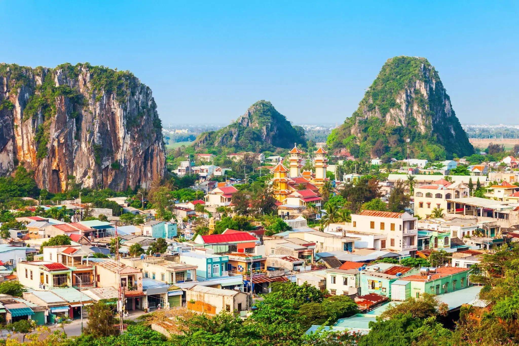
Ciepła morska bryza i miękki piasek sprawiają, że Da Nang to idealne miejsce dla tych, którzy szukają relaksu nad morzem i lekkości w każdym kroku. Tutaj nowoczesne kawiarnie sąsiadują z tradycyjnymi targami, a wieczorna promenada wypełnia się światłami i aromatem świeżych owoców morza. Można spacerować długimi plażami My Khe i Non Nuoc, które należą do najlepszych w Azji, oraz odkrywać przytulne zakątki z wietnamską kawą i uśmiechami mieszkańców.
Dla miłośników historii i natury Da Nang oferuje wyjątkowe trasy do Marmurowych Gór z jaskiniami i pagodami, skąd rozciągają się zapierające dech w piersiach widoki na wybrzeże. Stąd łatwo dotrzeć do starożytnego miasta Hoi An, które zachowało klimat przeszłości, lub wybrać się na przejażdżkę przełęczą Hai Van, gdzie każdy zakręt odkrywa nowe panoramy gór i morza. Miasto łączy relaksujący wypoczynek na plaży z możliwością odkrycia piękna Wietnamu i zaczerpnięcia świeżego, morskiego powietrza, które napełnia energią i lekkością.