| Region rejsu : kanał Panamski, Karaiby |
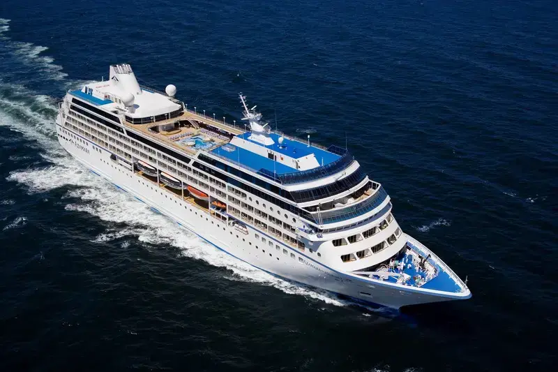
| Firma : Azamara Cruises |
| Statek : Azamara Quest |
| Data rozpoczęcia : pt. 18 gru 2026 |
| Data zakończenia : wt. 05 sty 2027 |
| Liczba nocy : 18 nocy |
| Dzień | Data | Port | Wypłynięcie | Odpłynięcie |
|---|---|---|---|---|
| 1 | 18.12 pt. | Miami / USA | 17:00 | |
| 2 | 19.12 sob. | Dzień na morzu / Morze | 15:00 | |
| 3 | 20.12 niedz. | Dzień na morzu / Morze | 15:00 | |
| 4 | 21.12 pon. | Cabo Rojo / Czerwona peleryna | 08:00 | 18:00 |
| 5 | 22.12 wt. | Dzień na morzu / Morze | 15:00 | |
| 6 | 23.12 śr. | Cartagena (Bolívar) / Kolumbia | 07:00 | 13:00 |
| 7 | 24.12 czw. | Kanał Panamski / Panama | 05:00 | 17:00 |
| 8 | 25.12 pt. | Dzień na morzu / Morze | 15:00 | |
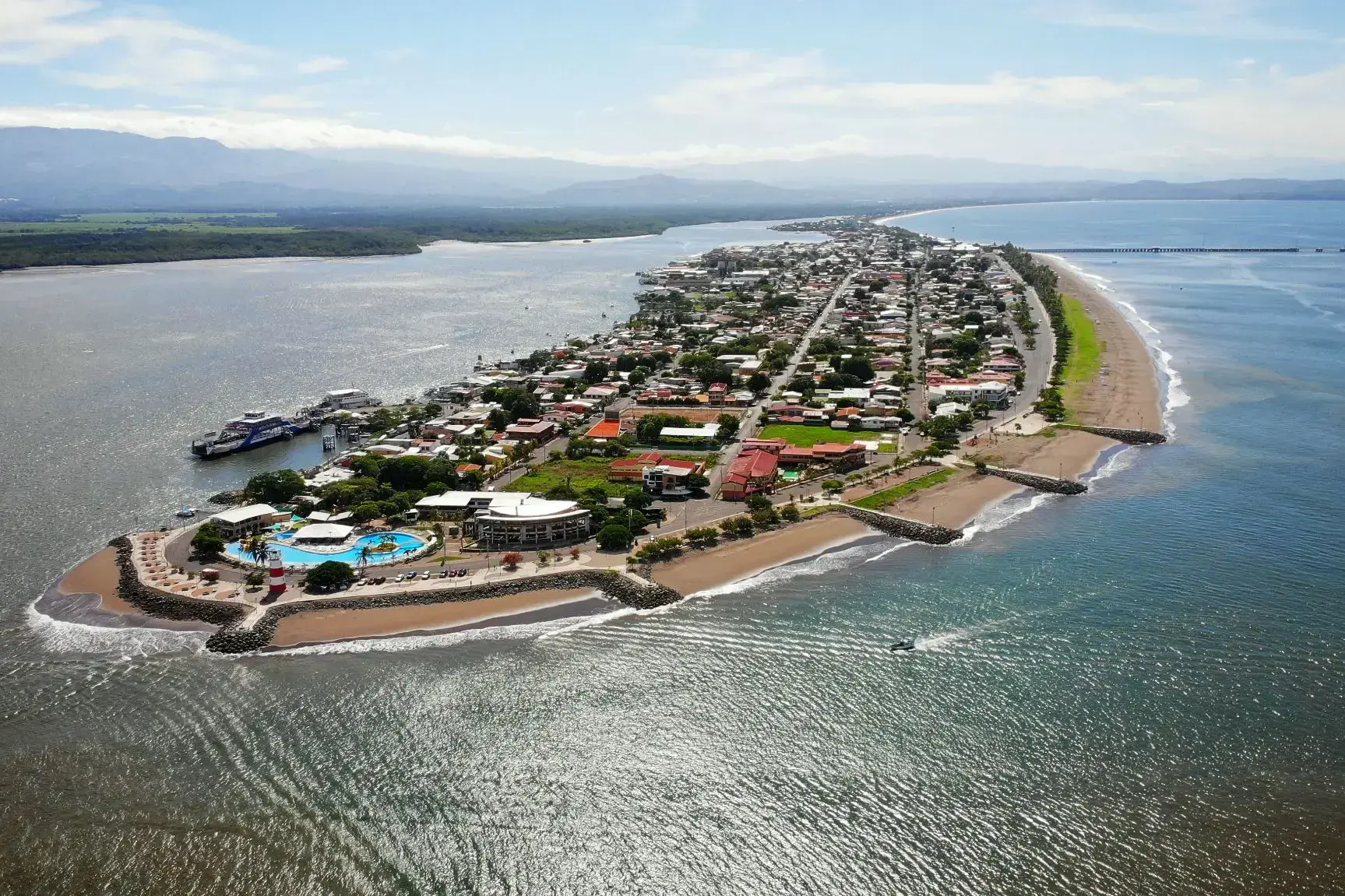
| 9 | 26.12 sob. | Puntarenas / Costa Rica | 08:00 | 17:00 |
| 10 | 27.12 niedz. | Dzień na morzu / Morze | 15:00 | |
| 11 | 28.12 pon. | Puerto Quetzal / Gwatemala | 08:00 | 16:00 |
| 12 | 29.12 wt. | Dzień na morzu / Morze | 15:00 | |
| 13 | 30.12 śr. | Dzień na morzu / Morze | 15:00 | |
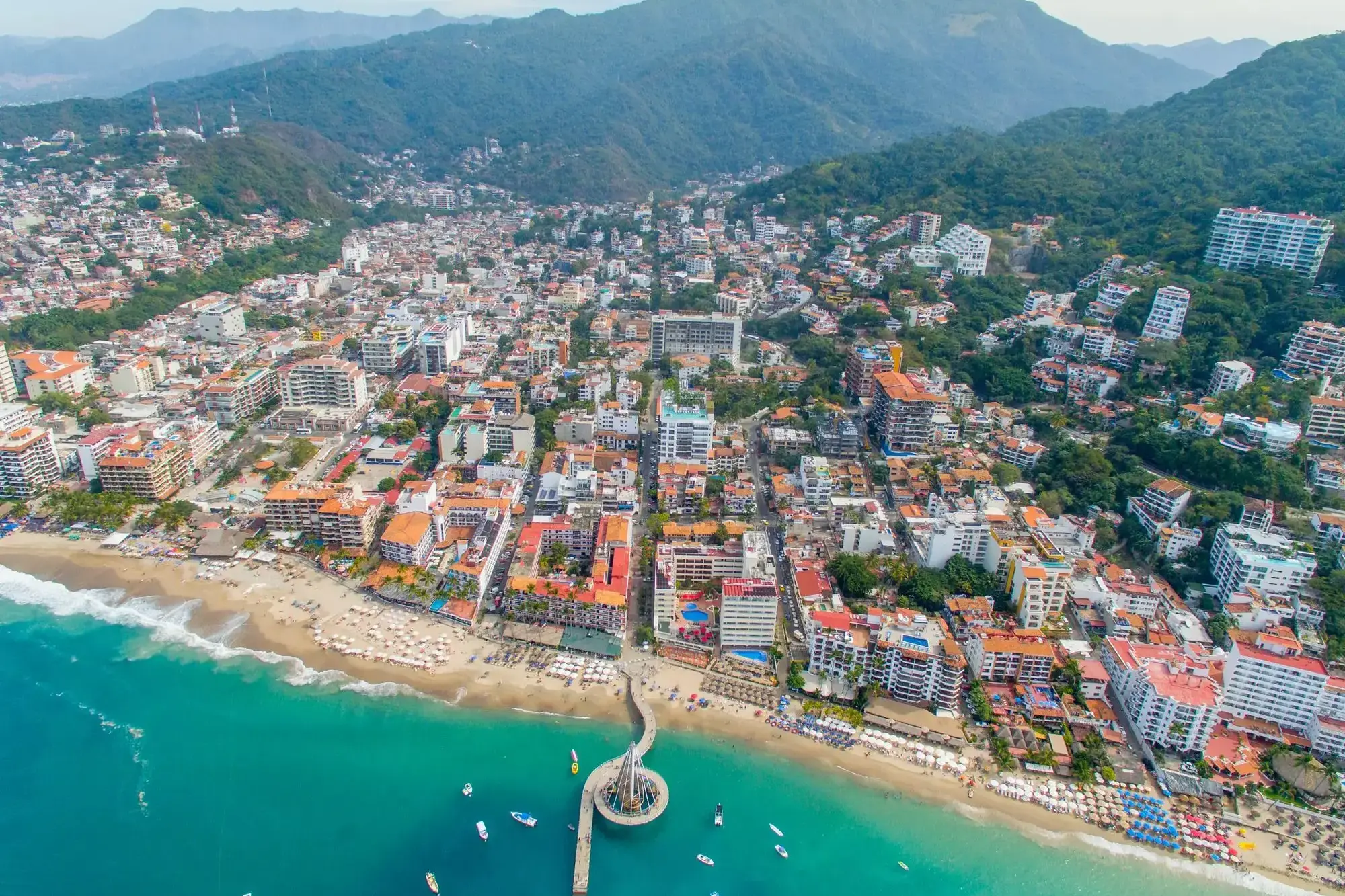
| 14 | 31.12 czw. | Puerto Vallarta / Meksyk | 09:00 | 23:00 |
| 15 | 1.01 pt. | Dzień na morzu / Morze | 15:00 | |
| 16 | 2.01 sob. | Dzień na morzu / Morze | 15:00 | |
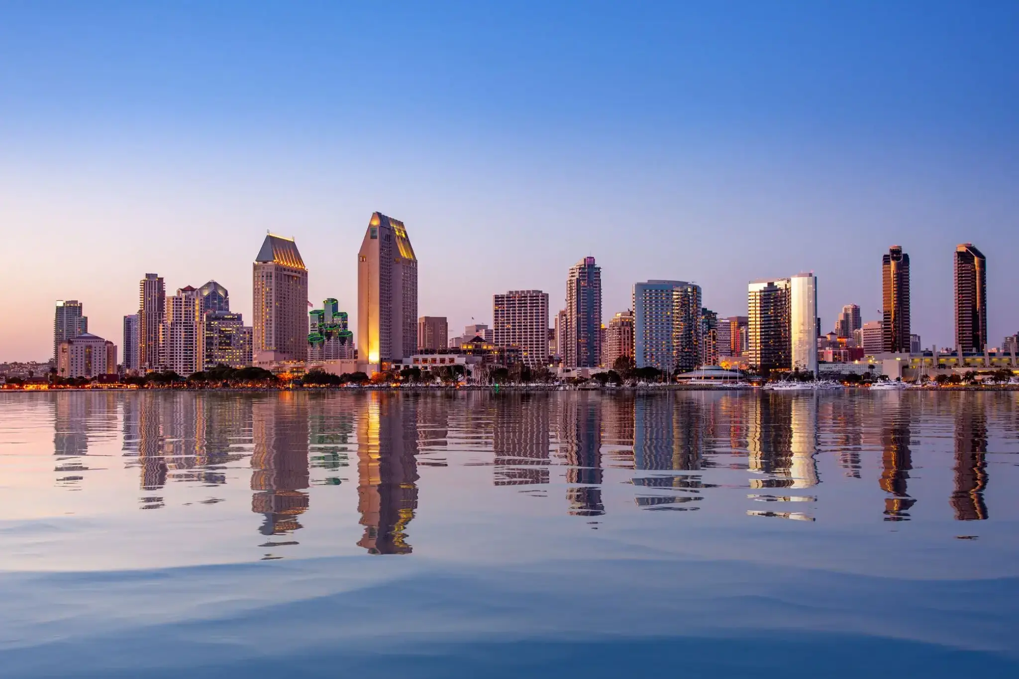
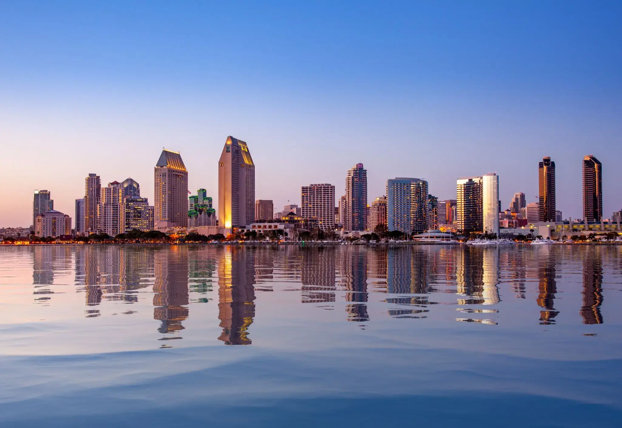
| 17 | 3.01 niedz. | San Diego, Kalifornia / USA | 08:00 | 22:00 |
| 18 | 4.01 pon. | Dzień na morzu / Morze | 15:00 | |
| 19 | 5.01 wt. | San Francisco / USA | 06:00 |

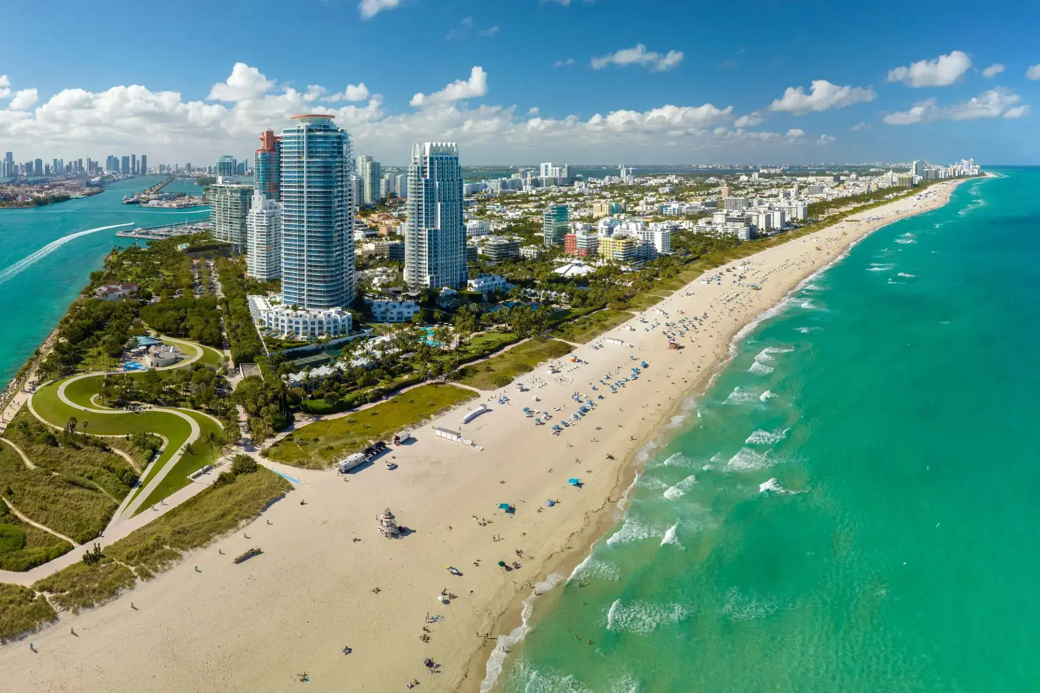
Miami, officially the City of Miami, is the cultural, economic and financial center of South Florida. Miami is the seat of Miami-Dade County, the most populous county in Florida. The city covers an area of about 56.6 square miles (147 km2), between the Everglades to the west and Biscayne Bay on the east; with a 2017 estimated population of 463,347, Miami is the sixth most densely populated major city in the United States. The Miami metropolitan area is home to 6.1 million people and the seventh-largest metropolitan area in the nation. Miami's metro area is the second-most populous metropolis in the southeastern United States and fourth-largest urban area in the U.S.
Miami is a major center, and a leader in finance, commerce, culture, media, entertainment, the arts, and international trade. The Miami Metropolitan Area is by far the largest urban economy in Florida and the 12th largest in the United States with a GDP of $344.9 billion as of 2017. In 2012, Miami was classified as an "Alpha−" level world city in the World Cities Study Group's inventory. In 2010, Miami ranked seventh in the United States and 33rd among global cities in terms of business activity, human capital, information exchange, cultural experience, and political engagement. In 2008, Forbes magazine ranked Miami "America's Cleanest City", for its year-round good air quality, vast green spaces, clean drinking water, clean streets, and citywide recycling programs. According to a 2009 UBS study of 73 world cities, Miami was ranked as the richest city in the United States, and the world's seventh-richest city in terms of purchasing power. Miami is nicknamed the "Capital of Latin America" and is the largest city with a Cuban-American plurality.
Greater Downtown Miami has one of the largest concentrations of international banks in the United States, and is home to many large national and international companies. The Civic Center is a major center for hospitals, research institutes, medical centers, and biotechnology industries. For more than two decades, the Port of Miami, known as the "Cruise Capital of the World", has been the number one cruise passenger port in the world. It accommodates some of the world's largest cruise ships and operations, and is the busiest port in both passenger traffic and cruise lines. Metropolitan Miami is also a major tourism hub in the southeastern U.S. for international visitors, ranking number two in the country after New York City.
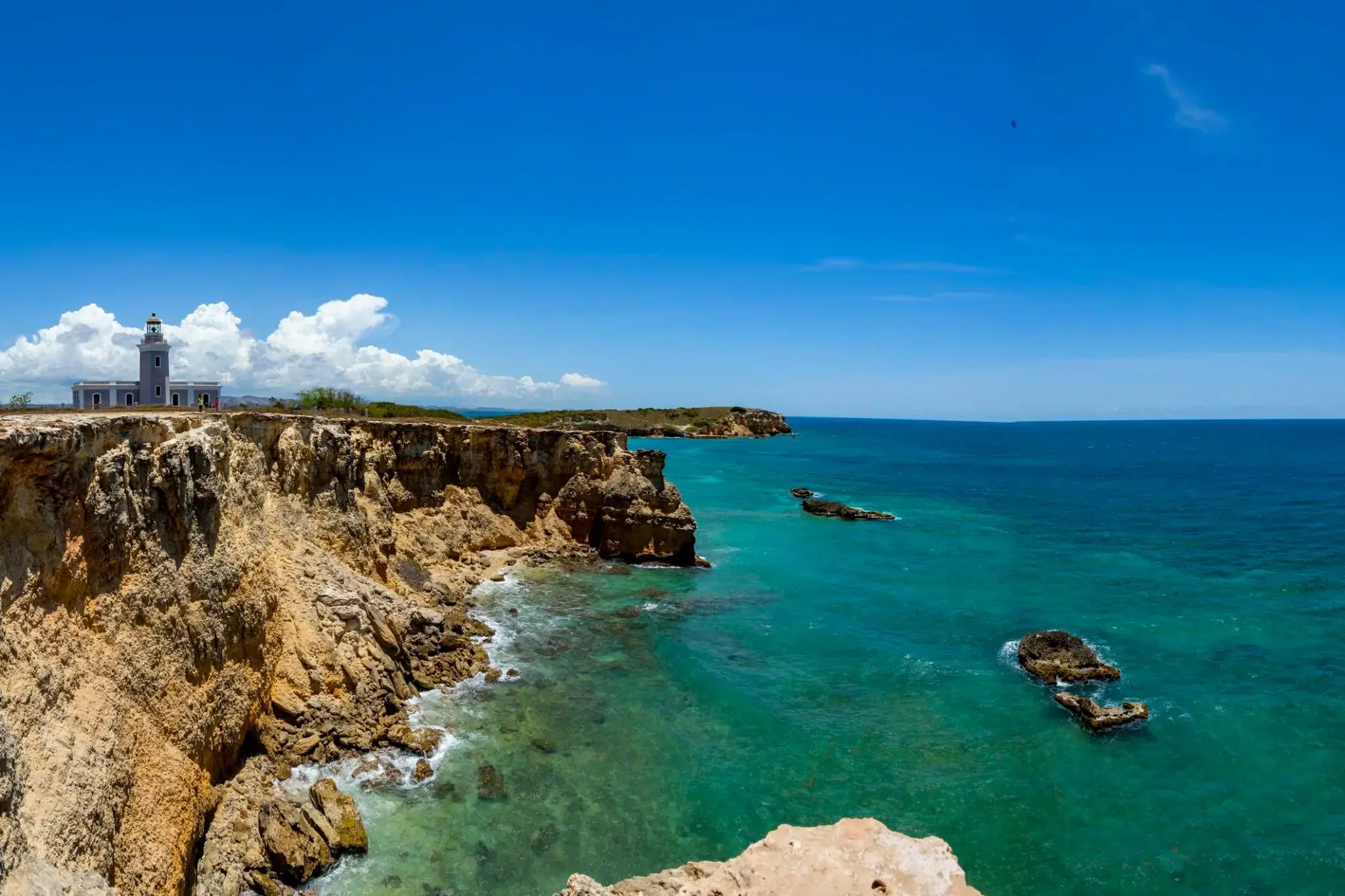
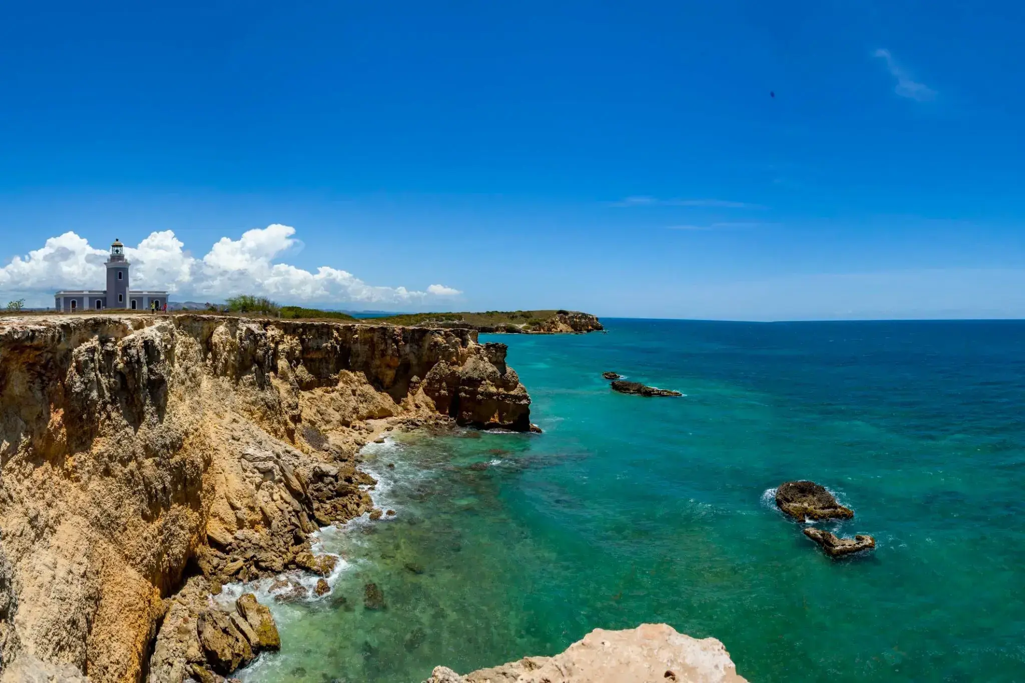
Odosobnione plaże, turkusowe wody i dzika przyroda sprawiają, że Cabo Rojo to jeden z najbardziej malowniczych zakątków Portoryko. Położony na południowo-zachodnim wybrzeżu wyspy region przyciąga turystów nie tylko widokami, ale i unikalnym ekosystemem – solniskami oraz nadmorskimi lasami namorzynowymi. Jedną z głównych atrakcji jest latarnia morska Cabo Rojo, z której roztaczają się zapierające dech w piersiach widoki na klify i Morze Karaibskie.
Cabo Rojo jest szczególnie ceniony przez tych, którzy szukają ciszy z dala od tłumów turystów. Można tu popływać kajakiem, wędrować dzikimi ścieżkami lub obserwować ptaki w rezerwacie przyrody. Miejscowa kuchnia, oparta na owocach morza, zachwyca świeżością, a zachód słońca na plaży Playa Sucia pozostanie romantycznym wspomnieniem na długo.
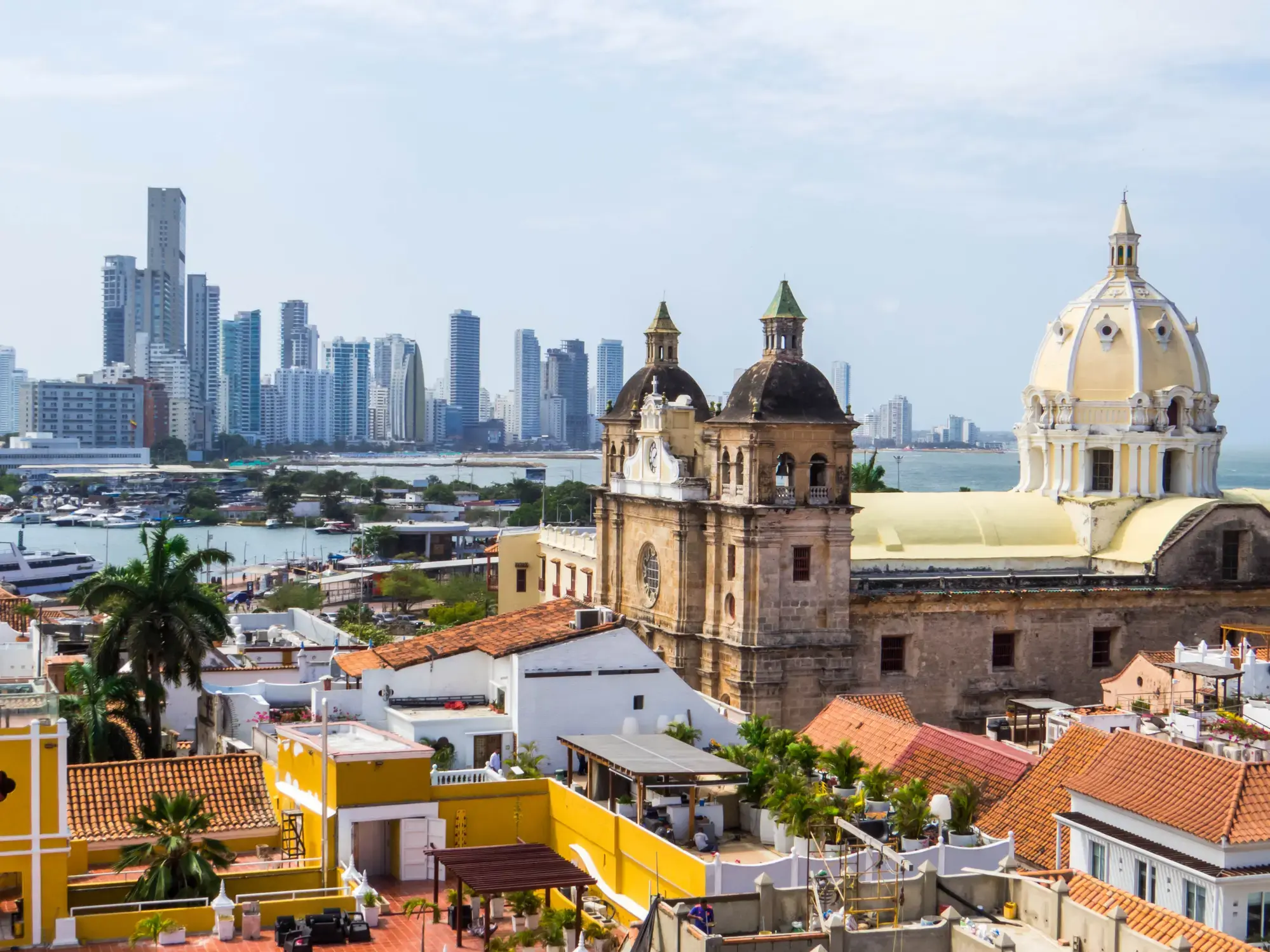
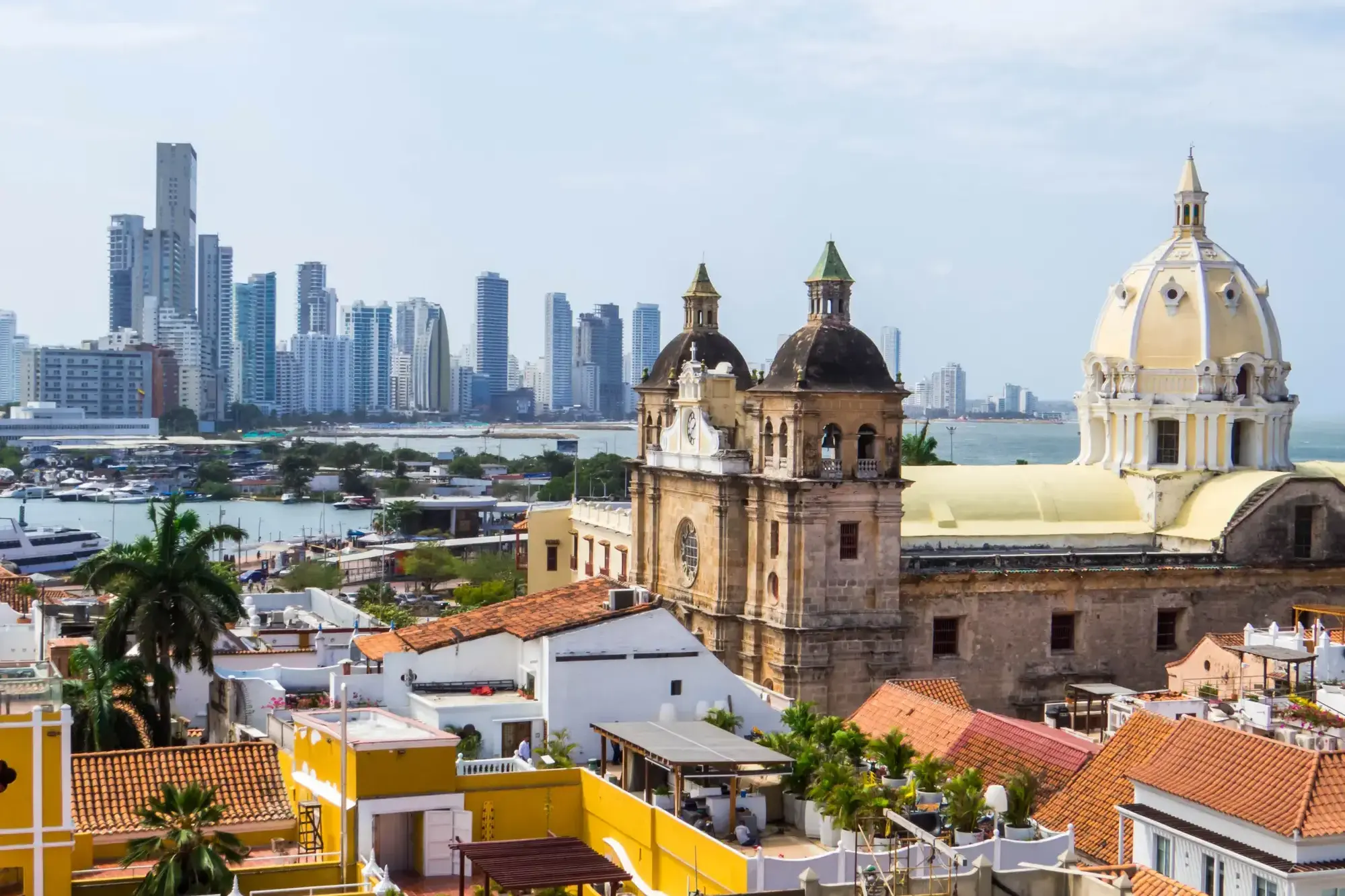
Starożytne mury forteczne, uliczni muzycy i karaibskie słońce tworzą niepowtarzalną atmosferę w Cartagenie (Bolívar) – perle kolumbijskiego wybrzeża. Miasto wpisane na listę światowego dziedzictwa UNESCO zachwyca kolonialną architekturą, uroczymi dziedzińcami i aromatem świeżo parzonej kawy z licznych kawiarni.
Zanurz się w tętniący życiem rytm Cartageny, spacerując brukowanymi uliczkami Starego Miasta, gdzie każdy zakątek kryje opowieści o piratach i hiszpańskich konkwistadorach. Zachód słońca przy starożytnej twierdzy Castillo San Felipe de Barajas to idealne zakończenie dnia pełnego kultury, historii i tropikalnego uroku.
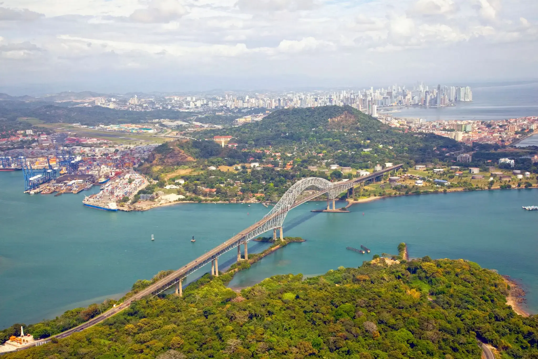
The Panama Canal is an artificial 82 km (51 mi) waterway in Panama that connects the Atlantic Ocean with the Pacific Ocean. The canal cuts across the Isthmus of Panama and is a conduit for maritime trade. Canal locks are at each end to lift ships up to Gatun Lake, an artificial lake created to reduce the amount of excavation work required for the canal, 26 m (85 ft) above sea level, and then lower the ships at the other end. The original locks are 34 m (110 ft) wide. A third, wider lane of locks was constructed between September 2007 and May 2016. The expanded canal began commercial operation on June 26, 2016. The new locks allow transit of larger, post-Panamax ships, capable of handling more cargo.
France began work on the canal in 1881, but stopped due to engineering problems and a high worker mortality rate. The United States took over the project in 1904 and opened the canal on August 15, 1914. One of the largest and most difficult engineering projects ever undertaken, the Panama Canal shortcut greatly reduced the time for ships to travel between the Atlantic and Pacific Oceans, enabling them to avoid the lengthy, hazardous Cape Horn route around the southernmost tip of South America via the Drake Passage or Strait of Magellan.
Colombia, France, and later the United States controlled the territory surrounding the canal during construction. The US continued to control the canal and surrounding Panama Canal Zone until the 1977 Torrijos–Carter Treatiesprovided for handover to Panama. After a period of joint American–Panamanian control, in 1999, the canal was taken over by the Panamanian government. It is now managed and operated by the government-owned Panama Canal Authority.
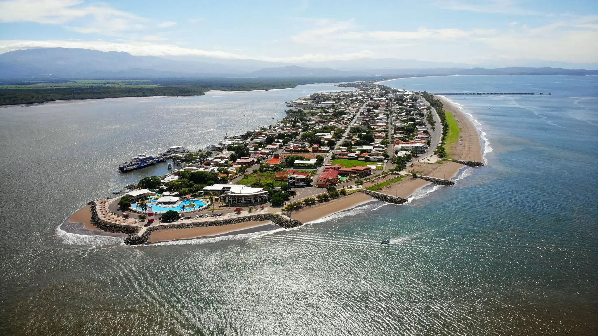
Puntarenas is the capital and largest city in the Province of Puntarenas, on the Pacific coast of Costa Rica.
Puerto Quetzal to ważne miasto portowe na wybrzeżu Gwatemali, położone w regionie Pacyfiku. Jest jednym z najpopularniejszych portów docelowych dla statków wycieczkowych, co czyni go istotnym węzłem transportowym i głównym wejściem dla podróżnych przybywających do kraju. Puerto Quetzal jest także punktem wyjścia do odkrywania cudów przyrody Gwatemali, w tym słynnych wulkanów i malowniczych plaż. W pobliżu znajdują się takie atrakcje, jak wulkan Acatenango i Park Narodowy Monterrico, który słynie z ekosystemu oraz plaż odpowiednich do surfingu.
Oprócz piękna przyrody Puerto Quetzal przyciąga podróżnych swoją unikalną atmosferą. Miasto zachowało klimat wybrzeża Pacyfiku z urokliwymi wioskami rybackimi i restauracjami, w których można skosztować świeżych owoców morza. Jego strategiczne położenie i rozwinięta infrastruktura sprawiają, że Puerto Quetzal jest wygodnym punktem wyjścia do podróży po Gwatemali, zarówno dla tych, którzy chcą odkrywać starożytne ruiny Majów, takie jak Tikal, jak i dla tych, którzy szukają relaksu na plaży.
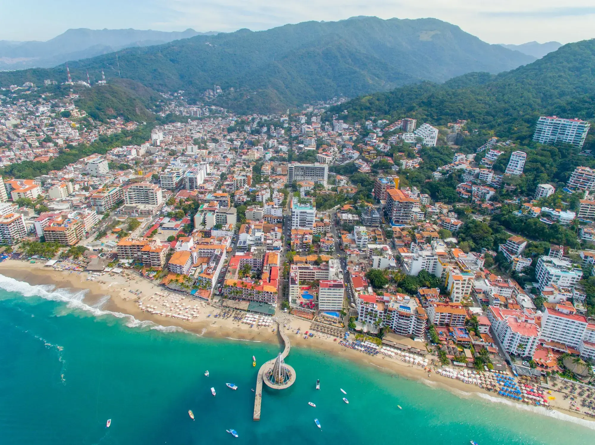
Ciepła morska bryza wita gości w Puerto Vallarta, malowniczym kurorcie na wybrzeżu Pacyfiku, gdzie góry Sierra Madre spotykają się ze złotymi plażami. Miasto słynie z przytulnej atmosfery, wąskich brukowanych uliczek w historycznym centrum oraz słynnej promenady Malecon, ozdobionej nowoczesnymi rzeźbami i sztuką uliczną. Tutaj można nie tylko cieszyć się słońcem, ale także obserwować wieloryby w zatoce Banderas w sezonie migracyjnym.
Dla podróżnych Puerto Vallarta oferuje bogatą kulturę i kulinarne doznania – od tradycyjnych tacos i świeżych owoców morza po galerie sztuki i meksykańskie festiwale muzyczne. Miasto jest również popularne wśród miłośników nurkowania i snorkelingu dzięki rafom koralowym i krystalicznie czystej wodzie. To miejsce, gdzie można połączyć relaks nad oceanem z odkrywaniem natury i życia kulturalnego Meksyku.
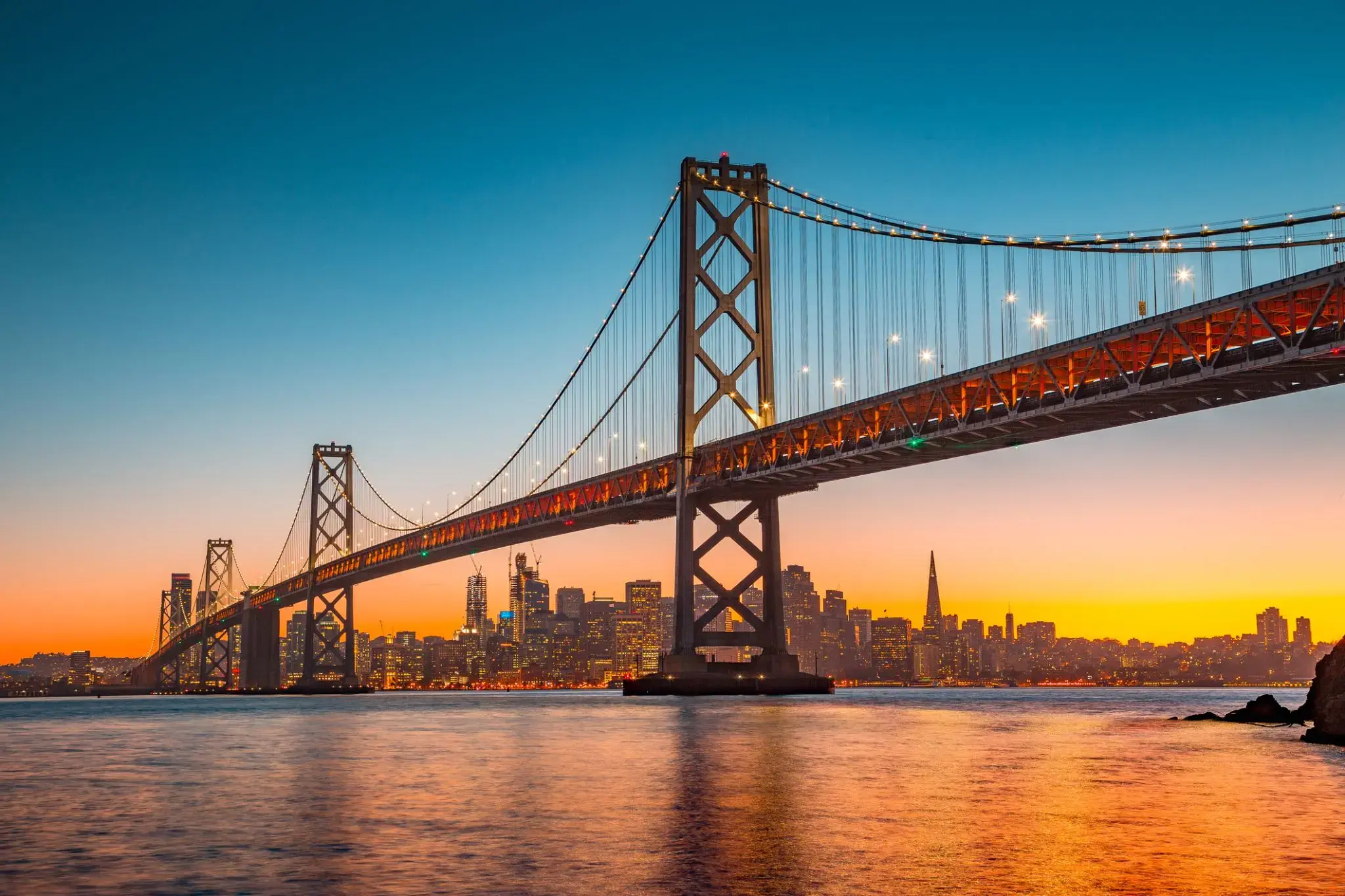
San Francisco , officially the City and County of San Francisco, is the cultural, commercial, and financial center of Northern California. San Francisco is the 13th-most populous city in the United States, and the fourth-most populous in California, with 884,363 residents as of 2017. It covers an area of about 46.89 square miles (121.4 km2), mostly at the north end of the San Francisco Peninsula in the San Francisco Bay Area, making it the second-most densely populated large US city, and the fifth-most densely populated U.S. county, behind only four of the five New York City boroughs. San Francisco is also part of the fifth-most populous primary statistical area in the United States, the San Jose–San Francisco–Oakland, CA Combined Statistical Area (9.7 million residents).