| Region rejsu : kanał Panamski, Karaiby |
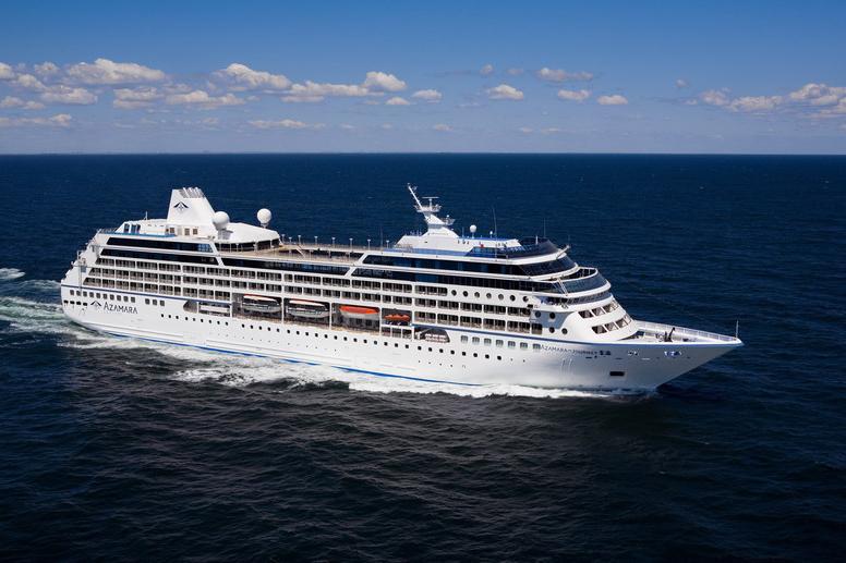
| Firma : Azamara Cruises |
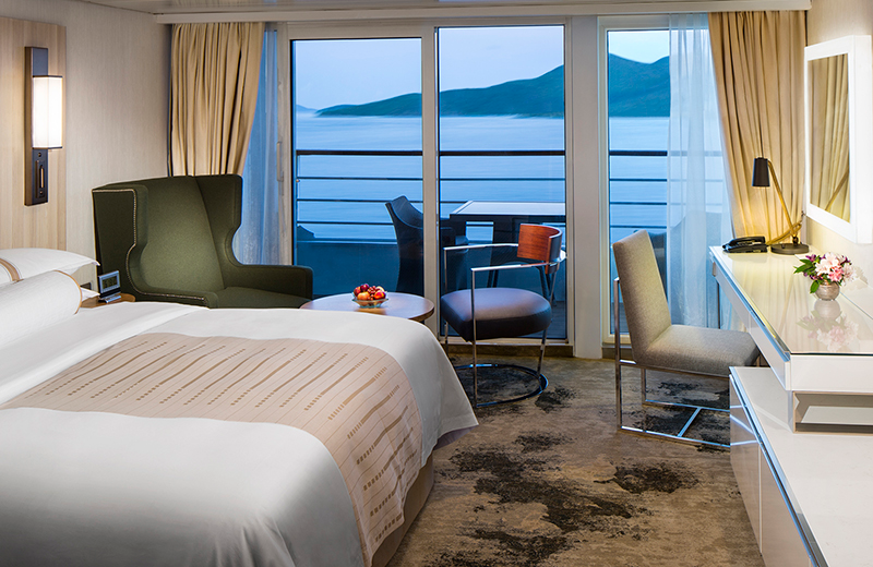
| Statek : Azamara Journey |
| Data rozpoczęcia : czw. 14 sty 2027 |
| Data zakończenia : pon. 29 mar 2027 |
| Liczba nocy : 74 nocy |
| Dzień | Data | Port | Wypłynięcie | Odpłynięcie |
|---|---|---|---|---|
| 1 | 14.01 czw. | Miami / USA | 17:00 | |
| 2 | 15.01 pt. | Dzień na morzu / Morze | ||
| 3 | 16.01 sob. | Dzień na morzu / Morze | ||
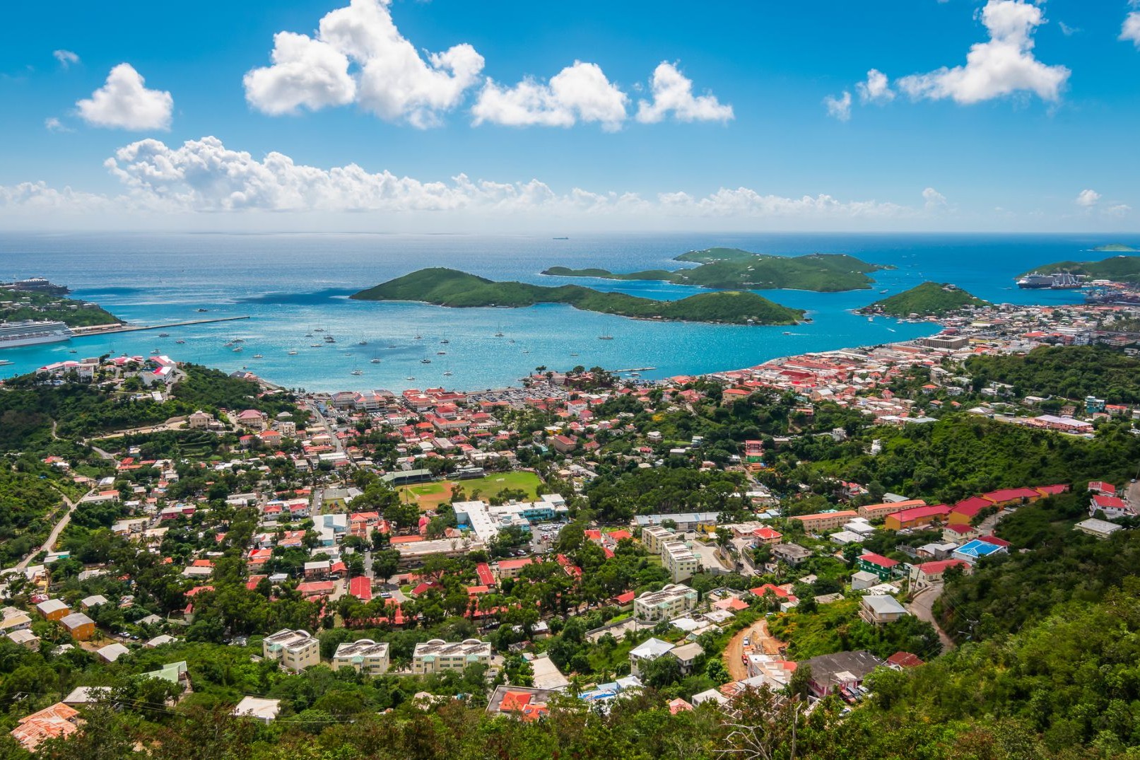
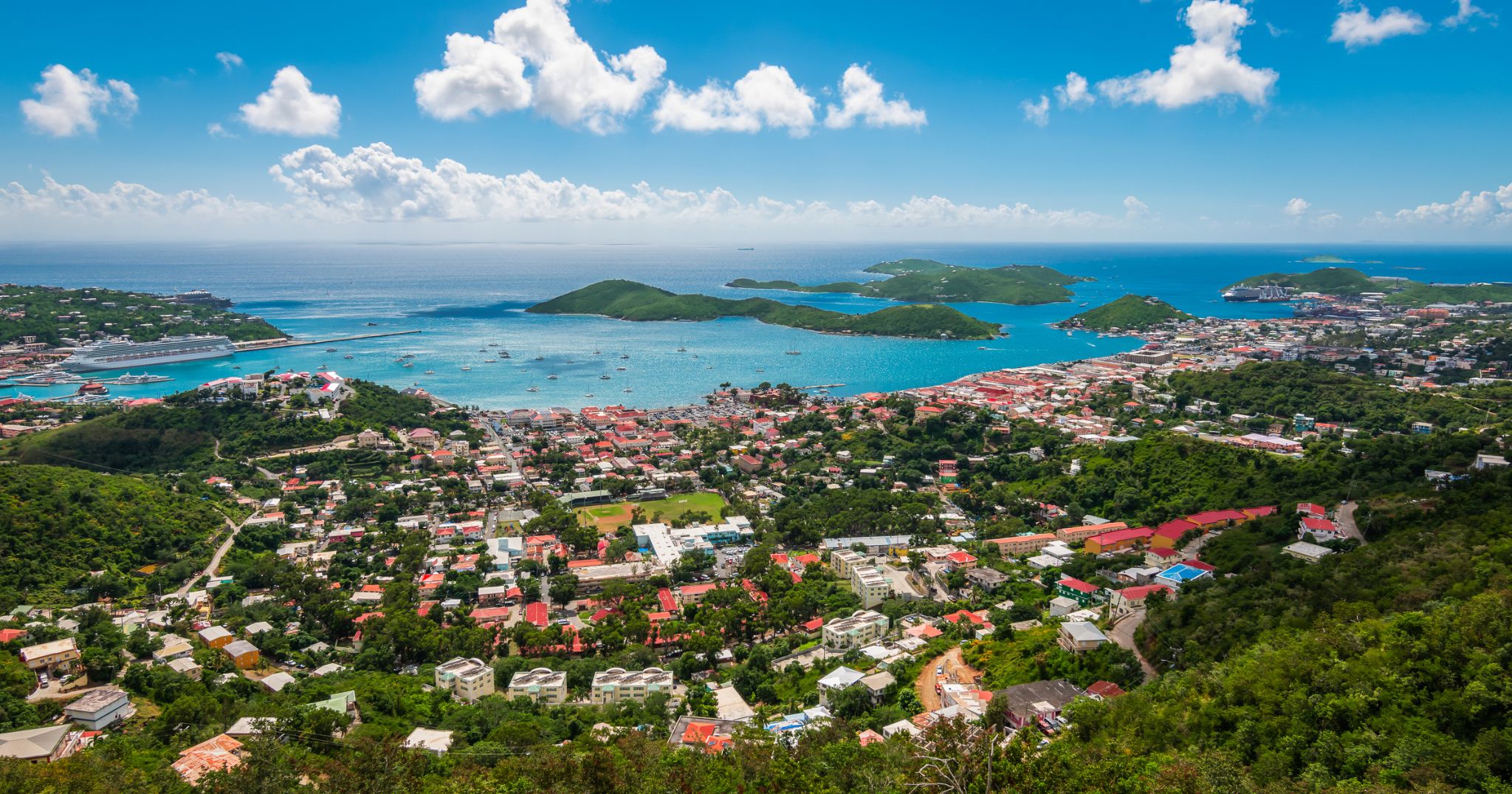
| 5 | 18.01 pon. | Charlotte Amalie, ks. Święty Tomasz / Wyspy Dziewicze | 08:00 | 18:00 |
| 6 | 19.01 wt. | PHILIPSBURG / Anguilla | 08:00 | 22:00 |
| 7 | 20.01 śr. | Charlestown / Saint Kitts i Nevis | 08:00 | 18:00 |
| 8 | 21.01 czw. | św. Jana | 08:00 | 18:00 |
| 9 | 22.01 pt. | Saint-Pierre i Miquelon / Francja | 08:00 | 20:00 |
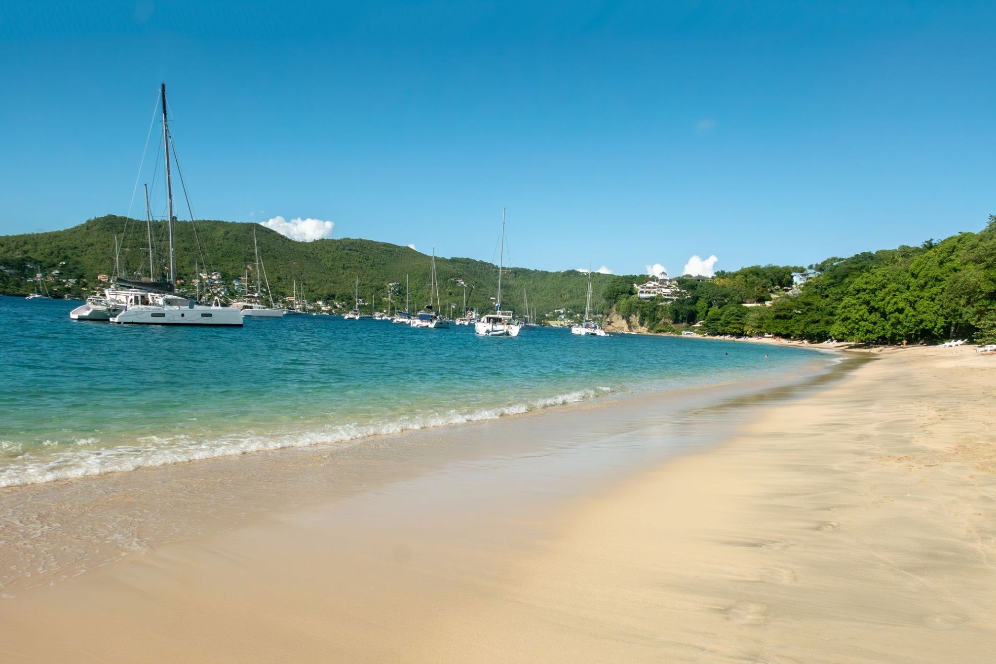
| 10 | 23.01 sob. | Port Elizabeth, Bequia / Saint Vincent i Grenadyny | 08:00 | 20:00 |
| 11 | 24.01 niedz. | Świętego Jerzego | 08:00 | 17:00 |
| 12 | 25.01 pon. | Bridgetown / Barbados | 06:00 | 18:00 |
| 13 | 26.01 wt. | Scarborough / Trinidad and Tobago | 08:00 | 16:00 |
| 14 | 27.01 śr. | Dzień na morzu / Morze | ||
| 15 | 28.01 czw. | dąb Królewski | 08:00 | 18:00 |
| 16 | 29.01 pt. | Dzień na morzu / Morze | ||
| 17 | 30.01 sob. | Belen / Brazylia | 08:00 | 17:00 |
| 18 | 31.01 niedz. | Dzień na morzu / Morze | ||
| 19 | 1.02 pon. | Dzień na morzu / Morze | ||
| 20 | 2.02 wt. | Recife / Brazylia | 13:00 | 20:00 |
| 21 | 3.02 śr. | Dzień na morzu / Morze | ||
| 22 | 4.02 czw. | Salwador / Brazylia | 08:00 | 18:00 |
| 23 | 5.02 pt. | Dzień na morzu / Morze | ||
| 24 | 6.02 sob. | Armacao dos Buzios / Brazylia | 13:00 | 20:00 |
| 25 | 7.02 niedz. | Rio de Janeiro / Brazylia | 08:00 | |
| 26 | 8.02 pon. | Rio de Janeiro / Brazylia | ||
| 27 | 9.02 wt. | Rio de Janeiro / Brazylia | 17:00 | |
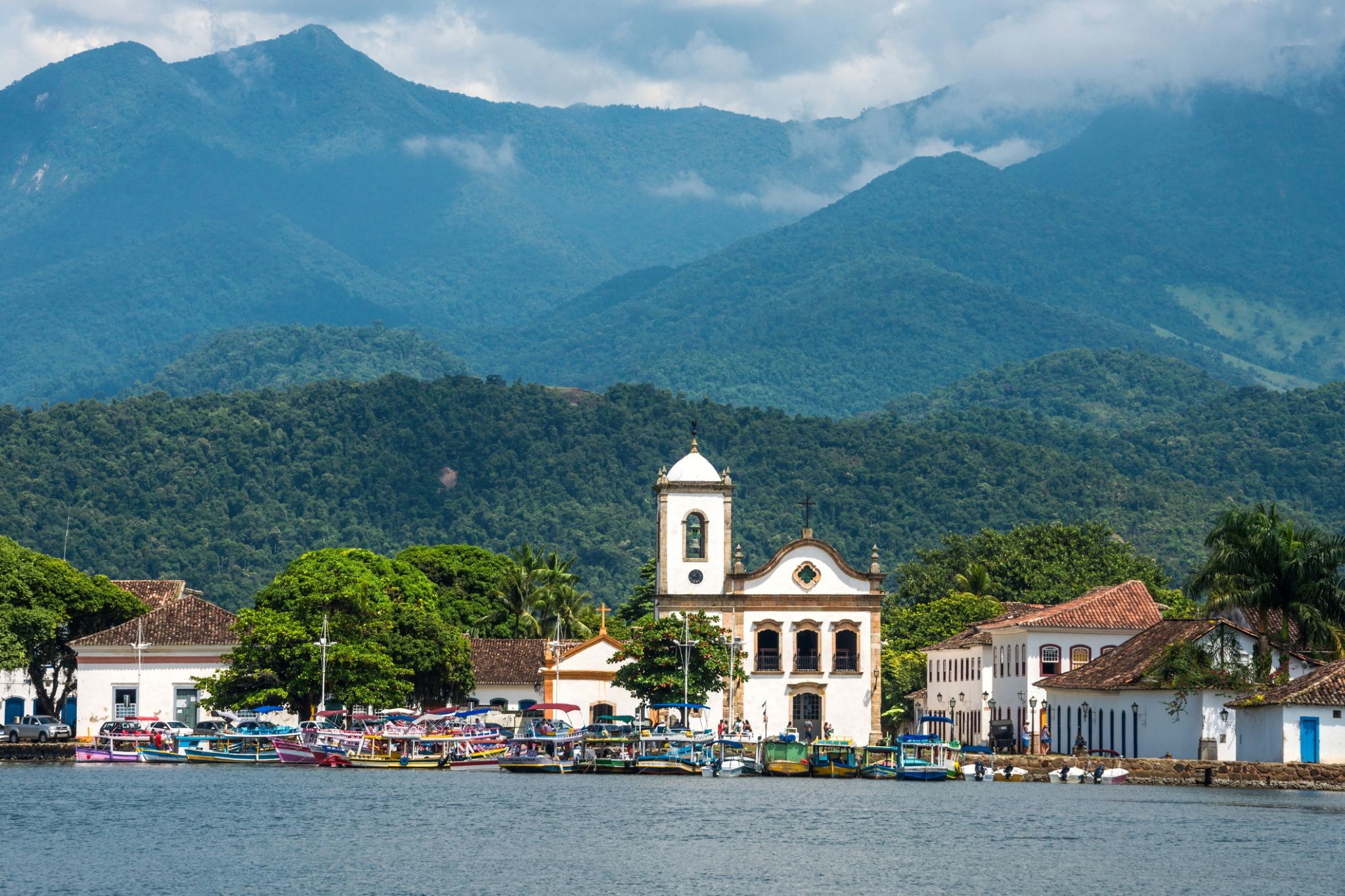
| 28 | 10.02 śr. | Parati / Brazylia | 08:00 | 18:00 |
| 29 | 11.02 czw. | Ilhabela / Brazylia | 08:00 | 18:00 |
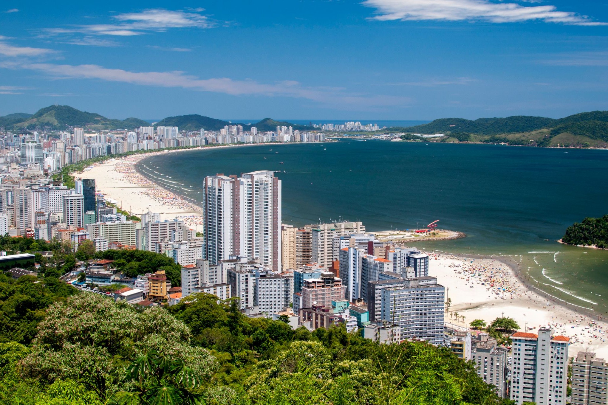
| 30 | 12.02 pt. | Santos / Brazylia | 08:00 | 18:00 |
| 31 | 13.02 sob. | Dzień na morzu / Morze | ||
| 32 | 14.02 niedz. | Dzień na morzu / Morze | ||
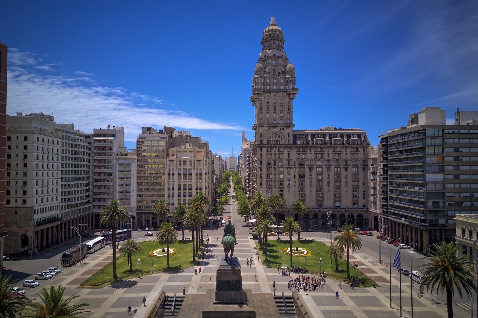
| 33 | 15.02 pon. | Montevideo / Uruguay | 08:00 | 18:00 |
| 34 | 16.02 wt. | Buenos Aires / Argentyna | 08:00 | |
| 35 | 17.02 śr. | Buenos Aires / Argentyna | 09:00 | |
| 36 | 18.02 czw. | Buenos Aires / Argentyna | 18:00 | |
| 37 | 19.02 pt. | Montevideo / Uruguay | 08:00 | 22:00 |
| 38 | 20.02 sob. | Punta del Este / Uruguay | 08:00 | 22:00 |
| 39 | 21.02 niedz. | Dzień na morzu / Morze | 03:00 | |
| 40 | 22.02 pon. | Dzień na morzu / Morze | ||
| 41 | 23.02 wt. | Dzień na morzu / Morze | ||
| 42 | 24.02 śr. | Port Stanley, Falklandy / Wielka Brytania | 07:30 | 17:00 |
| 43 | 25.02 czw. | Dzień na morzu / Morze | ||
| 44 | 26.02 pt. | Dzień na morzu / Morze | 06:00 | |
| 45 | 27.02 sob. | Dzień na morzu / Morze | ||
| 46 | 28.02 niedz. | Dzień na morzu / Morze | 18:00 | |
| 47 | 1.03 pon. | Dzień na morzu / Morze | ||
| 48 | 2.03 wt. | Ushuaia / Argentyna | 08:00 | |
| 49 | 3.03 śr. | Żeglowanie po kanale Beagle | 08:00 | 12:00 |
| 50 | 4.03 czw. | Ushuaia / Argentyna | 07:00 | |
| 51 | 5.03 pt. | Punta Arenas / Chile | 07:00 | 19:30 |
| 52 | 6.03 sob. | Chilijskie fiordy / Chile | 06:00 | |
| 53 | 7.03 niedz. | Chilijskie fiordy / Chile | 18:00 | |
| 54 | 8.03 pon. | Puerto Chacabuco / Chile | 07:00 | 14:30 |
| 55 | 9.03 wt. | Puerto Montt / Chile | 08:00 | 17:00 |
| 56 | 10.03 śr. | Dzień na morzu / Morze | ||
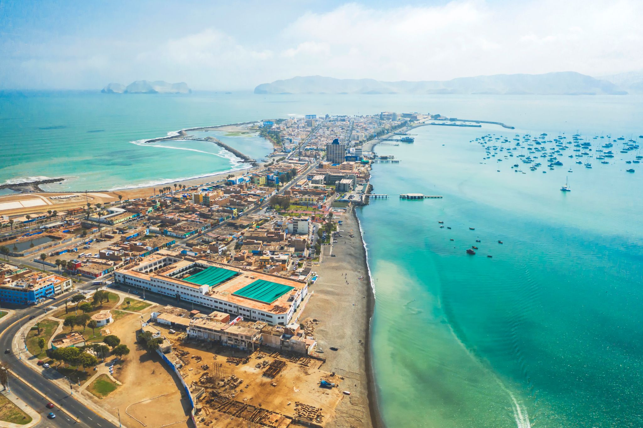
| 57 | 11.03 czw. | San Anton / Cuba | 07:00 | 17:00 |
| 58 | 12.03 pt. | Coquimbo / Chile | 11:00 | 17:00 |
| 59 | 13.03 sob. | Dzień na morzu / Morze | ||
| 60 | 14.03 niedz. | Iquique | 09:30 | 20:00 |
| 61 | 15.03 pon. | Arica / Chile | 08:00 | 20:00 |
| 62 | 16.03 wt. | Dzień na morzu / Morze | ||
| 63 | 17.03 śr. | Pisco / Peru | 08:00 | 20:00 |
| 64 | 18.03 czw. | Callao / Peru | 07:30 | |
| 65 | 19.03 pt. | Callao / Peru | 18:00 | |
| 66 | 20.03 sob. | Dzień na morzu / Morze | ||
| 67 | 21.03 niedz. | Dzień na morzu / Morze | ||
| 68 | 22.03 pon. | Dzień na morzu / Morze | ||
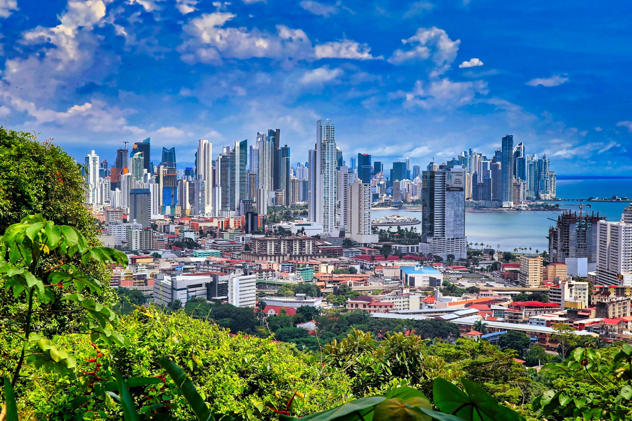
| 69 | 23.03 wt. | Panama City, Floryda / USA | 09:30 | 22:00 |
| 70 | 24.03 śr. | Kanał Panamski / Panama | 05:00 | 17:00 |
| 71 | 25.03 czw. | Puerto Lemon / Costa Rica | 08:00 | 18:00 |
| 72 | 26.03 pt. | San Andres / Kolumbia | 08:00 | 16:00 |
| 73 | 27.03 sob. | Dzień na morzu / Morze | 03:00 | |
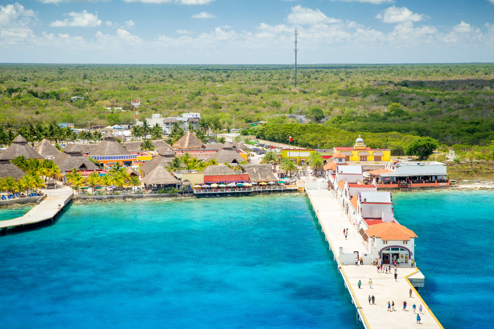
| 74 | 28.03 niedz. | San Miguel, wyspa Cozumel / Meksyk | 08:00 | 18:00 |
| 75 | 29.03 pon. | Dzień na morzu / Morze | 03:00 | |
| 76 | 30.03 wt. | Miami / USA | 06:00 |

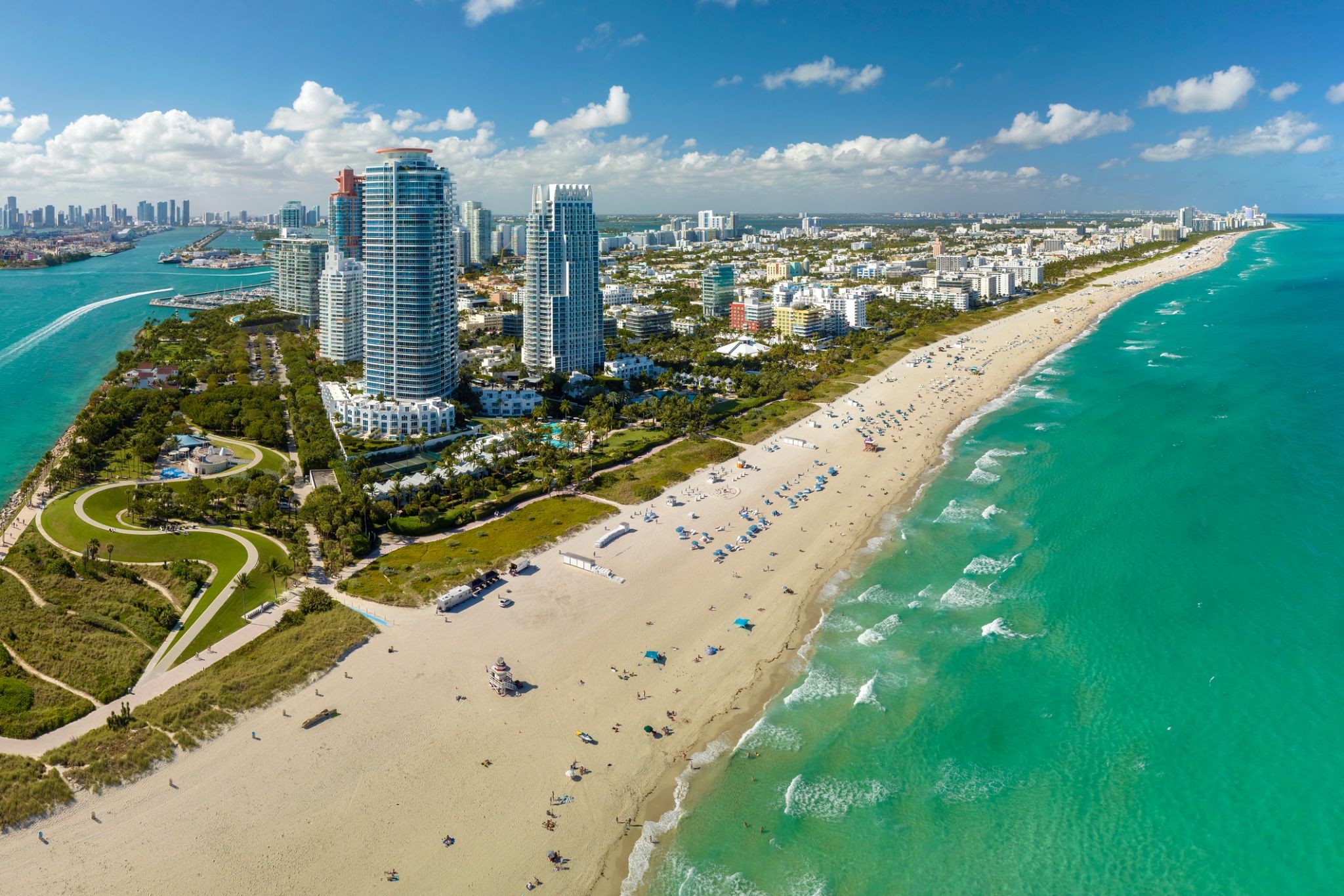
Miami, officially the City of Miami, is the cultural, economic and financial center of South Florida. Miami is the seat of Miami-Dade County, the most populous county in Florida. The city covers an area of about 56.6 square miles (147 km2), between the Everglades to the west and Biscayne Bay on the east; with a 2017 estimated population of 463,347, Miami is the sixth most densely populated major city in the United States. The Miami metropolitan area is home to 6.1 million people and the seventh-largest metropolitan area in the nation. Miami's metro area is the second-most populous metropolis in the southeastern United States and fourth-largest urban area in the U.S.
Miami is a major center, and a leader in finance, commerce, culture, media, entertainment, the arts, and international trade. The Miami Metropolitan Area is by far the largest urban economy in Florida and the 12th largest in the United States with a GDP of $344.9 billion as of 2017. In 2012, Miami was classified as an "Alpha−" level world city in the World Cities Study Group's inventory. In 2010, Miami ranked seventh in the United States and 33rd among global cities in terms of business activity, human capital, information exchange, cultural experience, and political engagement. In 2008, Forbes magazine ranked Miami "America's Cleanest City", for its year-round good air quality, vast green spaces, clean drinking water, clean streets, and citywide recycling programs. According to a 2009 UBS study of 73 world cities, Miami was ranked as the richest city in the United States, and the world's seventh-richest city in terms of purchasing power. Miami is nicknamed the "Capital of Latin America" and is the largest city with a Cuban-American plurality.
Greater Downtown Miami has one of the largest concentrations of international banks in the United States, and is home to many large national and international companies. The Civic Center is a major center for hospitals, research institutes, medical centers, and biotechnology industries. For more than two decades, the Port of Miami, known as the "Cruise Capital of the World", has been the number one cruise passenger port in the world. It accommodates some of the world's largest cruise ships and operations, and is the busiest port in both passenger traffic and cruise lines. Metropolitan Miami is also a major tourism hub in the southeastern U.S. for international visitors, ranking number two in the country after New York City.
Charlestown
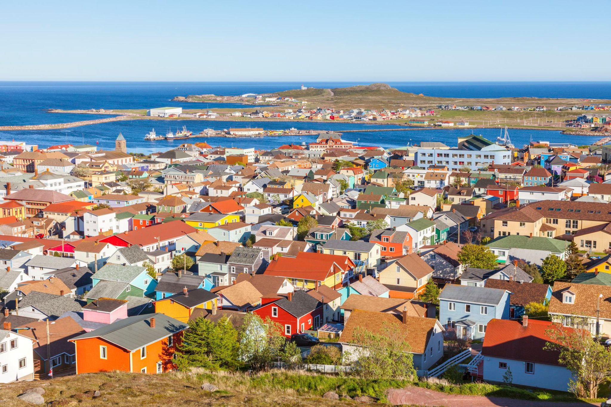
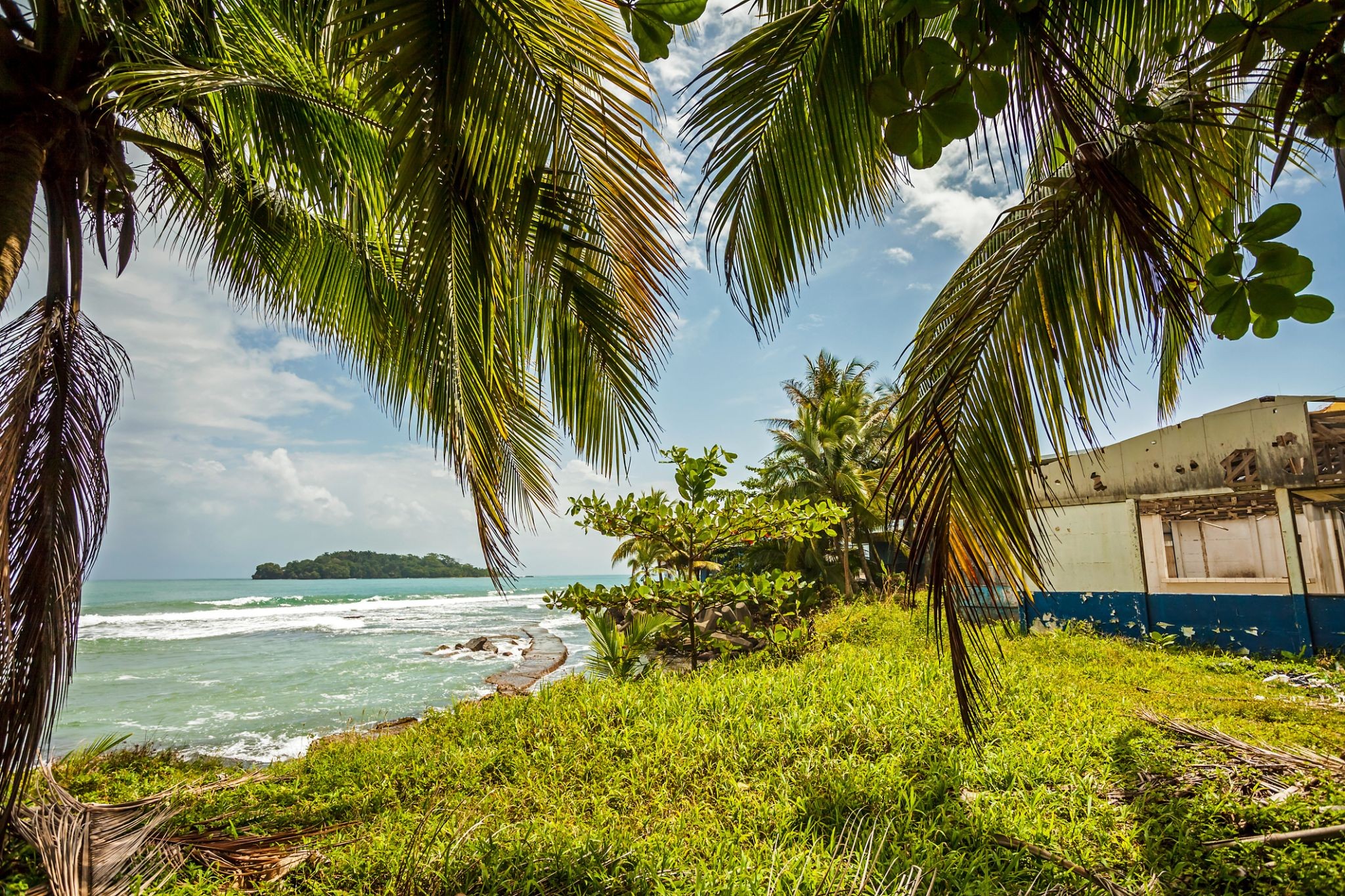
Saint-Pierre i Miquelon to maleńki francuski archipelag położony u wybrzeży kanadyjskiej prowincji Nowa Fundlandia i Labrador. To ostatni skrawek francuskiego terytorium w Ameryce Północnej, gdzie obowiązuje euro, działają francuskie przepisy, a ulice przypominają Europę — z piekarniami, bagietkami i kolorowymi domkami na tle surowego północnoatlantyckiego krajobrazu.
Archipelag składa się z dwóch głównych wysp — tętniącego życiem Saint-Pierre oraz dzikszego i bardziej przestronnego Miquelon. Turyści mogą tu obserwować migracje wielorybów, wędrować po szlakach lub podróżować rowerem i na rakietach śnieżnych. Ciekawostka: w czasach prohibicji w USA Saint-Pierre był ważnym punktem przemytniczym alkoholu — dziś można o tym dowiedzieć się w lokalnym muzeum.
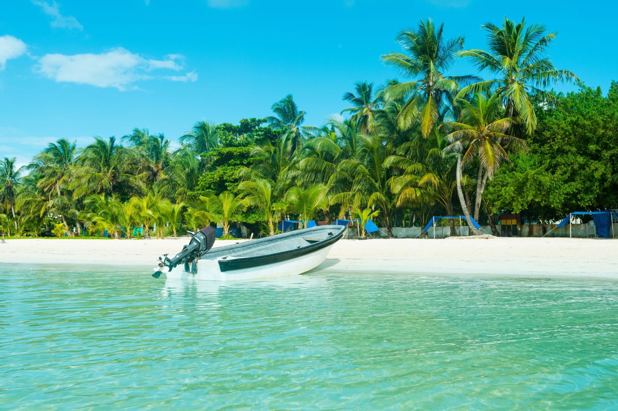
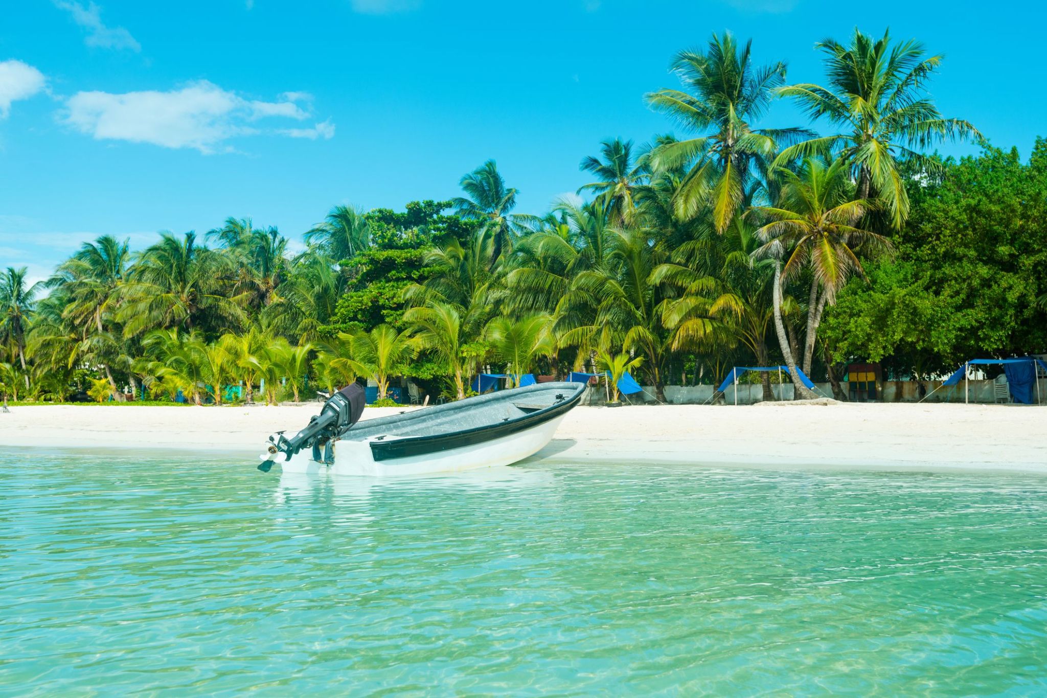
Podróżni poszukujący spokoju i autentycznego karaibskiego klimatu znajdą schronienie na brzegach Port Elizabeth, Bequia. To malownicze miasteczko portowe oferuje przytulne uliczki z kolorowymi domami kolonialnymi oraz przyjazną atmosferę, która zachowuje ducha prawdziwego życia na wyspie. Tutaj można poczuć rytmy tradycyjnej muzyki, spróbować świeżych owoców morza i cieszyć się spokojnym stylem życia.
Z dala od tłumów turystów Port Elizabeth, Bequia słynie ze swoich złotych piaszczystych plaż i krystalicznie czystych turkusowych wód, idealnych do pływania i nurkowania z rurką. Otaczająca przyroda zachęca do odkrywania zielonych wzgórz i tropikalnych lasów, a miejscowi rzemieślnicy oferują unikalne pamiątki odzwierciedlające kulturowe dziedzictwo wyspy. To idealne miejsce dla tych, którzy chcą połączyć wypoczynek z zanurzeniem w autentyczną karaibską atmosferę.

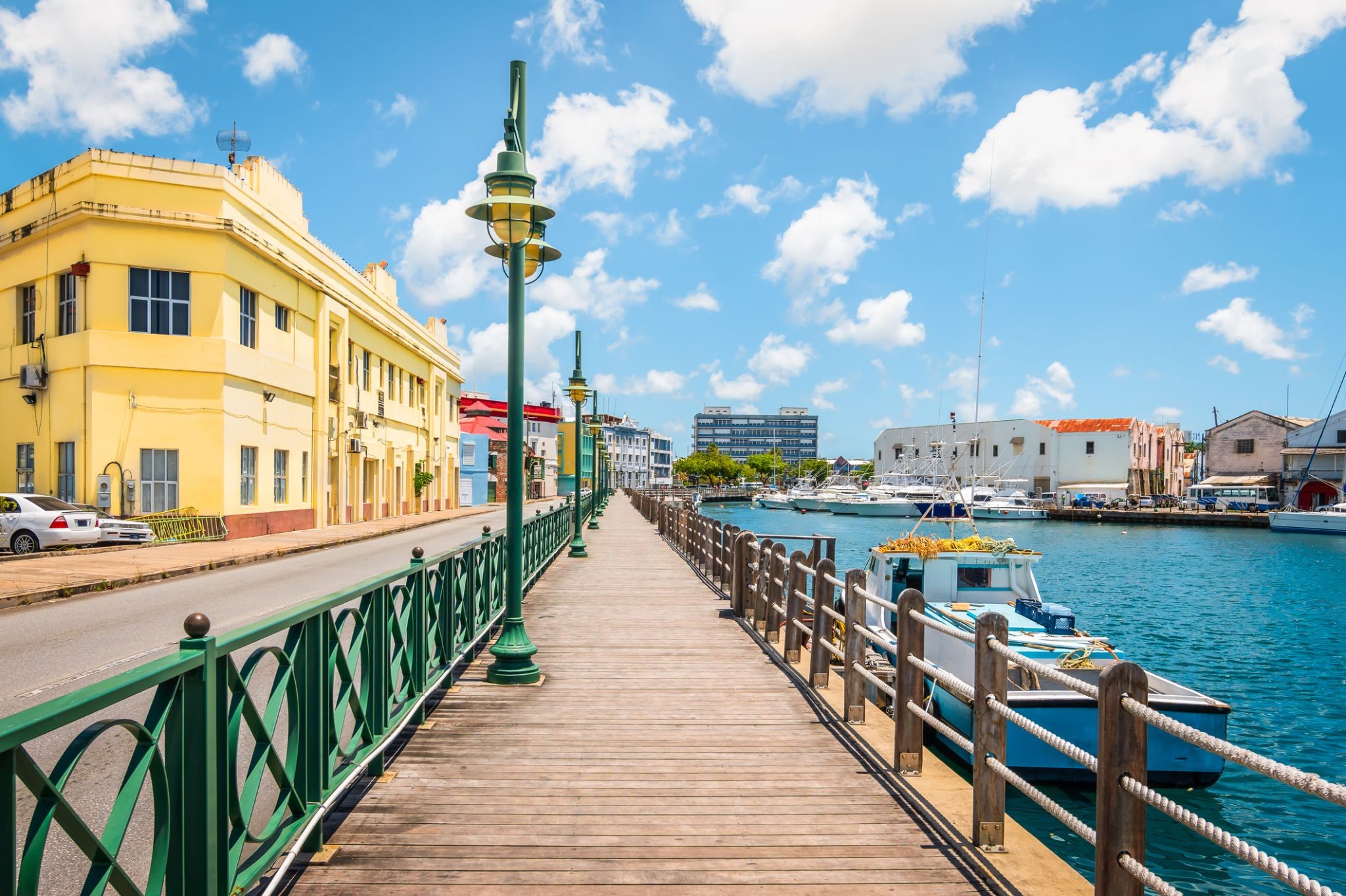
Bridgetown to stolica i największe miasto Barbadosu. Dawniej znane jako „Miasto św. Michała” (The Town of Saint Michael), obszar Greater Bridgetown znajduje się w parafii św. Michała. Miejscowi czasami nazywają je „Miastem” (The City), ale najczęściej po prostu „Town”. W 2014 roku populacja aglomeracji wynosiła około 110 000 mieszkańców.
Port Bridgetown znajduje się w zatoce Carlisle (13.106°N 59.632°W) na południowo-zachodnim wybrzeżu wyspy. Części obszaru Greater Bridgetown, ogólnie zdefiniowane przez obwodnicę (ABC Highway), leżą blisko granic sąsiednich parafii Christ Church i St. James. Międzynarodowe lotnisko Grantley Adams znajduje się 16 kilometrów na południowy wschód od centrum Bridgetown i oferuje codzienne loty do głównych miast Wielkiej Brytanii, USA, Kanady i Karaibów. Obecnie nie ma już lokalnych władz miejskich; Bridgetown jest okręgiem wyborczym w parlamencie krajowym. W latach 50. i 60. XX wieku, podczas istnienia Federacji Brytyjskich Terytoriów Indyjskich, Bridgetown było jednym z trzech miast rozważanych jako możliwa stolica federacji.
Obecna lokalizacja miasta została założona przez angielskich osadników w 1628 roku; wcześniejsza osada pod nadzorem Sir Williama Courtena znajdowała się w St. James Town. Bridgetown jest ważnym celem turystycznym na Karaibach, a także znaczącym centrum finansowym, informatycznym, konferencyjnym i portem dla statków wycieczkowych. 25 czerwca 2011 roku „Historyczne Bridgetown i jego garnizon” zostały wpisane na listę światowego dziedzictwa UNESCO.
Scarborough (Tobago) to urokliwe miasteczko położone na wschodnim wybrzeżu wyspy Tobago na Morzu Karaibskim. Jako stolica wyspy, stanowi centrum życia kulturalnego i historycznego regionu. Miasto słynie z malowniczych uliczek, tętniących życiem targowisk i zabytkowych budynków, które harmonijnie współistnieją z nowoczesną architekturą. Do najważniejszych atrakcji należy kościół św. Anny z 1770 roku, będący ważnym elementem dziedzictwa miasta. Popularnością cieszy się również lokalny targ, na którym można kupić świeże owoce, przyprawy i rękodzieło.
Poza bogactwem kulturowym Scarborough oferuje piękne widoki przyrodnicze. W pobliżu znajdują się plaże z białym piaskiem i krystalicznie czystą wodą, idealne do kąpieli i nurkowania. Szczególnie popularna wśród turystów jest zatoka Pleasant, znana z pięknych krajobrazów i podwodnego świata. Scarborough to doskonała baza wypadowa do odkrywania rezerwatów przyrody Tobago i aktywnego wypoczynku.
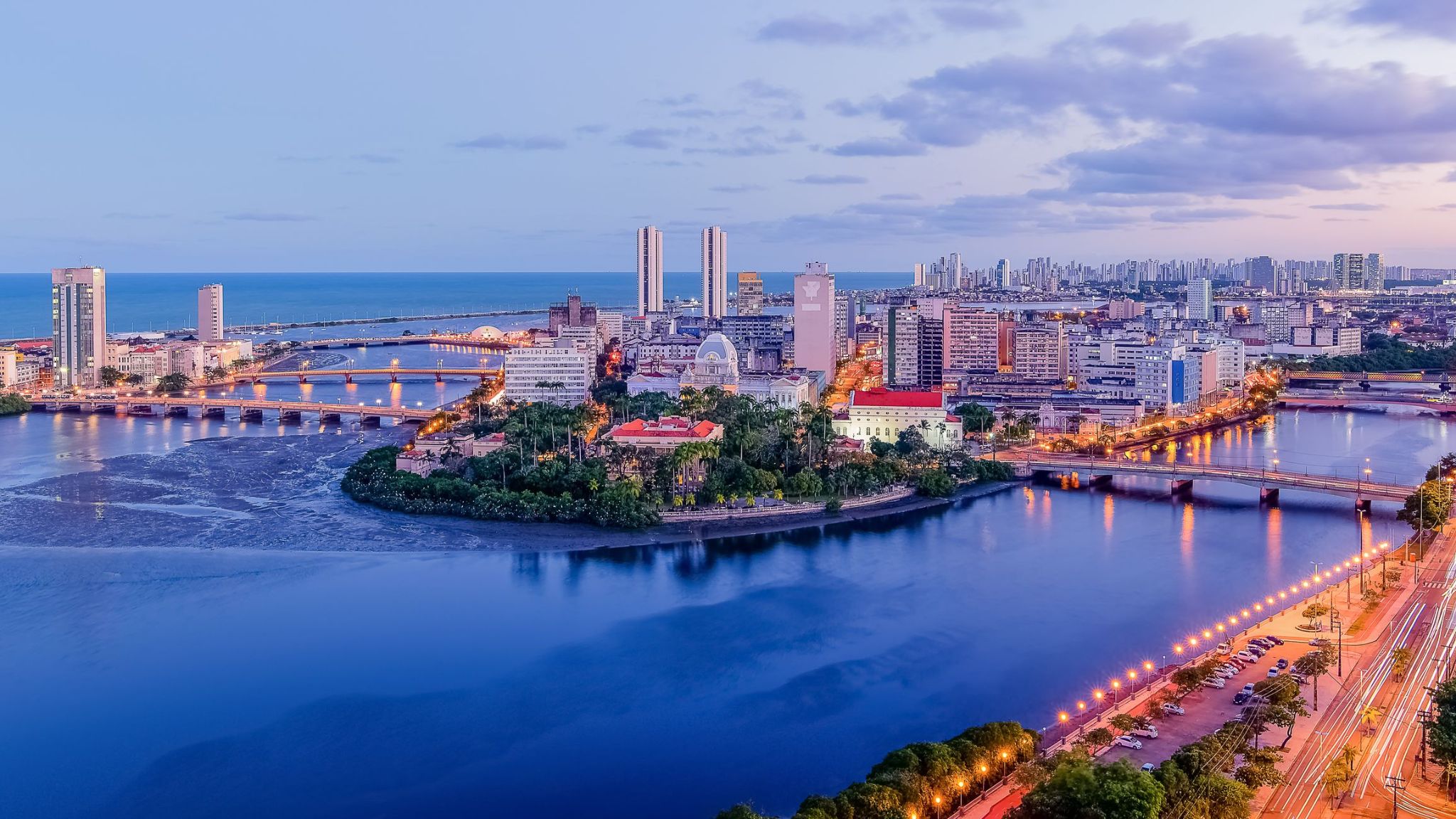
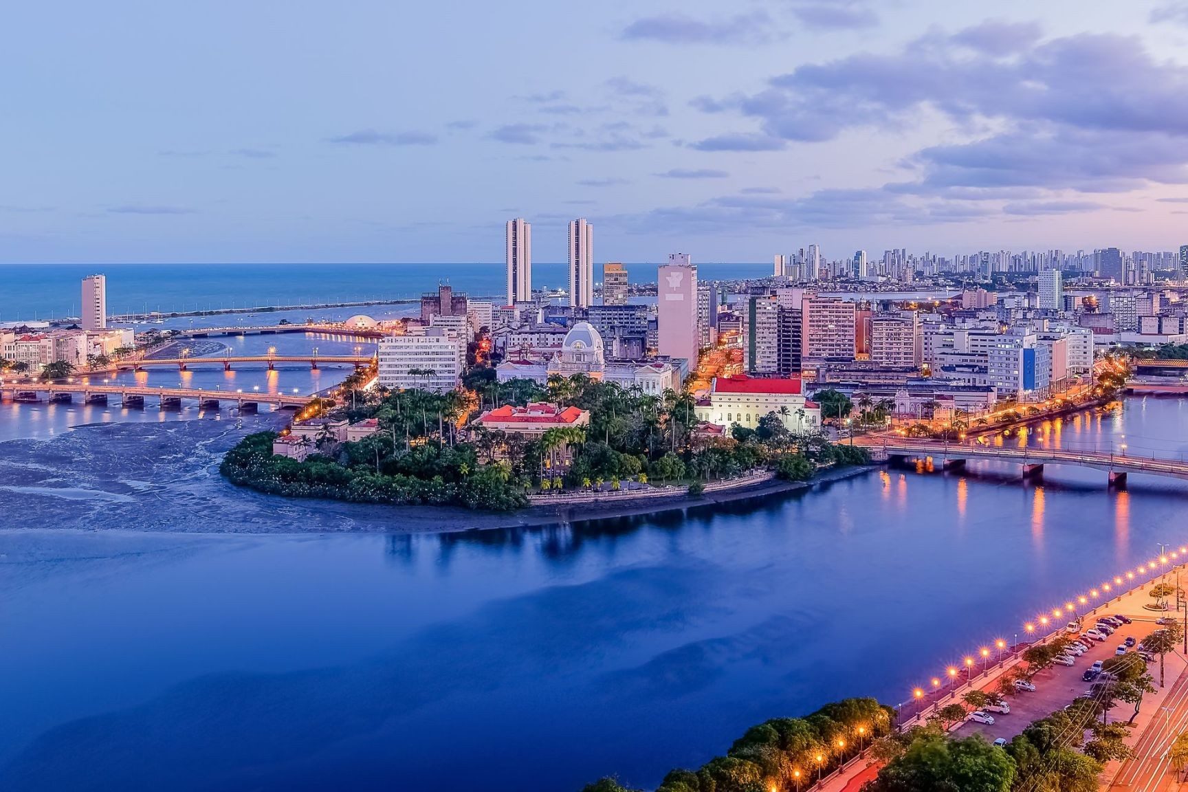
Recife: Tropikalna Wenecja Brazylii
Recife, stolica stanu Pernambuco w północno-wschodniej Brazylii, znane jest ze swojej sieci kanałów, mostów i rzek, dzięki czemu nazywane jest „brazylijską Wenecją”. Miasto łączy kolonialną architekturę z nowoczesnymi drapaczami chmur i tętniącą życiem kulturą, widoczną podczas karnawałów, w muzyce frevo i rytmach maracatu. Zabytkowa dzielnica Recife Antigo zachowuje portugalskie dziedzictwo wąskimi uliczkami, kościołami i starymi budynkami.
Recife słynie także z plaż, zwłaszcza Boa Viagem, gdzie biały piasek i palmy kontrastują z miejską panoramą. Turyści mogą zwiedzać muzea, jak Instytut Ricardo Brennanda z kolekcją broni i sztuki, lub odwiedzić pobliską kolonialną miejscowość Olinda, wpisaną na listę UNESCO. To idealne miejsce dla osób poszukujących kultury, relaksu nad morzem i autentycznej brazylijskiej atmosfery.

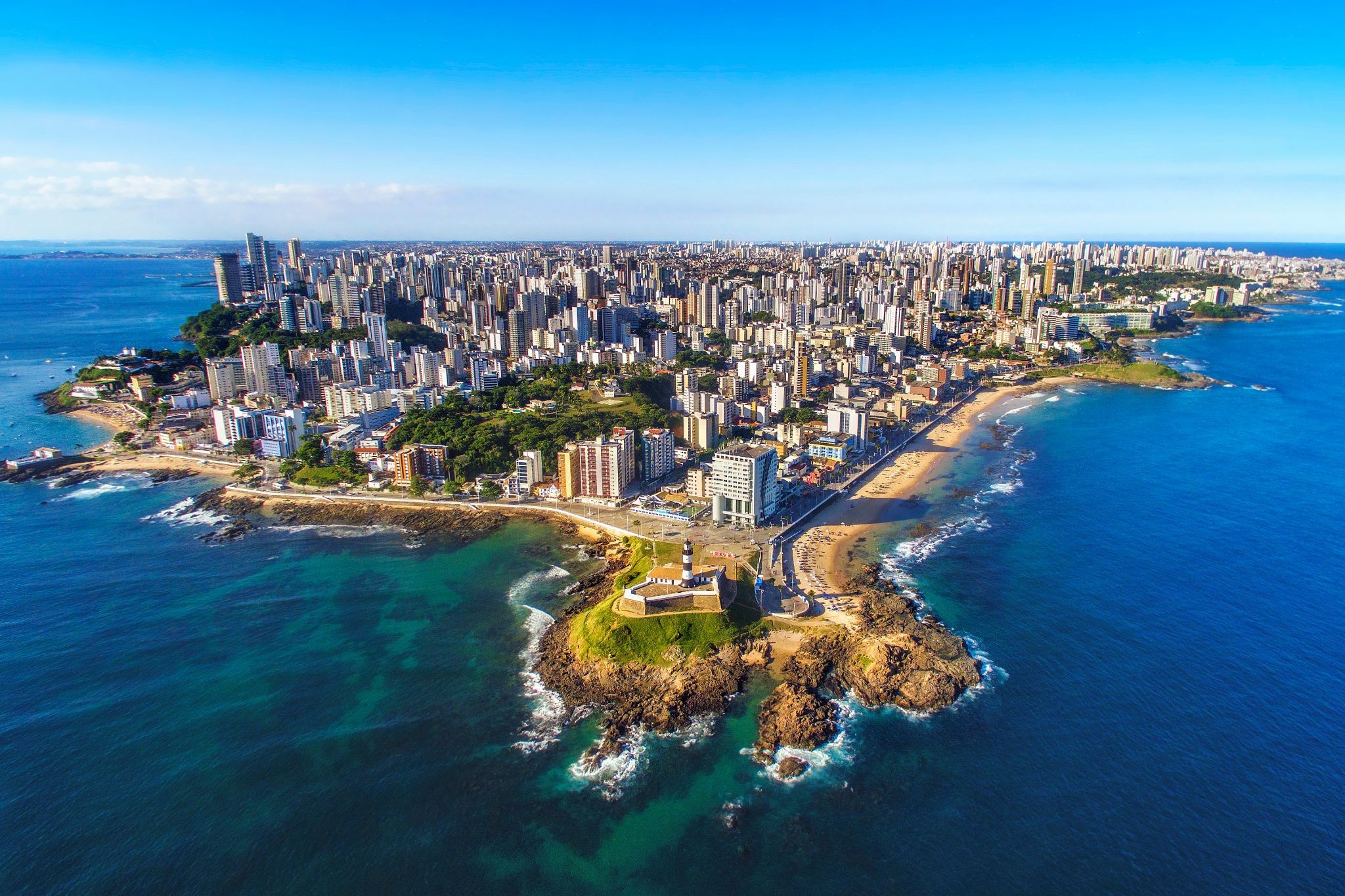
Salvador is the capital of Bahia state and was formerly the first capital of Brazil. Salvador is known for its endless number of churches, as well as for being a land of majestic fortresses. After visiting these places, it is also worth taking a look at the Chapada Diamantina National Park – the most interesting natural park in Brazil. In Salvador, there reigns an atmosphere of joy, revelry, and holidays – this is due to the fact that the local population was influenced by Africa. In Salvador, you can always admire the natural beauty of this area. You will be enchanted by the sensuality of this land, and you will be able to discover a piece of its mysterious power.
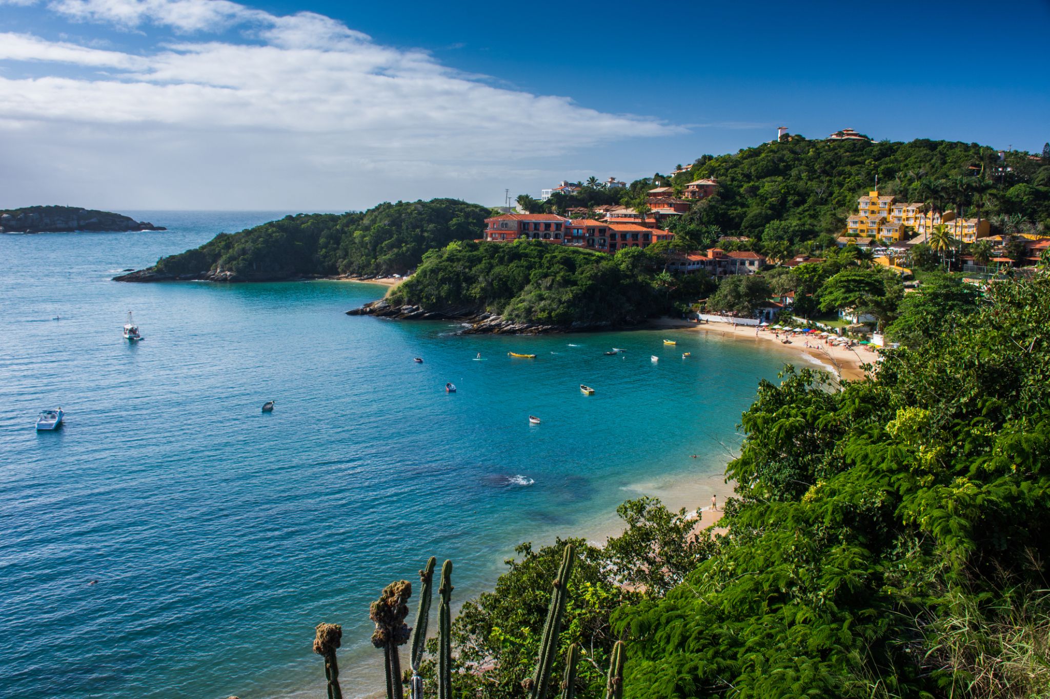
Armação dos Búzios, często nazywane po prostu Búzios, to nadmorskie miasteczko i gmina w stanie Rio de Janeiro w Brazylii. W 2012 roku liczyło 23 463 mieszkańców i zajmowało powierzchnię 69 km². Dziś Búzios jest popularnym miejscem wypoczynku, szczególnie wśród Brazylijczyków i Argentyńczyków.
Na początku XX wieku Búzios było niemal nieznaną wioską rybacką. Pozostało takie aż do 1964 roku, kiedy to francuska aktorka Brigitte Bardot odwiedziła Búzios. Od tego czasu miejsce to stało się popularne wśród wyższych sfer Rio de Janeiro, pragnących uciec od miejskiego zgiełku i cieszyć się ponad 23 plażami, które oferuje półwysep. Miasto rozwinęło się w międzynarodowy cel turystyczny.
Dziś półwysep oferuje spokój, bezpośredni kontakt z naturą i malownicze widoki. Plaże po zachodniej stronie oferują spokojne, przejrzyste wody, podczas gdy te po wschodniej stronie, zwrócone ku otwartemu morzu, są bardziej dzikie i przyciągają surferów oraz entuzjastów sportów wodnych. Azeda, Ferradura, João Fernandes i Armação to jedne z najpopularniejszych plaż w mieście. Wieczorem główna ulica Búzios, Rua das Pedras, oferuje aktywne życie nocne oraz szeroki wybór sklepów i restauracji.

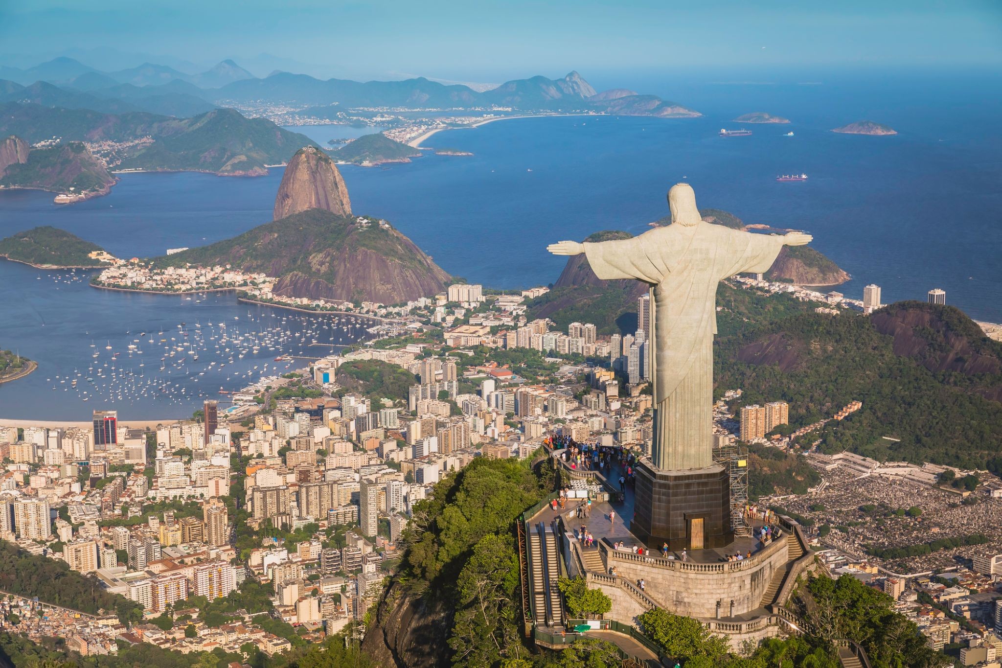
Rio de Janeiro is the second-most populous municipality in Brazil and the sixth-most populous in the Americas. The metropolis is anchor to the Rio de Janeiro metropolitan area, the second-most populous metropolitan area in Brazil and sixth-most populous in the Americas. Rio de Janeiro is the capital of the state of Rio de Janeiro, Brazil's third-most populous state. Part of the city has been designated as a World Heritage Site, named "Rio de Janeiro: CariocaLandscapes between the Mountain and the Sea", by UNESCO on 1 July 2012 as a Cultural Landscape.
Founded in 1565 by the Portuguese, the city was initially the seat of the Captaincy of Rio de Janeiro, a domain of the Portuguese Empire. Later, in 1763, it became the capital of the State of Brazil, a state of the Portuguese Empire. In 1808, when the Portuguese Royal Court transferred itself from Portugal to Brazil, Rio de Janeiro became the chosen seat of the court of Queen Maria I of Portugal, who subsequently, in 1815, under the leadership of her son, the Prince Regent, and future King João VI of Portugal, raised Brazil to the dignity of a kingdom, within the United Kingdom of Portugal, Brazil, and Algarves. Rio stayed the capital of the pluricontinental Lusitanian monarchy until 1822, when the War of Brazilian Independence began. This is one of the few instances in history that the capital of a colonising country officially shifted to a city in one of its colonies. Rio de Janeiro subsequently served as the capital of the independent monarchy, the Empire of Brazil, until 1889, and then the capital of a republican Brazil until 1960 when the capital was transferred to Brasília.

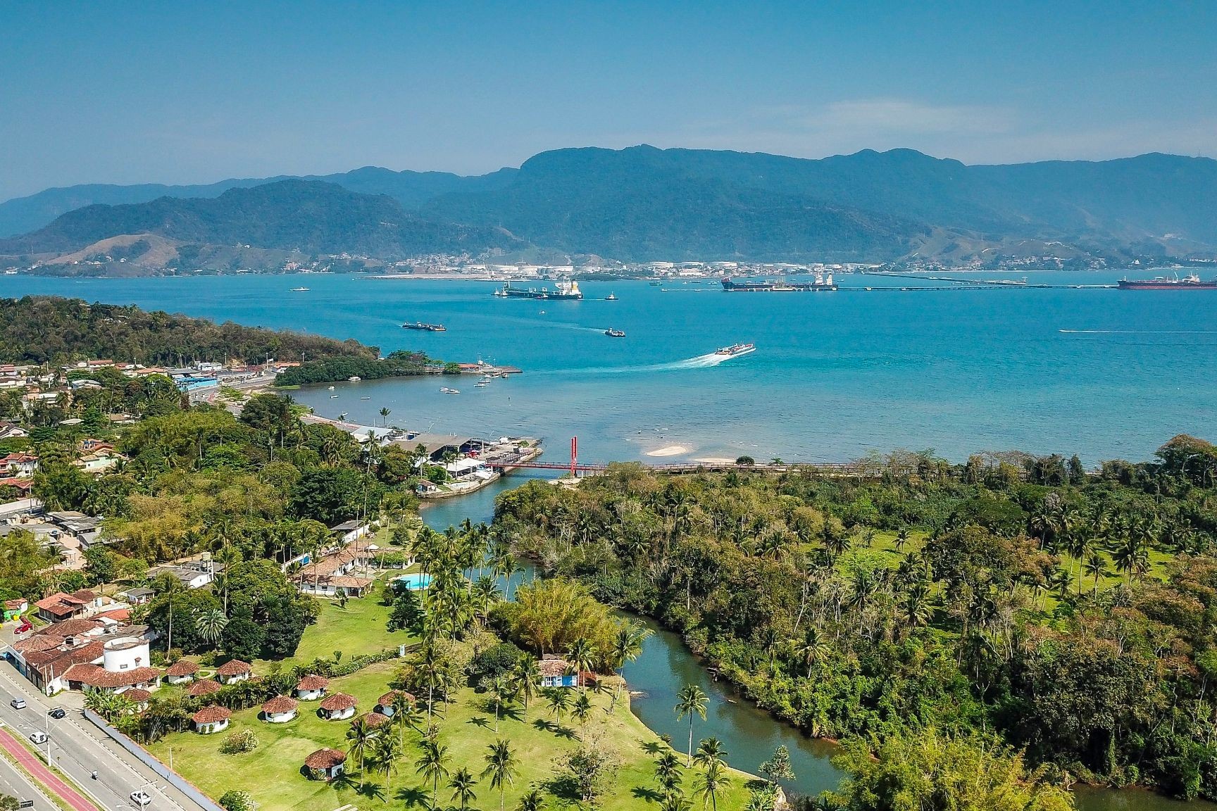
Ilhabela — brazylijski raj dla miłośników przyrody i przygód
Ilhabela to malowniczy archipelag i gmina w stanie São Paulo w Brazylii, składająca się z głównej wyspy i kilku mniejszych. Nazwa w tłumaczeniu z portugalskiego oznacza "piękna wyspa", co doskonale oddaje jej charakter. Ponad 80% terytorium wyspy jest chronione w ramach Parku Stanowego Ilhabela, obejmującego gęste lasy tropikalne, wodospady i szlaki turystyczne. To popularne miejsce wśród żeglarzy, nurków i osób szukających spokoju z dala od miejskiego zgiełku.
Ilhabela słynie nie tylko z plaż o złocistym piasku i krystalicznie czystej wodzie, ale także z unikalnej możliwości obserwacji wielorybów podczas ich migracji. Miasto często gości regaty żeglarskie, w tym międzynarodowe zawody. Turyści mogą zwiedzać zabytkowe budynki z okresu kolonialnego oraz cieszyć się atmosferą nadmorskich restauracji serwujących świeże owoce morza. Ilhabela łączy dziewiczą przyrodę, aktywny wypoczynek i spokojne tempo życia, czyniąc ją idealnym miejscem na podróż o każdej porze roku.
Montevideo is the capital and largest city of Uruguay. According to the 2011 census, the city proper has a population of 1,319,108 (about one-third of the country's total population) in an area of 201 square kilometres (78 sq mi). The southernmost capital city in the Americas, Montevideo is situated on the southern coast of the country, on the northeastern bank of the Río de la Plata.
The city was established in 1724 by a Spanish soldier, Bruno Mauricio de Zabala, as a strategic move amidst the Spanish-Portuguese dispute over the platine region. It was also under brief British rule in 1807. Montevideo is the seat of the administrative headquarters of Mercosur and ALADI, Latin America’s leading trade blocs, a position that entailed comparisons to the role of Brussels in Europe.
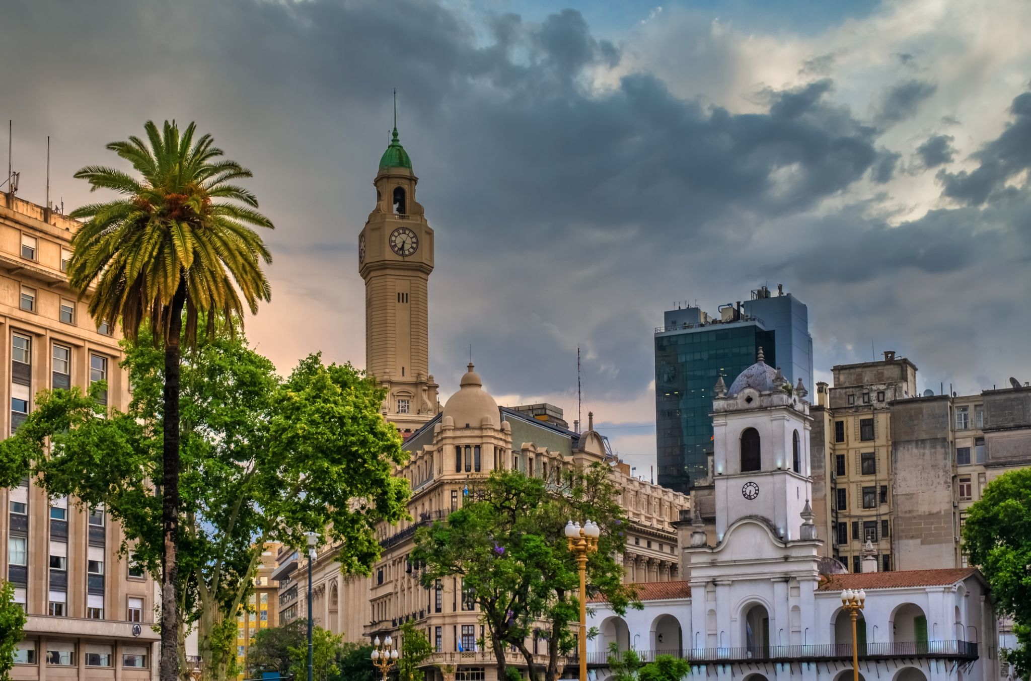
the capital city and chief port of Argentina, in the eastern central part of the country, on the Plata River; population 3,042,600 (est. 2008).
the capital city and chief port of Argentina, in the eastern central part of the country, on the Plata River; population 3,042,600 (est. 2008).
the capital city and chief port of Argentina, in the eastern central part of the country, on the Plata River; population 3,042,600 (est. 2008).
Montevideo is the capital and largest city of Uruguay. According to the 2011 census, the city proper has a population of 1,319,108 (about one-third of the country's total population) in an area of 201 square kilometres (78 sq mi). The southernmost capital city in the Americas, Montevideo is situated on the southern coast of the country, on the northeastern bank of the Río de la Plata.
The city was established in 1724 by a Spanish soldier, Bruno Mauricio de Zabala, as a strategic move amidst the Spanish-Portuguese dispute over the platine region. It was also under brief British rule in 1807. Montevideo is the seat of the administrative headquarters of Mercosur and ALADI, Latin America’s leading trade blocs, a position that entailed comparisons to the role of Brussels in Europe.
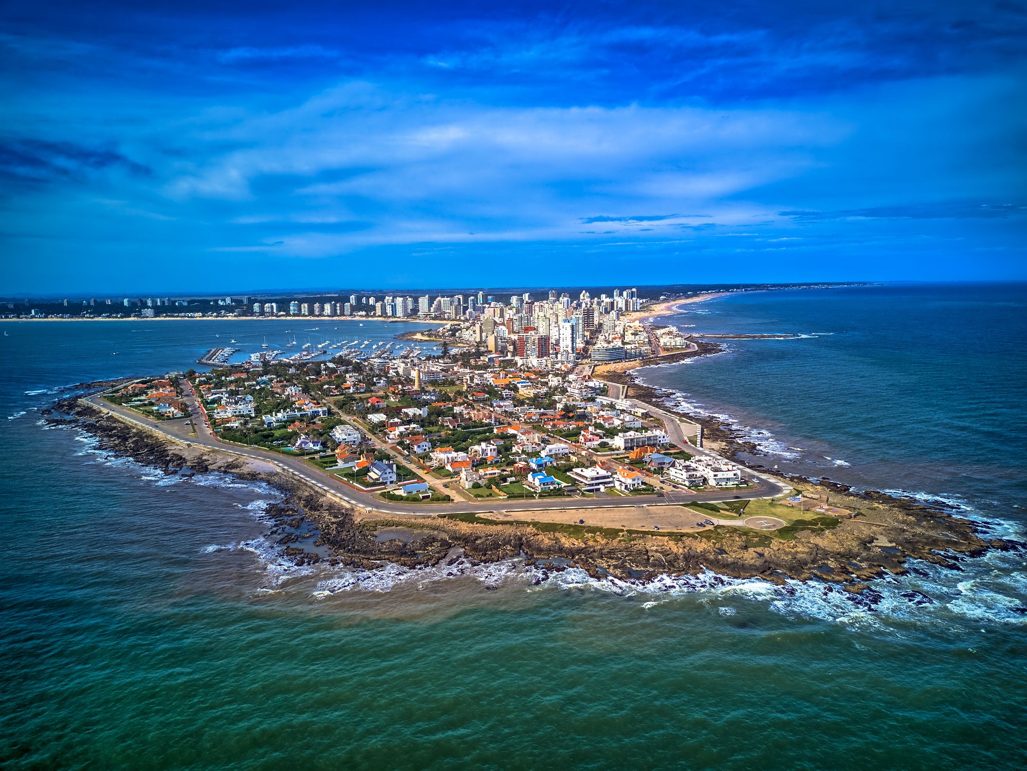
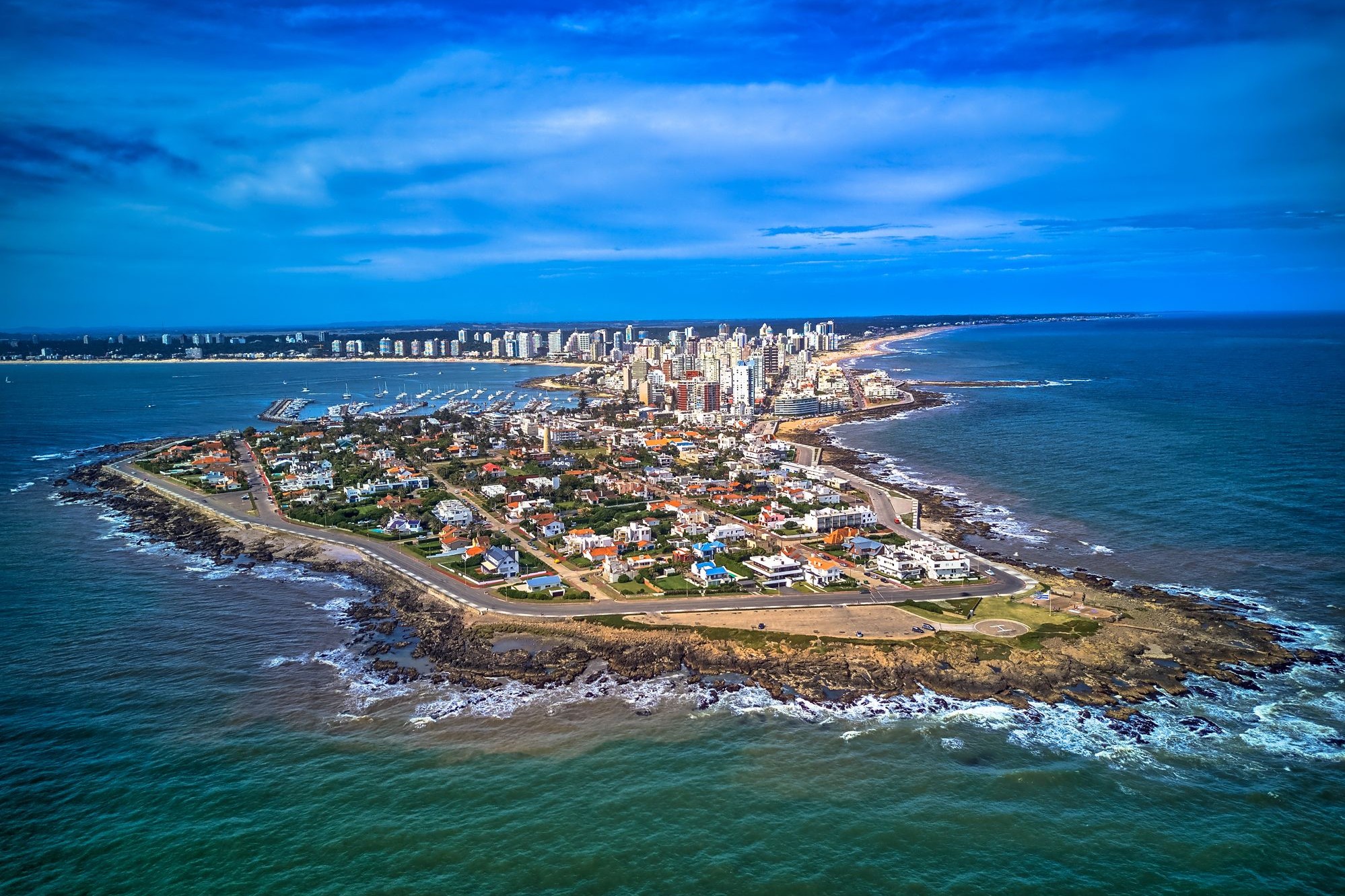
Punta del Este — urugwajski kurort nad Atlantykiem
Punta del Este to jeden z najsłynniejszych kurortów Ameryki Południowej, położony na południowym wybrzeżu Urugwaju, gdzie spotykają się wody Oceanu Atlantyckiego i estuarium La Platy. Miasto słynie z kontrastów — luksusowe dzielnice z nowoczesnymi wieżowcami, jachtami i wykwintnymi restauracjami sąsiadują z cichymi, piaszczystymi plażami, malowniczymi wydmami i falami idealnymi do surfowania. Nazywane jest „Monako Ameryki Południowej” ze względu na swoją luksusową infrastrukturę i popularność wśród międzynarodowych celebrytów.
Poza plażami, Punta del Este oferuje wiele atrakcji kulturalnych i przyrodniczych: rzeźba „La Mano”, która stała się symbolem miasta, muzeum sztuki współczesnej Ralli oraz pobliskie wyspy z fokami. Warto też odwiedzić artystyczną dzielnicę La Barra lub podziwiać zachód słońca przy latarni morskiej. W sezonie letnim (grudzień–luty) miasto tętni życiem, przyciągając turystów z całego świata szukających słońca, komfortu i dynamicznego życia nocnego.
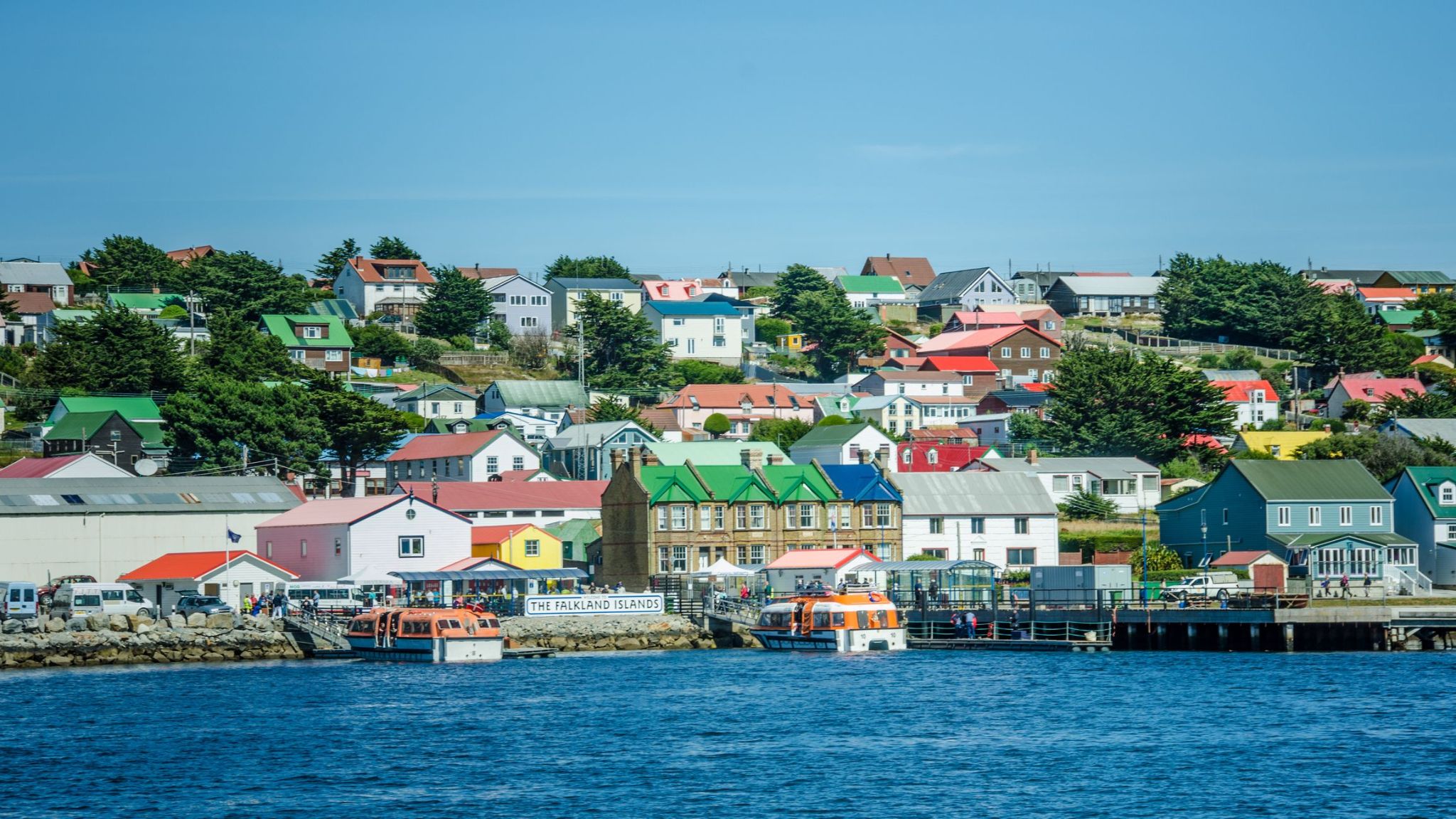
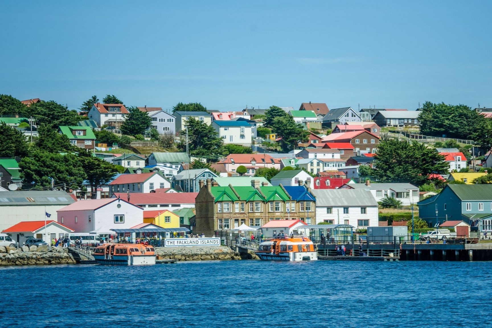
Port Stanley — Koniec świata z brytyjskim charakterem
Port Stanley to główne miasto i centrum administracyjne Falklandów, położone na wschodnim wybrzeżu Wyspy Wschodniej Falkland. To najdalej na południe wysunięta stolica Wielkiej Brytanii i jedna z najmniej zaludnionych stolic na świecie, z około 2500 mieszkańcami. Miasto zaskakuje harmonią dzikiej przyrody i rozpoznawalnymi cechami brytyjskiej kultury: można tu zobaczyć czerwone budki telefoniczne, przytulne puby, angielskie domy i zadbane ogrody.
Port Stanley otoczony jest zapierającymi dech w piersiach krajobrazami: pagórkowatymi równinami, malowniczymi zatokami i koloniami pingwinów, które łatwo spotkać w pobliżu. W mieście znajduje się interesujące muzeum poświęcone historii archipelagu i wojennej wojnie z 1982 roku. To wyjątkowe miejsce przyciąga miłośników przyrody, spokoju i nietypowych szlaków — jest to idealne miejsce dla tych, którzy szukają prawdziwej izolacji na końcu świata.

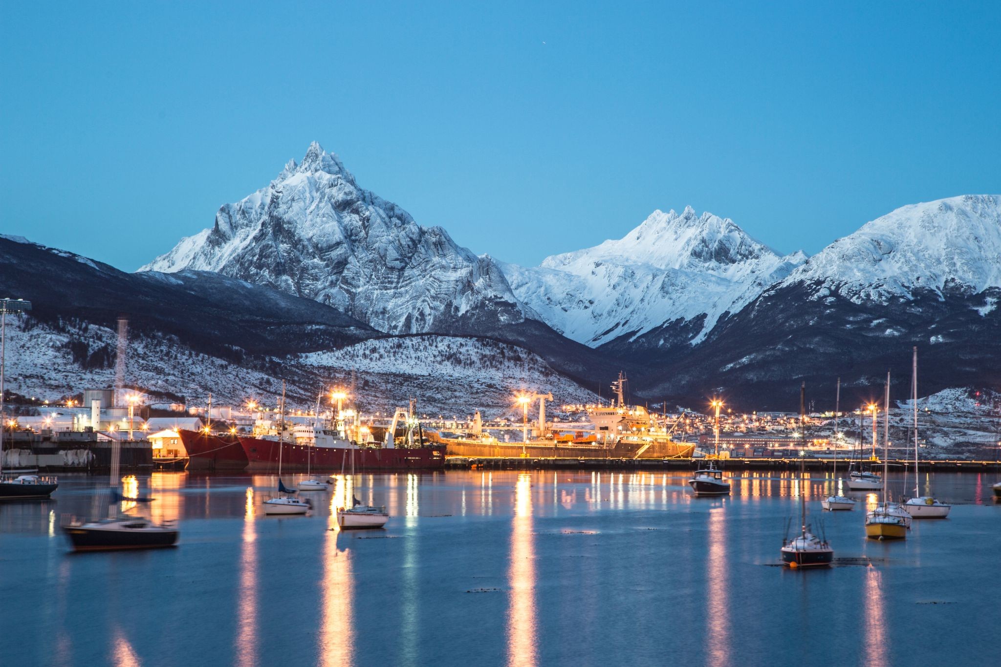
Ushuaia is the capital of Tierra del Fuego, Antártida e Islas del Atlántico Sur Province, Argentina. It is commonly regarded as the southernmost city in the world. Ushuaia is located in a wide bay on the southern coast of Isla Grande de Tierra del Fuego, bounded on the north by the Martial mountain range, and on the south by the Beagle Channel. It is the only municipality in the Department of Ushuaia, which has an area of 9,390 km2 (3,625 sq mi). It was founded October 12 of 1884 by Augusto Lasserreand is located on the shores of the Beagle Channel surrounded by the mountain range of the Martial Glacier, in the Bay of Ushuaia. Besides being an administrative center, it is a light industrial port and tourist hub.
Ushuaia is the capital of Tierra del Fuego, Antártida e Islas del Atlántico Sur Province, Argentina. It is commonly regarded as the southernmost city in the world. Ushuaia is located in a wide bay on the southern coast of Isla Grande de Tierra del Fuego, bounded on the north by the Martial mountain range, and on the south by the Beagle Channel. It is the only municipality in the Department of Ushuaia, which has an area of 9,390 km2 (3,625 sq mi). It was founded October 12 of 1884 by Augusto Lasserreand is located on the shores of the Beagle Channel surrounded by the mountain range of the Martial Glacier, in the Bay of Ushuaia. Besides being an administrative center, it is a light industrial port and tourist hub.
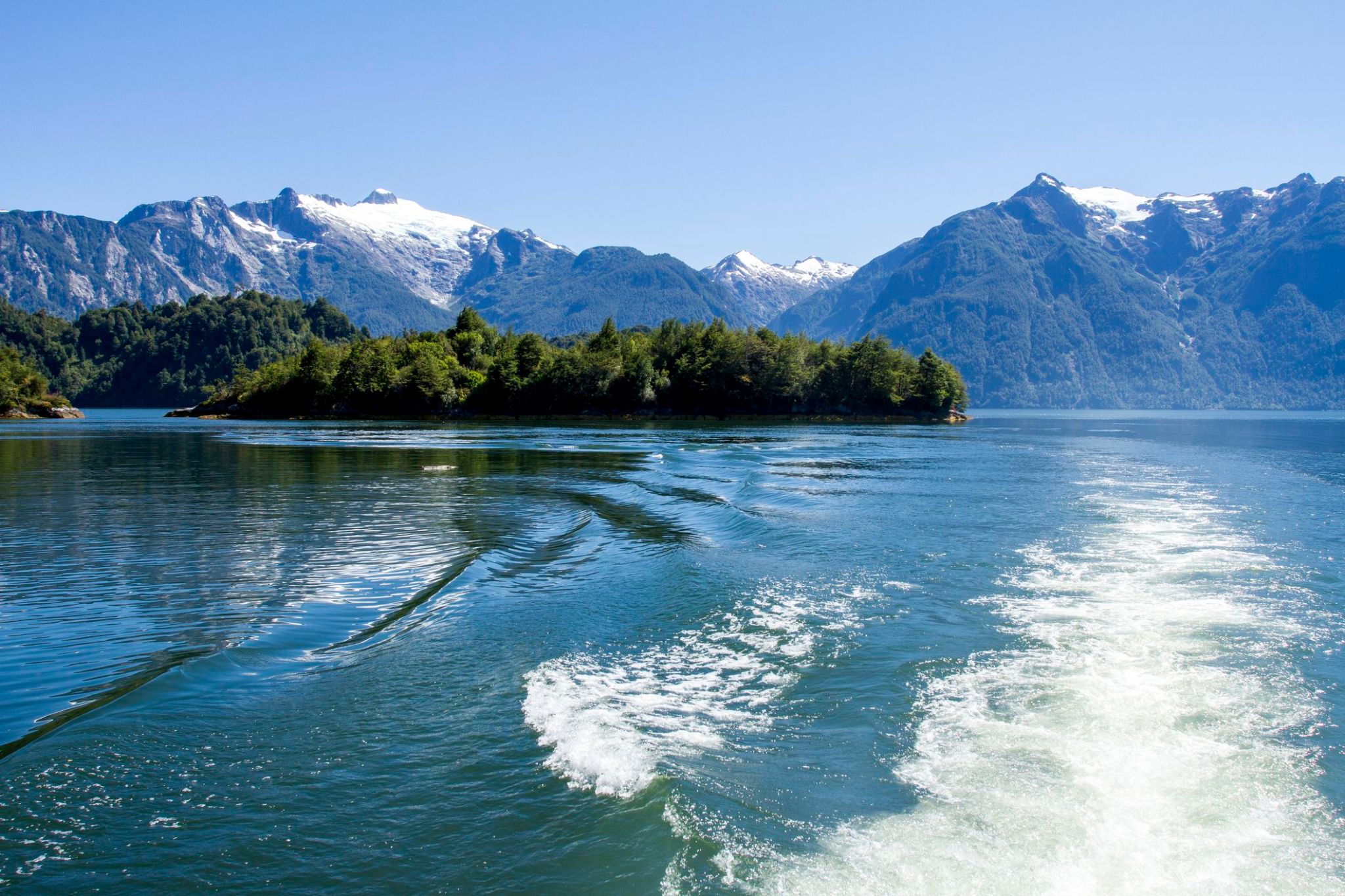
Nie tylko Europa może poszczycić się urzekającą przyrodą norweskich fiordów, ale również chilijskie fiordy. Chilijskie fiordy to wyspy o różnych rozmiarach i wysepki, ogromne głazy oraz lód wyłaniający się z wody, przybierający odcienie od śnieżnobiałych po zielonkawe. Lodowce na skałach i zboczach gór tworzą wrażenie teatralnej scenerii. Chilijskie fiordy zachwycają swoimi krajobrazami, gdzie ląd i morze stapiają się w labirynt wysp, fiordów, rzek z dopływami, jezior i wzgórz, porośniętych pradawnymi drzewami.
Chilijskie fiordy to wyjątkowe miejsce, które w cudowny sposób uniknęło ingerencji człowieka. Gdy mgła rozwiewa się pod wpływem słońca, odsłania się przed Tobą przepiękna panorama Andów, zimne wody Oceanu Spokojnego oraz bujne szmaragdowe lasy.
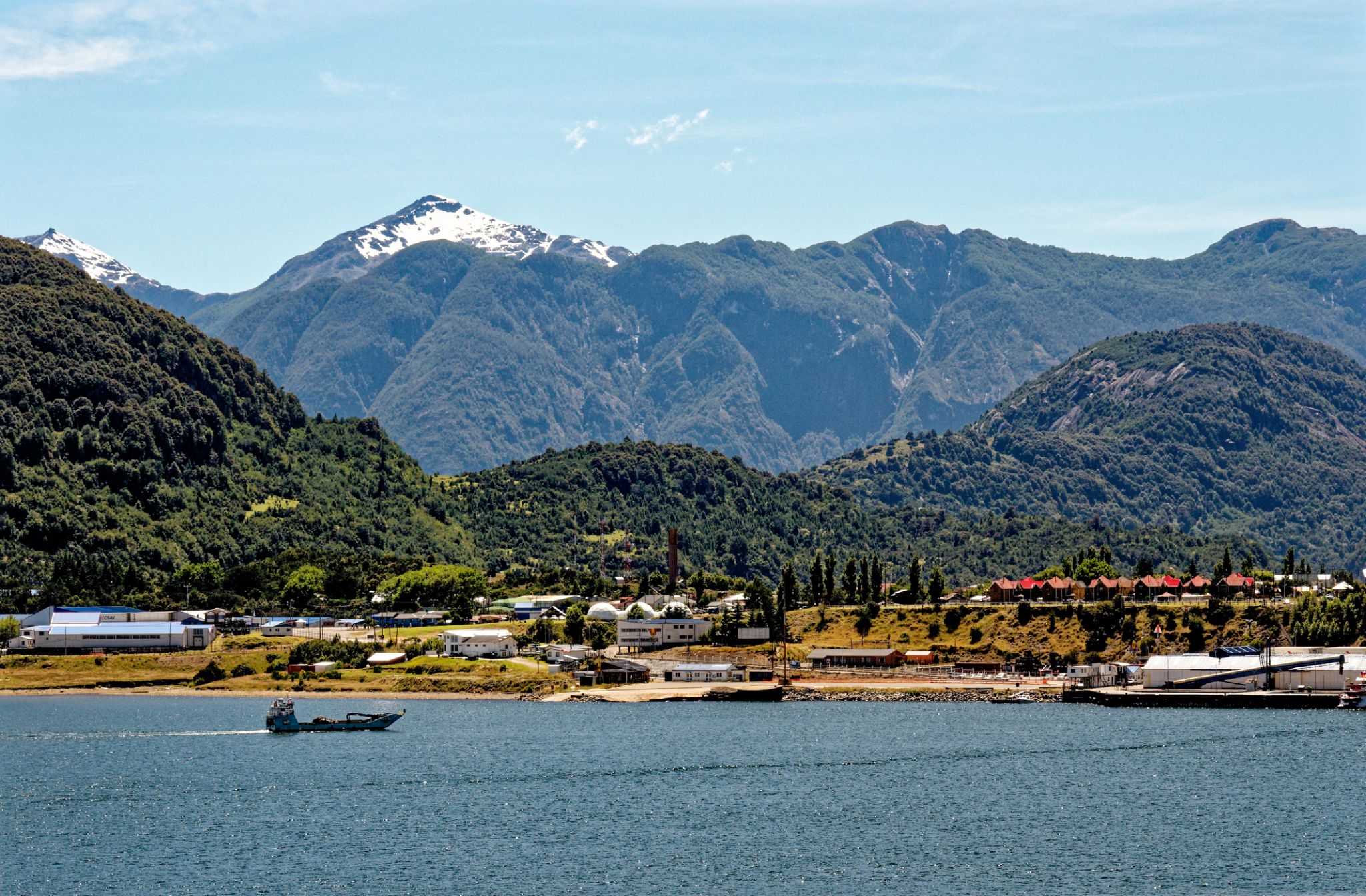
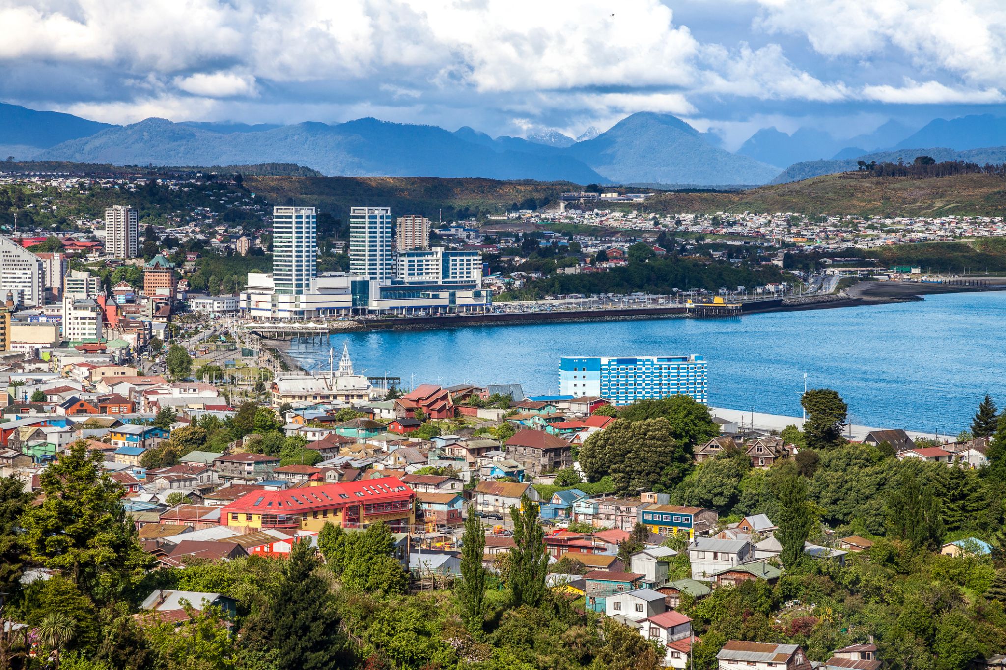
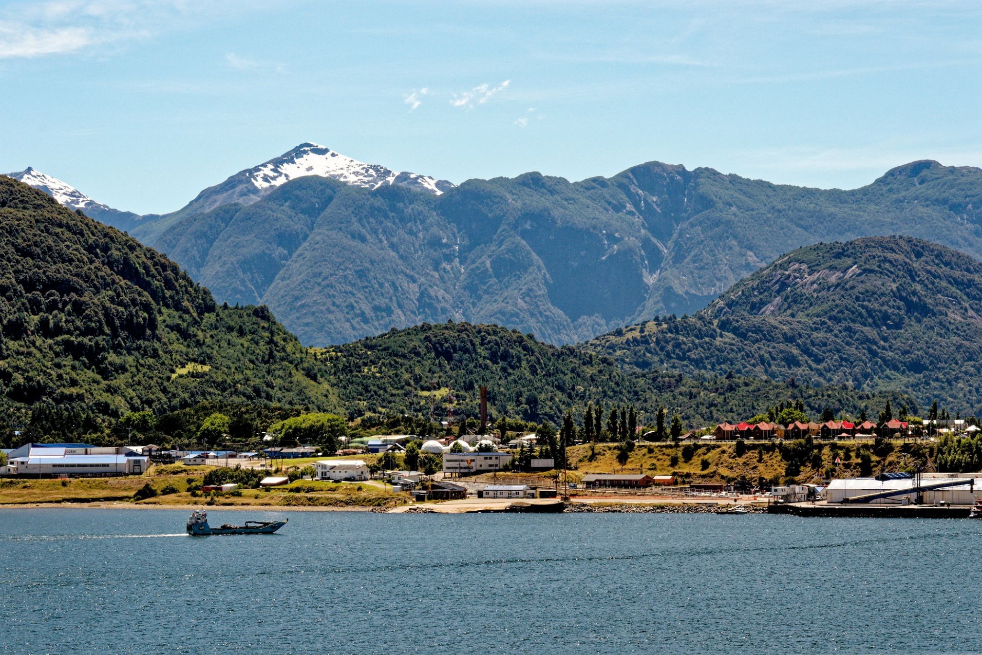
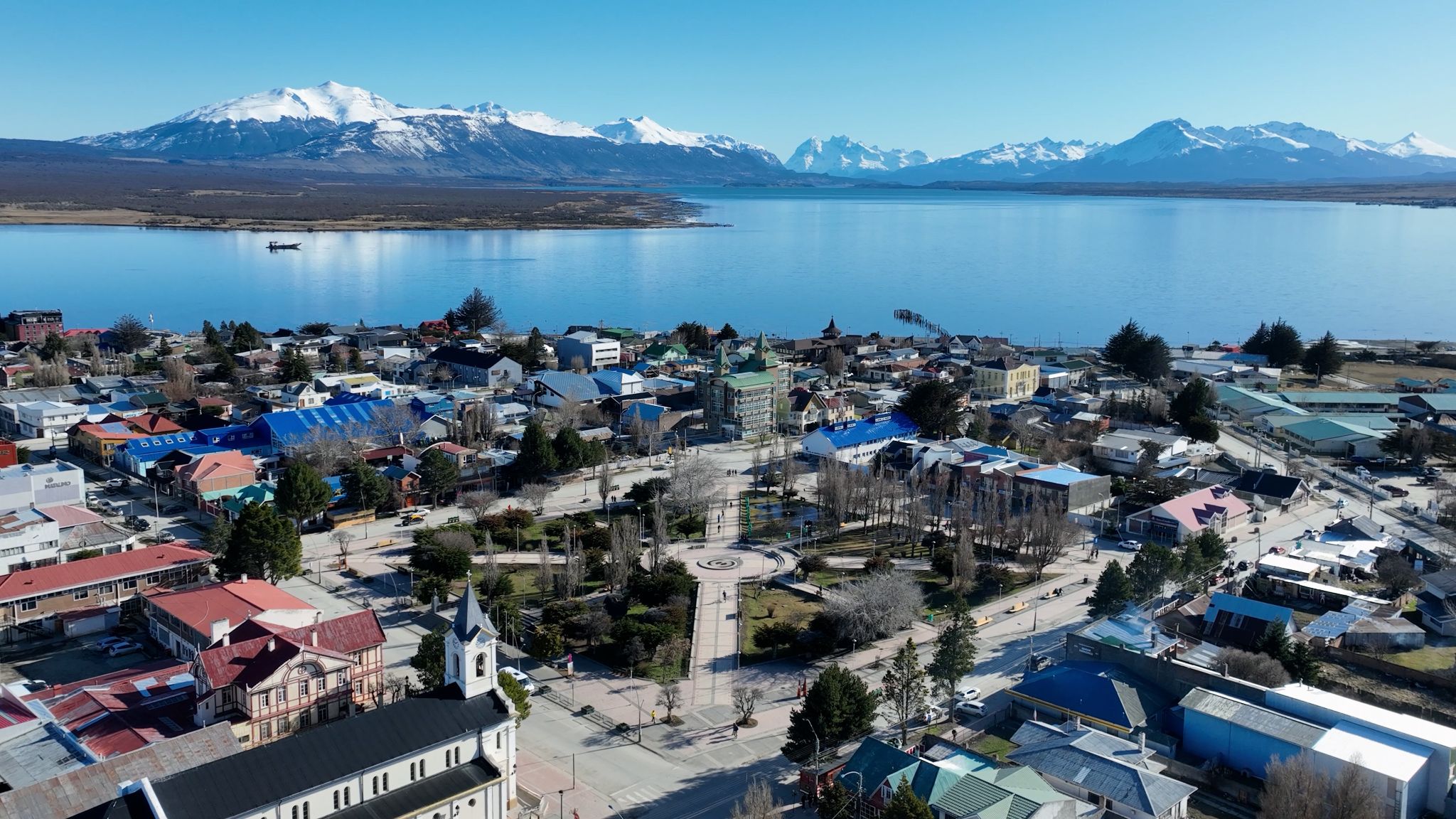
Puerto Montt is a port city and commune in southern Chile, located at the northern end of the Reloncaví Sound in the Llanquihue Province, Los Lagos Region, 1,055 km to the south of the capital, Santiago. The commune spans an area of 1,673 km2 (646 sq mi) and has a population of 245,902 in 2017. It is bounded by the communes of Puerto Varas to the north, Cochamó to the east and southeast, Calbuco to the southwest and Maullín and Los Muermos to the west.
Founded as late as 1853 during the German colonization of southern Chile, Puerto Montt soon outgrew older neighboring cities due to its strategic position at the southern end of the Chilean Central Valley being a gateway city into Chiloé Archipelago, Llanquihue and Nahuel Huapi lakes and Western Patagonia.
Puerto Montt has gained renown and grown significantly due to the rise of Chile as the second largest salmon producer of the world during the 1990s and 2000s. However, the Chilean salmon aquaculture crisis of the late 2000s resulted at least temporarily in severe unemployment and exposed weaknesses in the local economy. The city's cultural heritage mixes elements of Chiloé culture with German heritage although the city has attracted a significant number of newcomers from all over Chile in the last 30 years due to employment opportunities.

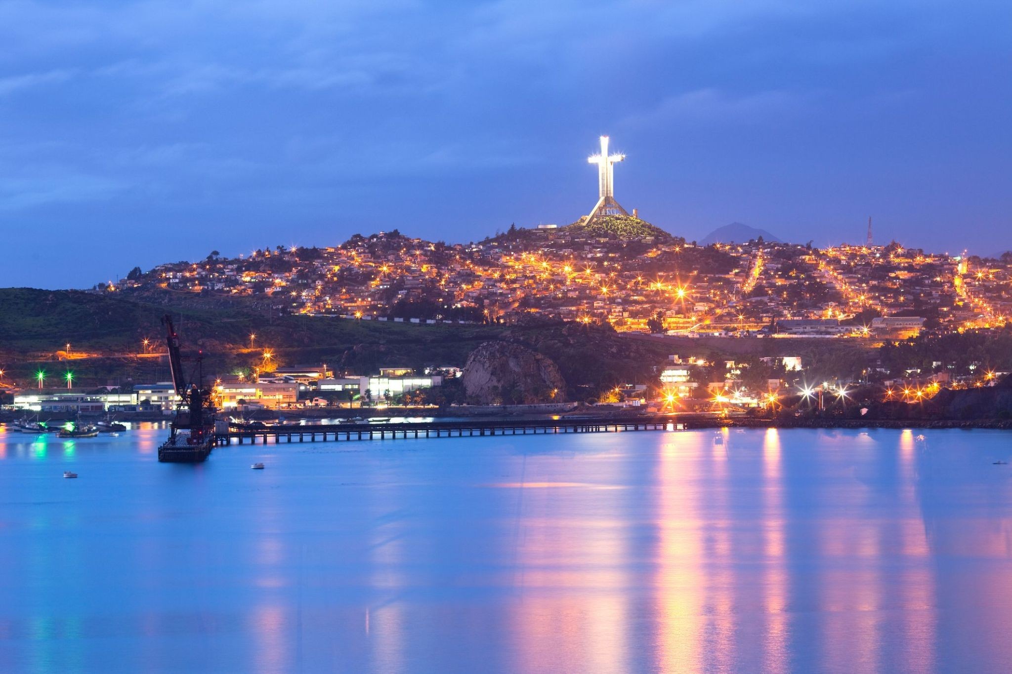
Niezapomniane spotkanie z wybrzeżem Pacyfiku czeka na każdego podróżnika, który wybierze się do Coquimbo — urokliwego miasteczka, gdzie nowoczesność i historia splatają się w niezwykłej harmonii. Od porannej bryzy w zatoce po przepiękne zachody słońca nad portem, to miejsce oferuje prawdziwą atmosferę chilijskiego wybrzeża, gdzie życie płynie spokojnym rytmem, a każda uliczka wypełniona jest zapachem morza. Tu można skosztować świeżych owoców morza w przytulnych restauracjach lub przespacerować się eleganckim nadbrzeżem, rozkoszując się widokami i krzykiem mew.
Coquimbo słynie także z zabytków i kulturalnych atrakcji: stare kościoły, targi rzemieślnicze i nowoczesne galerie sztuki tworzą wyjątkowe połączenie tradycji i nowych wrażeń. Miłośnicy przygód mogą odkrywać okoliczne wzgórza lub zajrzeć do tajemniczej twierdzy — pamiątki po czasach piratów. To miasto jakby zaprasza każdego podróżnika do napisania własnego rozdziału w niezwykłej historii chilijskiego wybrzeża.
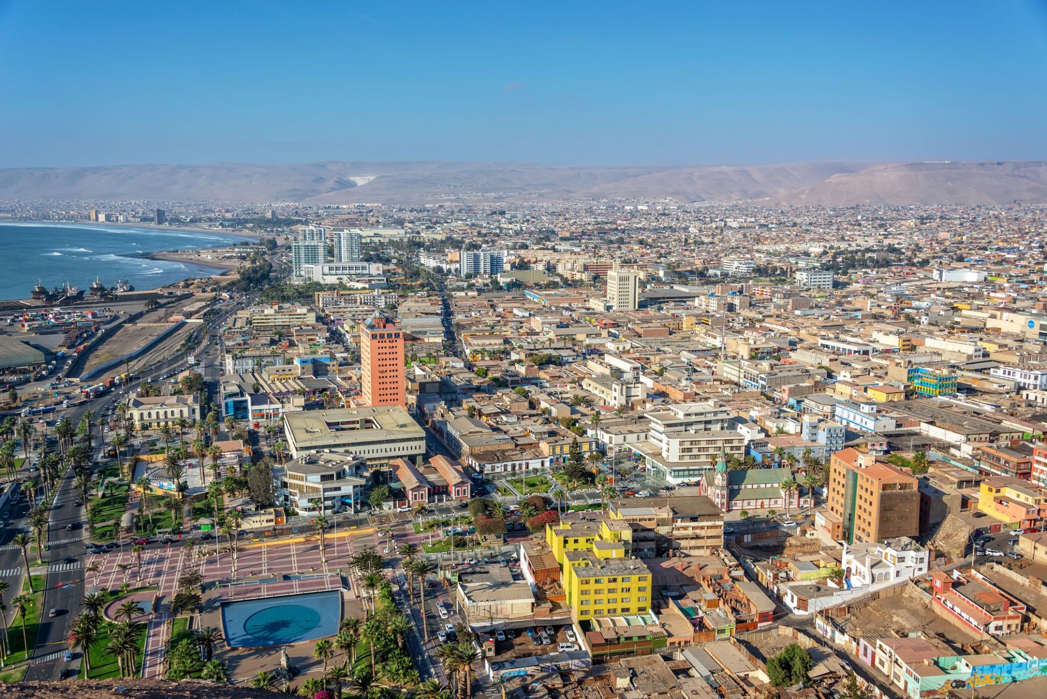
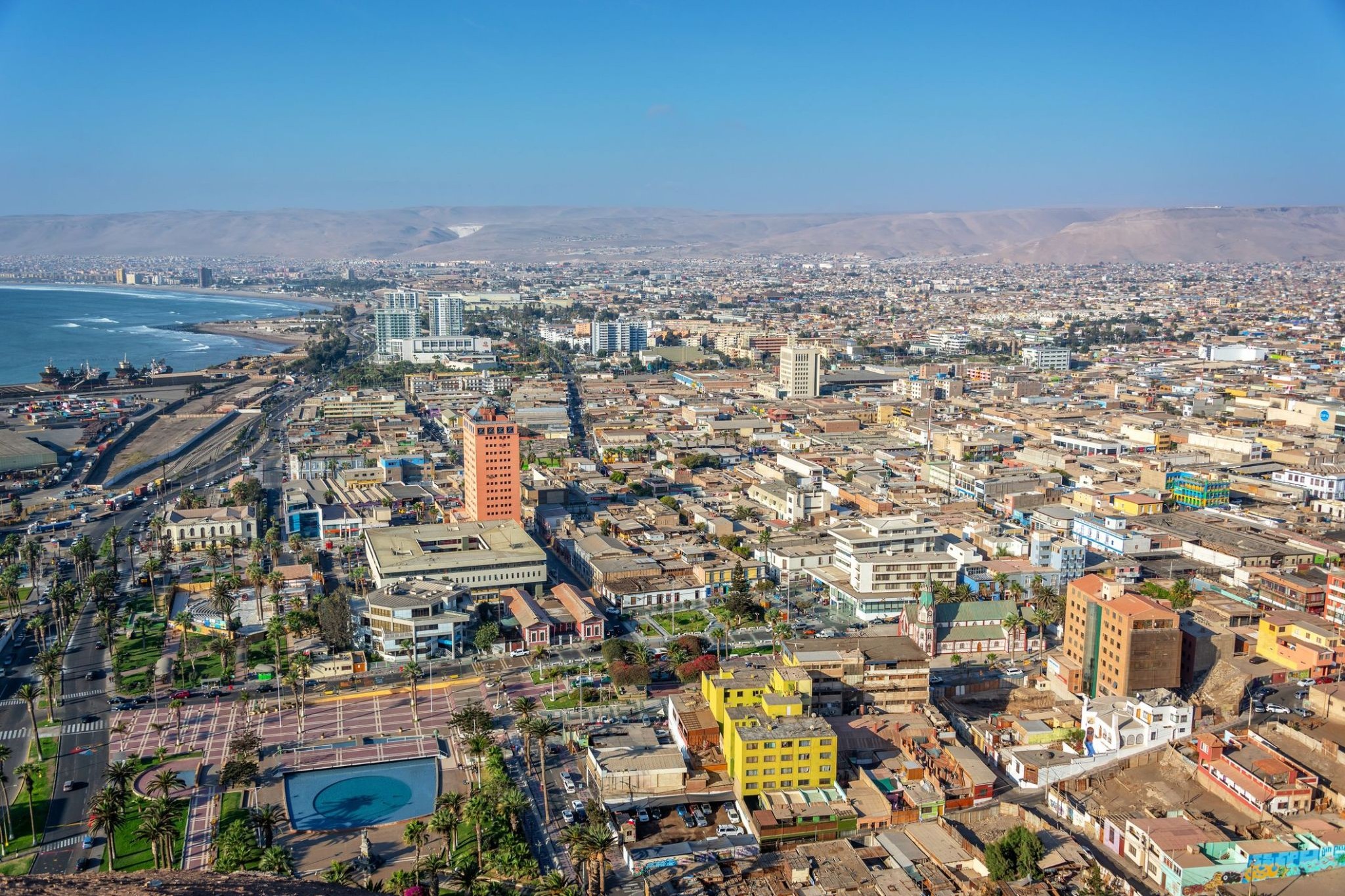
Tam, gdzie suche przestrzenie północnego Chile spotykają się z łagodnymi falami Oceanu Spokojnego, Arica wita podróżników wyjątkowym połączeniem wiecznego lata, bogactwa kultury i naturalnego piękna. Arica słynie z łagodnego klimatu przez cały rok i stała się ulubionym miejscem dla miłośników plażowania oraz sportów wodnych. Miasto szczyci się również jednym z najsuchszych klimatów na świecie — w niektórych rejonach nie padało od dziesięcioleci.
Spacerując kolonialnymi uliczkami, można dotrzeć do imponującej katedry San Marcos zaprojektowanej przez Gustave’a Eiffla. W pobliżu wznosi się klif El Morro, z którego szczytu roztacza się zachwycający widok na wybrzeże. W okolicach warto odwiedzić muzea archeologiczne z najstarszymi mumiami świata z kultury Chinchorro oraz podziwiać surowe piękno pustyni Atacama i zielone oazy zasilane wodami podziemnymi.
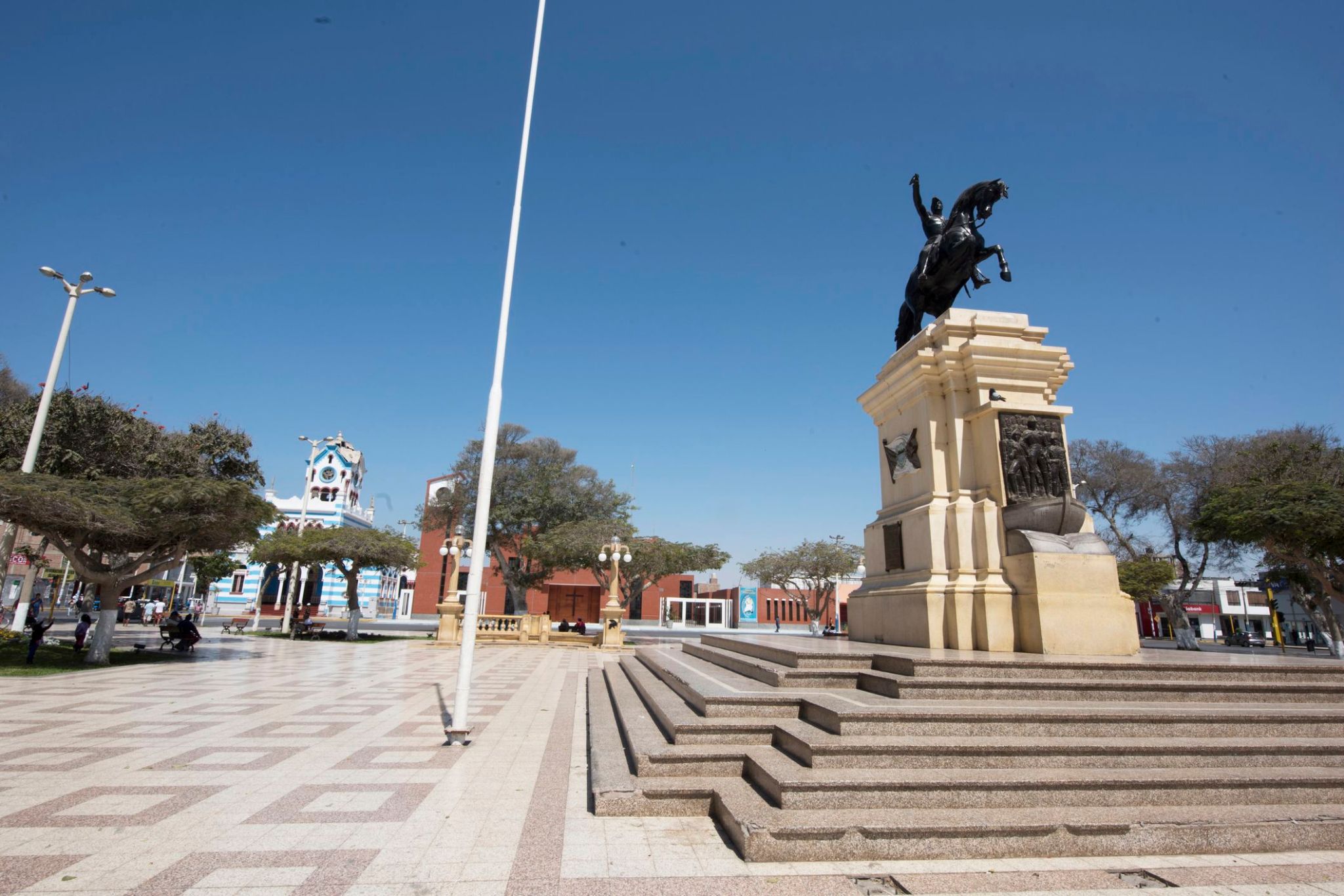
To malownicze miasto portowe na wybrzeżu Pacyfiku przyciąga podróżnych swoją bogatą historią i bliskością unikalnych atrakcji przyrodniczych. Pisco (Peru) to brama do słynnego Rezerwatu Narodowego Paracas, gdzie odwiedzający mogą zobaczyć rzadkie gatunki zwierząt i podziwiać zachwycające krajobrazy pustynnych wydm, plaż oraz morskich jaskiń.
Ponadto Pisco słynie z mocnej brandy winogronowej o tej samej nazwie, uważanej za jedną z najlepszych w Ameryce Łacińskiej. Miasto jest również punktem wyjścia na rejsy do Wysp Ballestas, zamieszkałych przez lwy morskie, pingwiny i liczne ptaki morskie, co czyni je obowiązkowym miejscem dla miłośników przyrody i aktywnego wypoczynku.
Panama City, położone na północno-zachodnim wybrzeżu Florydy, słynie z długich, białych plaż z miękkim, kwarcowym piaskiem i ciepłych, szmaragdowych wód Zatoki Meksykańskiej. To nadmorskie miasto jest popularne zarówno wśród rodzin z dziećmi, jak i miłośników sportów wodnych: można tu uprawiać kajakarstwo, parasailing, nurkowanie i wędkarstwo. Szczególną atrakcją jest promenada — Pier Park — gdzie znajdują się sklepy, restauracje i centra rozrywki.
Poza plażowaniem Panama City oferuje także unikalne atrakcje przyrodnicze. W pobliżu znajduje się rezerwat St. Andrews State Park, gdzie można obserwować delfiny, spacerować ścieżkami wśród wydm i lasów sosnowych lub wybrać się na wycieczkę na wyspę Shell Island, zachowaną w stanie nienaruszonym. Miasto łączy atmosferę kurortu z południowym urokiem, oferując spokojny, a jednocześnie pełen wrażeń wypoczynek.
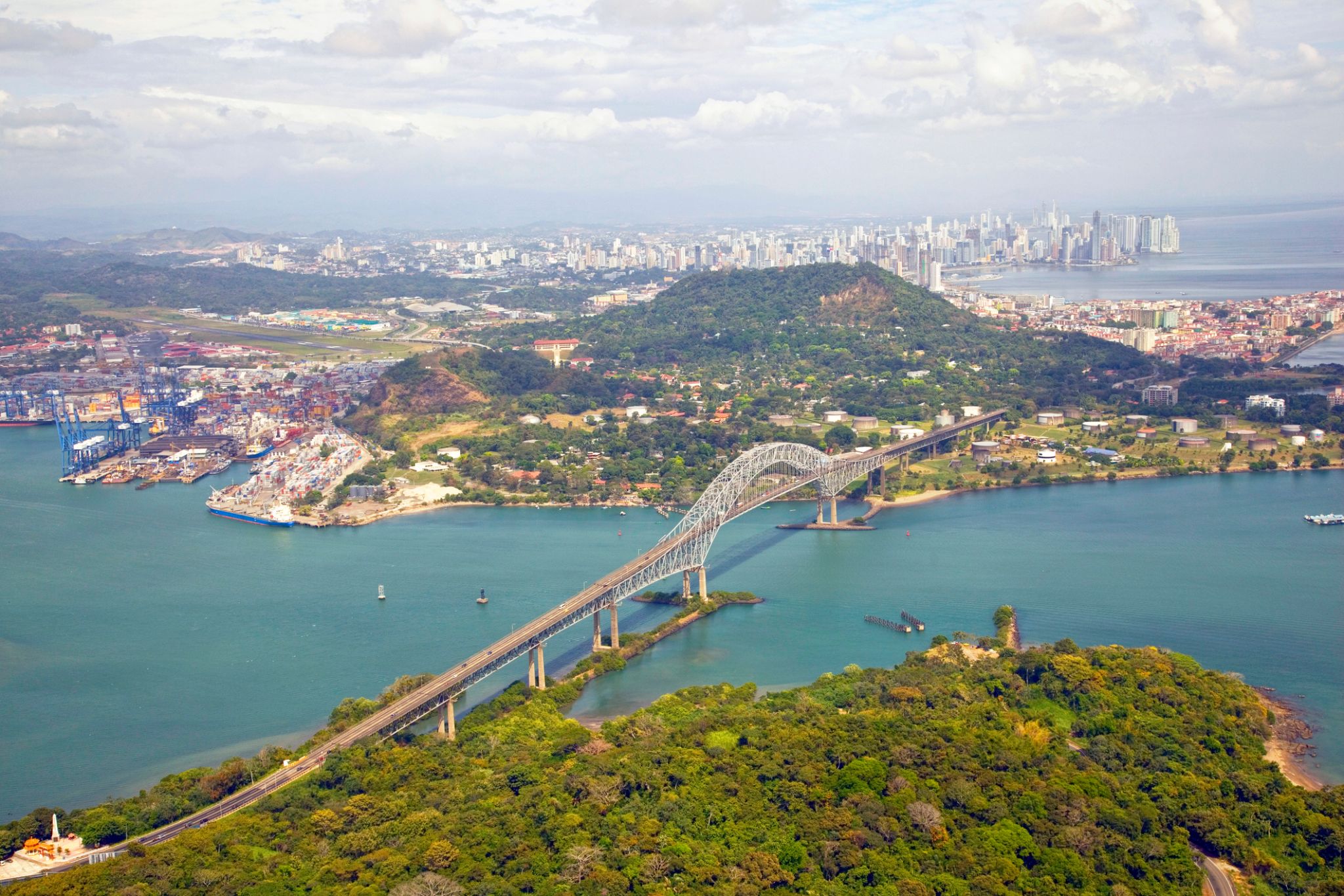
The Panama Canal is an artificial 82 km (51 mi) waterway in Panama that connects the Atlantic Ocean with the Pacific Ocean. The canal cuts across the Isthmus of Panama and is a conduit for maritime trade. Canal locks are at each end to lift ships up to Gatun Lake, an artificial lake created to reduce the amount of excavation work required for the canal, 26 m (85 ft) above sea level, and then lower the ships at the other end. The original locks are 34 m (110 ft) wide. A third, wider lane of locks was constructed between September 2007 and May 2016. The expanded canal began commercial operation on June 26, 2016. The new locks allow transit of larger, post-Panamax ships, capable of handling more cargo.
France began work on the canal in 1881, but stopped due to engineering problems and a high worker mortality rate. The United States took over the project in 1904 and opened the canal on August 15, 1914. One of the largest and most difficult engineering projects ever undertaken, the Panama Canal shortcut greatly reduced the time for ships to travel between the Atlantic and Pacific Oceans, enabling them to avoid the lengthy, hazardous Cape Horn route around the southernmost tip of South America via the Drake Passage or Strait of Magellan.
Colombia, France, and later the United States controlled the territory surrounding the canal during construction. The US continued to control the canal and surrounding Panama Canal Zone until the 1977 Torrijos–Carter Treatiesprovided for handover to Panama. After a period of joint American–Panamanian control, in 1999, the canal was taken over by the Panamanian government. It is now managed and operated by the government-owned Panama Canal Authority.

Puerto Limón, commonly known as Limón (Spanish for "lemon"), is the capital city and main hub of Limón province, as well as of the cantón (county) of Limón in Costa Rica. It is the second largest city in Costa Rica, with a population of over 55,000, and is home of the Afro-Costa Rican community. Part of the community traces its roots to Italian, Jamaican and Chinese laborers who worked on a late nineteenth-century railroad project that connected San José to Puerto Limón. Until 1948, the Costa Rican government did not recognize Afro-Caribbean people as citizens and restricted their movement outside Limón province. As a result of this "travel ban", this Afro-Caribbean population became firmly established in the region, which influenced decisions not to move even after it was legally permitted. Nowadays, there is a significant outflow of Limón natives who move to the country's Central Valley in search for better employment and education. The Afro-Caribbean community speaks Spanish and Limonese Creole, a creole of English.
Puerto Limón contains two port terminals, Limón and Moín, which permit the shipment of Costa Rican exports as well as the anchoring of cruise ships. In 2016, the government pledged ₡93 million ($166,000) for a new cruise ship terminal for Puerto Limón.
Health care is provided for the city by Hospital Dr. Tony Facio Castro. Two small islands, Uvita Island and Isla de Pájaros, are just offshore.
Bezkresne wody Morza Karaibskiego skrywają prawdziwe skarby, a jednym z nich jest San Andrés – kolumbijska wyspa, gdzie turkusowe morze mieni się wszystkimi odcieniami błękitu. Ten tropikalny raj od dawna przyciąga zarówno miłośników plażowania, jak i nurkowania – rafy koralowe w okolicy należą do najpiękniejszych w regionie. Biały piasek, palmy kokosowe i spokojna atmosfera tworzą idealne warunki do relaksu w karaibskim stylu.
San Andrés to nie tylko miejsce do kąpieli i opalania. Można tu popłynąć łodzią na małą wysepkę Johnny Cay, odkrywać naturalne akwarium El Acuario albo zapoznać się z kulturą społeczności raizal – afro-karaibskiej ludności wyspy. Do tego muzyka reggaeton i świeże owoce morza – i mamy wymarzone wakacje w karaibskim rytmie.
Miami, officially the City of Miami, is the cultural, economic and financial center of South Florida. Miami is the seat of Miami-Dade County, the most populous county in Florida. The city covers an area of about 56.6 square miles (147 km2), between the Everglades to the west and Biscayne Bay on the east; with a 2017 estimated population of 463,347, Miami is the sixth most densely populated major city in the United States. The Miami metropolitan area is home to 6.1 million people and the seventh-largest metropolitan area in the nation. Miami's metro area is the second-most populous metropolis in the southeastern United States and fourth-largest urban area in the U.S.
Miami is a major center, and a leader in finance, commerce, culture, media, entertainment, the arts, and international trade. The Miami Metropolitan Area is by far the largest urban economy in Florida and the 12th largest in the United States with a GDP of $344.9 billion as of 2017. In 2012, Miami was classified as an "Alpha−" level world city in the World Cities Study Group's inventory. In 2010, Miami ranked seventh in the United States and 33rd among global cities in terms of business activity, human capital, information exchange, cultural experience, and political engagement. In 2008, Forbes magazine ranked Miami "America's Cleanest City", for its year-round good air quality, vast green spaces, clean drinking water, clean streets, and citywide recycling programs. According to a 2009 UBS study of 73 world cities, Miami was ranked as the richest city in the United States, and the world's seventh-richest city in terms of purchasing power. Miami is nicknamed the "Capital of Latin America" and is the largest city with a Cuban-American plurality.
Greater Downtown Miami has one of the largest concentrations of international banks in the United States, and is home to many large national and international companies. The Civic Center is a major center for hospitals, research institutes, medical centers, and biotechnology industries. For more than two decades, the Port of Miami, known as the "Cruise Capital of the World", has been the number one cruise passenger port in the world. It accommodates some of the world's largest cruise ships and operations, and is the busiest port in both passenger traffic and cruise lines. Metropolitan Miami is also a major tourism hub in the southeastern U.S. for international visitors, ranking number two in the country after New York City.