| Region rejsu : Rejsy po Pacyfiku, Ameryka Południowa/Antarktyda |
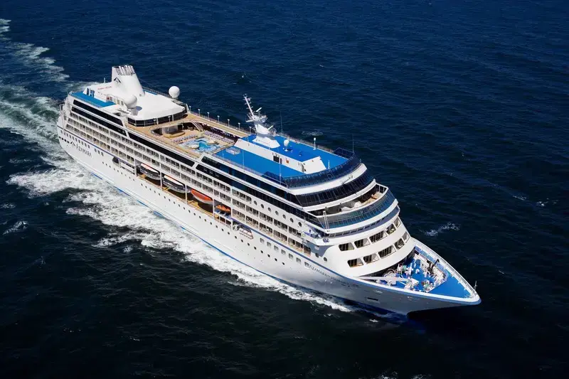
| Firma : Azamara Cruises |
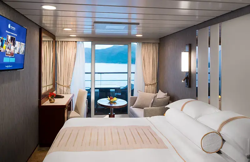
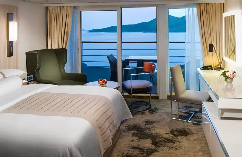
| Statek : Azamara Quest |
| Data rozpoczęcia : pon. 24 sty 2028 |
| Data zakończenia : pon. 13 mar 2028 |
| Liczba nocy : 49 nocy |
| Dzień | Data | Port | Wypłynięcie | Odpłynięcie |
|---|---|---|---|---|
| 1 | 24.01 pon. | Valparaiso / Chile | 18:00 | |
| 2 | 25.01 wt. | Dzień na morzu / Morze | ||
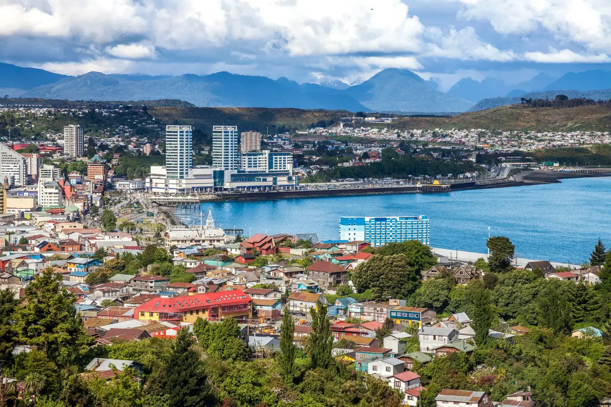
| 3 | 26.01 śr. | Puerto Montt / Chile | 11:30 | 20:00 |
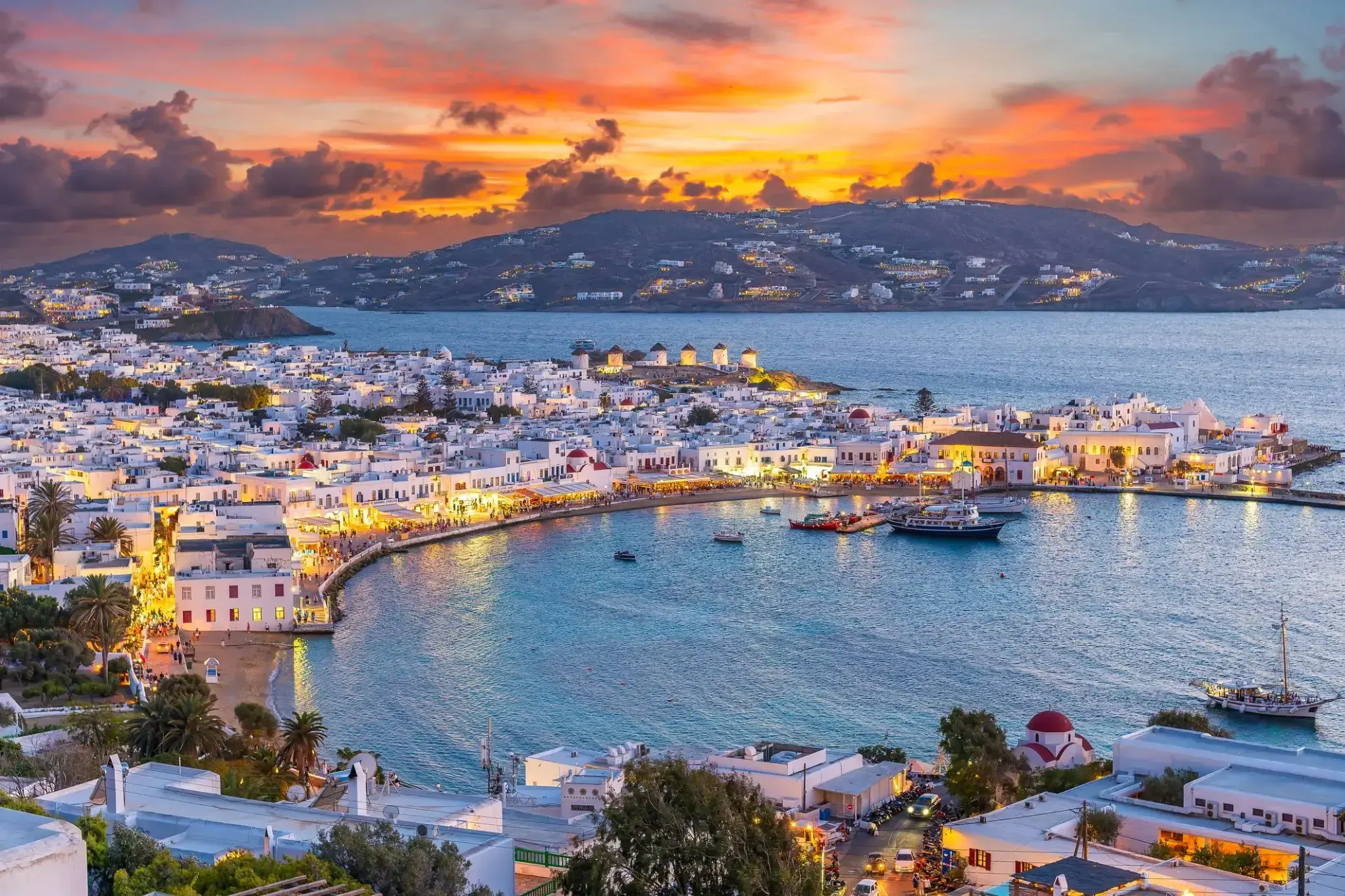
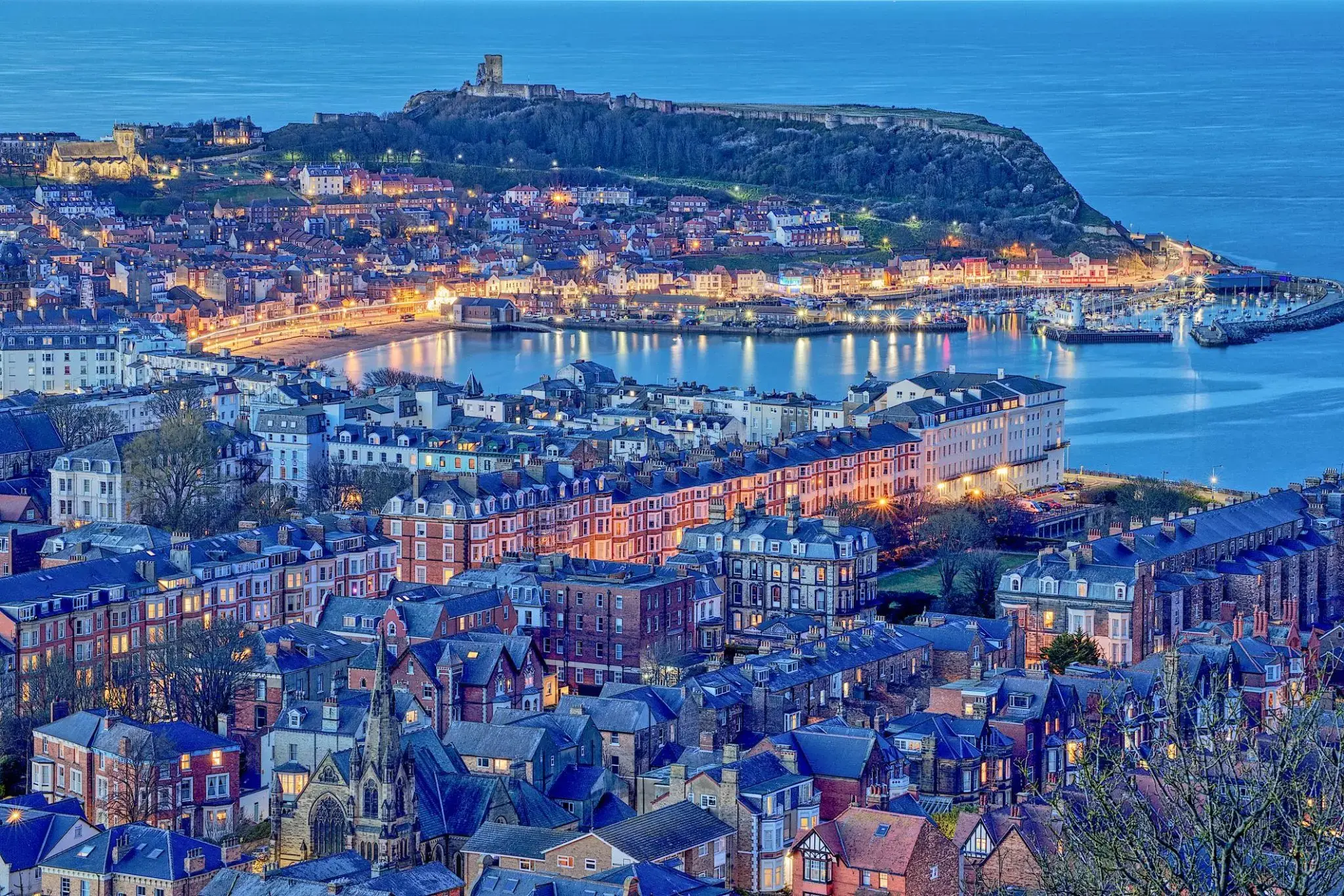
| 4 | 27.01 czw. | Mykonos / Grecja | 08:00 | 16:00 |
| 5 | 28.01 pt. | Puerto Chacabuco / Chile | 08:00 | 18:00 |
| 6 | 29.01 sob. | Dzień na morzu / Morze | ||
| 7 | 30.01 niedz. | Chilijskie fiordy / Chile | 08:00 | |
| 8 | 31.01 pon. | Chilijskie fiordy / Chile | 18:00 | |
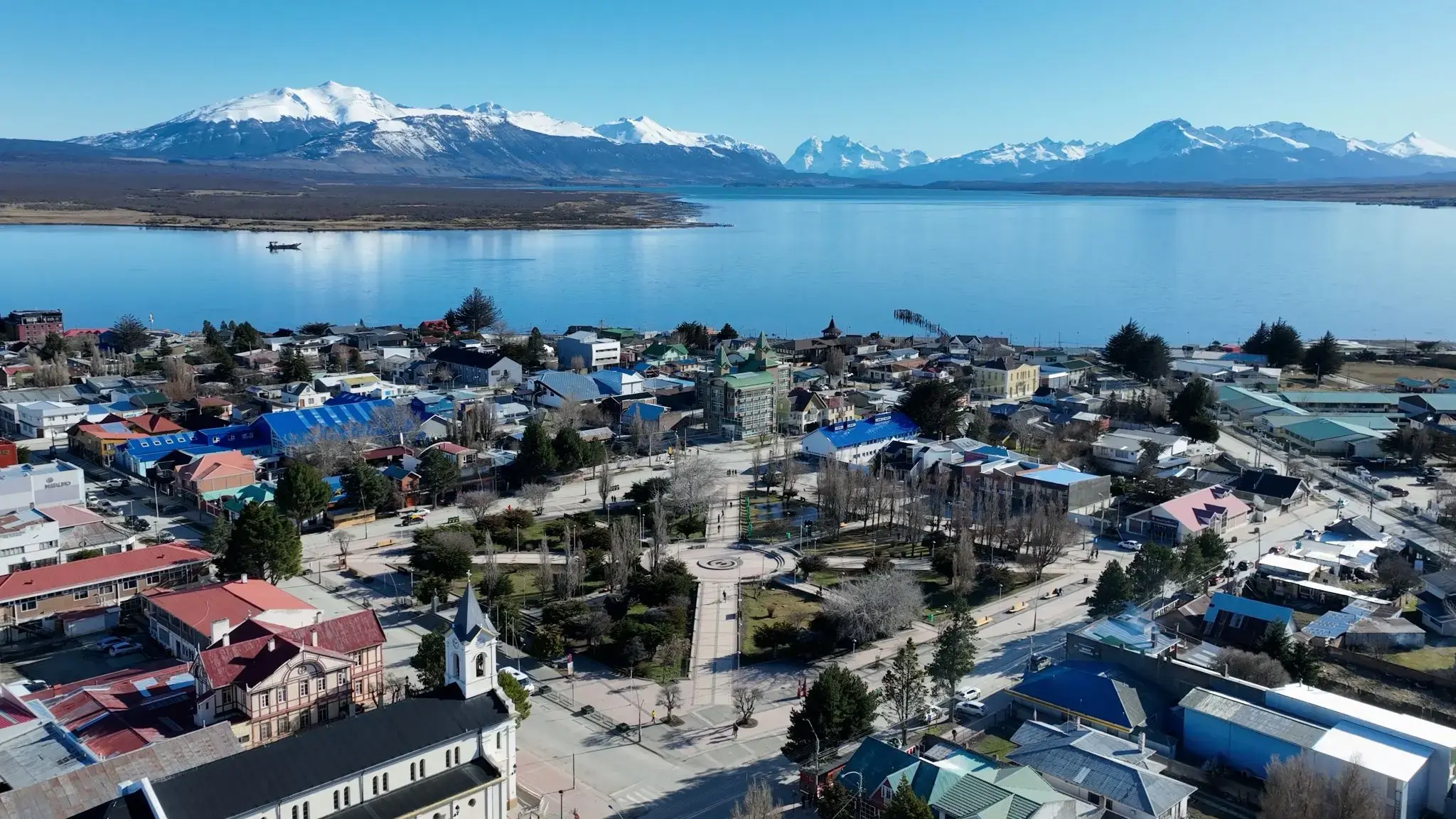
| 9 | 1.02 wt. | Punta Arenas / Chile | 08:00 | |
| 10 | 2.02 śr. | Punta Arenas / Chile | 07:00 | |
| 11 | 3.02 czw. | Ushuaia / Argentyna | 06:00 | 17:00 |
| 12 | 4.02 pt. | Dzień na morzu / Morze | ||
| 13 | 5.02 sob. | Dzień na morzu / Morze | ||
| 14 | 6.02 niedz. | Dzień na morzu / Morze | ||
| 15 | 7.02 pon. | Dzień na morzu / Morze | ||
| 16 | 8.02 wt. | Dzień na morzu / Morze | ||
| 17 | 9.02 śr. | Port Stanley, Falklandy / Wielka Brytania | 08:00 | 17:00 |
| 18 | 10.02 czw. | Dzień na morzu / Morze | ||
| 19 | 11.02 pt. | Dzień na morzu / Morze | ||
| 20 | 12.02 sob. | Punta del Este / Uruguay | 09:00 | 18:00 |
| 21 | 13.02 niedz. | Montevideo / Uruguay | 08:00 | |
| 22 | 14.02 pon. | Montevideo / Uruguay | 18:00 | |
| 23 | 15.02 wt. | Buenos Aires / Argentyna | 06:00 | |
| 24 | 16.02 śr. | Buenos Aires / Argentyna | 09:00 | |
| 25 | 17.02 czw. | Buenos Aires / Argentyna | 18:00 | |
| 26 | 18.02 pt. | Montevideo / Uruguay | 08:00 | 17:00 |
| 27 | 19.02 sob. | Rio Grande - Rio Grande do Sul / Brazylia | 14:00 | 21:00 |
| 28 | 20.02 niedz. | Dzień na morzu / Morze | ||
| 29 | 21.02 pon. | Porto Belo / Brazylia | 07:00 | 18:00 |
| 30 | 22.02 wt. | SÃO FRANCISCO DO SUL | 07:00 | 18:00 |
| 31 | 23.02 śr. | Paranaguá | 07:00 | 20:00 |
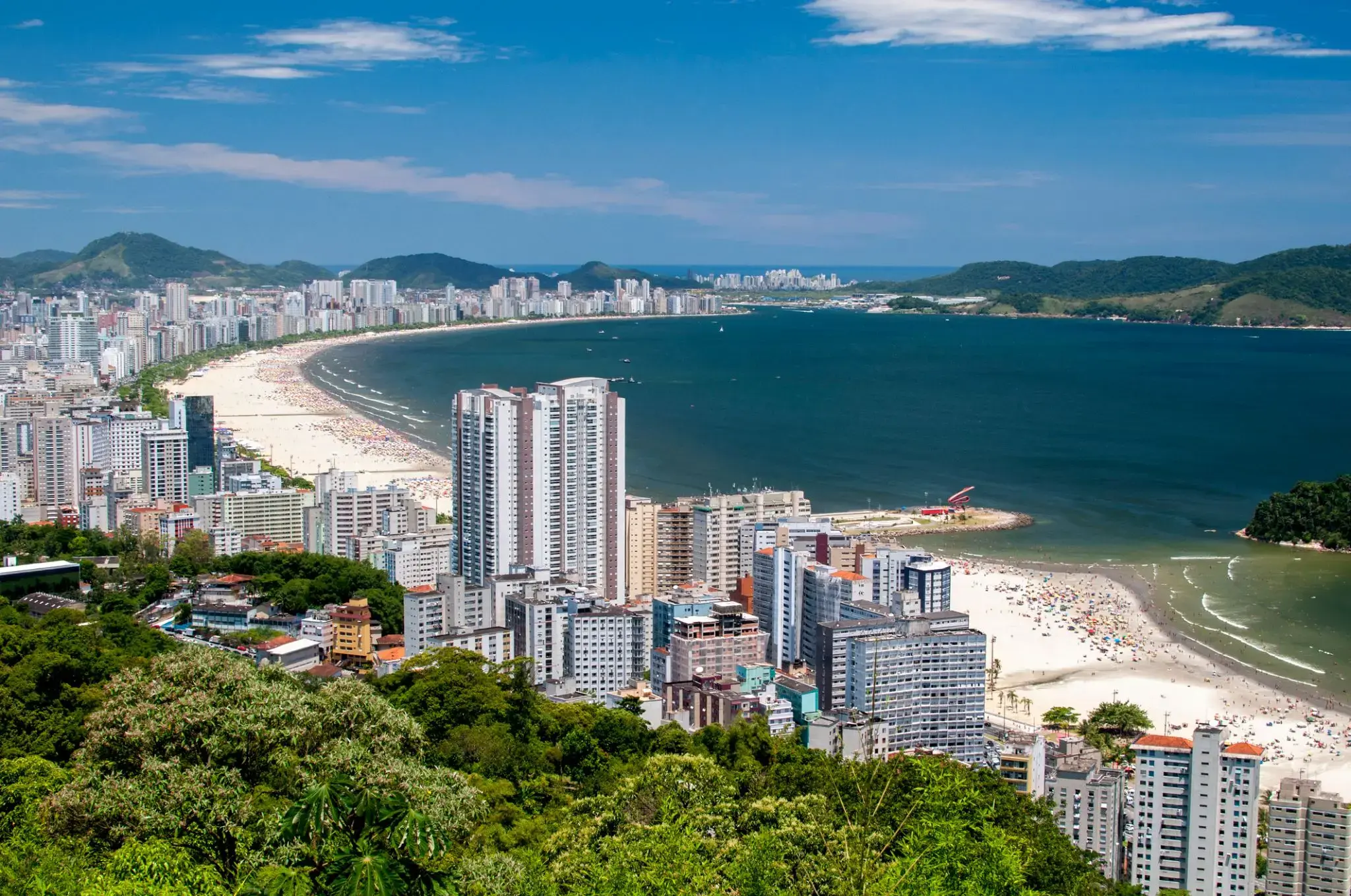
| 32 | 24.02 czw. | Santos / Brazylia | 08:30 | 22:00 |
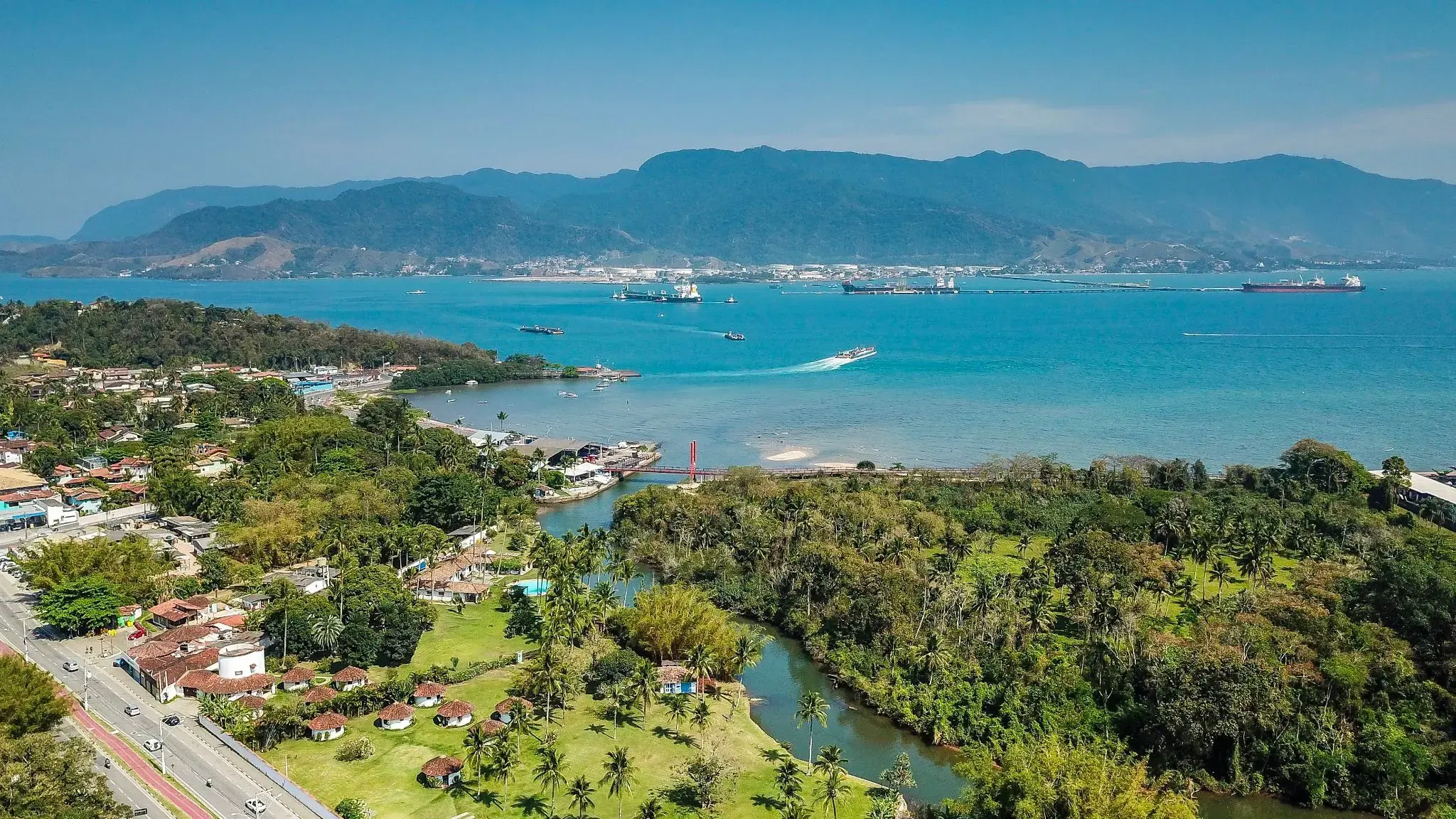
| 33 | 25.02 pt. | Ilhabela / Brazylia | 07:00 | 20:00 |
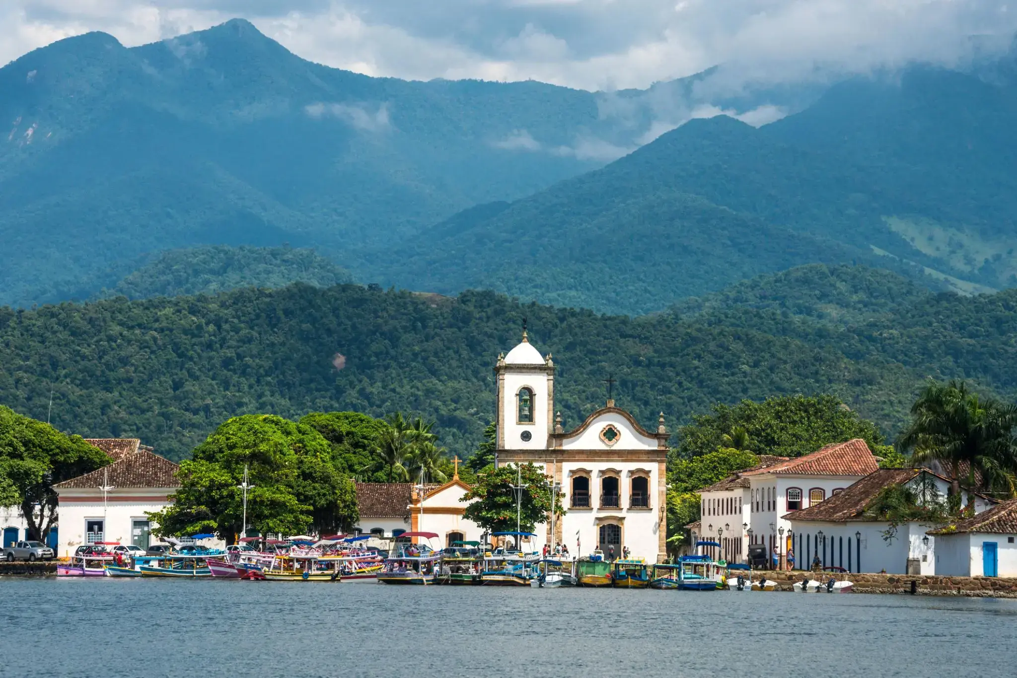
| 34 | 26.02 sob. | Parati / Brazylia | 07:00 | 23:00 |
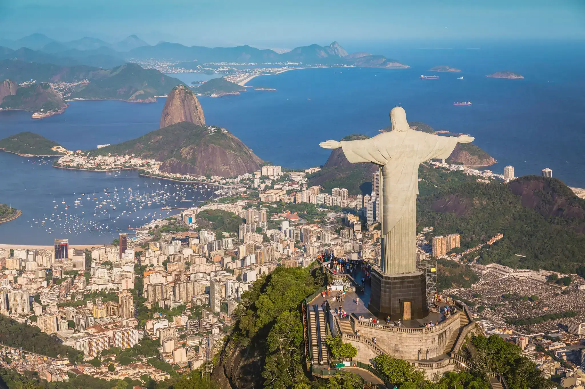
| 35 | 27.02 niedz. | Rio de Janeiro / Brazylia | 08:00 | |
| 36 | 28.02 pon. | Rio de Janeiro / Brazylia | 09:00 | |
| 37 | 29.02 wt. | Rio de Janeiro / Brazylia | 14:00 | |
| 38 | 1.03 śr. | Dzień na morzu / Morze | ||
| 39 | 2.03 czw. | Salwador / Brazylia | 13:00 | |
| 40 | 3.03 pt. | Salwador / Brazylia | 17:00 | |
| 41 | 4.03 sob. | Dzień na morzu / Morze | ||
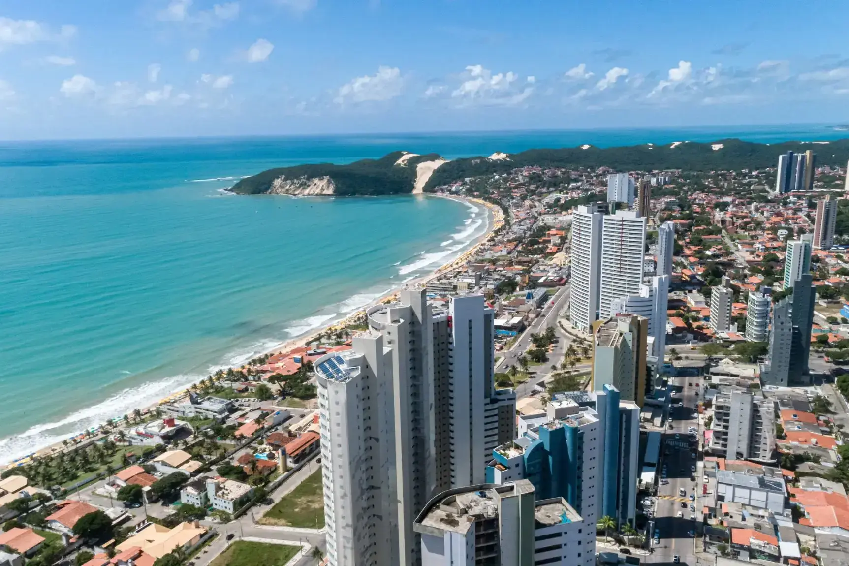
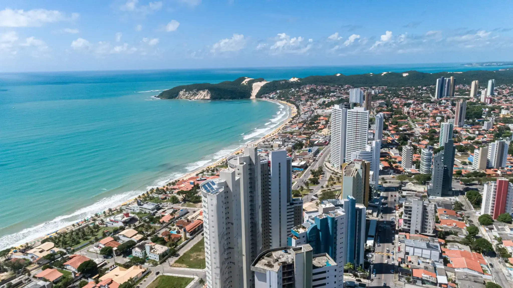
| 42 | 5.03 niedz. | Natal / Brazylia | 10:30 | 20:00 |
| 43 | 6.03 pon. | Dzień na morzu / Morze | ||
| 44 | 7.03 wt. | Dzień na morzu / Morze | ||
| 45 | 8.03 śr. | Belen / Brazylia | 08:00 | 18:00 |
| 46 | 9.03 czw. | Dzień na morzu / Morze | ||
| 47 | 10.03 pt. | dąb Królewski | 08:00 | 17:00 |
| 48 | 11.03 sob. | Dzień na morzu / Morze | ||
| 49 | 12.03 niedz. | Scarborough / Trinidad and Tobago | 08:00 | 18:00 |
| 50 | 13.03 pon. | Bridgetown / Barbados | 08:00 |


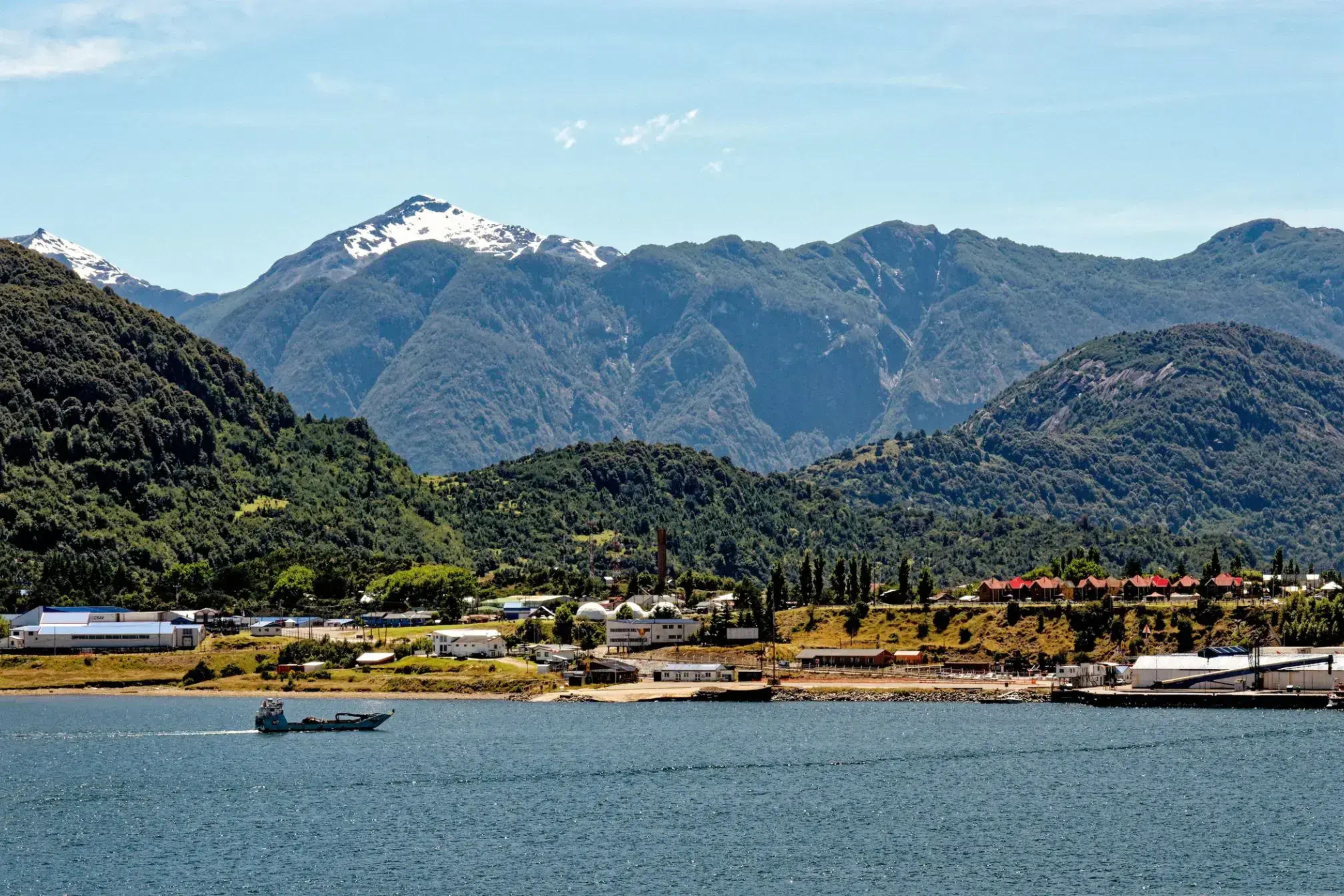
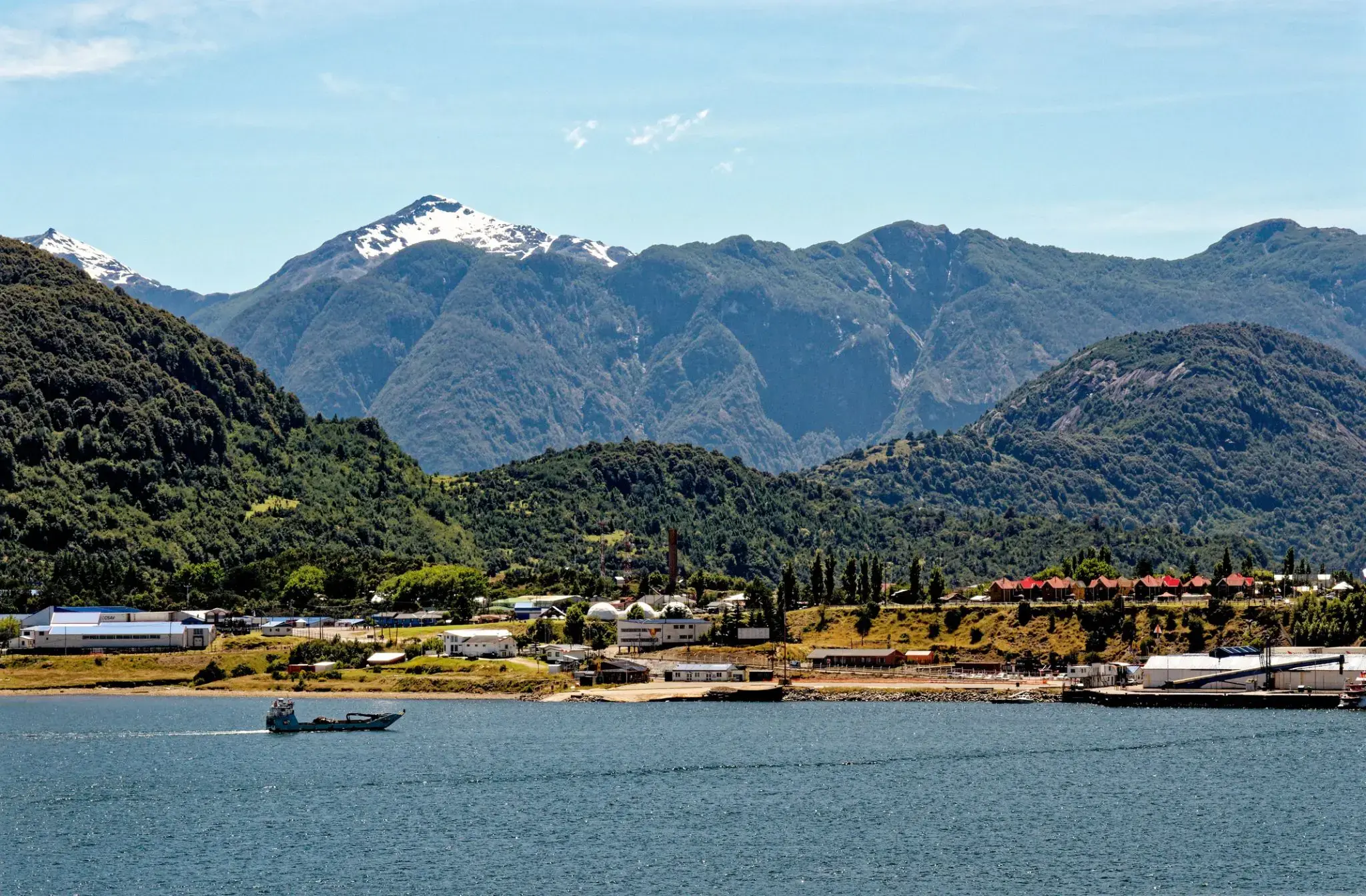
Puerto Montt is a port city and commune in southern Chile, located at the northern end of the Reloncaví Sound in the Llanquihue Province, Los Lagos Region, 1,055 km to the south of the capital, Santiago. The commune spans an area of 1,673 km2 (646 sq mi) and has a population of 245,902 in 2017. It is bounded by the communes of Puerto Varas to the north, Cochamó to the east and southeast, Calbuco to the southwest and Maullín and Los Muermos to the west.
Founded as late as 1853 during the German colonization of southern Chile, Puerto Montt soon outgrew older neighboring cities due to its strategic position at the southern end of the Chilean Central Valley being a gateway city into Chiloé Archipelago, Llanquihue and Nahuel Huapi lakes and Western Patagonia.
Puerto Montt has gained renown and grown significantly due to the rise of Chile as the second largest salmon producer of the world during the 1990s and 2000s. However, the Chilean salmon aquaculture crisis of the late 2000s resulted at least temporarily in severe unemployment and exposed weaknesses in the local economy. The city's cultural heritage mixes elements of Chiloé culture with German heritage although the city has attracted a significant number of newcomers from all over Chile in the last 30 years due to employment opportunities.

Słynna, nowoczesna wyspa Mykonos przyciąga turystów swoim urokiem. Trudno oprzeć się widokowi lazurowego morza i skąpanego w słońcu białego miasta. Mykonos to wyspa kontrastów – biel domów, błękit głębin i kolorowe okna. Wśród atrakcji warto wspomnieć liczne kościoły i muzea, m.in. Muzeum Archeologiczne z amforą przedstawiającą scenę z Trojańskim koniem.
Mykonos to modny kurort i ulubione miejsce bohemy. To tutaj można zanurzyć się w wir luksusowych usług, rozrywek i nocnego życia. Ale wyspa ma także spokojniejsze oblicze – czekają na Ciebie urokliwe, ciche zakątki, idealne do relaksu i odpoczynku.
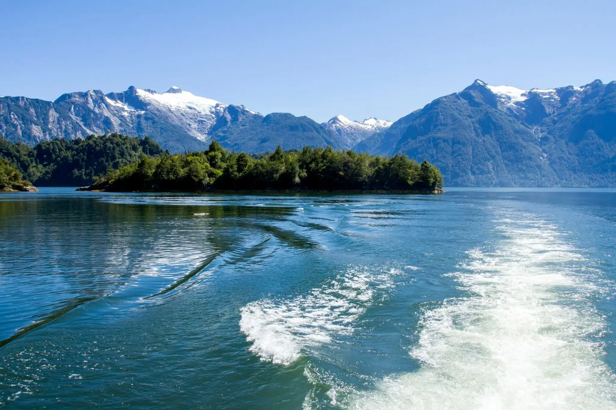
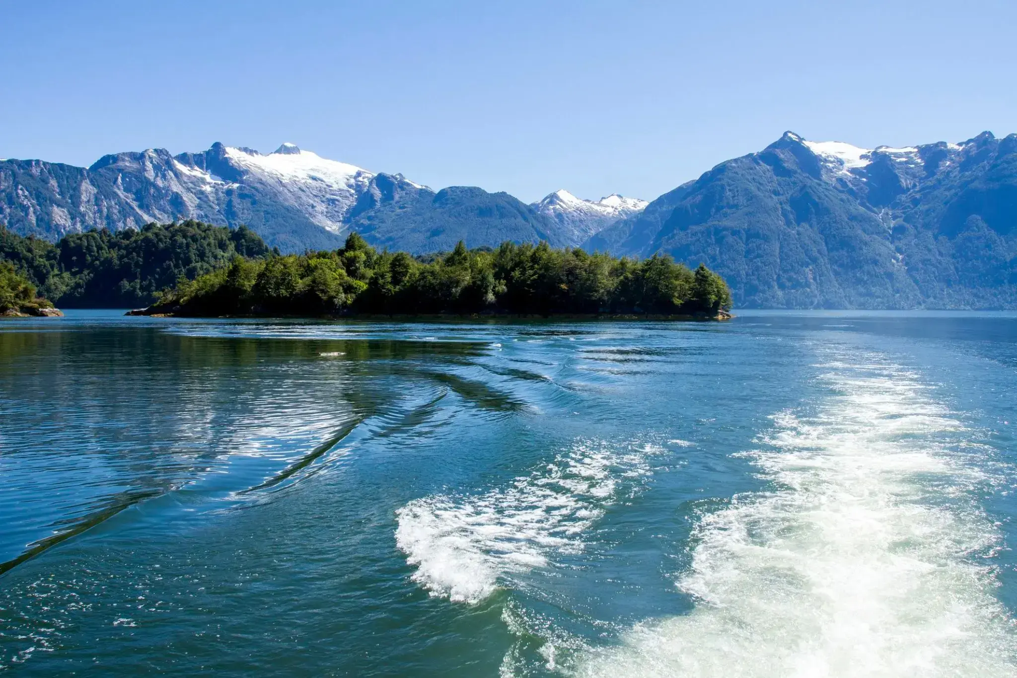
Nie tylko Europa może poszczycić się urzekającą przyrodą norweskich fiordów, ale również chilijskie fiordy. Chilijskie fiordy to wyspy o różnych rozmiarach i wysepki, ogromne głazy oraz lód wyłaniający się z wody, przybierający odcienie od śnieżnobiałych po zielonkawe. Lodowce na skałach i zboczach gór tworzą wrażenie teatralnej scenerii. Chilijskie fiordy zachwycają swoimi krajobrazami, gdzie ląd i morze stapiają się w labirynt wysp, fiordów, rzek z dopływami, jezior i wzgórz, porośniętych pradawnymi drzewami.
Chilijskie fiordy to wyjątkowe miejsce, które w cudowny sposób uniknęło ingerencji człowieka. Gdy mgła rozwiewa się pod wpływem słońca, odsłania się przed Tobą przepiękna panorama Andów, zimne wody Oceanu Spokojnego oraz bujne szmaragdowe lasy.
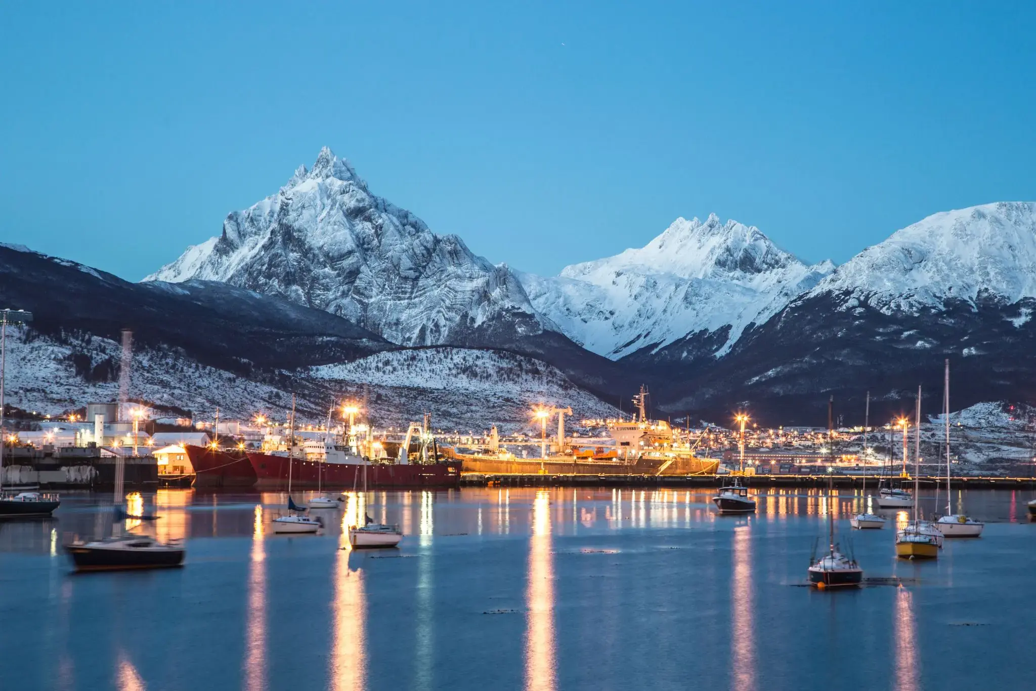
Ushuaia is the capital of Tierra del Fuego, Antártida e Islas del Atlántico Sur Province, Argentina. It is commonly regarded as the southernmost city in the world. Ushuaia is located in a wide bay on the southern coast of Isla Grande de Tierra del Fuego, bounded on the north by the Martial mountain range, and on the south by the Beagle Channel. It is the only municipality in the Department of Ushuaia, which has an area of 9,390 km2 (3,625 sq mi). It was founded October 12 of 1884 by Augusto Lasserreand is located on the shores of the Beagle Channel surrounded by the mountain range of the Martial Glacier, in the Bay of Ushuaia. Besides being an administrative center, it is a light industrial port and tourist hub.
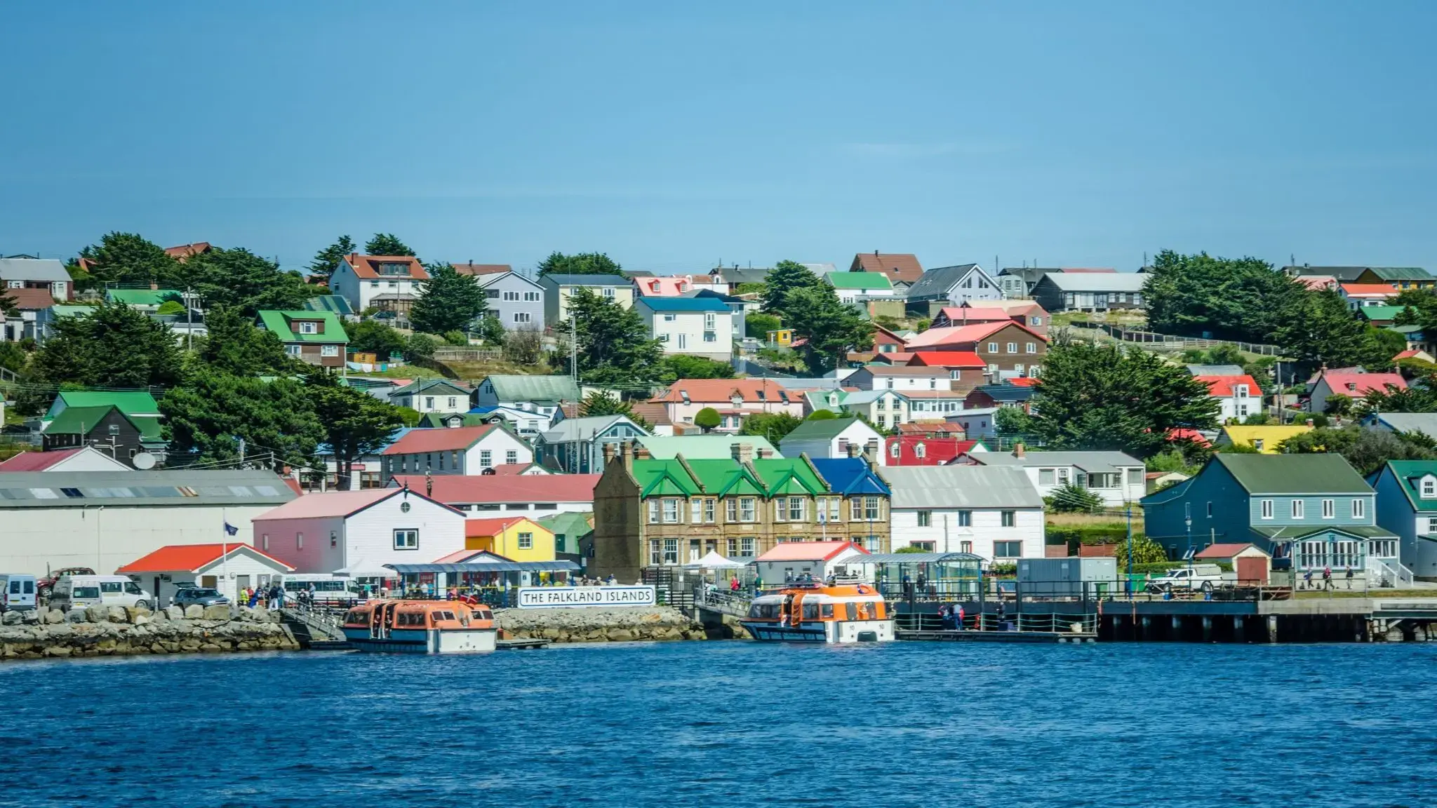
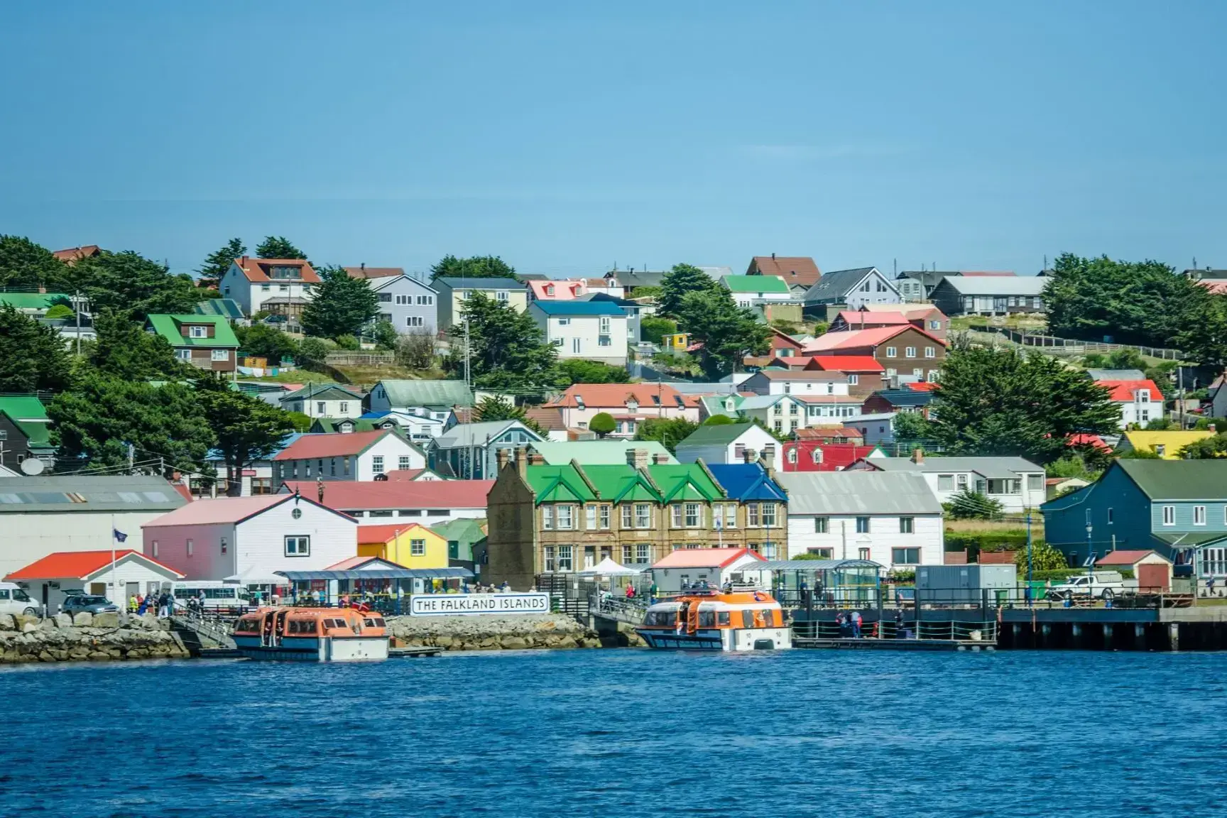
Port Stanley — Koniec świata z brytyjskim charakterem
Port Stanley to główne miasto i centrum administracyjne Falklandów, położone na wschodnim wybrzeżu Wyspy Wschodniej Falkland. To najdalej na południe wysunięta stolica Wielkiej Brytanii i jedna z najmniej zaludnionych stolic na świecie, z około 2500 mieszkańcami. Miasto zaskakuje harmonią dzikiej przyrody i rozpoznawalnymi cechami brytyjskiej kultury: można tu zobaczyć czerwone budki telefoniczne, przytulne puby, angielskie domy i zadbane ogrody.
Port Stanley otoczony jest zapierającymi dech w piersiach krajobrazami: pagórkowatymi równinami, malowniczymi zatokami i koloniami pingwinów, które łatwo spotkać w pobliżu. W mieście znajduje się interesujące muzeum poświęcone historii archipelagu i wojennej wojnie z 1982 roku. To wyjątkowe miejsce przyciąga miłośników przyrody, spokoju i nietypowych szlaków — jest to idealne miejsce dla tych, którzy szukają prawdziwej izolacji na końcu świata.
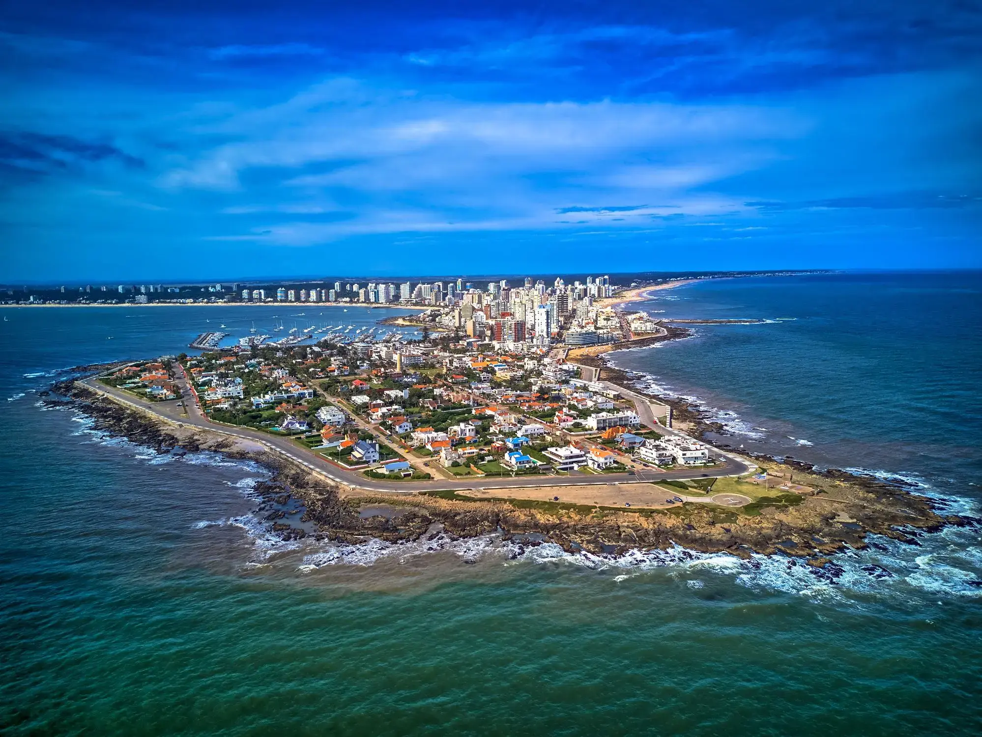
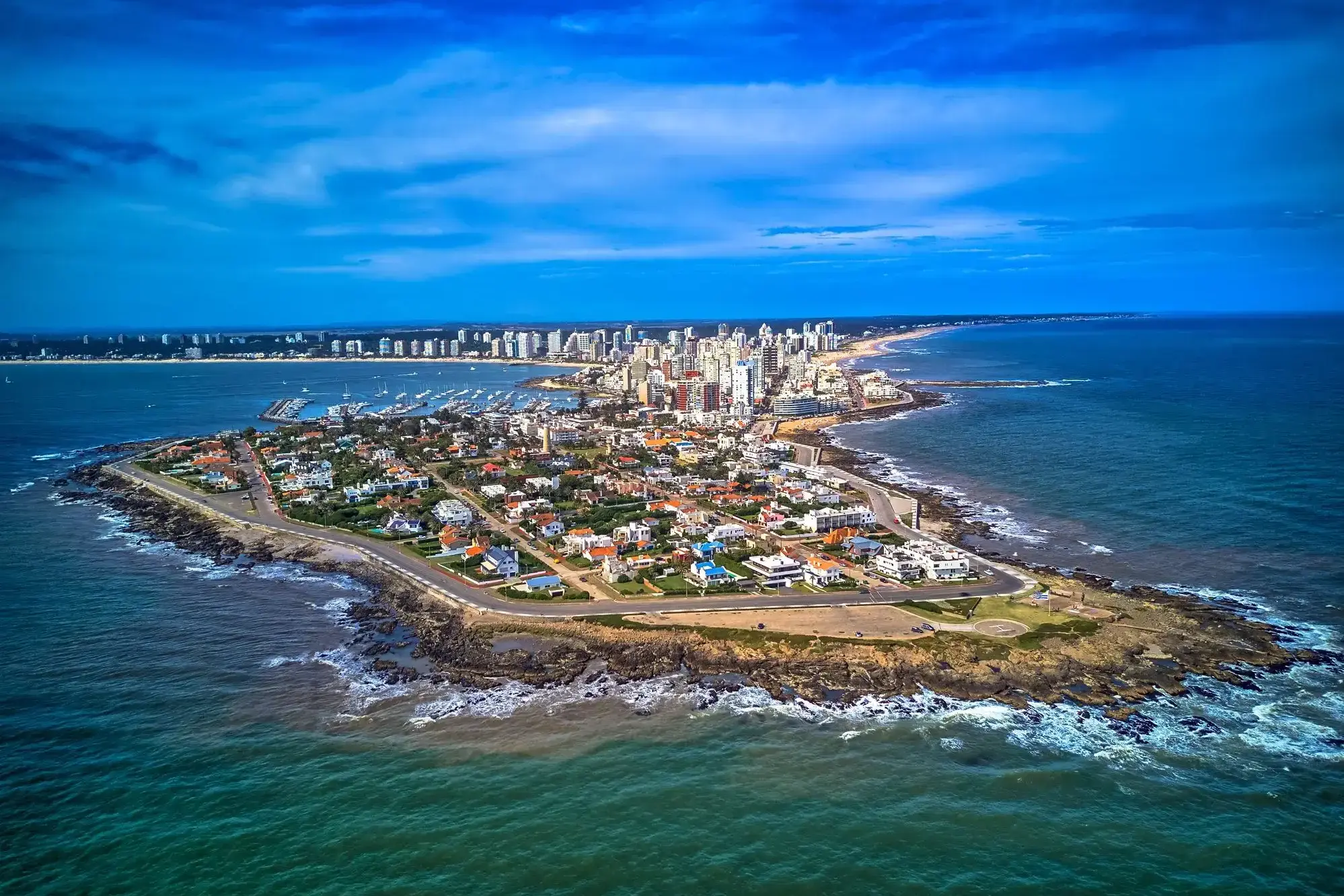
Punta del Este — urugwajski kurort nad Atlantykiem
Punta del Este to jeden z najsłynniejszych kurortów Ameryki Południowej, położony na południowym wybrzeżu Urugwaju, gdzie spotykają się wody Oceanu Atlantyckiego i estuarium La Platy. Miasto słynie z kontrastów — luksusowe dzielnice z nowoczesnymi wieżowcami, jachtami i wykwintnymi restauracjami sąsiadują z cichymi, piaszczystymi plażami, malowniczymi wydmami i falami idealnymi do surfowania. Nazywane jest „Monako Ameryki Południowej” ze względu na swoją luksusową infrastrukturę i popularność wśród międzynarodowych celebrytów.
Poza plażami, Punta del Este oferuje wiele atrakcji kulturalnych i przyrodniczych: rzeźba „La Mano”, która stała się symbolem miasta, muzeum sztuki współczesnej Ralli oraz pobliskie wyspy z fokami. Warto też odwiedzić artystyczną dzielnicę La Barra lub podziwiać zachód słońca przy latarni morskiej. W sezonie letnim (grudzień–luty) miasto tętni życiem, przyciągając turystów z całego świata szukających słońca, komfortu i dynamicznego życia nocnego.
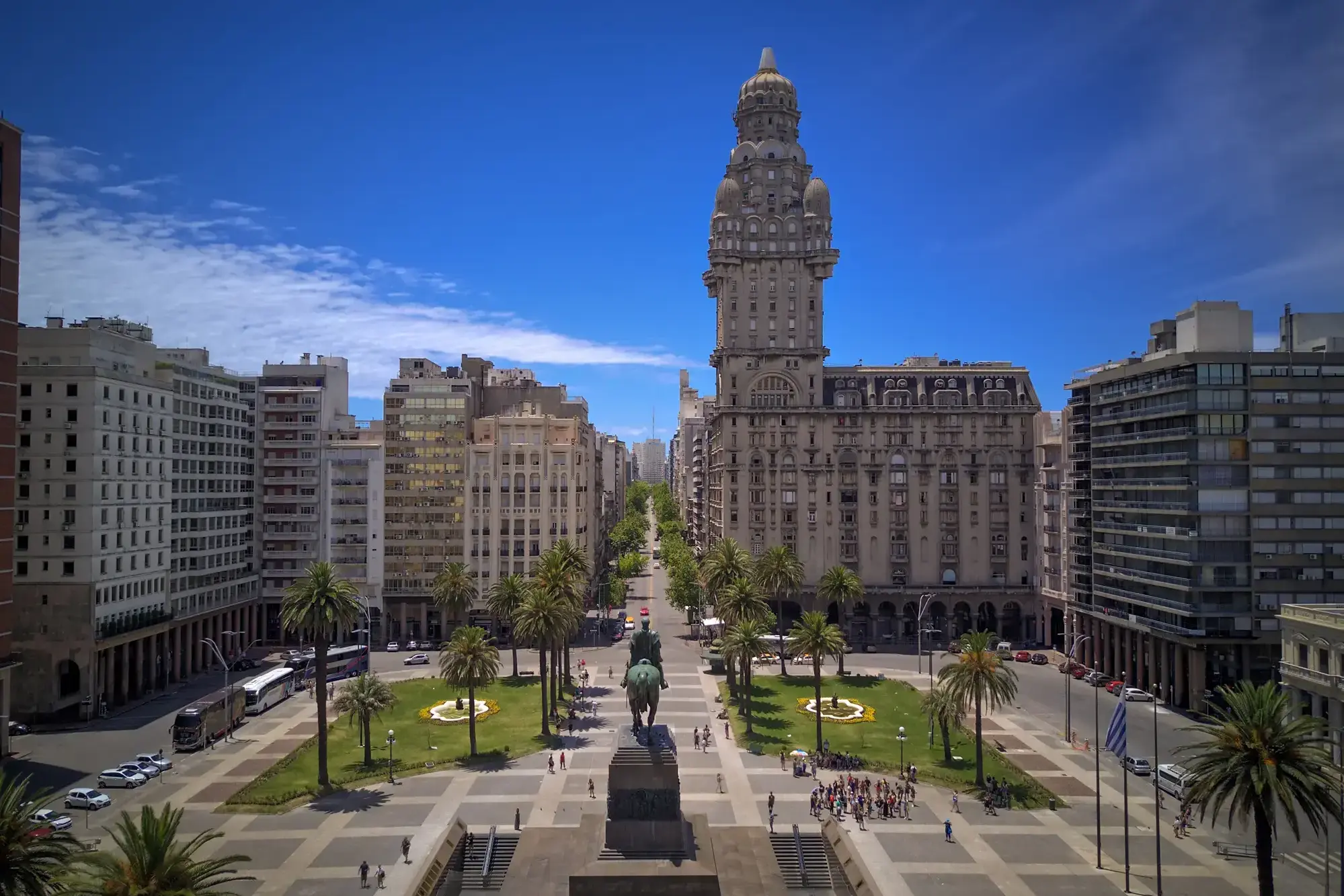
Montevideo is the capital and largest city of Uruguay. According to the 2011 census, the city proper has a population of 1,319,108 (about one-third of the country's total population) in an area of 201 square kilometres (78 sq mi). The southernmost capital city in the Americas, Montevideo is situated on the southern coast of the country, on the northeastern bank of the Río de la Plata.
The city was established in 1724 by a Spanish soldier, Bruno Mauricio de Zabala, as a strategic move amidst the Spanish-Portuguese dispute over the platine region. It was also under brief British rule in 1807. Montevideo is the seat of the administrative headquarters of Mercosur and ALADI, Latin America’s leading trade blocs, a position that entailed comparisons to the role of Brussels in Europe.
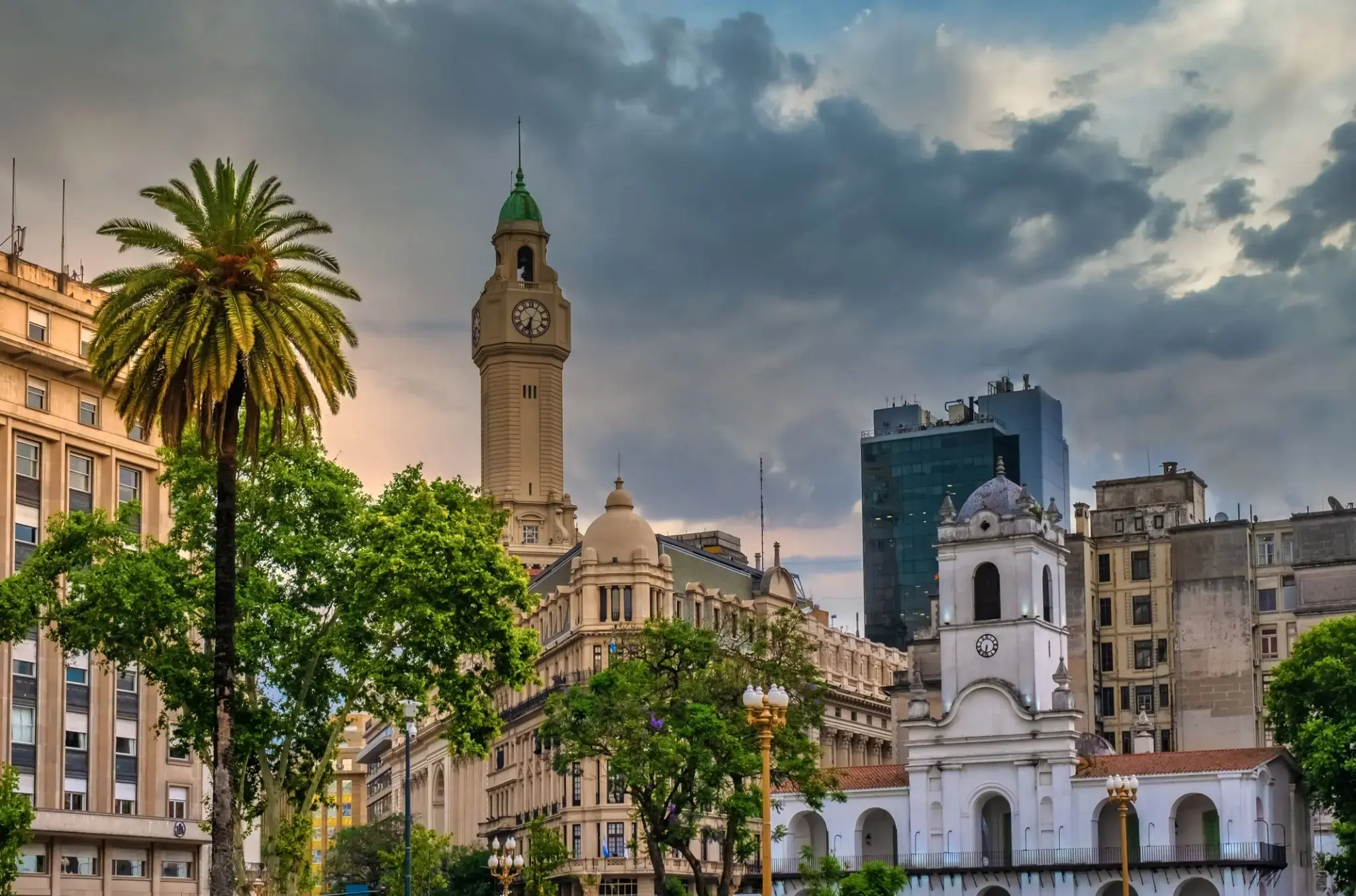
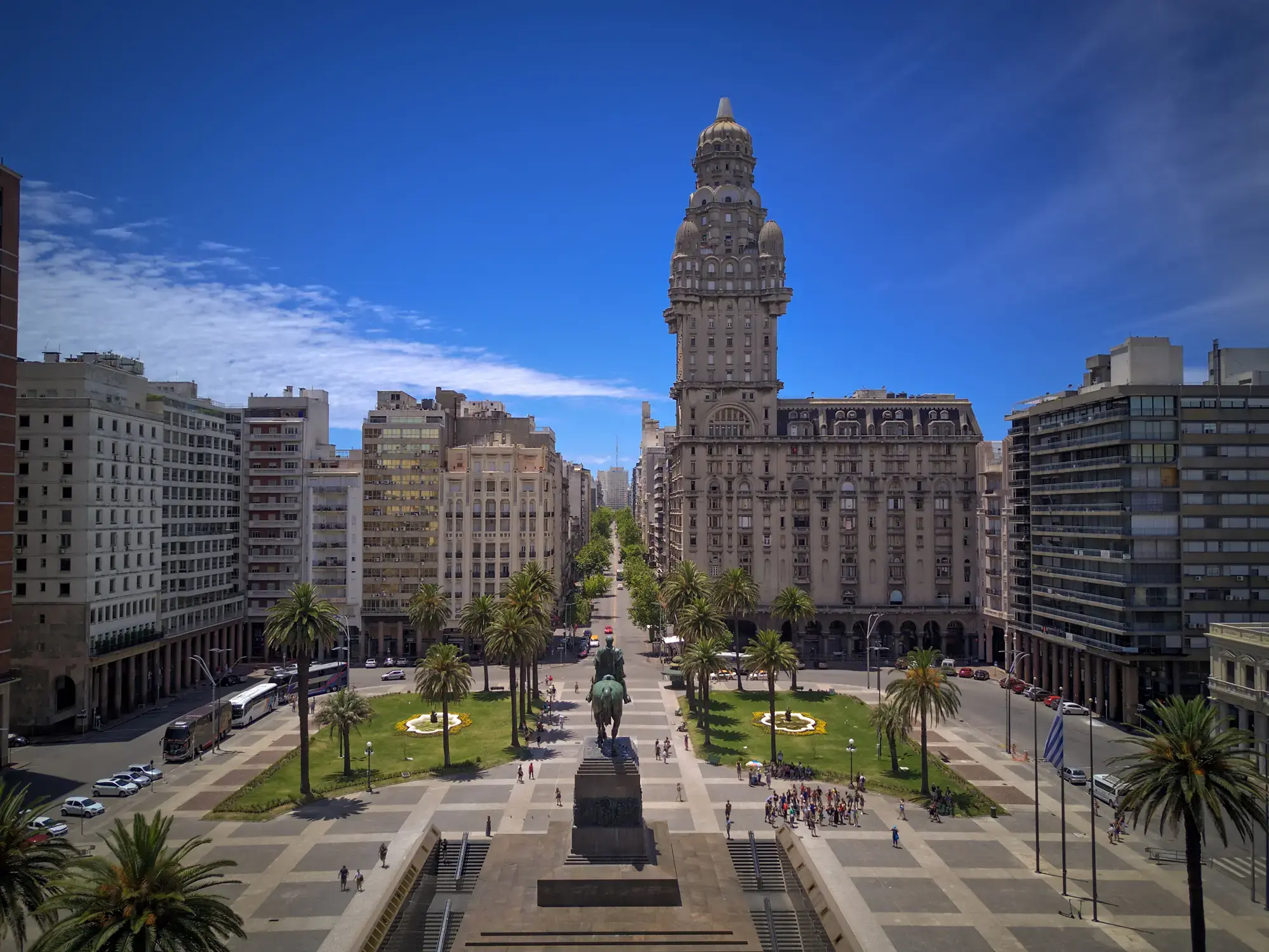
the capital city and chief port of Argentina, in the eastern central part of the country, on the Plata River; population 3,042,600 (est. 2008).
the capital city and chief port of Argentina, in the eastern central part of the country, on the Plata River; population 3,042,600 (est. 2008).
the capital city and chief port of Argentina, in the eastern central part of the country, on the Plata River; population 3,042,600 (est. 2008).
Montevideo is the capital and largest city of Uruguay. According to the 2011 census, the city proper has a population of 1,319,108 (about one-third of the country's total population) in an area of 201 square kilometres (78 sq mi). The southernmost capital city in the Americas, Montevideo is situated on the southern coast of the country, on the northeastern bank of the Río de la Plata.
The city was established in 1724 by a Spanish soldier, Bruno Mauricio de Zabala, as a strategic move amidst the Spanish-Portuguese dispute over the platine region. It was also under brief British rule in 1807. Montevideo is the seat of the administrative headquarters of Mercosur and ALADI, Latin America’s leading trade blocs, a position that entailed comparisons to the role of Brussels in Europe.
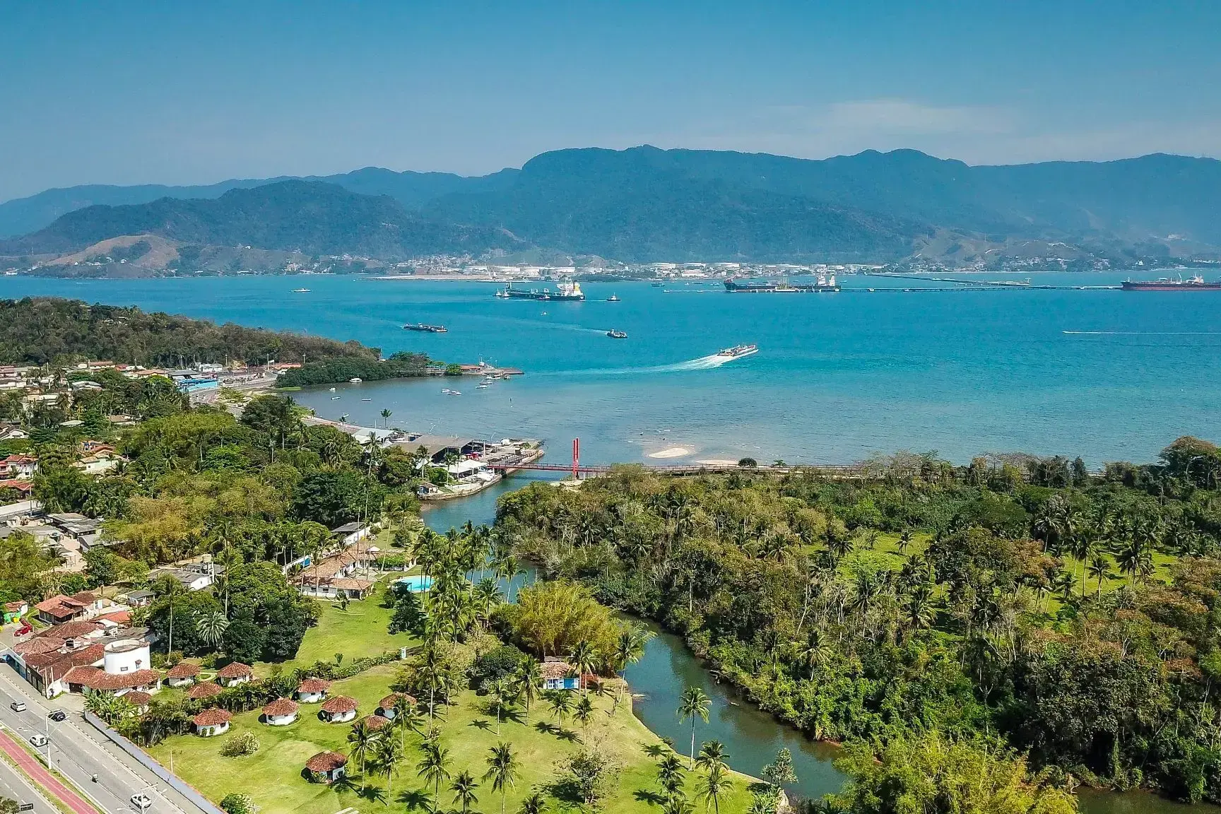
Ilhabela — brazylijski raj dla miłośników przyrody i przygód
Ilhabela to malowniczy archipelag i gmina w stanie São Paulo w Brazylii, składająca się z głównej wyspy i kilku mniejszych. Nazwa w tłumaczeniu z portugalskiego oznacza "piękna wyspa", co doskonale oddaje jej charakter. Ponad 80% terytorium wyspy jest chronione w ramach Parku Stanowego Ilhabela, obejmującego gęste lasy tropikalne, wodospady i szlaki turystyczne. To popularne miejsce wśród żeglarzy, nurków i osób szukających spokoju z dala od miejskiego zgiełku.
Ilhabela słynie nie tylko z plaż o złocistym piasku i krystalicznie czystej wodzie, ale także z unikalnej możliwości obserwacji wielorybów podczas ich migracji. Miasto często gości regaty żeglarskie, w tym międzynarodowe zawody. Turyści mogą zwiedzać zabytkowe budynki z okresu kolonialnego oraz cieszyć się atmosferą nadmorskich restauracji serwujących świeże owoce morza. Ilhabela łączy dziewiczą przyrodę, aktywny wypoczynek i spokojne tempo życia, czyniąc ją idealnym miejscem na podróż o każdej porze roku.

Rio de Janeiro is the second-most populous municipality in Brazil and the sixth-most populous in the Americas. The metropolis is anchor to the Rio de Janeiro metropolitan area, the second-most populous metropolitan area in Brazil and sixth-most populous in the Americas. Rio de Janeiro is the capital of the state of Rio de Janeiro, Brazil's third-most populous state. Part of the city has been designated as a World Heritage Site, named "Rio de Janeiro: CariocaLandscapes between the Mountain and the Sea", by UNESCO on 1 July 2012 as a Cultural Landscape.
Founded in 1565 by the Portuguese, the city was initially the seat of the Captaincy of Rio de Janeiro, a domain of the Portuguese Empire. Later, in 1763, it became the capital of the State of Brazil, a state of the Portuguese Empire. In 1808, when the Portuguese Royal Court transferred itself from Portugal to Brazil, Rio de Janeiro became the chosen seat of the court of Queen Maria I of Portugal, who subsequently, in 1815, under the leadership of her son, the Prince Regent, and future King João VI of Portugal, raised Brazil to the dignity of a kingdom, within the United Kingdom of Portugal, Brazil, and Algarves. Rio stayed the capital of the pluricontinental Lusitanian monarchy until 1822, when the War of Brazilian Independence began. This is one of the few instances in history that the capital of a colonising country officially shifted to a city in one of its colonies. Rio de Janeiro subsequently served as the capital of the independent monarchy, the Empire of Brazil, until 1889, and then the capital of a republican Brazil until 1960 when the capital was transferred to Brasília.

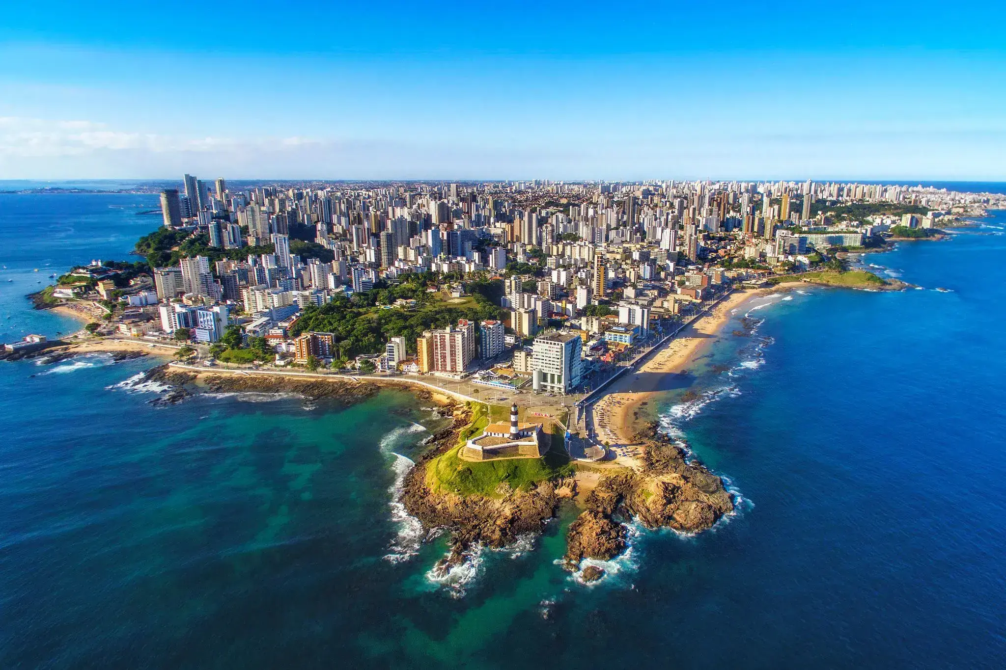
Salvador is the capital of Bahia state and was formerly the first capital of Brazil. Salvador is known for its endless number of churches, as well as for being a land of majestic fortresses. After visiting these places, it is also worth taking a look at the Chapada Diamantina National Park – the most interesting natural park in Brazil. In Salvador, there reigns an atmosphere of joy, revelry, and holidays – this is due to the fact that the local population was influenced by Africa. In Salvador, you can always admire the natural beauty of this area. You will be enchanted by the sensuality of this land, and you will be able to discover a piece of its mysterious power.
Salvador is the capital of Bahia state and was formerly the first capital of Brazil. Salvador is known for its endless number of churches, as well as for being a land of majestic fortresses. After visiting these places, it is also worth taking a look at the Chapada Diamantina National Park – the most interesting natural park in Brazil. In Salvador, there reigns an atmosphere of joy, revelry, and holidays – this is due to the fact that the local population was influenced by Africa. In Salvador, you can always admire the natural beauty of this area. You will be enchanted by the sensuality of this land, and you will be able to discover a piece of its mysterious power.
Scarborough (Tobago) to urokliwe miasteczko położone na wschodnim wybrzeżu wyspy Tobago na Morzu Karaibskim. Jako stolica wyspy, stanowi centrum życia kulturalnego i historycznego regionu. Miasto słynie z malowniczych uliczek, tętniących życiem targowisk i zabytkowych budynków, które harmonijnie współistnieją z nowoczesną architekturą. Do najważniejszych atrakcji należy kościół św. Anny z 1770 roku, będący ważnym elementem dziedzictwa miasta. Popularnością cieszy się również lokalny targ, na którym można kupić świeże owoce, przyprawy i rękodzieło.
Poza bogactwem kulturowym Scarborough oferuje piękne widoki przyrodnicze. W pobliżu znajdują się plaże z białym piaskiem i krystalicznie czystą wodą, idealne do kąpieli i nurkowania. Szczególnie popularna wśród turystów jest zatoka Pleasant, znana z pięknych krajobrazów i podwodnego świata. Scarborough to doskonała baza wypadowa do odkrywania rezerwatów przyrody Tobago i aktywnego wypoczynku.
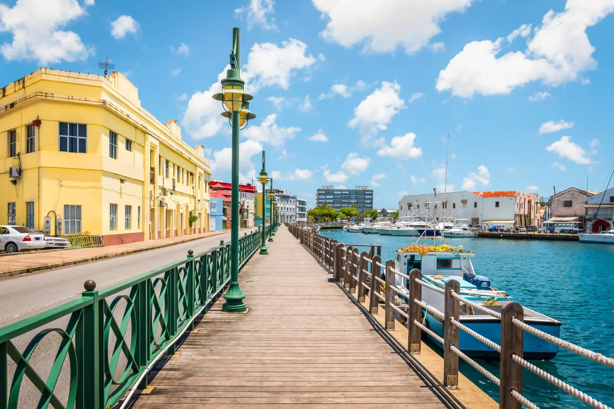
Bridgetown to stolica i największe miasto Barbadosu. Dawniej znane jako „Miasto św. Michała” (The Town of Saint Michael), obszar Greater Bridgetown znajduje się w parafii św. Michała. Miejscowi czasami nazywają je „Miastem” (The City), ale najczęściej po prostu „Town”. W 2014 roku populacja aglomeracji wynosiła około 110 000 mieszkańców.
Port Bridgetown znajduje się w zatoce Carlisle (13.106°N 59.632°W) na południowo-zachodnim wybrzeżu wyspy. Części obszaru Greater Bridgetown, ogólnie zdefiniowane przez obwodnicę (ABC Highway), leżą blisko granic sąsiednich parafii Christ Church i St. James. Międzynarodowe lotnisko Grantley Adams znajduje się 16 kilometrów na południowy wschód od centrum Bridgetown i oferuje codzienne loty do głównych miast Wielkiej Brytanii, USA, Kanady i Karaibów. Obecnie nie ma już lokalnych władz miejskich; Bridgetown jest okręgiem wyborczym w parlamencie krajowym. W latach 50. i 60. XX wieku, podczas istnienia Federacji Brytyjskich Terytoriów Indyjskich, Bridgetown było jednym z trzech miast rozważanych jako możliwa stolica federacji.
Obecna lokalizacja miasta została założona przez angielskich osadników w 1628 roku; wcześniejsza osada pod nadzorem Sir Williama Courtena znajdowała się w St. James Town. Bridgetown jest ważnym celem turystycznym na Karaibach, a także znaczącym centrum finansowym, informatycznym, konferencyjnym i portem dla statków wycieczkowych. 25 czerwca 2011 roku „Historyczne Bridgetown i jego garnizon” zostały wpisane na listę światowego dziedzictwa UNESCO.